Desert Creek, Toiyabe National Forest
Trip Date: May 31, 2013
This is an historic third weekend in a row that I have camped – what a great run.
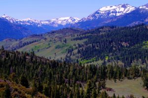
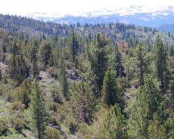
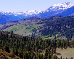
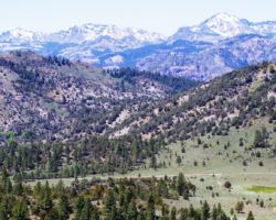
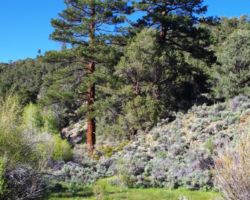
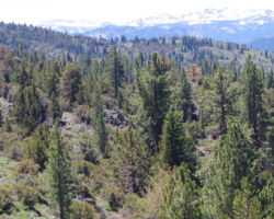
On most of the boys trips, the main goal is to get away from people and camp at a spot that has a great view. The Holy Grail however, would also to be near water. This has very rarely been accomplished; however, Risue Canyon is one of those places where it is possible. Risue runs generally East-West from the East side of Topaz Lake along Highway 395 to Highway 338 in Nevada. If you don’t know where that is, I’m sorry but there aren’t any other towns, landmarks or descriptions that would help – that is, this area is really out there. It is high desert country at about 7000’ elevation in Pinyon, Juniper, Aspen, Mountain Mahogany country, with a few monster Jeffrey Pines mixed in.
There are usually some, sometimes more, motorcycle/ATV traffic in the area, but they typically pass by now and again with a friendly wave and that is about it. In the three times I have been in the Canyon, we have never had anyone camped near us. Also, the ATV’s are generally pretty quiet; more like a passing Jeep or small rig. The racing type ATV’s and the motorcycles do make more noise, but again, they usually pass by and are quickly out of sight, out of sound, out of mind.
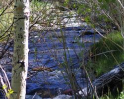
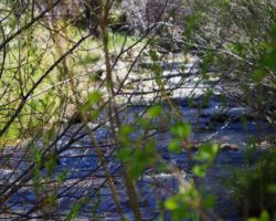
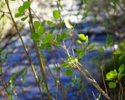
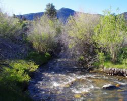
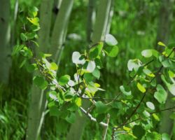
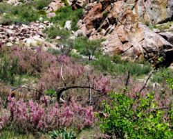
What makes Risue Canyon special is Desert Creek. In an otherwise dry/desert/ rocky canyon, the creek makes it all seem softer, gentler, and safer. The creek is about eight to ten feet wide and typically just a foot or two deep with a rocky bottom and gentle sides. It supports a lush diversity of life with dense green banks of Willow, Wild Rose, Aspen, Cottonwoods, and many wildflowers. It supports many amphibians and tons of birds, small mammals, and deer. I have to imagine there are plenty of coyotes and maybe some Big Horn Sheep on the rocky cliffs high above the canyons, for no other reason than it just looks like a perfect home for them. Big Horn Sheep are on my short list of animals I have not seen in the wild so I am always imagining them. Bob claims he saw one wearing a bonnet in the Black Rock Desert, but that is another story.
Kristen and I saw several female Big Horn Sheep along the road just outside Missoula, Montana a few years back, but that really didn’t satisfy me. I want to see the big boys with their big horns upside some ridiculously steep rocky cliff or ledge, the real picture book setting. So, Bob and I were ever vigilant on our hikes. Not seeing the big one surely didn’t detract from our trip though, as we had much to celebrate and be thankful for.
After leaving Highway 395, we soon were on dirt roads driving across a vast open dry landscape that burned a few years back. This was a massive fire burning both sides of Highway 395; up into several canyons that cut deep into the Sierras towards the West. On the East of 395 where we were headed, the fire burned almost all the way to Nevada in some areas. The fire moved fast, but was not the inferno-fire ball type of burn, leaving many standing dead trees – a most eerie, black, leafless forest. The low scrub and sage bushes are returning which definitely softens the landscape and brings hope for the return of a living green forest. After a short distance through this burn area on the top of the mesa, we dropped steeply into Risue Canyon and picked up Desert Creek.
About half way through the canyon, we stopped at a great site along the creek where Bob and I had camped last year. It is an open grassy area, maybe thirty by sixty feet of grass, completely enclosed by brush. The spot is about 40 feet down a steep thin track from the road, so when you get down in there, you feel safe and sound, serenaded by the babbling brook and the song birds in surround sound. There are some black birds nesting in one of the bushes on the edge of the site that do a lot of squawking going in and out of the bush, communicating to each other and letting us know when we are getting too close or otherwise annoying them.
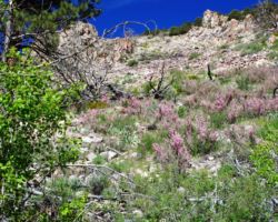
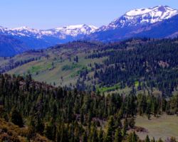
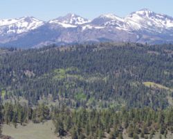
We stopped at this spot to visit and reminisce and perhaps have a beverage, but I really wanted to get all the way through the canyon so we could be on the East side of the Sweetwater Mountains. The Sweetwater Mountains are known for their spectacular color in the upper elevations. Five main peaks form the Sweets, from south to north they include: Wheeler Peak and Mt. Patterson both above 11,600’, and the Three Sisters – South Sister at about 11,300, Middle Sister at about 10,800, and finally East Sister, the loan Nevada dweller, a hair below that. The entire Eastern face of Wheeler and Patterson above about 9000’ looks like it was colored with powdered pastel chalk – blues, tans, pinks of a million shades, tints and tones all softly blurred and blended into a fascinating pallet. The color fades quite a bit to the North, but then picks up again at South Sister where it ends. Photographs at sunrise and during full moons are spectacularly eerie and beautiful.
I have made two other attempts to get up into this country with varying degrees of success. I first heard about this area from some great guys from the University of Nevada Reno. I met them on the best work trip I ever had. I went alone to San Diego for a meeting of people interested in Pollution Prevention – essentially trying to convince manufacturers, corporations, retailers, etc. to produce and sell products and services that are less toxic, use fewer harmful chemicals and raw materials, and generally cause less harm to the environment. It was a very interesting group of folks from around the State who were talking about what could be done and how to go about doing it.
Most of the group seemed to know each other, some quite well. As a new comer and being alone, I felt a little awkward and out of the loop. These guys from Reno really made an effort to include me. I very much appreciated the effort and joined the group for dinner, which included some Margarita’s and then possibly a couple after-dinner drinks. We ended up back at the hotel, with a few beers and munchies and literally laughed and told tall tales all night long. It just was such a great feeling to be included, fit in, and have such a good time. Whether we were strangers, work acquaintances, friends, or old buddies didn’t matter. We were just having fun.
At some point, we were sharing backpacking stories and they told me about Frying Pan Creek and Valley. I do not understand how, but for some reason, this place lodged in my tiny memory (I don’t remember any of the work stuff) and I have wanted to find it ever since. My friend Ken and I drove through Risue some years back, headed down Nevada Highway 338 and then into the Sweets in the area where we were supposed to be able to access Frying Pan Valley. We didn’t find it, but we did find a great camp spot up on the shoulder of South Sister with a great view. On our way home, we hit Buckeye Hot Springs which sits alongside Buckeye Creek, Southwest of Bridgeport off the road to Twin Lakes which sits along the Yosemite National Park boundary. The hot springs are naturally flowing out of the hillside; most of the hot water flows below the surface to a streamside pool, but some of the hot water flows across the surface of the hill and trickles into the pool in a little shower – most excellent. I have only been to the hot spring in the Spring when the creek water is flowing pretty fast, but I imagine later in the year it is calmer, and you could literally step out of the hot spring pool and into the calm creek in one step, sit/soak for a bit in the creek, and then step back over the little rock wall and back into the hot spring pool. That may call for another visit – perhaps in the Fall when the water flow will be lower and the colors will be awesome.
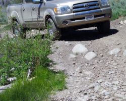
Another more recent effort to find Frying Pan and get up into the color of the Sweets was last year with Bob. We spent an entire day trying to match my recollection of what I remembered from my trip with Ken, with what I remembered seeing on the satellite images on Google maps with what we had on the Toiyabe National Forest map, with actually what was on the ground. There was a dizzying degree of discrepancy and conflicting memories, but it made for high adventure. We definitely were close, but, not quite there. We drove up into a canyon a few miles until the road quickly deteriorated into a narrow, steep trail. We just stopped, literally in our tracks on the road not wanting to risk going another foot down what was quickly becoming a soft gravelly path.
Once semi-stable, we could barely get out of the truck; one step beyond my door and I could have tumbled ass over teakettle off the cliff and Bob could barely open the door on his side for the cliff face – it was definitely time to stop driving and continue on foot. It was a sort of box canyon and once we got in there – up and over the ridge was the only way to get anywhere, and up was a long way. We were convinced this was not where we wanted to be and were fairly certain we had given all that we could, so we returned to our grassy spot along the creek for an excellent happy hour and dinner.
On this trip, I was determined to drive all the way through Risue and camp somewhere out on the East side with a view looking back at the color or possibly even finding a spot up in the color. But, as is usually the case, an alternative presents itself and you modify/revise/improvise on the fly. I probably could not have been a Marine, but I think I do posses some of the skills; not the run away screaming like a girl skills, but the improvise on the spot skills. We recalled from our last sojourn into Risue that the road forked leaving Risue canyon to follow Desert Creek up into another canyon trending Southeast that looked like it may lead up into the higher elevations. Last year, we took this fork just a couple hundred yards but we stopped as road and creek became one. There was no need to push on last time as we already had a great camp spot, so back we went.
This time, I was torn, Rip Torn. Again, I wanted to get to the East side and the color, but as we arrived at the fork in the road and drove to the exact same spot where the road dropped down into the creek bed, and we gazed up into the canyon beyond, the steering wheel was pulling hard. I could not resist the call. We descended into maybe a foot of water and then up and out back to dry road, starting a real gradual ascent into the canyon. Through the Aspens, in and out of the creek, across several crossings, we were leaving the people, the main road, Risue Canyon, and the past behind. We were excited about the future and the exploration of new country that lay ahead – surely new tales to tell, and certain success. The road was very rough and rocky, and a couple of the creek crossings were fairly deep, more than a foot, and in several stretches the road/creek combo were twenty feet or longer. But on we went, up this canyon, stopping to look over the crossings and deciding again and again that they were doable, the water not too deep, the creek bed not too soft. The pull from yonder was strong; it felt like we were heading in a good direction, and we wanted to continue on as far as we could.
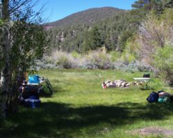
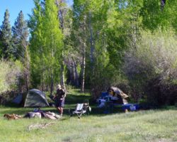
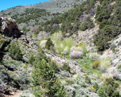
So on we went, to the end of the road – literally. The road became a trail into the woods and without a doubt, we had driven as far as we could. We backtracked a couple hundred feet and stopped above a picture perfect camp spot: grassy open meadow, Aspen and Willows scattered about, creek running alongside, wildflowers scattered along the riparian zone. This vantage point from the road looking down to the site was particularly impressive because you could see how green and rich the life was along the creek, but looking above the creek, out over the open slope on the other side, it was dry as an old bone – sharp edged volcanic rock, thorny brush, horny backed lizards, and rattlesnakes. We were happy to stay on our side of the creek. The only question now was do we drive down the steep slope from the road to the camp spot below, or do we haul everything down there by multiple trips on foot.
After much debate, critical thinking, evaluation of alternatives, the application of counterfactuals, and perhaps a beverage for deep clarity of conviction, it was the will of the group to drive down the pitch to the site. So, down we went. Ah, the benefits of good clean living. Once down among the grass, flowers, and trees, alongside the babbling brook, we felt great. What a spot. It was tough passing up the old spot in Risue Canyon because that is a great spot. So, we were stoked that this was an even better spot – end of the road privacy, open floor plan, park-like setting, great price. We had it all.
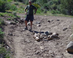
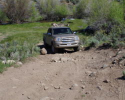
In a few minutes we were unloaded, and it was time to reckon with our decision to drive down the steep pitch. It had gotten significantly steeper as we peered up the slope from below. As is often the case, it wouldn’t seem so daunting if not for something, this one thing – a massive pointy boulder in the exact middle of the road. It was decided she must be moved (clearly a conclusion of the Irish)! Fortunately, I had brought two shovels, so without too much loathing, moaning and whining, we began clanging our metal shovels against solid rock and stones. We were able to dig out quite a few sizable stones on all sides of the boulder, enough to clearly see that this boulder went to the center of the earth. She weren’t a budgin’. We theorized that trying to drive around her might be a more probable path to success, and so we went about clearing a path alongside her to the upslope side of the pitch. We began replacing the vast majority of stones we had just removed from around the boulder shoulder to hopefully prevent sliding into the crevasse we had created. We soon realized we had inadvertently built up the fill too high so as to make a giant step up from the road surface rather than a smooth or at least more gradual transition from road to boulder shoulder. Removing more rock and filling in with looser soil material, we felt like it was about time to give her a go.
I mounted me trusty steed, positioned the truck in a straight line on the far side of the meadow, got the thumbs up from Bob who was positioned at the top of the hill on the road, chose my line, and went for it. Less than half way up, I got a sinking feeling in my gut and in the rear end (the trucks, not mine). It brought back a time not too long ago on another trip, where me and two of the fellas made the same decision to “go for it” and four-wheel off the road up the hillside to get around a fallen tree. Once above the tree, we literally slid down the other side to the road over super soft and fluffy forest duff – not rock, soil, or solid ground – more like dry coffee grounds. But we made it and we could get into the area we wanted to get to. Two days later, on our way out, we attempted to get back up and around the tree over that really soft ground four, five, maybe six times. Sometimes with a running start, sometimes at a slow crawl, always in four low, but even though we spent a couple hours filling the trenches we made with our spinning tires with rocks and freshly cut fir branches and sticks, we made very little progress.
We got our exercise, and made a gigantic mess, but we sure didn’t get anywhere close to making it back up that track that probably only ATV’s and motorcycles could have traversed. Maybe a really good rock crawling Jeep could have done it, but certainly nothing bigger/heavier than that. It was one of the very very few times I really felt like I was in over my head and couldn’t get myself out. Really, usually I am pretty confident – no really I am. Look I am – whatever. This time though, I got myself pretty worked up at the failure of getting up the hill and not being able to get ourselves out. There were two fir trees that fell across the road, each of them maybe 24” in diameter. So we needed to make two cuts in each tree to create a path wide enough to drive the truck through. Being an experienced camper and outdoorsman, I didn’t bring my chain saw; I didn’t bring a big ax, I didn’t even bring an ax with a head solidly attached to its handle. All we had was a very old and sentimental ax that used to be my dad’s that could cut some fine kindling but that was about all – certainly not chop four cuts in two 24 inch diameter trees.
I lost my confidence and figured we needed someone to bail us out. I walked a mile or more down the road constantly checking cell reception to call my wife at work to ask her to go home, get my chain saw and come find us up here in the woods. God bless her, she was willing to do it without question or threat. When I returned to my friends Ken and Keir, they had used the tiny ax with the loose head to whittle down about half of the first log that blocked the road. It was slow going and frustrating as hell, having to stop and reposition the ax head back on the handle after every three or so chops. But, I’ll be dammed if they weren’t making some pretty good progress, and of course, giving me a ration for not having more faith in my fellow man.
So, off I went with my tail between my legs, traipsing back down the road to get cell reception again to call my wife back and tell her not to bother, that apparently we were going to hack (or more accurately, whittle) our way out. By the time I got back to Keir and Ken this time, they were all the way through the first log and celebrating with a beverage. This brought my first sense of calm and I regained my confidence that all would be well. We had packed up and left our camp spot pretty early (I will explain why another time), and we weren’t far from home so we had plenty of time. Keir was putting his Cub Scout experience to full effect. Ken was using his Altar Boy powers, and it was all working. We hooked up my chain (why the hell I had that but no saw or axes I don’t know) to the truck and pulled the log up the road and out of the way. Ken was already whacking away on the next log and we soon took turns chopping, repairing the ax, and breaking off branches. Before too long, we had carved through the other fallen tree and pulled a section of it out of the way just enough to slowly and carefully make several zig and zags to pass between them. This entire process maybe took three hours, but froggy had been stressed and there was much rejoicing and a celebratory beverage upon rescuing ourselves.
All of that tomfoolery was scrambling around my brain as I backed down the hill, got out and conferred with Bob on the next approach to gain the high ground. Some of our road work had been loosened and strewn down the hill from the torque of the tires, but actually much of it remained in place. We figured a tad higher approach may be the path to success, so we did a bit more road construction and repair, tried to soften the approach to the boulder shoulder a bit more, and went our separate ways – Bob back up to the road and me back down to the rig. I’m not sure if I felt more confident this time around, or since I learned my lesson with Ken and Keir, I just remained my calm and collected self. All of this positive energy must have been transferred to the truck, because we just crawled up to the road fairly easily and soon we were sitting in the tall cotton once again.
A beverage was called for, nay, required to celebrate our work and success. We retreated to the shade of the Aspens along the creek for some much deserved R&R and to regale ourselves with tales from this and other adventures. We slowly got around to setting up camp and settling in. After a while, we walked back down the road a bit to get our bearings and familiarize ourselves with our new surroundings. On our way back, we caught a nice view of one of the Three Sister’s with tiny patches of snow still clinging to her Northern shoulder. Back at camp, it was time to begin cocktail hour, start the fire, and get to eating.
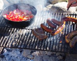
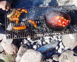
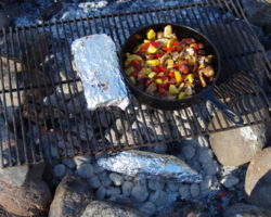
As usual, there was an immense amount of food. I made an excellent zucchini, onion, mushroom medley in a cast iron skillet. I had some sausages to grill and then add them to the brew. I had a massive Yam wrapped in foil roasting in the coals. Bob had a steak and a few more sausages and we had bread, lunch meat and cheese for hors d’ oeuvres. Bob brought fresh lemons and limes, Tequila, club soda, and homemade “simple syrup.” Simple syrup is made by combining two parts water to one part sugar. Bring it to a boil slowly and you have a great concentrated sweetener for cocktails – add maple flavoring and its great on pancakes. In our case, it worked for making excellent Margarita’s. I had some whiskey and coke and life was good. The meal was excellent, the mellow fire perfect for waiting for the stars to really get thick. Before too long, I was crawling into the tent for shleepy shleepy.
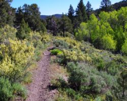
I was up early as is my usual routine. I made my morning constitutional, started the fire, had a cup of coffee, and headed out along the trail that continued on where the road left off. We had discussed hiking for most of the day, but beyond that, we did not know where, what direction, if there was a trail, or what the hiking would be like – uphill, steep, boulder-hopping, bush whacking, or what. So I was glad to have found what appeared to be a good trail following Desert Creek, heading Southeast towards the Sister’s. I headed back to camp to report my findings to Bob and it was agreed we would follow this path. After a good breakfast and making sure camp was neat and tidy, we loaded up with food, water, beers, map, compass, and requisite emergency “just-in-case” goods and supplies and headed out. It was only about 8:30 and the weather was fantastic.
I had camera in hand and was super excited to finally be prepared to use it. Battery was charged and film, well film is now a thing of the past, but memory card was in place and ready to roll. The trail was fantastic; a very gentle walk along the creek among the Aspen, passing many wildflowers, birdies, and beautiful vistas. We had to cross the creek many times as the trail meandered and the creek meandered creating quite a twisted braid. If we had to cross the creek a dozen times, we built eight bridges or crossings with rocks, branches, limbs, logs – whatever we could get our hands on. This made it kind of slow going, but it was fun tossing the materials in the creek and then trying to balance on them to make our way across. Most of the time, if we had slipped we simply would have gotten wet – up to our knees or so. But in several spots, a bend in the creek created a nice pool or a particularly narrow spot where the water ran faster and scraped the bottom deeper, we could have gotten soaked and looked funny doing it. These little challenges added a real sense of adventure.
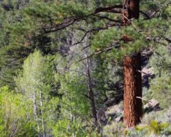
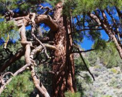
Every so often, a massive Jeffrey Pine or three would be hunkered down in the creek, 40 – 50 inches in diameter, beautiful red-brown bark, typically with a blown out top. Most tall trees at higher elevations get struck by lightning and have their tops blown out. This increases the diameter of their trunks and often makes the branches grow to immense size themselves, as they dare not put any effort into height growth as it will most likely just get blown off again. It was very cool, every so often, coming upon another giant red grandfather among the Aspen and Willows, remnants of an ancient forest, yet even these massive old gnarled veterans must adhere to the forces of nature. Get too tall, get your top knocked off. Start to grow too far up the slope and you get no water. Grow too near the creek, and the water washes away the soil and gives you spider roots. It is a tricky balance of ever changing conditions making their presence all the more impressive and worthy of respect and admiration.
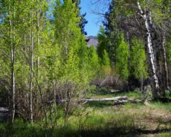
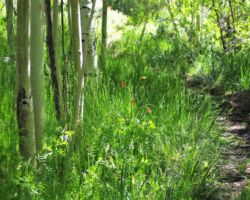
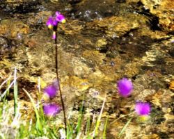
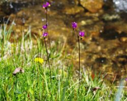
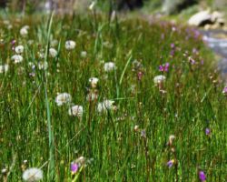
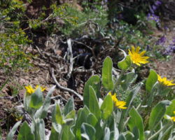
This trail offered a great variety of interesting things to see, hear, smell, and feel. The one constant was the very slight and gradual rise in elevation as we followed along the creek under dense tree canopy, alongside shady pools, cool dells and wet glades. Both sides of the trail were covered in rich green vegetation – mosses, mushrooms, herbs, sedges, rushes, Iris, Monkey flower, ferns, Columbine. All alongside the creek on many a broad flat grassy bench a few feet above the creek, were stands of Aspen and the occasional Jeffrey Pine. These benches often had dead logs haphazardly fallen this way and that. Each log begged to be visited, sat upon, used as a rest stop, lunch spot, or simply to sit and peacefully absorb as much as your senses could hold.
A little further away from the creek, beyond the edge of the riparian zone, was either an open, hot, dry sage covered hillside, or a rocky cliff face. The hillsides were of little interest, but the rocky cliffs were spellbinding. First off, you always have to be on the lookout for Indians, because this is where they would leap down on your party and whack the hell out of you. If not the Indians, a mountain lion could basically do the same thing. I am always on the lookout for mountain goats and we saw some perfect habitat for them – so much so that I just might superimpose a Billy goat into one of my pictures just because they should have been there – it was such a perfect place for them. In other spots, the cliffs hosted condominiums of swallows that swooped and swished through the air above – such a beautiful blue color, such a beautiful song, and such a graceful acrobatic display.
The headliner, though, was a pair of hawks, very light in color and markings matching the light colored tree trunks and rock of their habitat. They were working the upper portion of a fantastic rocky slope. They each made multiple passes low across the talus and then out away from the face, to catch a draft of warm air to lift them back up to the top of the ridge. Not a single flap of the wings, circling in effortless rings, until finally folding up their wings and jetting over their prey on another deadly pass. Every once in a while they would give a screech to each other perhaps a tease for missing their target or a “look what I can do”. So much life to observe and enjoy – it was quite a gift.
After about five miles, we left the narrow canyon and entered a broad open valley. The trail became a road again and we soon saw motorcycles off in the distance. Looking over the maps in the morning before we left, I had thought it would be cool to hike until we intersected Forest Road 089, but having come through the canyon, and seeing so much, I couldn’t ask for more. We hunkered down under a group of small Aspen on a hillside looking down on the road, the creek, and up to the mountains – Wheeler and Patterson still further Southeast and almost a mile higher in elevation. Upon opening my pack, I was rocked with the realization that one of the plastic bottles of beer had leaked. Although bummed, I had another and this was quickly consumed for fear of another catastrophe. I was pretty hungry so I had some cheese and crackers, trail mix, an apple, and an orange. I drank one of my water bottles and was ready for a nap.
We sat for a bit, oriented the map with the compass, agreed again not to push on and find road 089, and soon received the message that it was definitely time to head back. A lone motorcycle rider on an orange KTM passed in front of us on the road below from the South. He had no idea we were watching him, but the noise of his bike and the frantic pace he was travelling made it seem like he drove right over us. He turned off the road and up a track to the East and was quickly out of site, but like the Indians in 1860, we knew there would be many more of them to come. We packed up and headed back down the road to re-enter the canyon and hopefully the peace and solitude it provided on the way up. Before we could reach it however, the rider was back with six more of his kind. They slowed quite a bit to pass us, then crossed the creek and went back up the route the lone rider had taken before. They quickly were out of sight again, but now could be heard for quite a while longer. Fortunately, that was the last of the bikes, or anyone else for that matter, that we passed, saw or heard on our hike back.
The trek back was much quicker as many of our bridges and structures were still intact. We simply walked through the creek at several crossings; and although the slope was very modest, we were following the creek downstream, so the going was even easier. We were making good time without rushing, without a care – feeling good about the exercise, about the freedom, about the trip and ourselves, and our place in the universe. Sometimes, getting too caught up in all the good vibes can lead to a reckoning, and one was soon upon us – or more accurately – upon Bob.
The buzz was unmistakable, awesome and terrifying. Fortunately, Bob is an experienced hiker, meaning aware of your surroundings, alert with all your senses. Bob had left me in his dust some time before, so he was coming back down the trail to meet me with a look of excitement and amazement on his face. He suggested we immediately get off the trail and blaze through the brush down closer to the creek. He definitely had good reason so I did not waste time with questions or debate, and it soon became apparent I had made a good choice. Something had pissed these bees off and they wanted retribution, a pound of flesh or more if they could get it. They were not fooling around nor were we. I wanted to get well on down the road before I was willing to stop and look back.
The cloud of bees was 15 feet thick and 30 feet tall, plus the forward guard that were taking a few shots at us even as far away as we were. We had seen several motorcycles riding on what clearly were hiking trails and I was imagining a motorcycle riding down this trail and right into the cloud because they wouldn’t be able to hear the buzz. Their only chance would be to outpace the swarm on the other side, but I would not bet on that; my money says it would not end well for the riders. Maybe it would have been nature’s way of teaching a valuable lesson, but for now it was just me and Bob, and we were glad as hell we weren’t running for our lives.
We had been gone about 7 hours and covered about 8 miles, so the last stretch before we were back in camp took a little more effort, mentally and physically. I wanted to start whining about the heat and how tired I was, but I really felt pretty good and was happy with the distance, the time, and the spectacular scenery we were treated to. Every tree was looking familiar as I was sure we were back to camp 11 or 12 times, until finally, unmistakably, I saw my laundry line stretched between 2 perfect Aspens, then the tents, then the bar table, and the rush of success was like a super adrenaline shot.
We were both quite pleased with ourselves, so as we got our packs off and shoes and socks gave way to sandals and Tevas, we suggested a soak in the creek and a celebratory cocktail. Both were accomplished with great satisfaction, and although we probably could have squeezed in a nap, I know I was already feeling the end of the trip was near and so wanted to cram a bit more into my consciousness, increasing the likelihood the memories would last. A few snacks consumed, a few photos taken, a stroll down the road, a little organizing around camp, a stroll through the Aspen Grove upstream by the laundry line, and sure enough, it was cocktail hour and dinner preparations were under way.
We had lots of leftovers from the night before. That is one of the benefits of cooking a lot of food the first night – it is great for breakfast, lunch, snacks or dinner the next day. All the flavors have melded for a full day and then reheating them all up together, it is almost always better the second time around. We had more of the vegetable brew with the sausages and meat mixed in and a little steak on the side. The cocktails, some Tequila and the simple syrup, and several Bourbon and cokes benefitted greatly from the fresh limes Bob brought, facilitating another exceptional meal, fire, starry sky, and tale-filled night. Sleep came easily and early. So did morning.
I was up both mornings before Bob, which was somewhat unusual, both for how long Bob was sleeping and how early I was getting up. It was great though – I had slept well and felt good. The usual breakfast of coffee, maybe a biscuit, fruit, yogurt, and more coffee soon had me hustling up the hill with shovel and my important papers to find a nice canyon view and good digging. It was a physiologically, mentally, and spiritually fulfilling experience. Since I had made the effort to propel myself up the hill, after my spiritual awakening, I took the opportunity to stroll down the road a tad to watch the wave of warm, clear, and comforting morning sunlight cascade down the hillside and across the broad valley. What I wouldn’t give to be able to watch that spectacle over and over, through the seasons, year after year.
This was a moment that I sometimes become aware of. It is that intersection of past, present and future; the memories of prior trips, the consciousness of this trip; the coming end of an end; imagining future adventures; and the constant blending of life on these trips and the one you are returning to; it is a constantly evolving cocktail. At this instant I was feeling the feeling that I get when I am on these trips; why I need these trips; why I love these trips. The instant I turned my head, took that first step back up the road, the trip would be over. It was time to get back, but I was bathing in satisfaction. This had been another great trip. But it was time and one step was all it took.
Back at camp, it wasn’t long before we had begun to organize, breakdown camp, pack, etc. and soon the conversation turned to whether or not to drive the truck back down the hill to save us from having to make 20 trips carrying the gear up the hill to the truck. I do not think either of us wanted to test the gods or our luck any more than we already had – that we were aware of and that we were not. So up we went, over and over, again and again.
Soon enough, Bob was tying down the load and we turned our gaze down the road, down the valley to the West. This was such a great trip; I did not feel the usual sadness or melancholy at another trip being over. The mere act of moving towards the West was meaningful, symbolic, and provocative. We still had some great country ahead of us, even if it was on the drive home. And we had the stream crossings just to get out of the canyon and back to the main road that would be invigorating. The creek had clearly risen over the past two days, perhaps from the warm temperatures melting the snow, but it certainly gave us a bit of a thrill as we crossed, and crossed, and crossed again the meandering Desert Creek. In this mile or so of real rough, rocky, and wet road, we had four crossings, two hard landings on large pointy rocks, and one rattle snake – well, what was left of the snake after some yahoos cut its head and rattles off, but a large fatty rattlesnake body nonetheless.
Back on the main road, good driving ahead, I was interested in finding another main forest service road that we saw on the map that seemed to access the high country a little farther South. It looked to climb up high, near the terminus of our hike the previous day, Road 089 and Desert Creek as it flowed out of the high country. At that elevation, it may only be a trickle, but how cool would it be to have a high mountain stream alongside your camp? Plus, at that point, we would be fairly near the site of the first adventure we had in the Sweetwater Mountains and it would be great to connect the dots of the various trips.
Another time, another trip, another reason to come back. We would have to wait to find that road, and that spot, reconnect with our old camp site, and ultimately find our way to the infamous East side color. The great thing about exploring is that for every trip and road you take, you see three or four more you want to take, so there is always something else to see, to find, to explore, to keep you coming back for more. It is a great feeling to have gotten some, so much really, but still have so much left. I still haven’t even found Frying Pan Valley which is the place that initially led us out here, and the next time will be my fourth trip back. Life is good and the feeling’s getting better.
Desert Creek Photo Gallery


