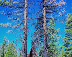
Packsaddle Pass I; El Dorado National Forest
Trip Date: June 21, 2013
The annual occurrence of the Summer Solstice has a very hip, mystical, mythical, ritualistic connotation for some people, and the boys have often discussed getting together or possibly camping to celebrate the event. This year, there also was a “Supermoon” phenomenon and the combination was just too much to ignore. So, this was the first time we actually got out of town together to observe the Solstice, and although technically we were a couple days early for the maximum effect of the “Supermoon”, we were pretty stoked about getting out for the twofer.
Although scientifically the solstice is an instant in time when the tilt of a planet’s axis is most inclined toward the sun, it is commonly referred to as the longest day of summer. It occurs each year usually between June 20 and June 22, at which time the sun reaches its highest position in the sky and therefore – the longest day (most daylight) of the year. There is also an annual Winter Equinox when the tilt of the Earth’s axis is inclined neither away from nor towards the Sun, the center of the Sun being in the same plane as the Earth’s equator. The Winter Equinox actually occurs in the Spring, usually between March 19 and March 22 and it technically is called the Vernal Equinox. Nonetheless, the equinox is when the shortest day of the year occurs. There is much to know about equinoxes and solstices, such as they occur in both the northern and southern hemispheres, but I will leave that up to you.
 The “Supermoon” was an added bonus. The newly coined term is now used to describe the time when a new or full moon occurs at the same time as its closest orbit to Earth. In short, Earth, Moon and Sun are all in a line, with moon in its nearest approach to Earth. Astronomer’s call this sort of close full moon a perigee full moon. But the June full moon is even more Super! This is when the full moon falls closer to the time of perigee, the moon’s closest point to Earth, just under about 357,000 km. Close full moons happen about every 14 months, and those of the next few years will be even a tad closer to Earth. It is pretty cool to think about space, stars, planets, orbits, and such and then look up at our moon, thank it for being there, and know it is as close to your fingertips as it will be for another year.
This being late June and all, we knew we might be getting into the time the Forest Service and Bureau of Land Management begin restricting camp fires as part of their fire prevention efforts. I always check for fire conditions and any other warnings on the particular national forest or BLM region web site ahead of time. Sure enough, fire restrictions were in place for most of the El Dorado National Forest, so no campfires were allowed outside of designated campsites along Mormon Emigrant Road below (West of) the intersection with Silver Fork Road. I didn’t think this would be a problem since I recalled many roads and little dirt spurs all along Mormon Emigrant. The plan was to just drive up there and once we passed Silver Fork Road, we would begin taking roads, primarily to the left (North) so we could hopefully get a view of Pyramid Peak and the mountains on the southern end of Desolation Wilderness.
You pass right by these incredible mountains as you drive East on Highway 50 to Lake Tahoe but you don’t notice them because you basically are underneath them – Highway 50 slicing right through their shoulder. So, as with many mountain scenes, you have to get far away and up high to get that view and perspective. We also wanted an open sky to view the Supermoon rise over the mountains to the East and possibly even a vista to the West to see the moon set – the moments when the Supermoon was supposed to be the biggest – or appear the biggest at least. This was a lot to ask we knew, but we were worth it.
 So with map, compass, and gear packed, I headed over to Ken’s house about 9:00. Bill was already there in his minivan and they were just about loaded up and ready to roll. The morning was already getting warm so I was anxious to get going, even though, I expected/hoped our camp spot was less than an hour and a half away.
We were soon on our way. A breakfast beverage was fueling my drive up the hill. Because we were going to be camping so close, I planned on cutting fire wood tomorrow on my way home and needed to stop at the US Forest Service station to get my wood cutting permit. I also figured we could stop in Pollock Pines at the Safeway to do some last minute shopping – particularly to pick up a sandwich for lunch. It has been known to happen, that a few power beverages consumed on an empty stomach might make me a little mushy by the early afternoon (this may have happened on the last trip in fact, but that is mere coincidence I assure you). I don’t eat breakfast as a rule – just coffee – so when I get out on these trips, I make sure I have some snacks with me to make sure I get some food in my gullet early. You never know when the power liquids will come and shortly you may think to yourself, “How did I get here”. So this time for sure, I was determined to be prepared.
In about 40 minutes, I was just about to drive past the exit we needed; I was surprised to realize that the exit for the Forest Service station was before the exit for the Safeway, so I had to exit all of a sudden and then hover near the exit to make sure Ken and Bill saw me as they were some distance behind. They soon appeared and we were quickly in the parking area. It is apparent in many ways that, like most organizations, the Forest Service has had to cut back and get by with limited funds. I say this because as I pulled into a parking space, there was a young couple in a pick-up truck dry humping away with the door open and basically out in the open. In the old days, the station would be abuzz with activity, fire crews, timber staff, recreation and archeology folks, all coming and going and gearing up for a day in the field. It was very quiet this morning, with only two enforcement officers tucked away in the shade talking shop. While I didn’t stare at the youngsters for too long (really I didn’t), it did bring a slight smile to my face and more than a few memories of the old days with Marty and Gabe when we all worked for the Forest Service..
After I regained my focus, I remembered Bill and Ken and we headed up to the office – except I was headed for the outhouse instead. Things had changed since the last time I was here. It had been a couple years since I had cut wood in the El Dorado National Forest so I had gotten my permits at other stations. A few years before, the Forest Service station a few miles back down Highway 50 in Camino, just off the highway to the South was the place to stop for permits, information, free literature, and what not. It was easy and convenient to get to and you could see it from the road, so it just seemed like a much more inviting location. It has been closed for several years now; no doubt another budget decision to cut expenses, but certainly a bigger loss of a more quaint, friendly, convenient place for the public to get the help they need.
So maybe I was still kind of thinking of the old office, or maybe I did need to go to the outhouse, but luckily the boys redirected me just in time and we found the people that help the people in need. The wood cutting permit is easy to obtain with minimal effort. They record your driver’s license and issue paper tags for each quarter cord of wood you want to cut – up to a maximum of 20 cords I believe. The cost has gone up from $10 per cord to $15 per cord, and I have never cut more than two cords per year, so for $30 I can cut as much wood as I need all year. I also bought a cool Native Wildflower Guide for a couple bucks and off we went.
A never-as-quick-as-you’d-like-it-to-be stop at Safeway, and we were off, again, this time for real. There is a slow, twisty, congested stretch of road between Highway 50 and Mormon Emigrant Road that passes through residential areas of Pollack Pines and then past Sly Park Recreation Area that always seems to take forever to get through, but in the longest 10 minutes ever, we were turning left onto Mormon Emigrant Road, crossing over two sections of dam that form Jenkinson Lake, then up into the El Dorado.
Once you are on Forest Service land, you can camp just about anywhere (of course there are some restrictions and rules – not on patches of private property, not within 100’ of water, you have to park at least a vehicle length off any road etc.), so as we headed East up Mormon Emigrant Road, images of many previous trips played in my mind as we passed roads that led off to the North and South. As the deep canyon of the South Fork of the American River is North of the road, most of the roads lead south, to the right of Mormon Emigrant – out to Baltic Peak, Cat Creek Ridge, Leek Spring, and Capps Crossing. We had camped, cut wood, played in the snow or otherwise explored these areas many times in the past.
 Since we wanted to have a campfire, we needed to get up past Silver Fork Road. It turned out, as many things do, that it was a tad different than our recollection from previous trips. Silver Fork Road was farther up than I had thought and we passed many of the roads that we had thought were beyond the fire restriction boundary. Once we pulled over at Silver Fork Road, we knew our options were limited. We went further up/East on Mormon Emigrant and tried one spur road off to the left which could have brought us out to the edge of the canyon with the proper orientation, but the road petered out at an old landing in the middle of the forest.
We had to have a beverage and discuss our options. With no view in the middle of the woods, our eyes took to the ground – to observe and investigate the micro world. We began watching some ants attack a grasshopper. Despite our better judgment, as usual, we intervened in this natural occurrence that is no doubt repeated every day, all day and most nights, in most time zones, habitats, environments, and continents. We were able to extract the grasshopper and flick off the ants that had already locked onto its parts like mini pit bulls. And the result of our intervention – you guessed it – we only made things worse. The ants had already inflicted major damage and while the grasshopper made a few gallant strides once he had been placed it in a safe zone, he stumbled and fell, his fight over. Thus, we prevented the ants from getting the meal they needed, and we didn’t rescue the victim, so as is often the case, the human intervention, while perhaps well intentioned, did not improve the situation.
Pulling up hard on the yoke, our horizon increased significantly, and our attention again fixed on our current situation. We could not camp anywhere near where we thought we would; further up was the Old Iron Mountain Ski resort and then Highway 88. We had explored the very few options between us and Silver Fork Road so we knew there were no possibilities there. After much consulting, presentations of alternatives, and a thorough vetting of the negative declaration, we headed back down Mormon Emigrant Road to Silver Fork Road. We could just stay anywhere below this point and not have a campfire. It has been done before and we still had a great time, and it was late June and the night would be plenty warm, so we didn’t have to have a fire. But fire is good, it was still early in the day, and fire is good, so we headed North down Silver Fork Road, knowing that we could again get beyond the fire restriction boundary and perhaps find a cool camp spot where we could have a campfire.
The road dropped and dropped, down off the ridge, down to the Silver Fork of the American River, into a congested area of campers and campgrounds. Without any other options, we took Forest Road 71 Northeast, which we believed was a road our buddy Tom had recommended as a possibility. Fortunately, we began climbing again and leaving the humans behind (not literally – their behinds I mean) and our spirits were lifting with every foot of elevation gain. We seemed to be pretty close to Packsaddle Pass and assuming the Pass would be the highest point of the road, we took a chance and turned left hoping we would get to a clearing and see the view of Pyramid and the Crystal Range we were hoping for. The angles of the dangles appeared to be pointing in the desired direction.
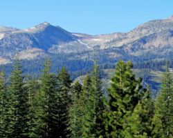
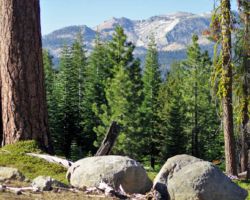
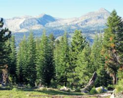
I cannot tell you how lucky we have been on so many of our trips. This happens so often. Yes, we know our directions, consult the maps frequently, and have some common sense – not a lot mind you, but we luck out so often. We drive and drive, get cranky as it gets late and the day passes, try this road and that, turn around and backtrack and try again and another, and more often than not, we come to the view we covet and a fantastic camp spot. And holy moly if we didn’t do it again (oops!). This was a good dirt road that led Northwest from the Pass (we later figured out we were actually at Packsaddle Pass) and eventually came to a clearing with a magnificent view of Pyramid and a sizable chunk of the Crystal Range. A couple massive Jeffrey Pines smack dab in the middle of our picture window prevented us from having a perfectly unobstructed view, but the vista was pretty sweet. Nobody around – check. View – check. Beyond the fire restriction boundary – check. Good camp spot with clear/semi-flat areas for tents – check. Room to park the two rigs – check. Defensible space from hunters or other alien attack – not so much – but it ain’t never gonna be perfect.
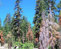
 The area had burned several years ago leaving black charring and scarring on some of the bigger trees, but that also removed most of the underbrush. While it definitely looked like people had camped in the area before, there were few fire rings and almost no litter, no garbage left in the fire rings, tire tracks, or other vestiges of human existence. We walked about long enough to be sure we weren’t still driving, looking here and there, trying to squeeze every part of Pyramid and the Range into our view, investigating all our options, and finally settling on what seemed to be the best spot for our camp site. However, before we committed to this exact spot, as nice as it was, for as long as we had been searching, in light of how early it still was, Bill and I decided we should follow the road out a bit more to see if, just by chance, and the grace of Jehovah, we could find a better spot.
Bill had mentioned he was interested in buying a truck and liked the Tundra, so I let him drive it to see how he liked it. Bill is a big guy, maybe 6-4 and since I had the back seat loaded with stuff, he couldn’t push the seat back, so his big ol’ legs were just about bent in half pushing his knees up to the dash board. It didn’t look especially comfortable but it would at least give him a little feel for the truck. Off we went, on down the road, catching glimpses of the Crystals but nothing that matched the open view of our spot. We came to another landing and the road petered out into a skid road. Having done our due diligence, we returned to Ken. We were home.
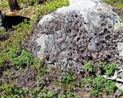
We slowly unpacked, a little from being a bit tired from the day’s hard work and a little from being in a good zone and not needing to do anything too quickly – there rarely is reason to push when we are out on a trip – that is kinda the point – or at least one of them. I believe a celebratory beverage may have been had while we unpacked and got settled in. Wanting to continue to explore our new environs, we loaded up a day pack with a couple beverages and headed South away from the mountain vista but towards an open area a couple hundred yards away that began to slightly fall away seemingly to provide us with another viewshed. We found a cool rock outcropping climbed aboard to relax and enjoy the warm sun and the peace and satisfaction of arriving at yet another sweet spot.
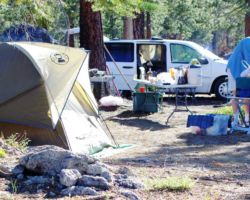
After a nice respite, we returned to our camp spot. It may have been cocktail hour, so a beverage or more was poured. Bill whipped out a cheese plate with three kinds of dry cheese and crackers that were most excellent. A quick inventory of who brought what and a menu was established. We wandered off a bit and got our tents up and gear stowed inside. Although Kenny needed a significant amount of assistance from Bill with his newfangled tent, we soon were ready to get to serious dinner preparations and cooking. More cheese and beverages were consumed. I was cutting up a vegetable medley of zucchini, squash, onion, chives, eggplant, and peppers. It is possible some wine was added and Bill put his sausage in there too – there was much rejoicing.
 I love cooking over a fire – briquettes and mesquite are good, yes, but a little flame is most excellent. I love it when we all take inventory of what we each brought and together we figure out what to cook and what to mix together. Somebody splashes a bit of wine into the sauce. Someone cuts up some fresh herbs and sprinkles them into the pasta. Someone else decides a dry rub and light coating of olive oil would be perfect for the chicken. Everybody adds something and it almost always turns out excellent. I can honestly say I have never tasted anything I didn’t like on any trip. Some things were better than others for sure, and some things were cooked better than others (somewhere between al dente and blackened), but we always eat exceptionally well on these trips and one of my favorite parts is the randomness of the menu and the various contributions coming together into a really good meal.
The sun was setting and projecting an ever-changing orange/yellowish light show on the mountains and the sky. We each wandered around the area catching the exact perspective we wanted. The little patches of snow on the Northern slopes in the shadowy nooks and crannies of the mountains were clinging to the cooler temperatures. At about 2500 feet above us on the light colored Sierra granite, the sunset colors were making quite a pretty picture. We seemed busy with trying to prepare for dinner, keep an eye on what was cooking, enjoy our beverages and keep them freshened up, munch on the hors’ d oeuvres, and watch the light show. And people wonder what we do out there all the time – it is exhausting I tell you!
With full bellies and a brain full of beautiful images, we decided to take an evening stroll down the road to see what we could see. We left the road after a bit and ventured out onto an open area with a view to the Northeast, basically up the Highway 50/South Fork of the American River Canyon corridor. We were imagining where Lover’s Leap and Horsetail Falls were. We were all driving up Highway 50 in our minds and looking over familiar landmarks as they are seen from the road, yet, as we were a couple thousand feet above the road and a mile or so South, our perspective was entirely different – making it fun to try to “see” as you do while driving and then visualize from where we were as we flew over the top.
The light continued to change as the sun dropped. Different ridges and rock outcroppings were illuminated with the decreasing angles of the sun’s rays. The cloud cover, now above the sun, picking up and reflecting back a palette of yellows, oranges, and pinks. With one stumble into the Manzanita bushes, we knew it was time to waddle back to camp, zig-zagging our path to throw off any posse that might be on our tails.
The moon was full although we really couldn’t tell how “Super” it was. It was bright, but it wasn’t exceptionally bright or big or exhibiting any other particularly “Super” characteristics. It didn’t light up Pyramid Peak like a halogen spotlight so I couldn’t take the night photos I had imagined. For good or bad, better or worse, richer or poorer, we had enough light to refill our cocktails, find another piece of wood for the fire, and tell a few tall tales of past lives. That was more than we could ask for.
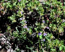
 Come morning, I was a little disappointed in the supermoon (the name no longer warrants a capital “S”) and my lingering inadequacy with my new camera, but I snapped a few photos of the general area, our camp, the Crystal Range, and a few wildflowers in the soft early light. I typically am ready to get back home on our last morning, even if it’s our only morning. It is hard for me to relax and dawdle when I think about the drive home, or want to do some exploring along the way, or, in this case, want to cut some firewood. My attention quickly turns to stuff to do at home; the garden, house chores and repairs, the cats, this, that, and the other; all the crap that needs attention that I was so looking forward to getting away from in the first place. I did want to head further out Road 71 towards Highway 50 to make sure that we had actually reached Packsaddle Pass and to hopefully see the view that our friend Tom had told us about. But I also wanted to get a good load of wood on the way home and you never are certain how easy that is going to be, so I wanted to get going to make sure that went well and I wasn’t too tired and would get home safely, sanely, soberly, and soundly.
So, I had a morning beverage. I often find it calming to have a breakfast beverage while starting to pick up, pack up, and put away. It keeps me in camping mode and allows me to mellow for a bit longer, to enjoy a few more laughs and the relaxed morning banter with the fellas around a morning fire and coffee. We also usually toast our friendship and the spot, the trip, the area as a whole, and thank the gods for another trip. So before fully entering “on the way home mode”, I often get myself back into morning mode and this was accomplished quite well.
I followed Bill and Ken down Road 71 for a bit until it was pretty clear we had crossed Packsaddle Pass and were in fact heading down to Highway 50. The actual encounter with that exact intersection would have to wait for another time – another trip. I had to chase them down before I got their attention to tell them I was turning back. A few more laughs and hugs goodbye and another trip ended. One turn of the road and they were gone.
After an exhausting 8-point turn in the middle of the road to turn around, I was headed back up to the Pass. I stopped at the top to get my bearings again, (OK to take a quick leak) and off down the other side of the Pass retracing the prior day’s trail. Back down Road 71 to Silver Fork, past the campground and the campers along the creek; past the private Ranch and back up to Mormon Emigrant Road. Turning right and heading down the hill, I morphed from camper to woodcutter.
 I had all my gear – saw, gas, oil, bucket of tools, shovel, two axes, rope, tie-down straps, and of course, my permit and tracking log. I typically only cut Oak (Quercus) and Cedar (Libocedrus) – nothing else. I had scouted these new piles of thinning debris the Forest Service had created along several miles of the road, but most of the piles were in the higher elevations, meaning they were mostly red and white fir (Abies). Before I got to the piles that were the farthest down the hill, those I thought had the best chance of having Oak and or Cedar in them because they were at lower elevations, I came to an old burn area on the South side of the road. It was loaded with Cedar – which, more so than the Oak, was my primary objective. Much of the bark on the trees was charred black and that is a big mess, so I didn’t want to fool with that, but it appeared there was enough unblackened dead and down smaller Cedars to stop and cut a small load.
The sun was unobstructed in a clear blue sky, but it wasn’t hot. This was an open ridge top of poor soil, little underbrush, a fair amount of rock – typical Cedar habitat. As usual, if you see some good trees or dead and down firewood from the road, once you get in there on foot, you typically find much more. I am not too picky about my wood. It can’t be rotten or buggy, or too green/wet, but as long as it is Cedar or Oak, I am happy to pick up small pieces, branches, chunks, and other people’s leavings – whatever. I don’t like to handle big heavy logs or rounds anymore and I don’t like to split anything back home, so smaller stuff is fine with me. There was a ton of saplings that died from the heat of the fire – not from burning – so the bark was clean and although the smaller trees that are open grown have a lot of branches that need to be removed, they are very brittle and pretty easily knocked off with the back of an ax.
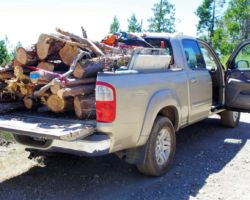
Before long, I had staged a decent load of wood, found a tangle of trees that were smashed from a larger pine falling into them, and noticed three or four standing dead trees that could be taken. I hauled the saplings (about 4” in diameter and 6’ long) to the edge of the road, and then went back to the tangle. I cut out about 6 – 6” x 6’ logs from there, and staged them at the side of the road. I loaded those two piles into the truck to see how much that was – maybe half of what I wanted. I dropped the four trees and got 12 – 6’ x 3- 10” diameter logs out of them. Picking here and there, I soon had a pretty good load of nothing but small Cedar with only having to drive the truck about 50’ to make the loading easier.
 I wasn’t hung, but I still didn’t want a celebratory beverage – sticking with lots and lots of water. I rested in the shade a spell, thought about the trip, thought about many other trips in this country, thought about all we had done and seen in two days and one night, and then I started getting a wee bit of an eerie feeling – a sort of nostalgia or wistfulness. Not sad so much, but, like sensing a presence. I wandered away from the rig up and down the road a piece, and then it hit me. This spot appeared to be a road that we had come to many years ago to play in the snow. The kids were very young so it must have been 15 or more years ago. We had a fire and inner tubes and sleds. I think Cub was with us and a bunch of people from the Board. It was a great snow-play day many moons ago with some great people. It was a great memory and a great way to end the day. Besides, I was hungry.
