Trip Date: October 17, 2013
I don’t remember when this was as I am writing this several years later, however, it was either during the Rim Fire in Yosemite in 2013 or when the federal government shut down due to the lack of a budget which was also in 2013, so my hunch is this trip occurred in October of 2013. Due to one reason, the other, or both, our recent run of Fall trips to Yosemite had to be curtailed and an alternative plan implemented.
I had wanted to go to the Central Coast for some time, and Kristen loves the coast, so I felt the energy convergence in that neck of the woods. Some years ago we had a trip planned to Montaña de Oro State Park west of San Luis Obispo with Howard and Kathy and the boys and it fell through, so I have had it on my radar for many years and this seemed to be a good time to get er done. I should have known better.
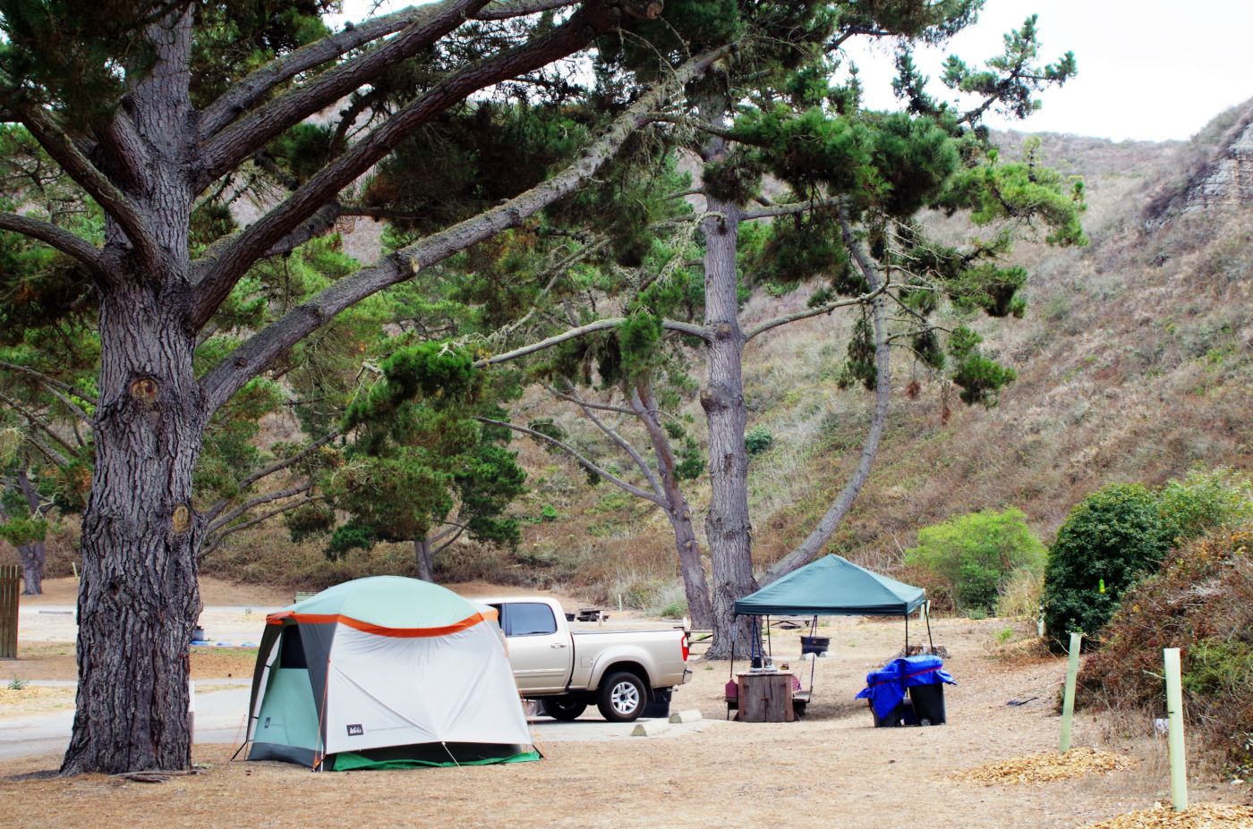
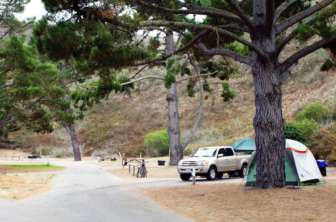
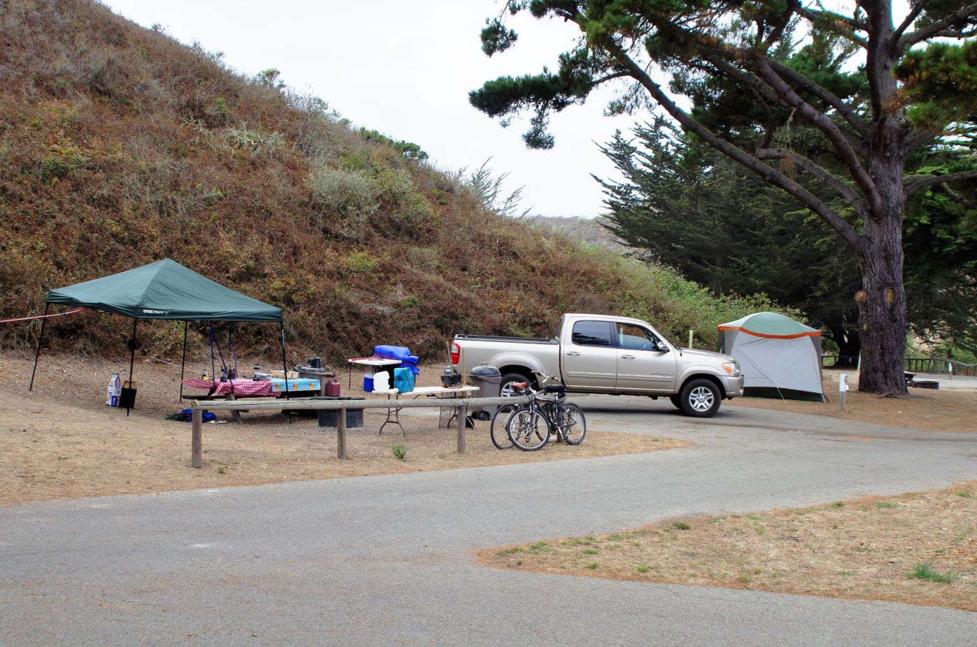
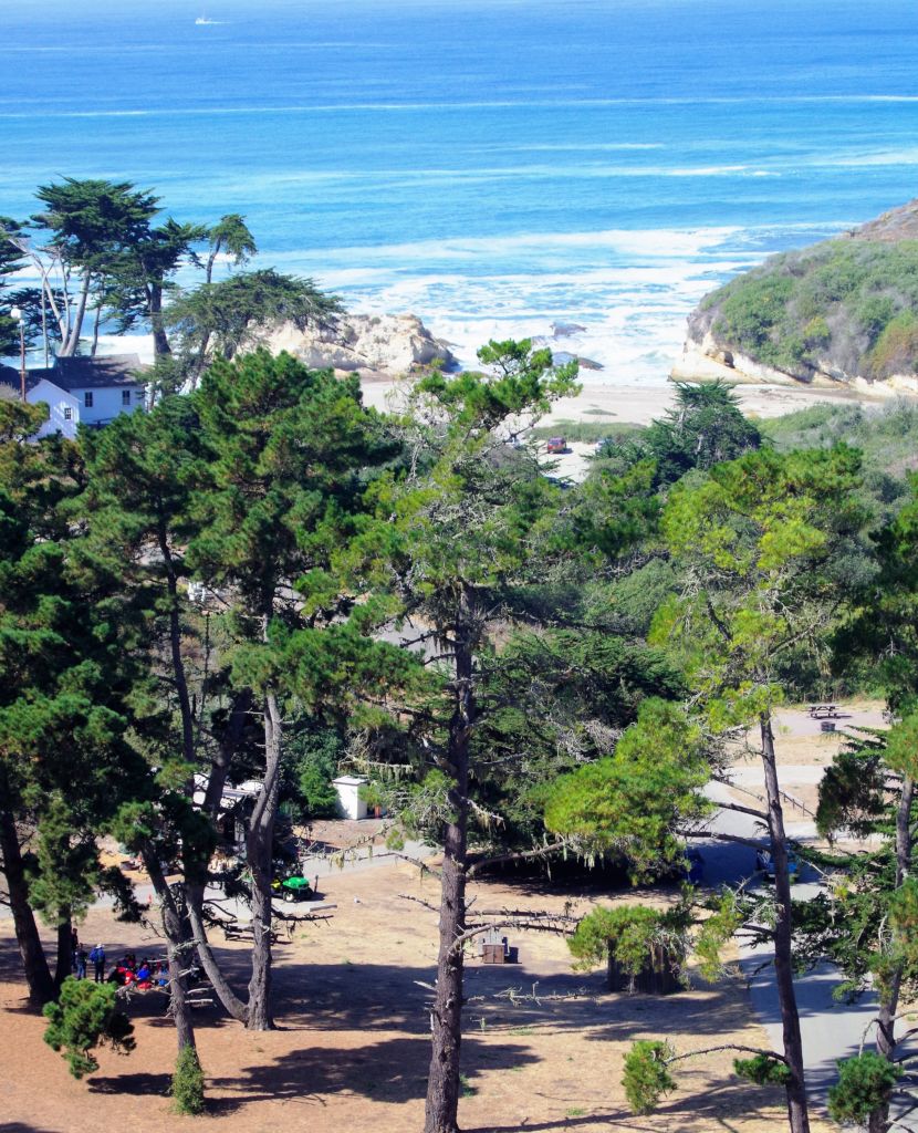
Since it was already September, I went to the government reservation web site to look for accommodations. I failed miserably. I ended my web site experience under the impression that reservations weren’t being accepted and everything was first come first served. We went down on a Wednesday and found the tiny campground virtually empty. The campground is in a narrow canyon just off the coast. With maybe 38 of the 40 spots vacant, we picked a great spot and settled in. The daytime temperatures were great and the night time temps even better. We had time to walk through the campground, look at the other sites, then head back for a great dinner and raging fire before an early bedtime.
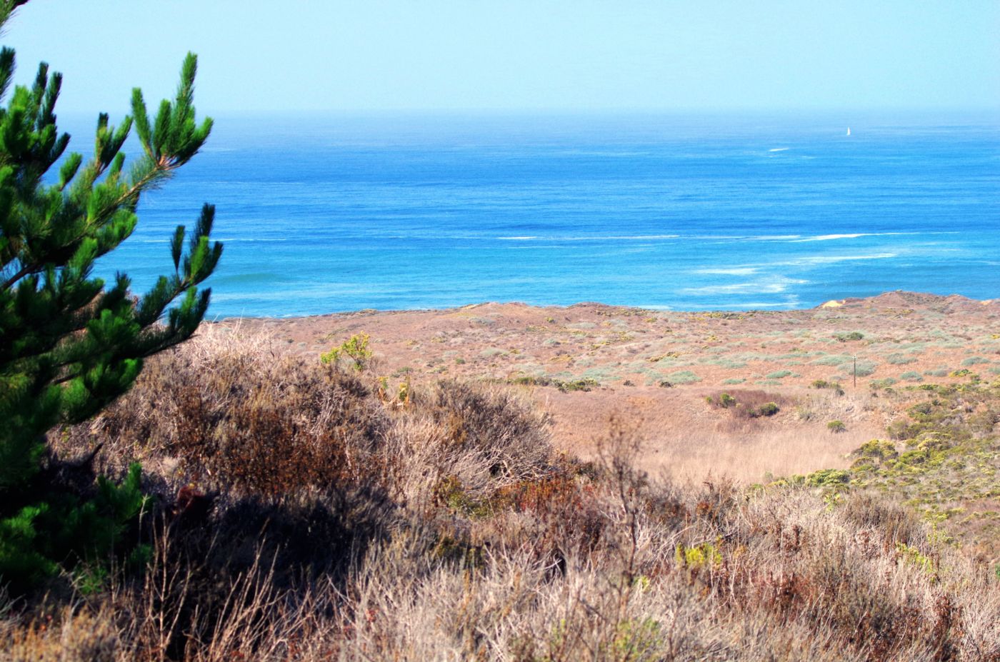
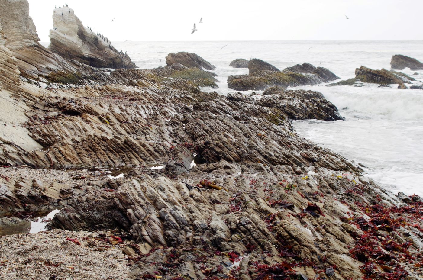
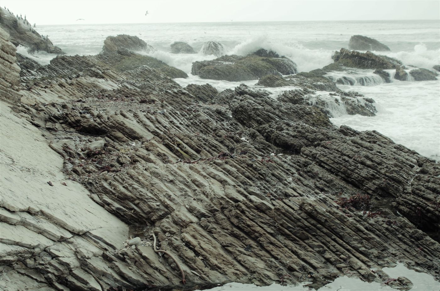
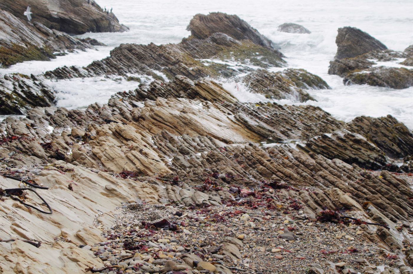
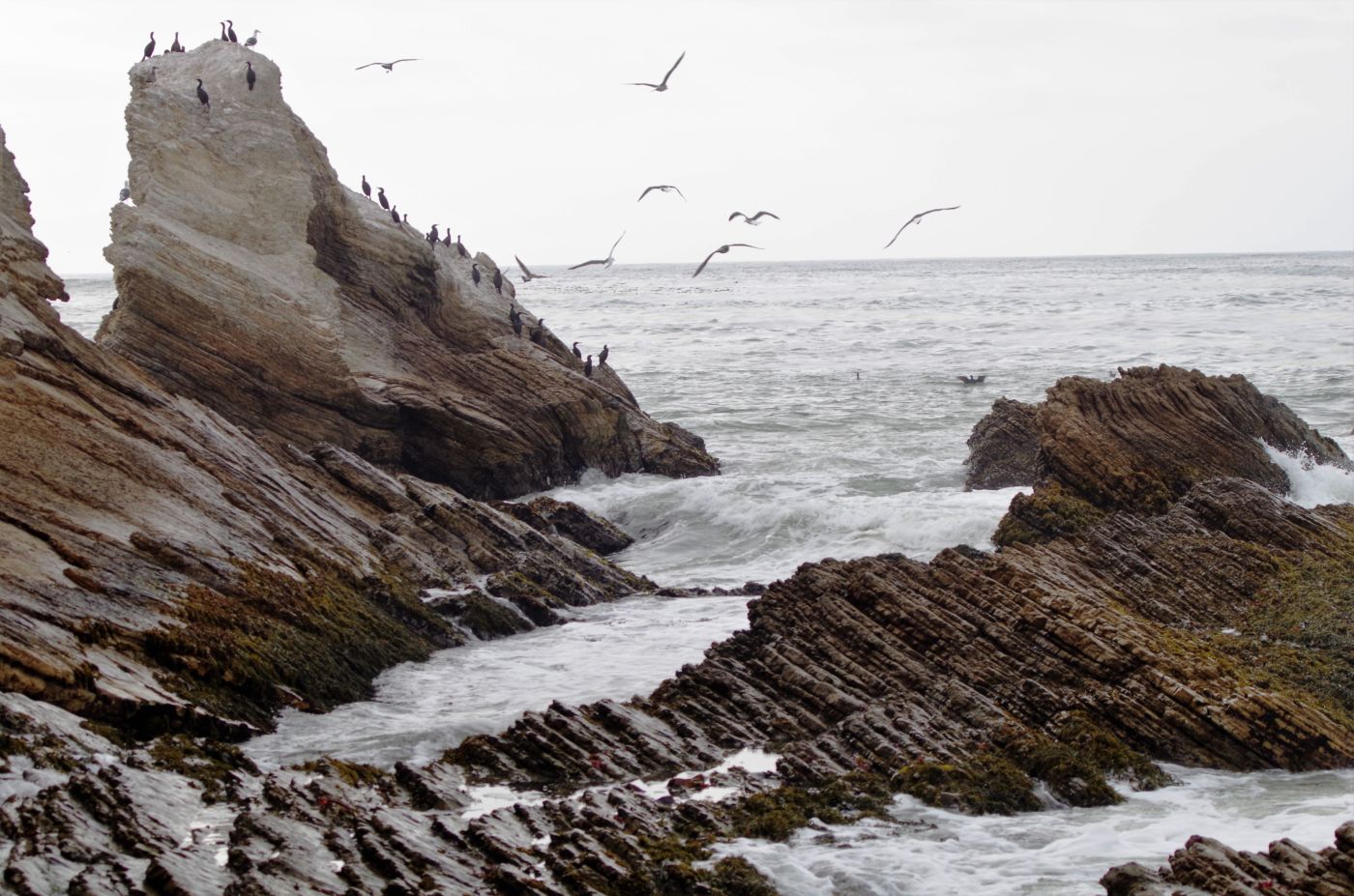
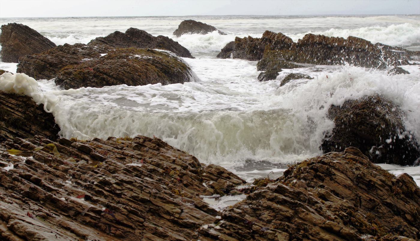
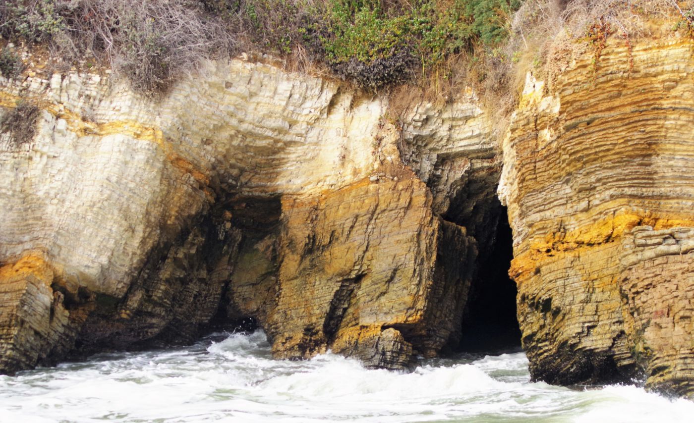
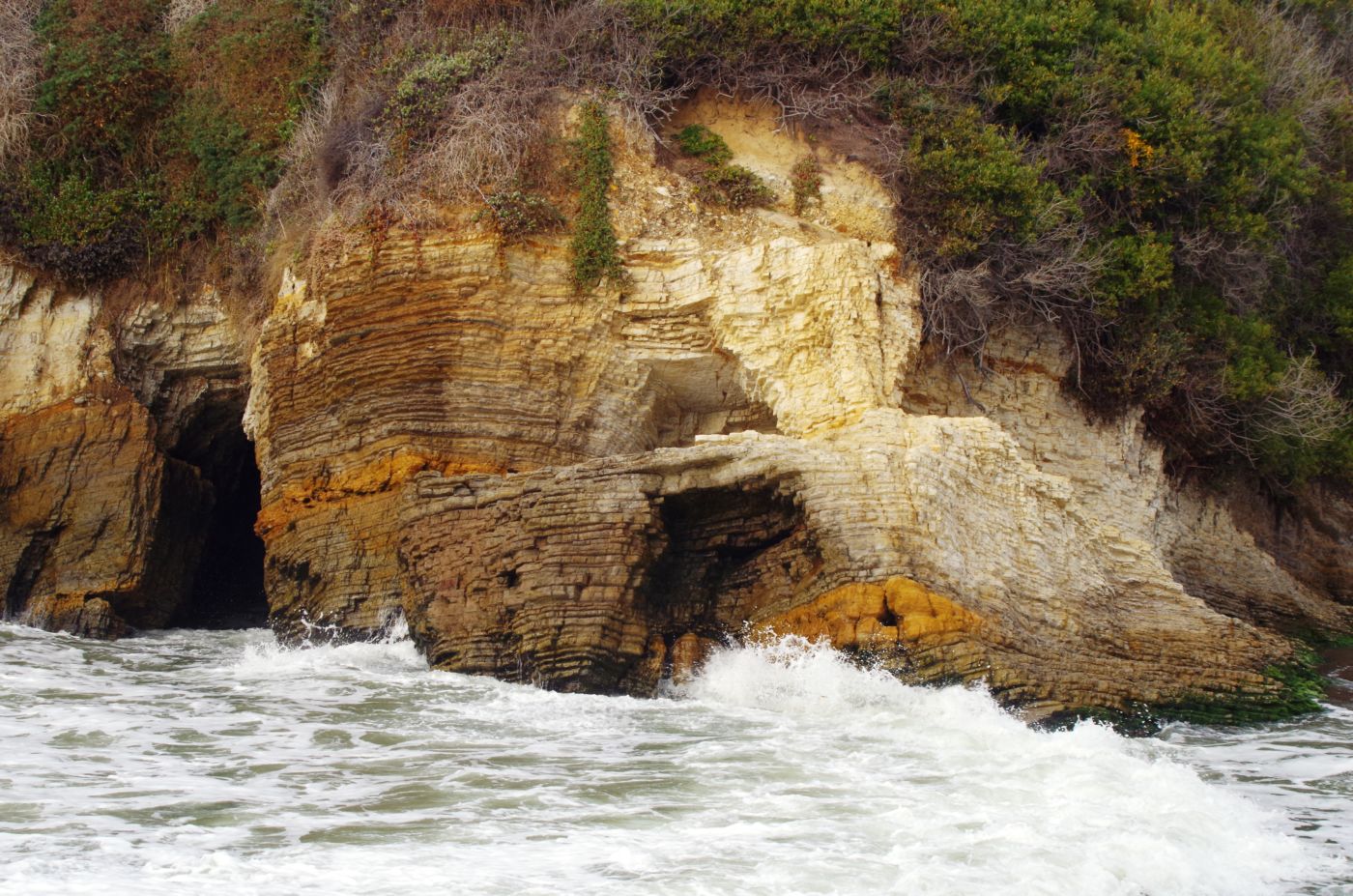
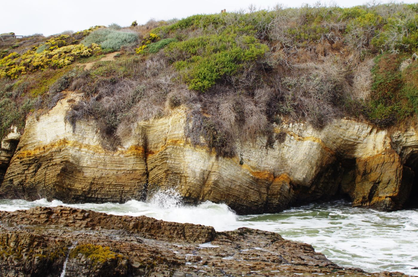
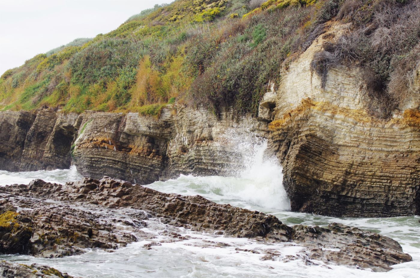
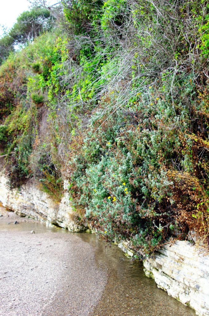
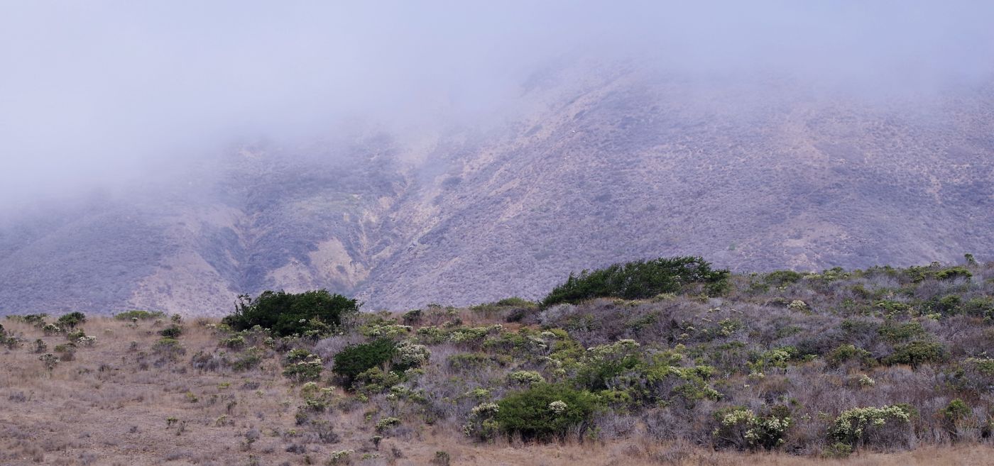
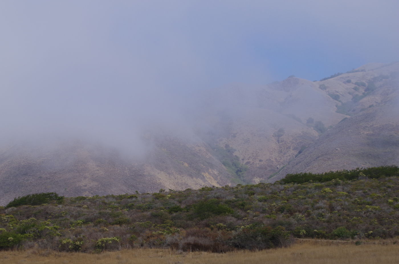
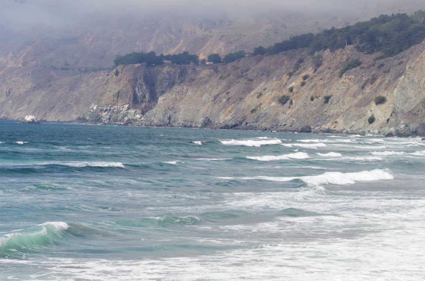
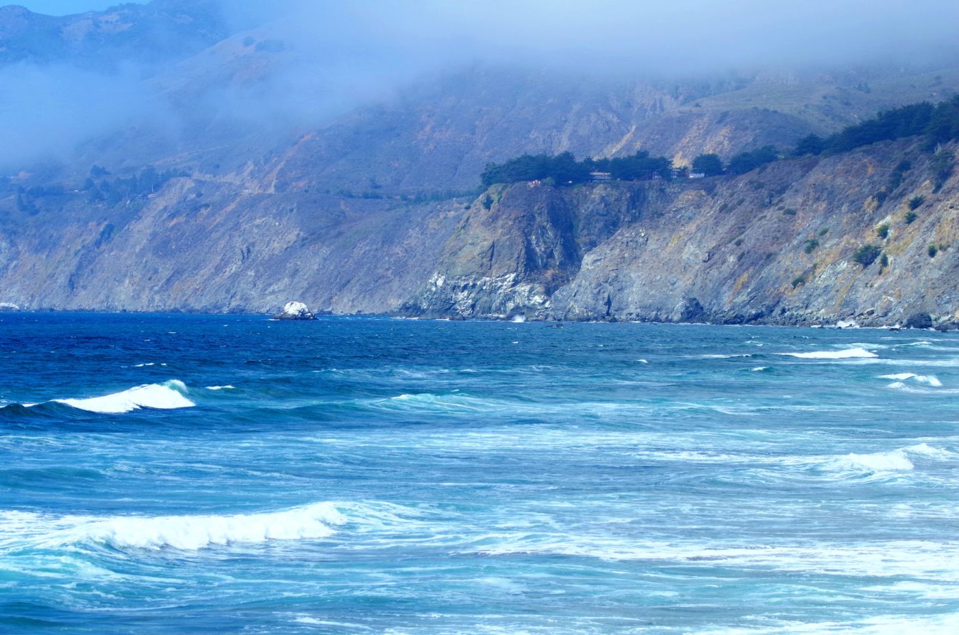
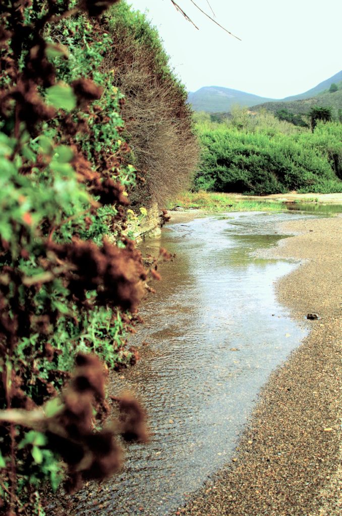
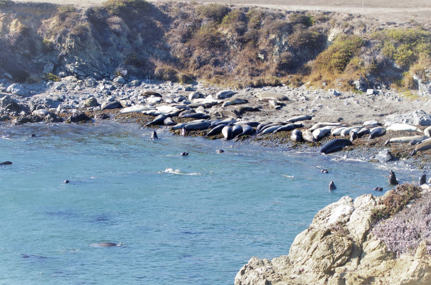
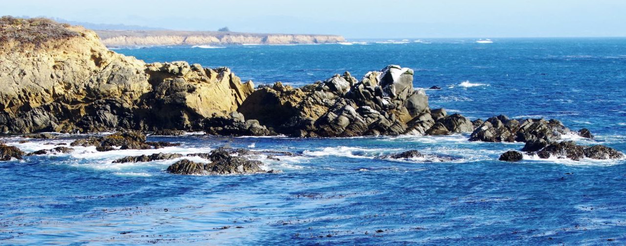
The next day we drove the dirt road south along the coast to the old rusty fence that marked the park boundary and the common boundary with the Diablo Canyon Nuclear Power Plant. This was like a very surreal scene out of some bad syfi movie – this rusty old fence degrading quickly from the salt air and the brutal coastal weather with enough holes and security breaches to just beg trespassing, despite skull and cross bones signs and warnings of federal violations from trespassing and armed guards and dogs and such, all set against the backdrop of the spectacularly beautiful central coastline and dramatic views out over the glorious Pacific ocean. We walked the fence line for a while, only kind of hoping to motivate a warning salvo from the watchful eyes we felt. Then we turned our sites on more pleasant surrounds and ventured inland, into the wonderful canyon country formed by Islay Creek flowing to the sea from the East.
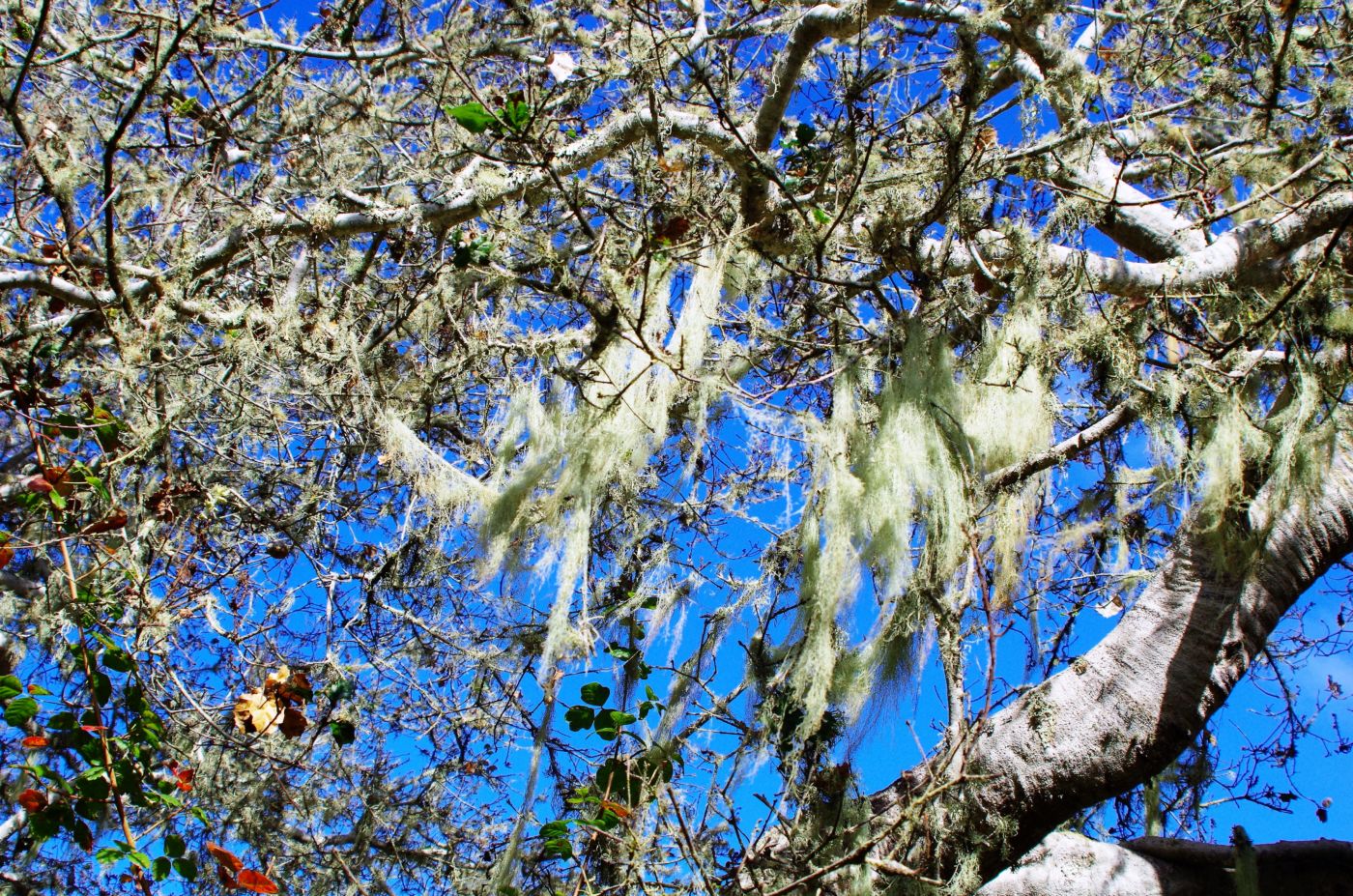
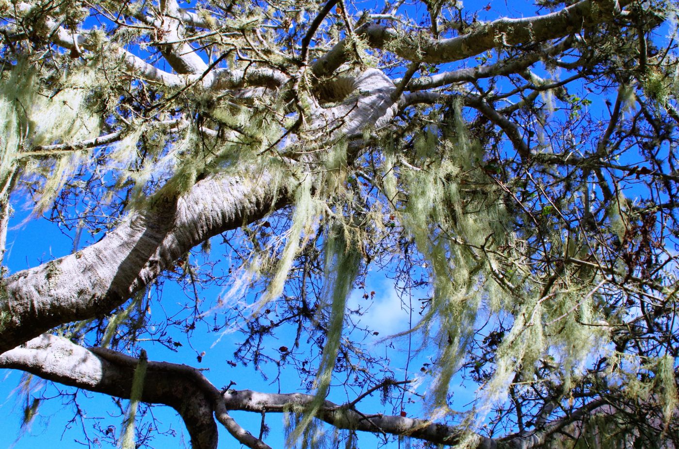
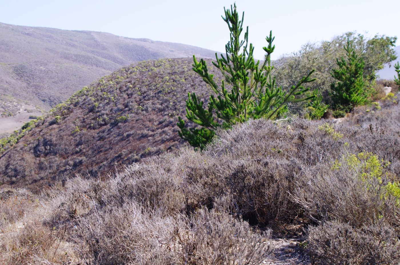
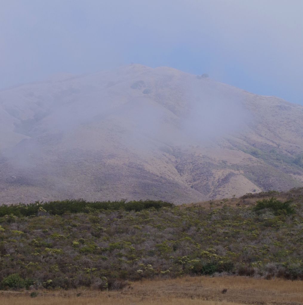
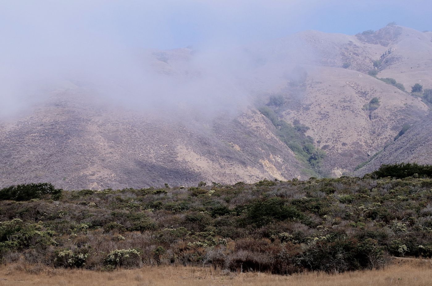
The canyons were a totally distinct environment. The cool coastal breeze was unable to penetrate the hills and canyons, so it was much warmer, very still, and very quiet in the canyons. The vegetation was plentiful and completely different. It was very cool to have this totally distinct area to explore and enjoy in addition to the exposed expansive coastal plateau. On our return, we attempted a loop trail, as usual trying to avoid retracing our prior path, and came out on the bluff directly above the campground. This was great but for the fact that our truck was still down yonder at the end of the road.
The next day, we ventured into the town of Los Osos which is just outside the park. In fact you literally have to drive through town to get to the park, unless you came via landing craft as Morro Bay is to the North, the Pacific to the West, and Diablo Valley to the South. The only way in is via Los Osos Valley Road into town and then out Pecho Valley Road which dead ends at the rusty fence.
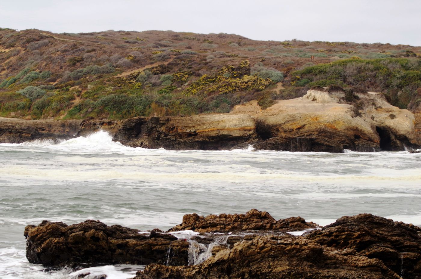
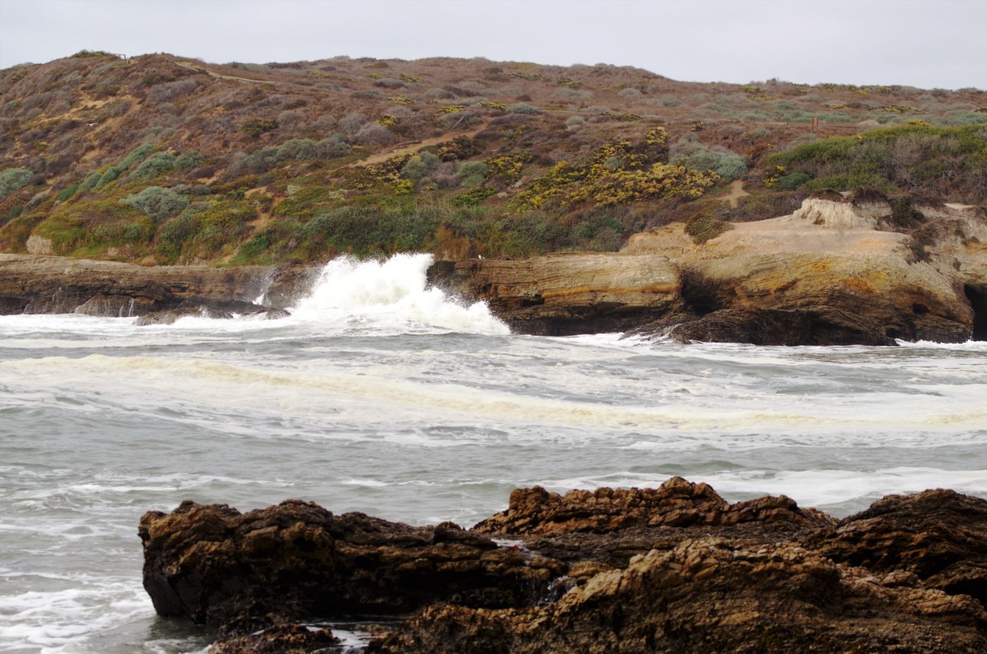
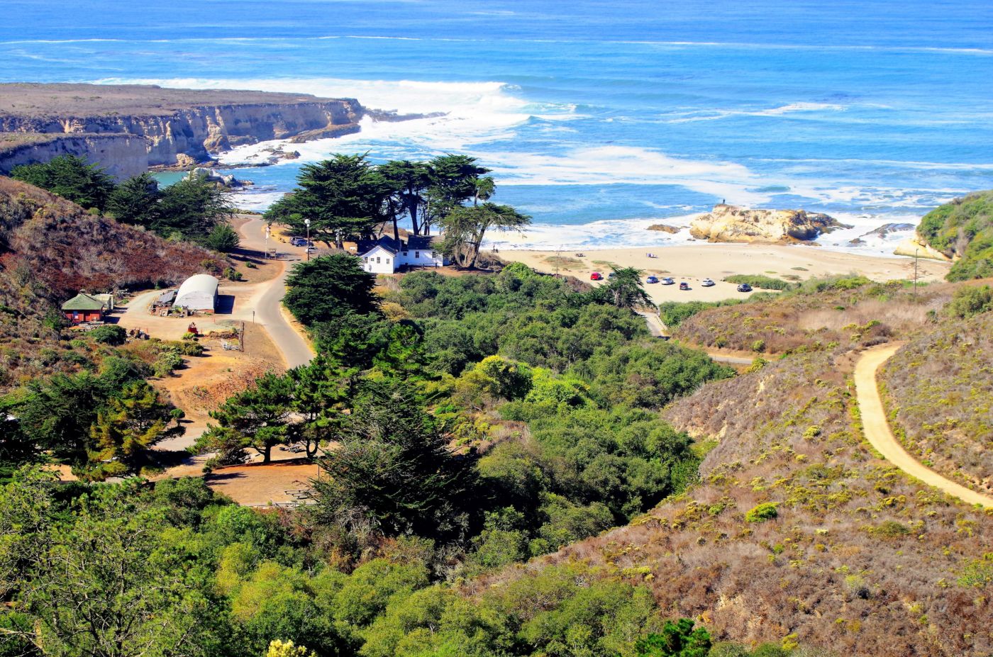
With over 8,000 acres, including seven miles of shoreline, Montaña de Oro is one of the largest state parks in California. It has no amenities, no store, supplies, or visitor center per se. The old Spooner Ranch House is staffed periodically by docents, and that is it. The campground is primitive meaning no water or flush toilets, showers, or dump stations. The area is popular with horseback riders and school groups, and due to its small size, fabulous location, and proximity to Los Osos, San Luis Obispo, and Cal Poly SLO, it is well used.
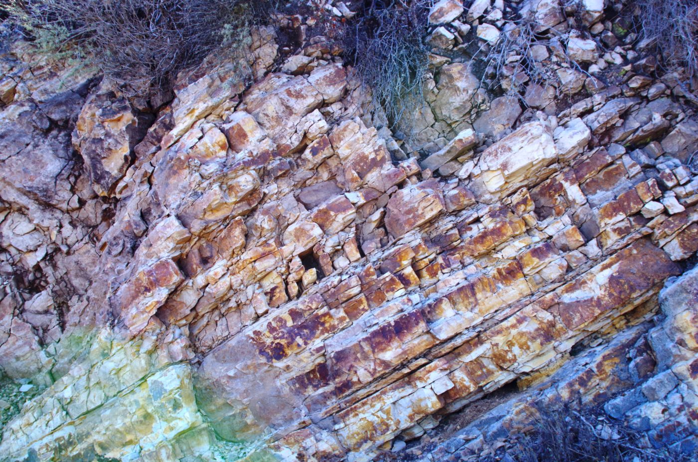
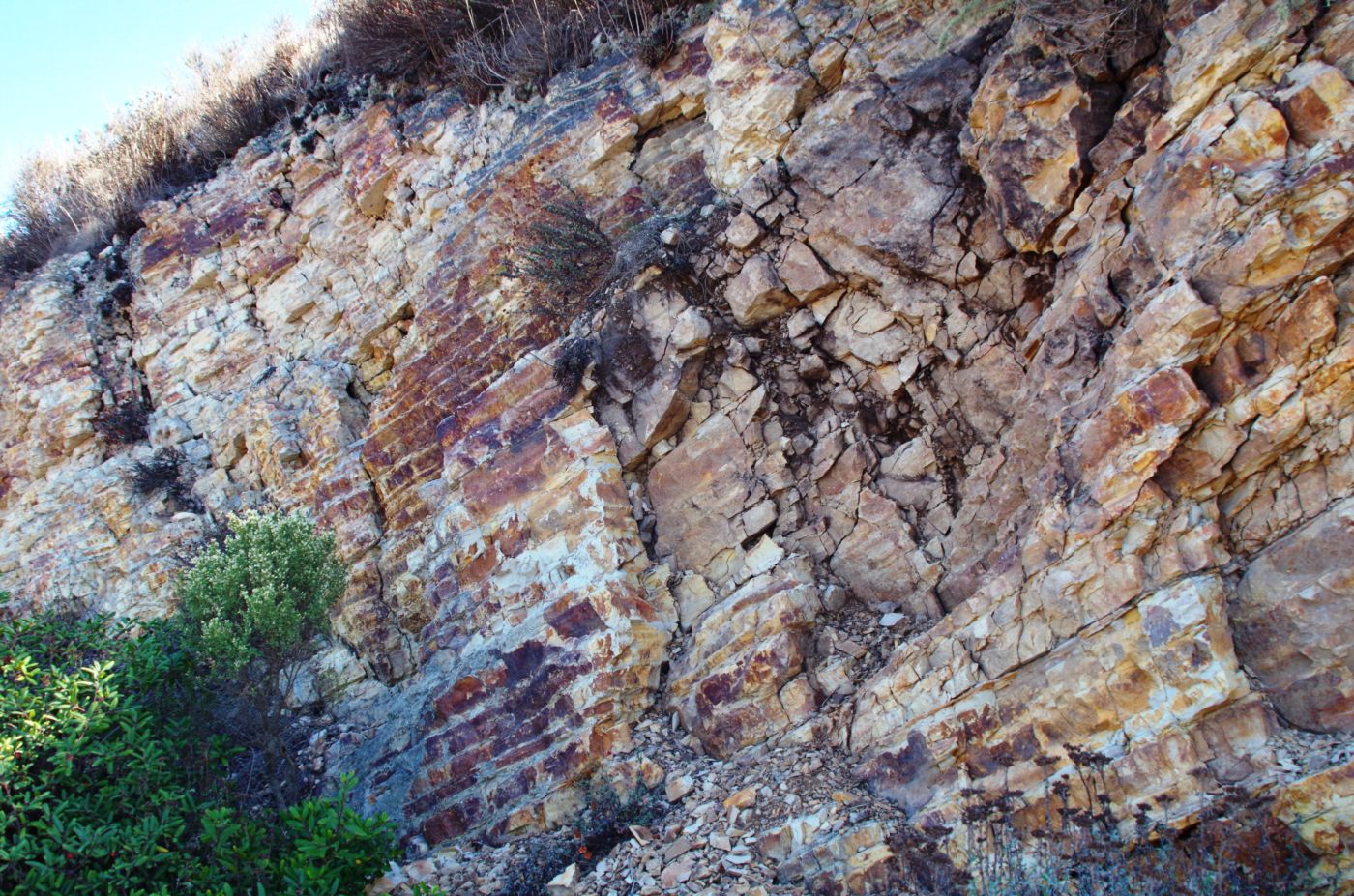
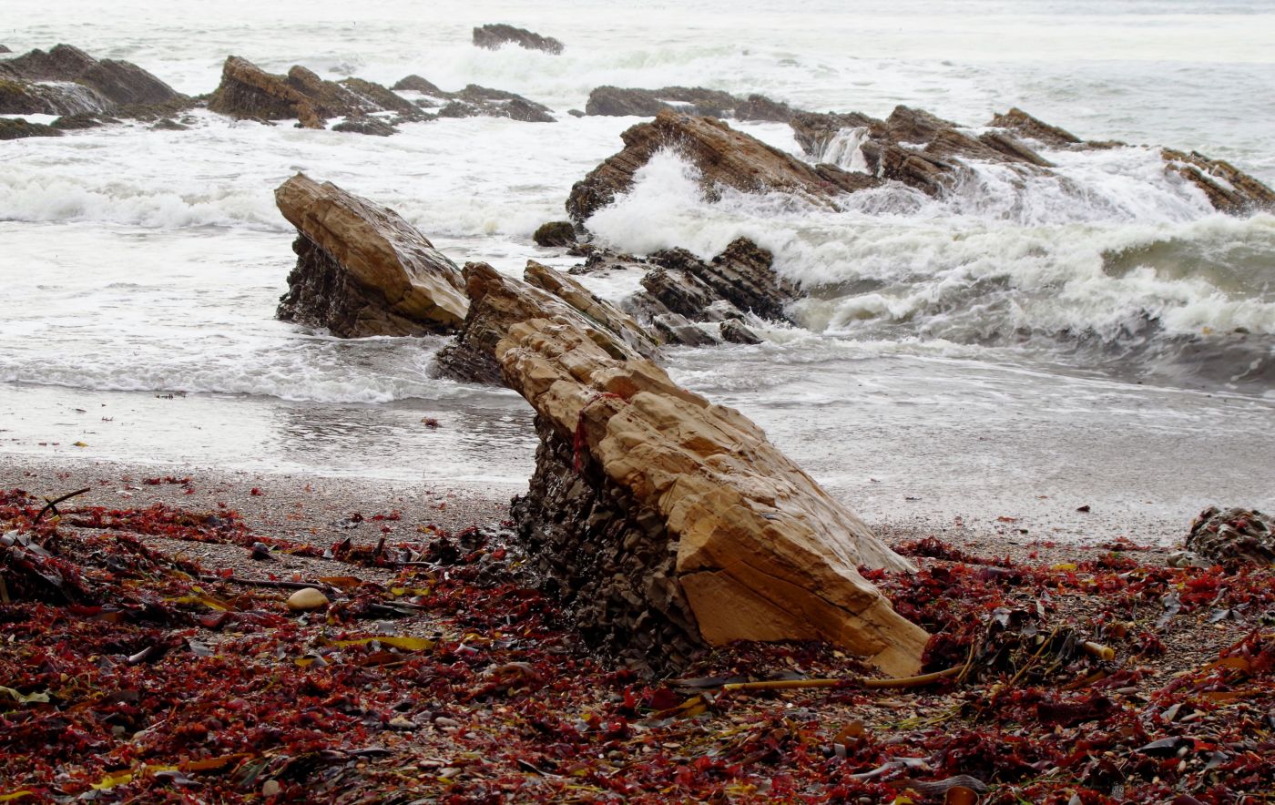
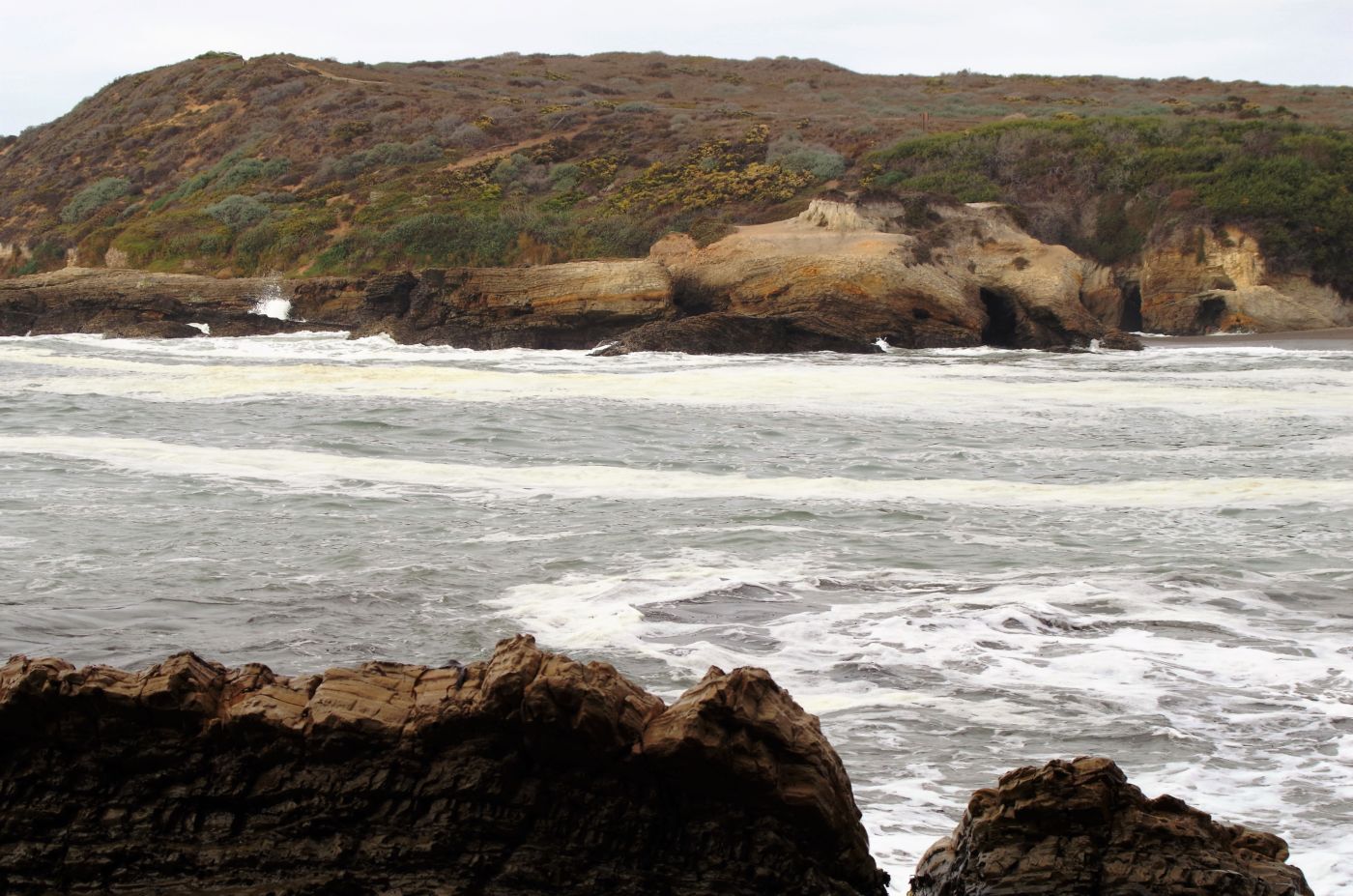
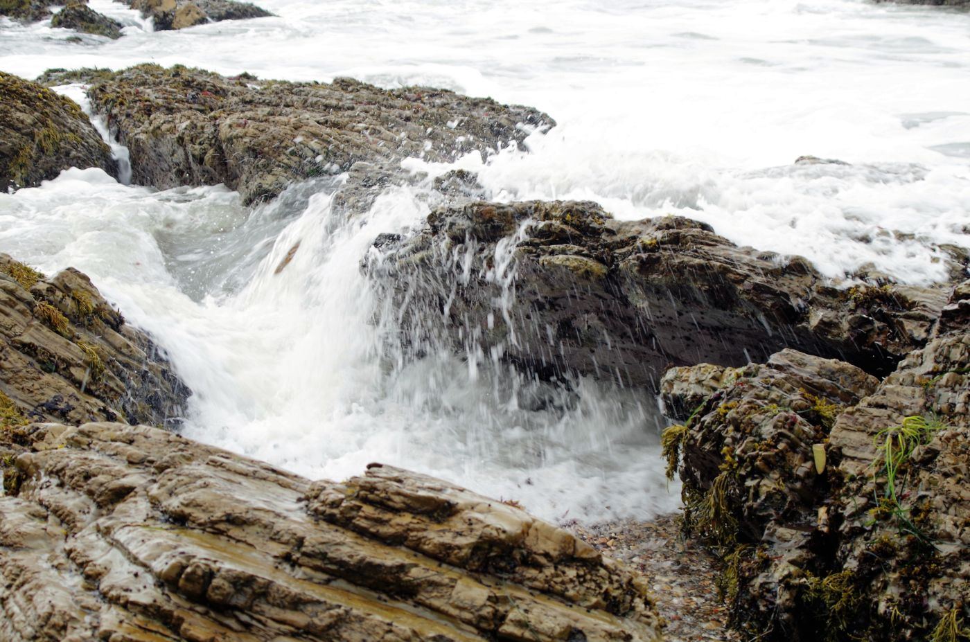
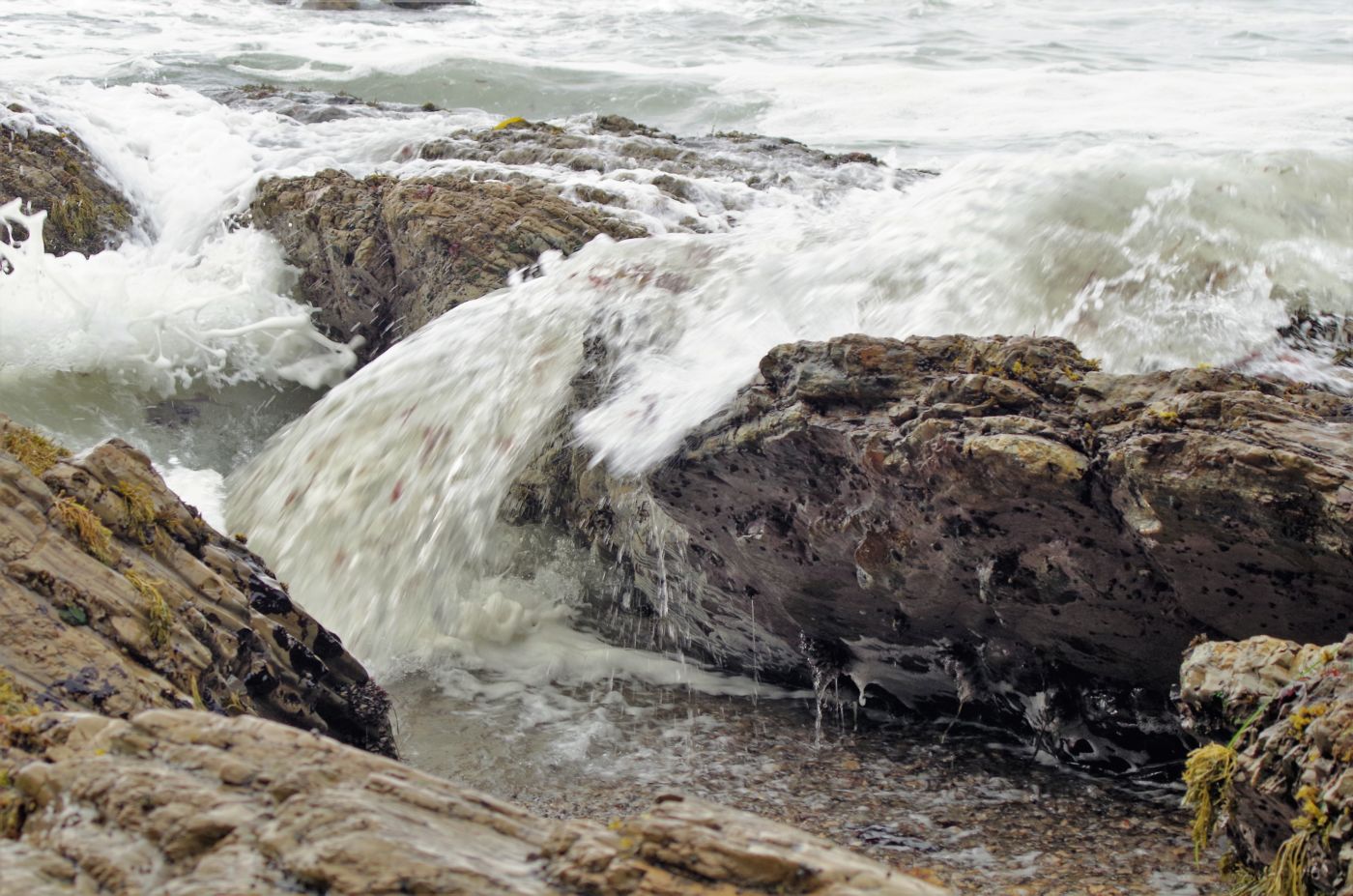
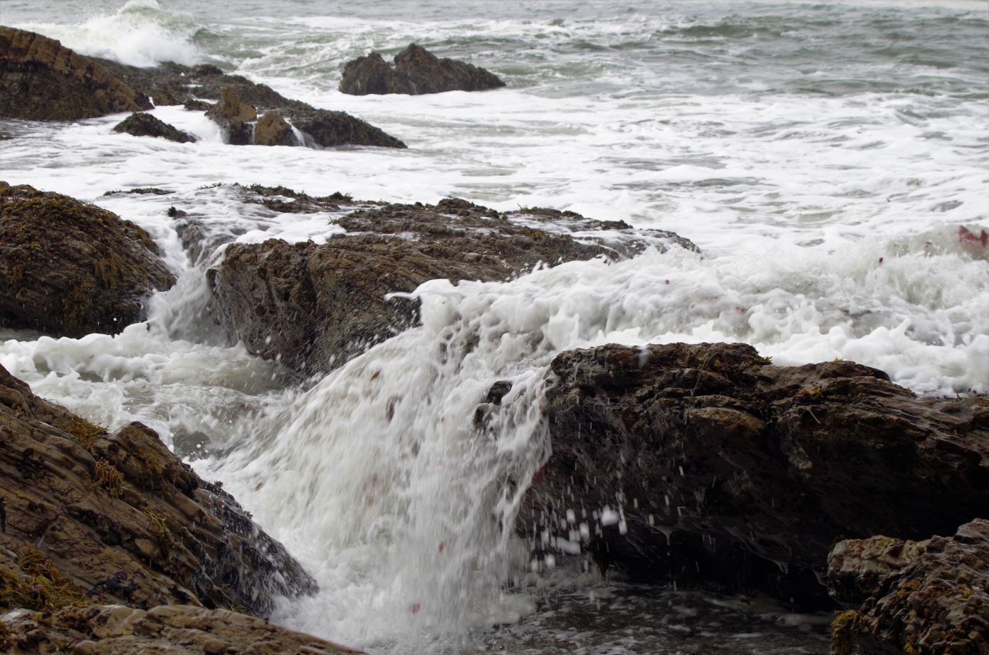
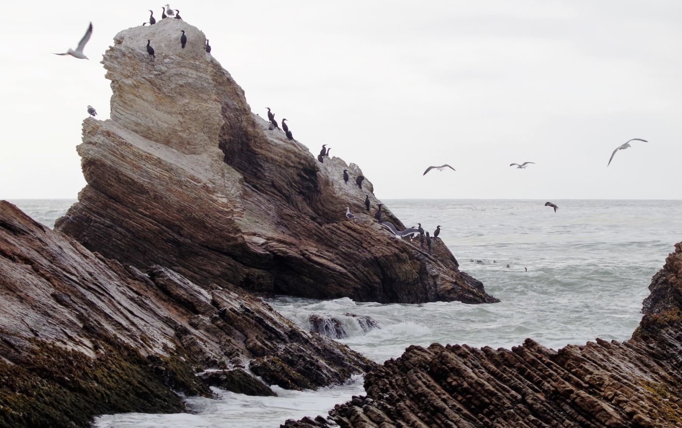
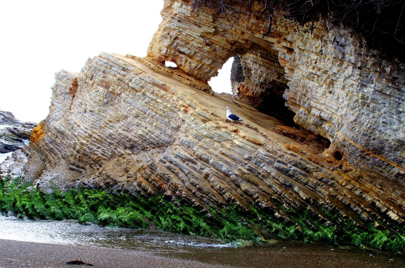
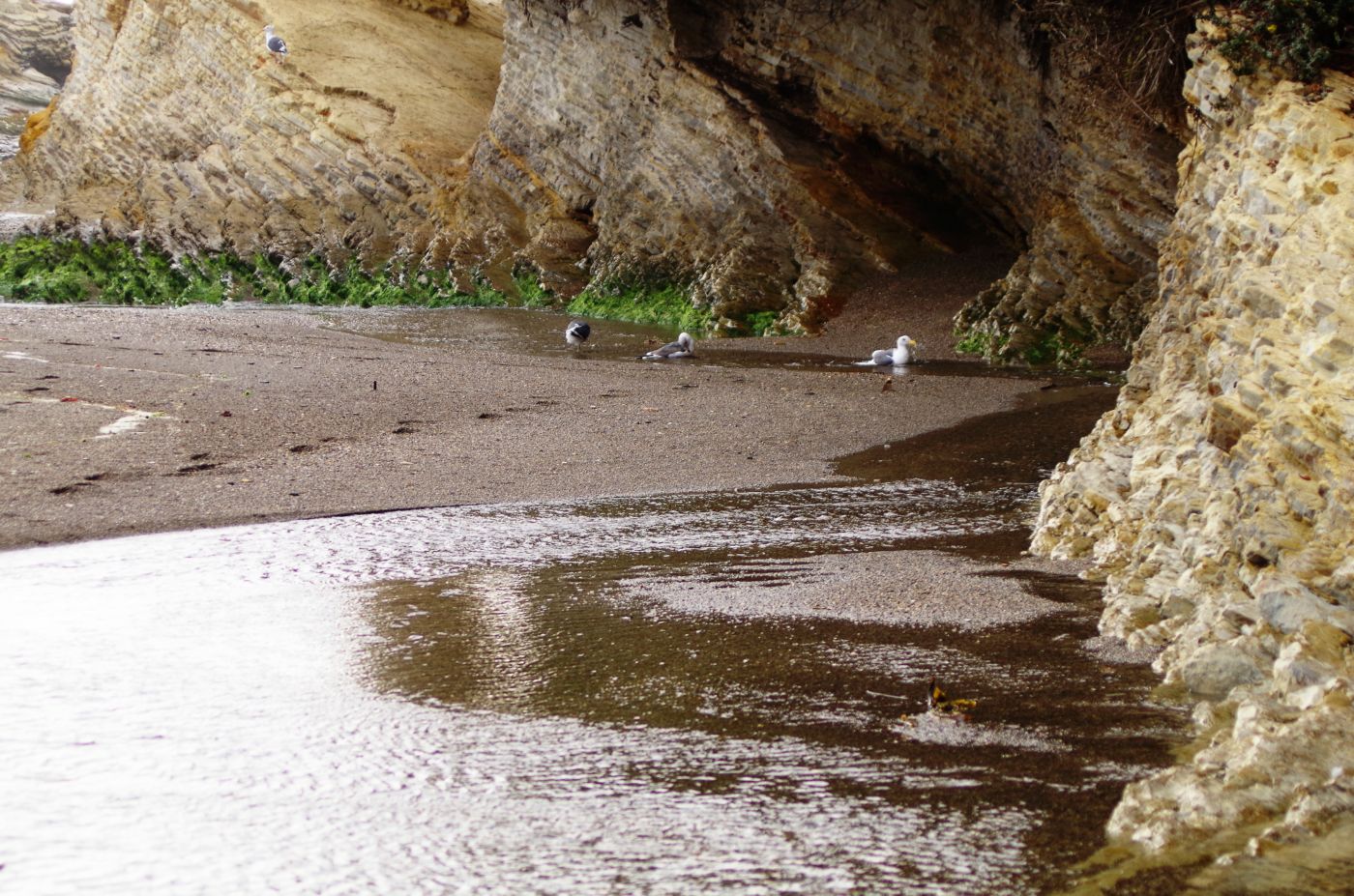
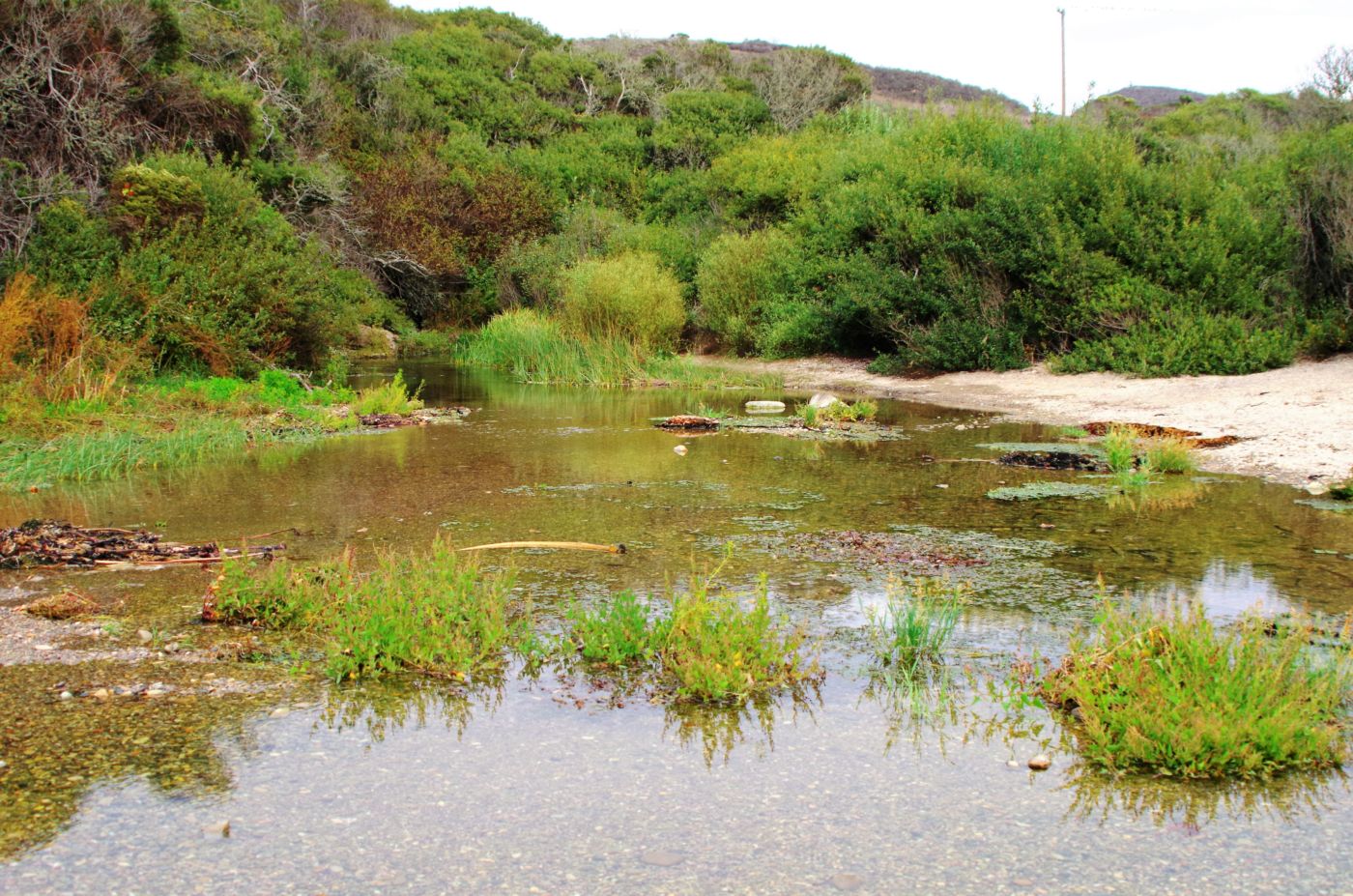
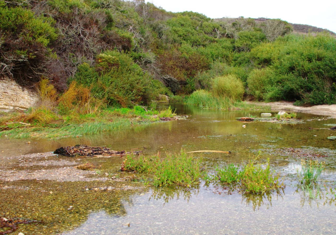
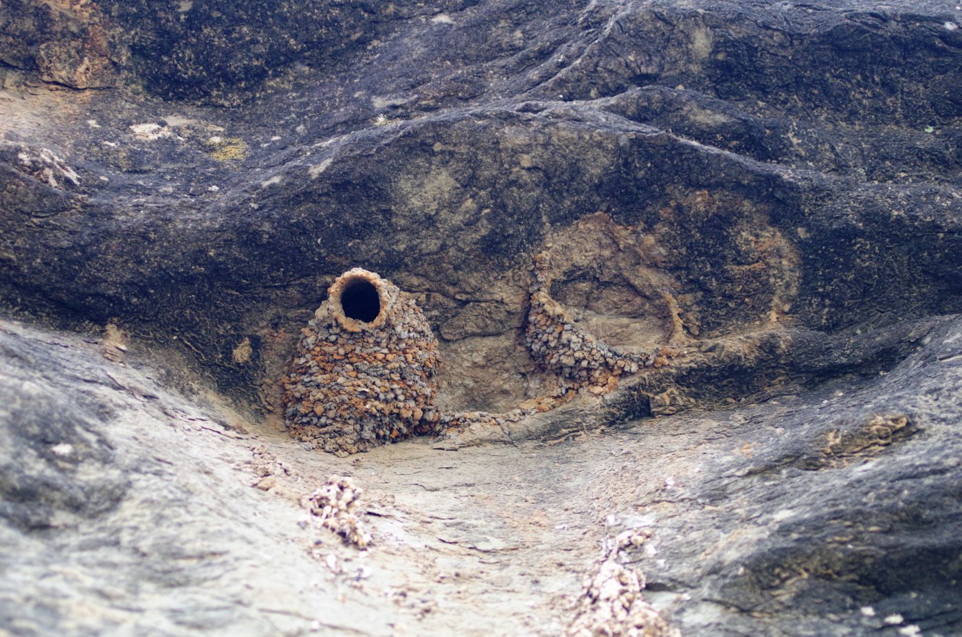
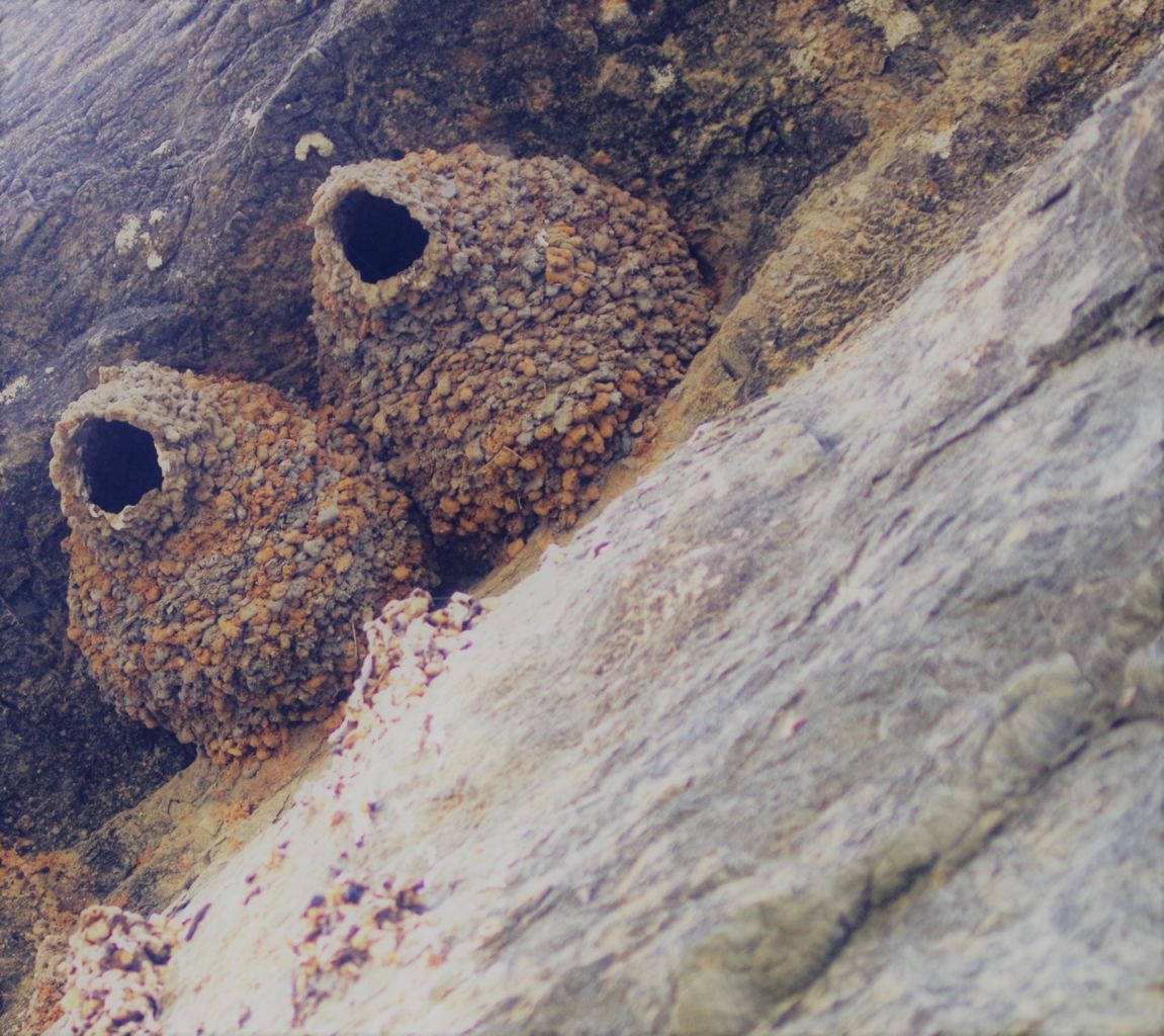
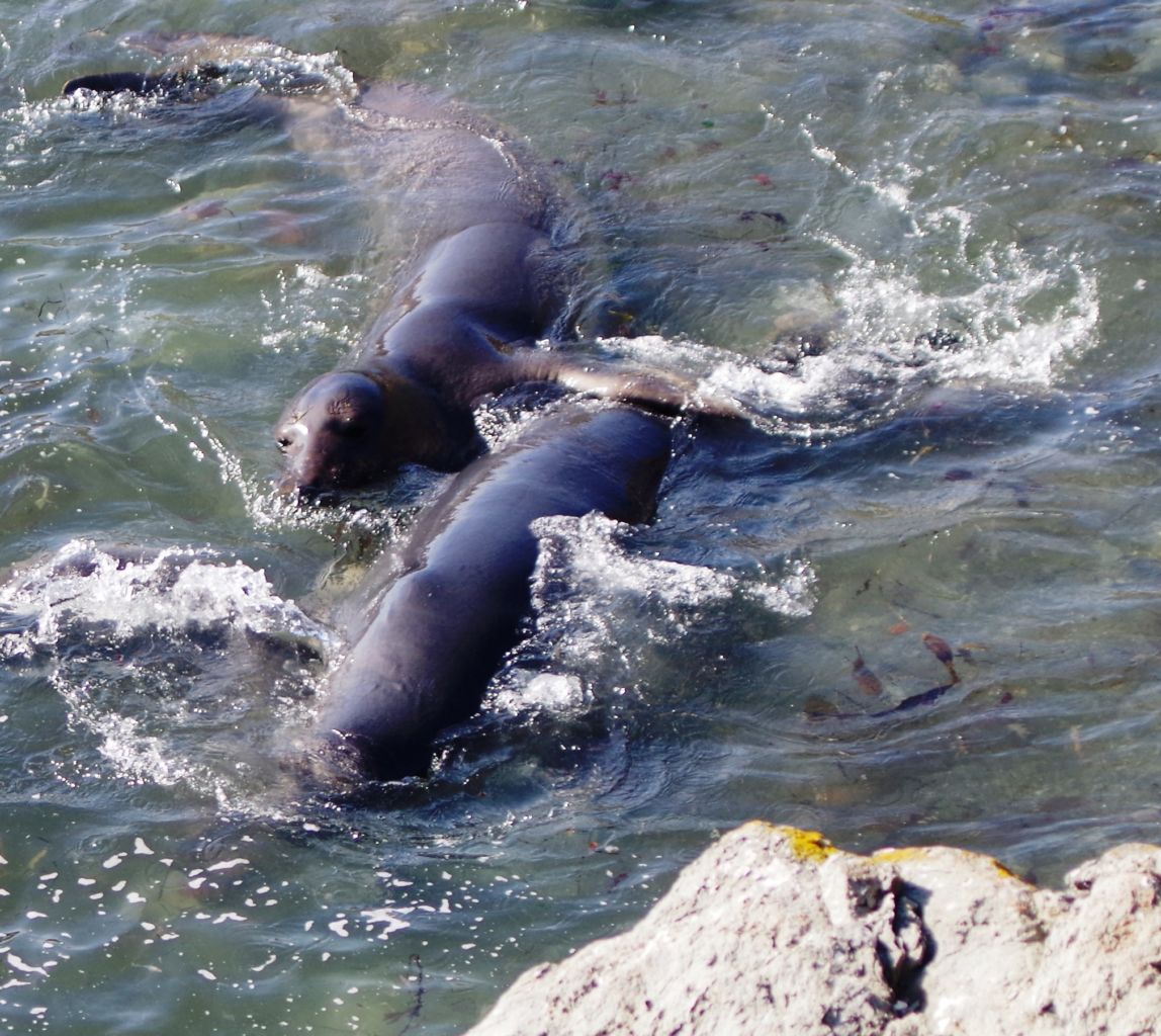
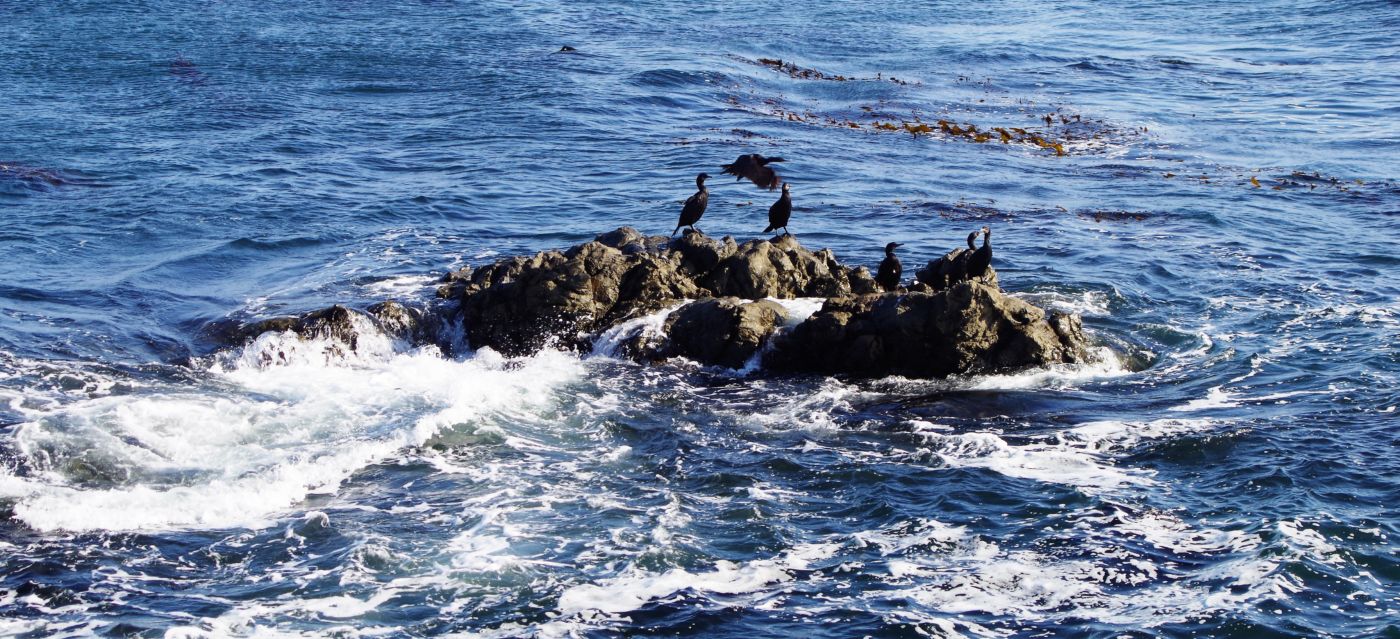
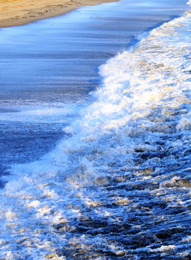
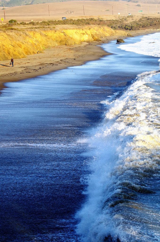
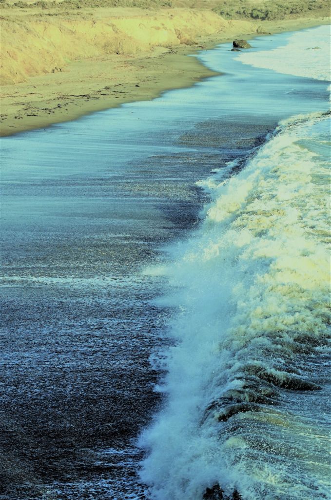
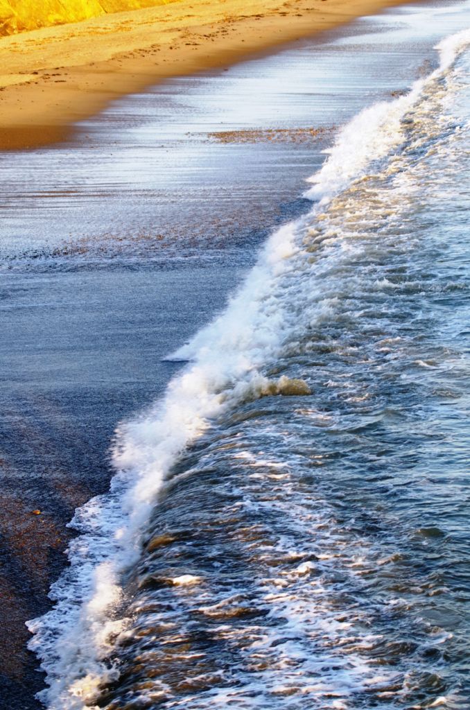
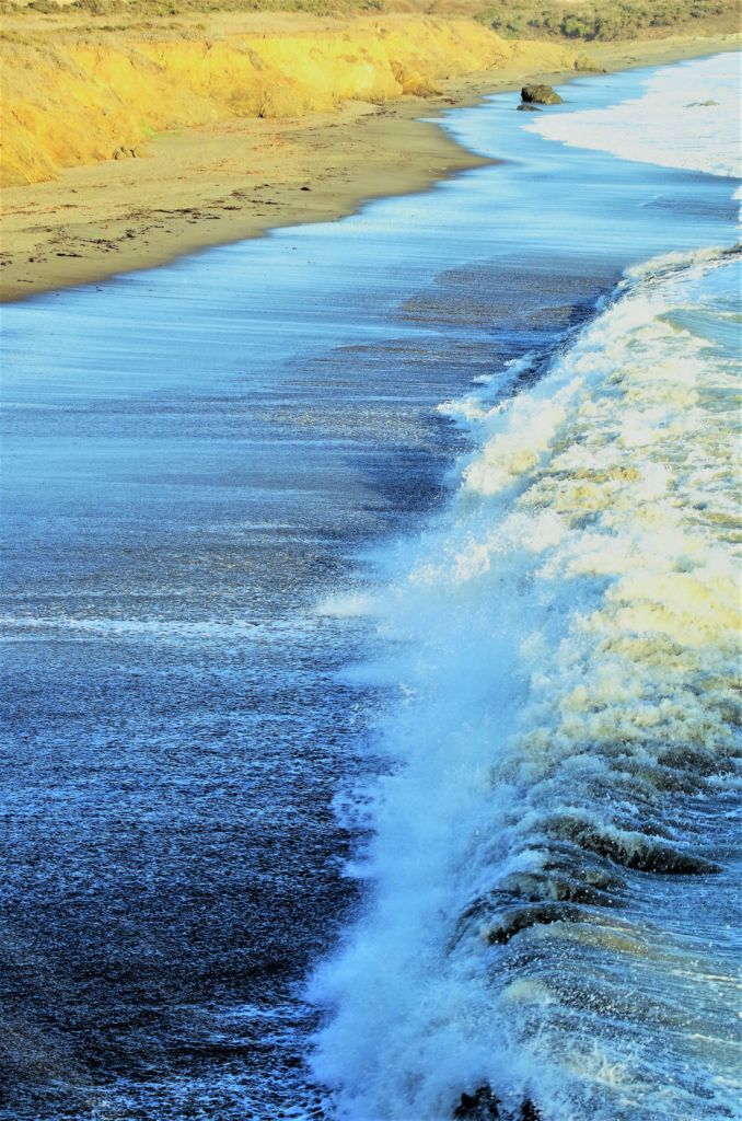
Clearly, the main event is the ocean and the coastal features, but the creek and canyons are not to be overlooked. The northern part of the park is a gigantic sand-pile. Ancient sand dunes are revealed in the bluffs at the south end of the sand spit, and you can walk for miles along the long finger of sand that separates the ocean and the Morro Bay estuary. You can look out over the bay and the sand spit as you drive back and forth to the park and all other environs so you can’t help but be drawn out there. It is truly a treat to walk along the sandy hump separating bay from ocean surrounded by crashing waves, squaky birds, and wetlands. Despite being a tiny bit sandblasted, it is a glorious adventure.
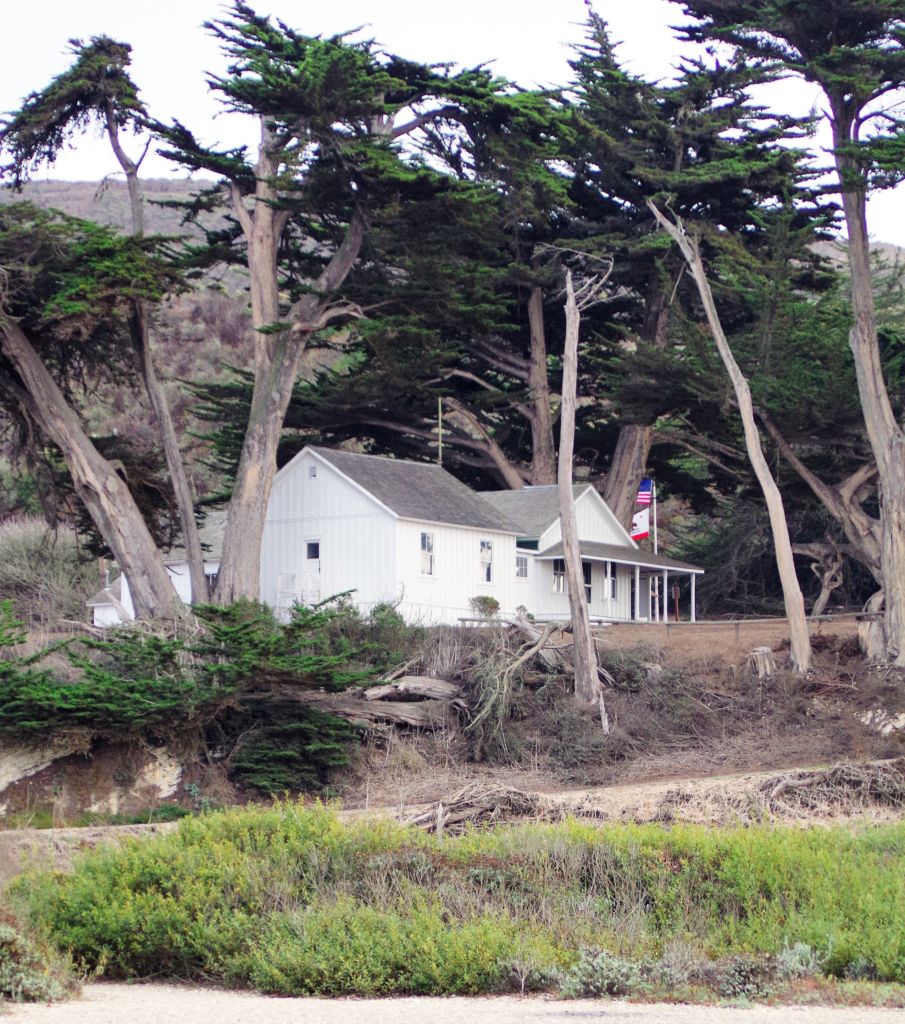
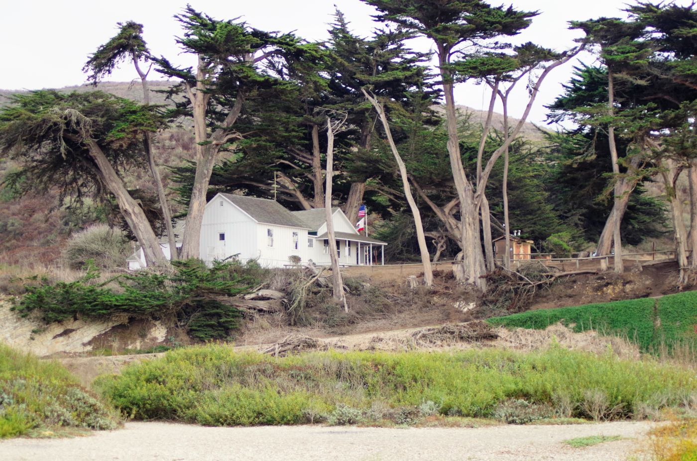
Following the demise of the missions, the Mexican government granted large tracts of what had been mission lands to political allies. Rancho Cañada de los Osos y Pecho y Islay was granted in 1845 by Governor Pio Pico to James Scott and John Wilson. The grant extended from the Pacific coast almost to San Luis Obispo, and encompassed Montaña de Oro State Park and Los Osos. In the early 1890’s, Alden B. Spooner II established a farm, dairy, and hog raising operation, ultimately purchasing it in 1902. By 1917 Spooner was working 9,000 acres with six miles of ocean frontage. Spooner built a ranch house, a reservoir, several barns, a creamery powered by a water wheel, stables, and sheds. As there were no roads to transport his goods, Spooner built a warehouse on the south bluff above Spooner’s Cove with a long chute reaching down to the ocean where goods could be loaded directly onto ships.
Land on the marine terraces was leased to Japanese farmers who lived and grew vegetables until their internment during World War II. Spooner’s neighbor to the north was Alexander S. Hazard who also raised crops and operated a dairy. Hoping to cash in on California’s growing need for timber, in 1908 Hazard planted hundreds of Eucalyptus trees. Eucalyptus proved unsatisfactory for commercial use; however Hazard’s legacy, row upon row of Eucalyptus trees, remains in the park today. In the early 1940’s Oliver C. Field purchased the ranch from the Spooner family, selling it 10 years later to Irene McAllister. In 1965 the land was purchased by the State of California for use as a park.
Montaña de Oro can’t help but seem a step child of it’s more popular sibling to the North – Morro Bay State Park. What is great is that paying the admittance fee to Montaña de Oro allows you entrance to Morro Bay State Park as well. We took advantage of this offer and took long hot showers after exploring the area a little. We shopped in Los Osos on our way back after having scouted town. By the time we got back the joint was filling up and we had neighbors on all sides. Being in the narrow canyon only added to the feeling of being hemmed in and being too close to thy neighbor.
In the morning we had a visit from the campground host – just another reason to minimize or at least be very timely with your visits to such parks. We were informed that we had to be out of our site because people we coming in that day. I let them know that the web site says there are no reservations so I couldn’t make a reservation, how could these people – or anyone else for that matter.
I am sure it was just coincidence but the ranger pulled up in full armor and joined the discussion. With getting kicked out of our spot through a system I was sure didn’t exist or at least was unavailable to me, I wanted to move into the handi-man spot. I was trying to prove my limited mental acuity, or perhaps it was already on full display, when the ranger made it pretty clear that was not an option. Therefore, our only option was to leave. This turn of fate did not crush me as I believe we had already experienced the best of Montaña de Oro and the number of people in and around the park was really pressing in on me.
Somewhat relived to be leaving, we headed north into Morro Bay and headed down by the rock and the waterfront. We had a nice lunch and headed up the coast to explore and find a camp ground. We were told San Simean State Park just about an hour up Highway 1 rarely is full so we set our sites there. Along the way, we stopped in Harmony, a wide spot along Highway 1 that was originally the site of a creamery that closed in 1955. It has a Post Office and most notably, Harmony Pottery Works, owned and operated by my cousin John. He has been there for 30 years or more now, and recently moved from the red farmhouse up the hill from the shop to Los Osos, near his sister Kathy. Kathy’s daughtter also works in the pottery shop with her uncle John. That is quite a slice of California history.
We didn’t linger as we needed to find a camp spot so we shot up 1 to the campground. Fortunately, there was plenty of space at the upper Washburn Primitive Campground, about a mile inland from the beach up on a plateau overlooking the Santa Lucia mountains and the ocean. We didn’t have an ocean view, but we had a nice shady spot looking East to the mountains. We were very happy to find a spot and get settled again, and be in more new country to explore. Once we were re-established at camp, we headed back down 1 about a mile to Cambria. Cambria is a great town of about 6,000 people and has a real nice feel of small country town and tourist destination. It being a Fall Friday night, we soon heard the yelling and honking and commotion of the JV and Varsity football teams being driven down Main Street on their way to the school for their games. Shop owners and clerks, restaurant waiters and chefs all left their posts to run out onto the sidewalk to cheer and join in the celebration. It was very old school and very cool to witness.
We had a great meal and visited some very cool shops before we headed back to camp. You could literally walk to town from the campground, even though Washburn was up on a hill another mile or so from the Highway. We settled into our camp fire and cooking and watching the latecomers arrive, pick out a site and set up camp. It is great, cheap entertainment.
Unfortunately, sometimes the entertainment doesn’t stop when you want it to. We had noticed the youthful appearance of some of the occupants of our neighboring campsite. It became overtly evident that this was an unauthorized high school party. It was interesting and certainly entertaining with a high degree of spectacle and drama, which did provide them with a much greater level of patience and tolerance. Plus, some of them were trying to maintain, which was appreciated, but we were far too close together for their antics to be ignored. It wasn’t terrible, and not totally surprising being this close to town.
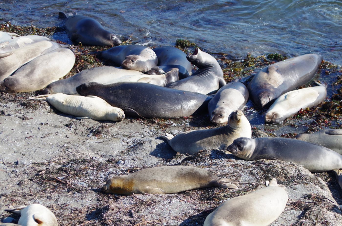
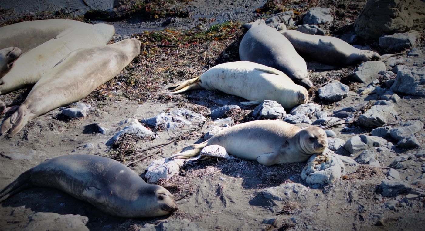
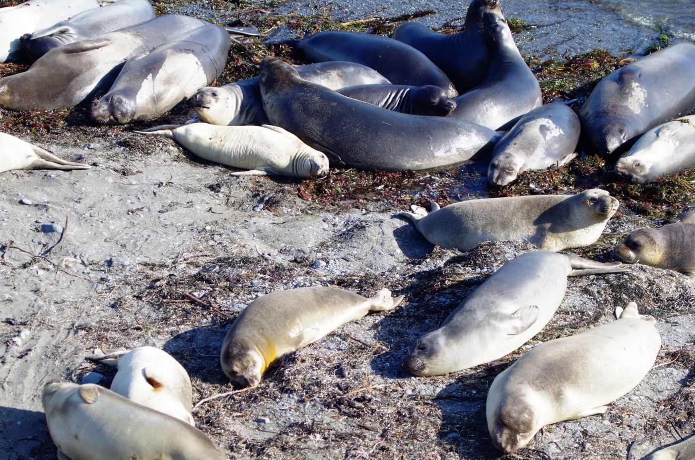
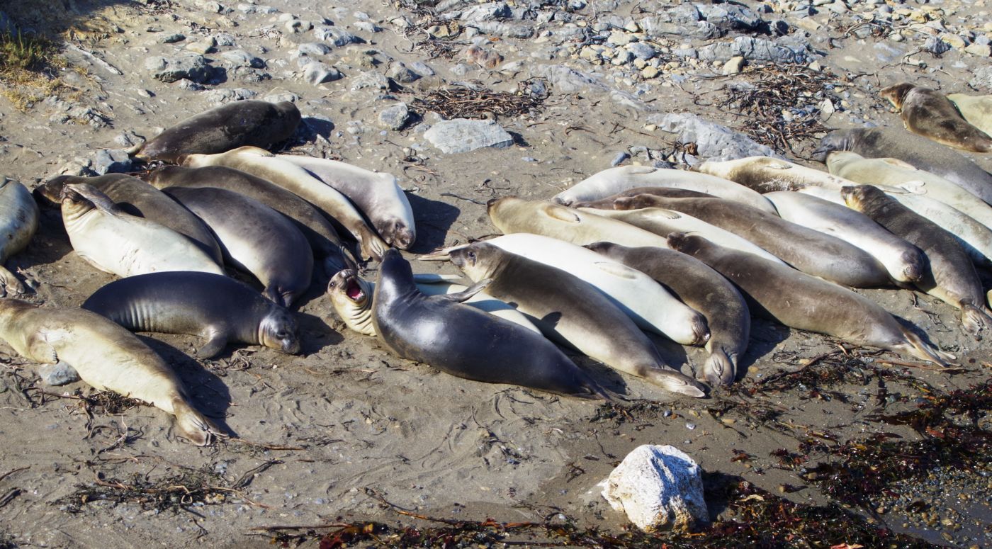
The next day, we were a bit groggy – all of us I believe. K and I headed about 5 miles North on Highway 1 to the tiny berg of San Simean, which isn’t really much bigger than Harmony. The best thing about San Simean is the beach and the pier that juts out into the bay – all named San Simean. Historically, the pier was built by Hearst so he could bring in his building materials, supplies, workers, artifacts, wildlife, and of course his hordes of uber-rich party friends.
We drove up to the visitor center for Hearst Castle tours, but much the way I feel about Disneyland and old, rundown, overpriced houses of ill repute, I felt about this place. It is a masterful effort to get the money out of your pocketand into theirs, and even though it is run by the State Parks system, it is operated by concessionaires and has taken all historical benefit out of the equation and replaced it with capitalism. You can’t just go up and see the place or half the place or a quarter of it. Each tour is quite expensive and you might see the kitchen, the pool, the grounds, or the pantry. You’d spend $500 to really get a feel for the place and I don’t need it that bad. I actually was quite satisfied with the visitor center and the gift shop, where they display quite a few photos, play a short video, and of course, sell replicas of some of the art up in the palace. Within an hour we were done here and quite frankly, it was plenty.
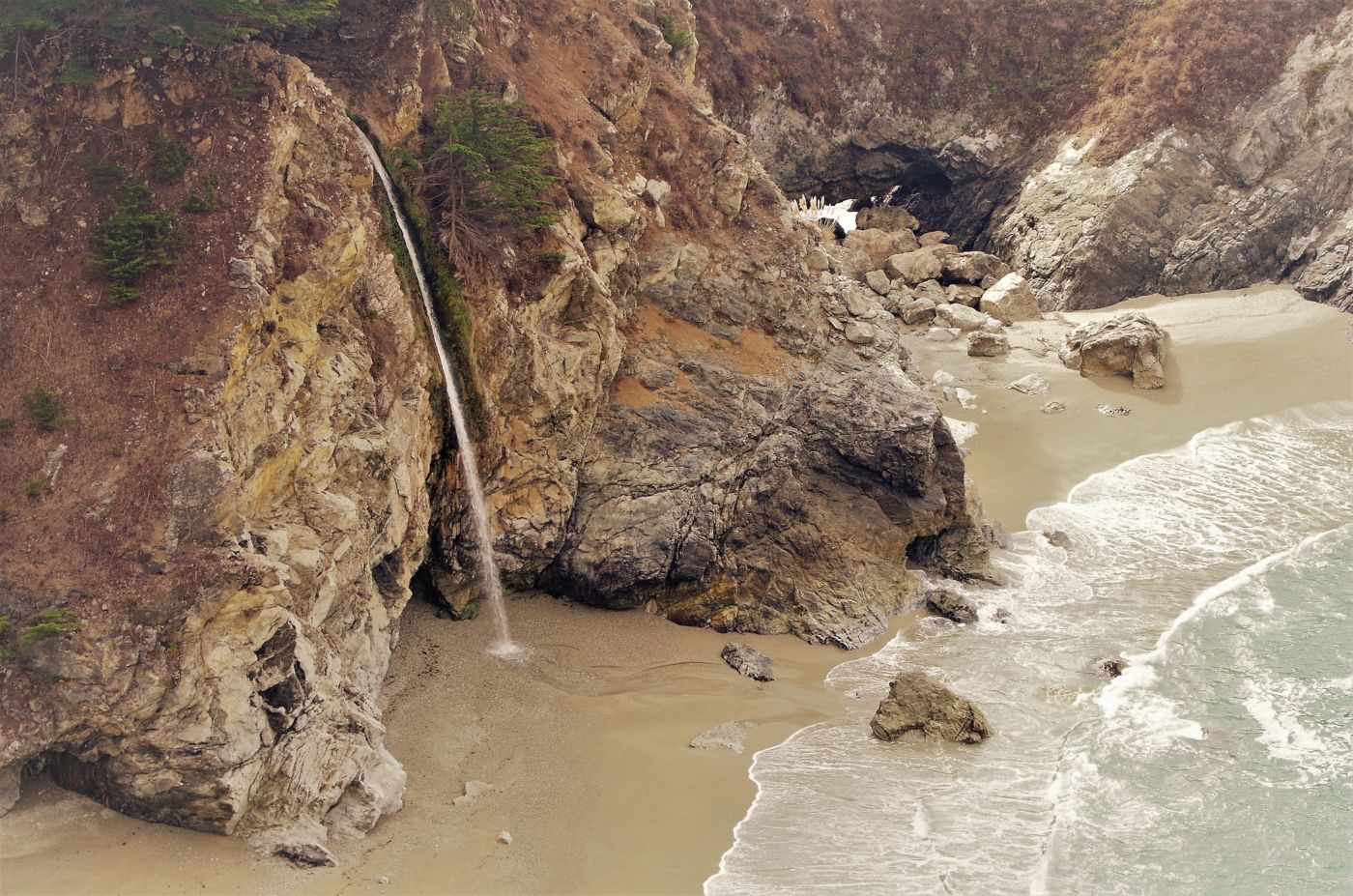
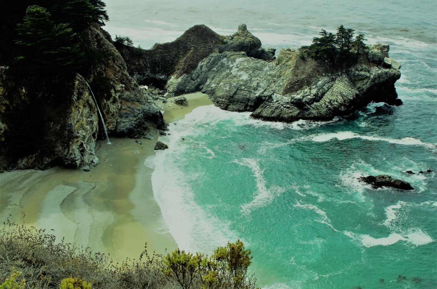
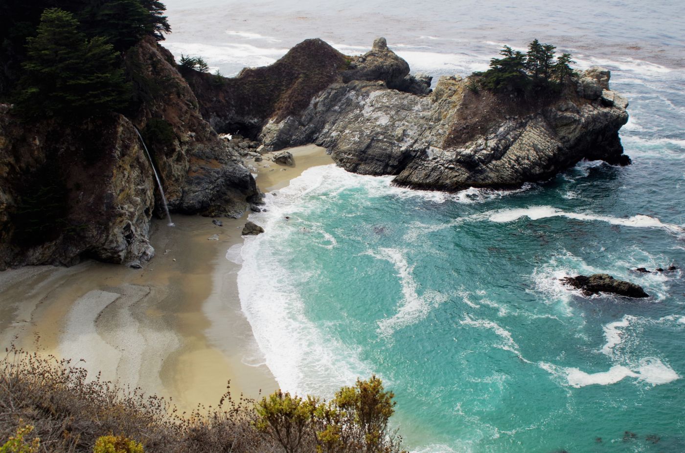
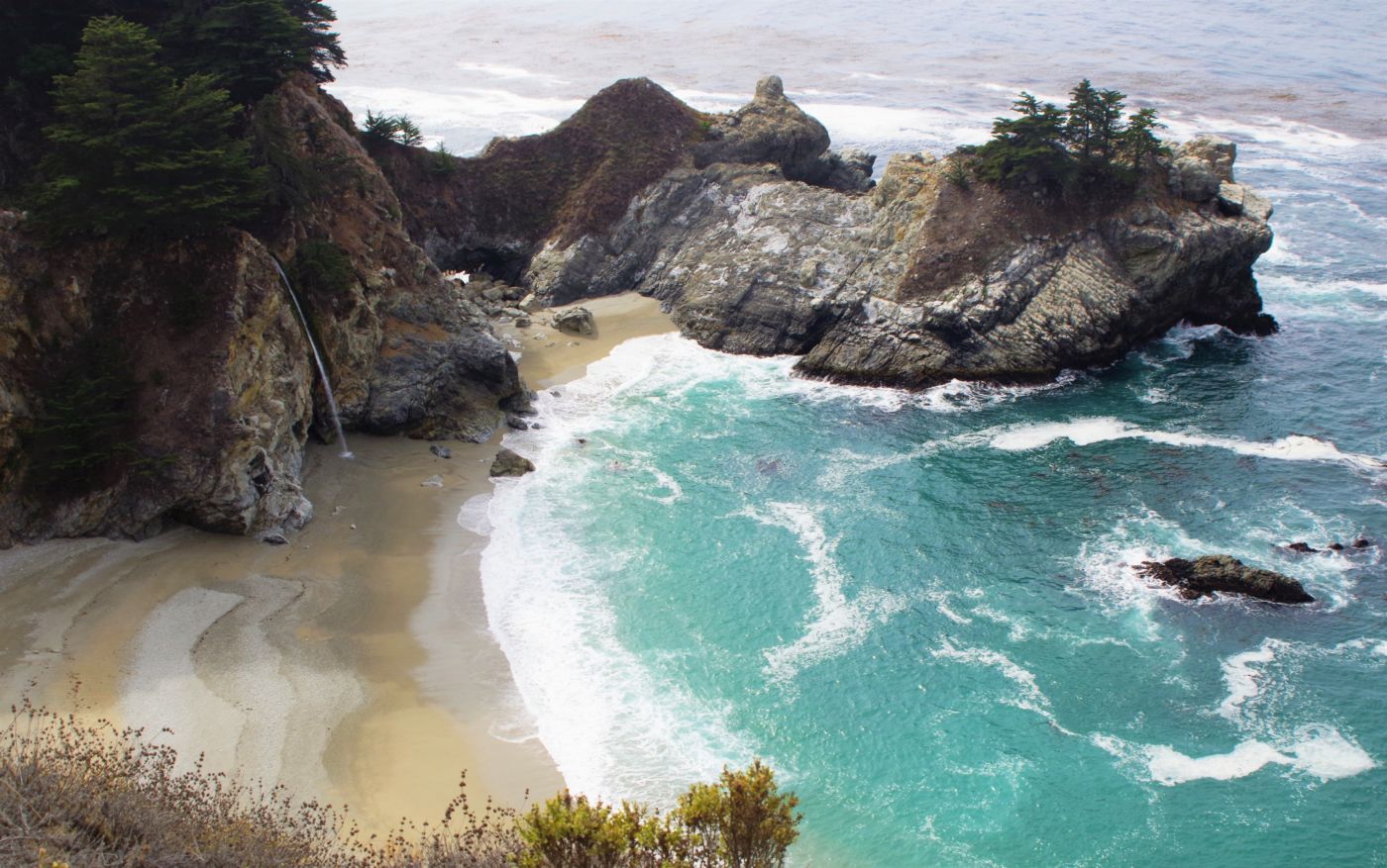
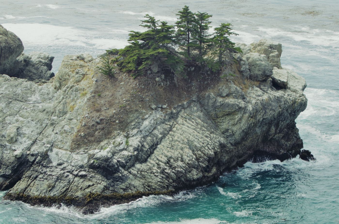
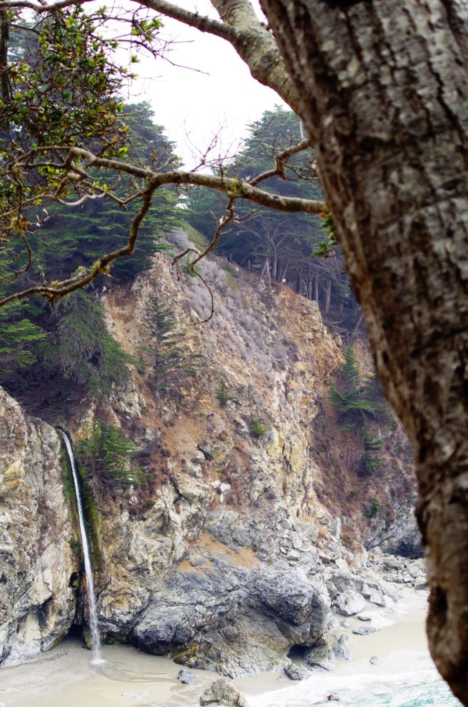
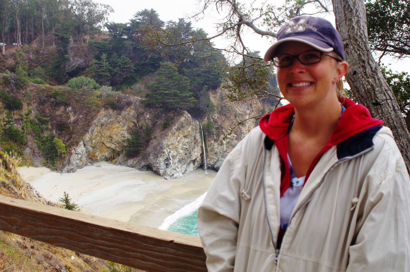
We may have stopped at the bakery in town for coffee and biscuits before heading up the coast. We crossed into Monterrey County and then stopped at the intersection of Highway 1 and Nacimiento-Fergusson Road above Mill Creek, which we have taken to the unofficial camping area we call Big Sur. It bisects the Los Padres National Forest and drops down the East side into Fort Hunter Liggett that has the historic motel I am still trying to make reservations at. We stopped for a minute to enjoy the view, stretch our legs, and recall a few memories before clamoring back into the rig for points North. We stopped a few miles up the road at Julia Pfeiffer Burns State Park. It has one of the most picturesque and photographed spots in all of the state park system. It is McWay Creek becoming McWay Falls falling directly onto McWay Beach along McWay Cove as it flows through McWay Canyon alongside McWay Trail that goes up to the McWay Waterfall House.
I think, generally speaking, between Carmel to the North and San Simean to the South, this stretch of California Coast is referred to as Big Sur. There is actually a town/ community named Big Sur, but this area’s beauty and romantic history far exceeds the town limits. It is now home to some of the most expensive coastal real estate in the country and is riddled with state and regional parks attempting to preserve the majestic redwood trees and sensitive watersheds along the dramatically steep and lush rugged coastline.
On up the road a piece, I was surprised to be back in familiar territory of Carmel. We took the 17 Mile Drive out past the most famous cluster of golf courses in the world; Pebble Beach, Spyglass, Cypress Point, and Poppy Hills. This area is simply stunning. Beyond Monterey, we were jamming for home. We had covered a lot of new ground and seen a ton of spectacular California scenery. But, as usual, discovered much more that needs to be explored.
Find this Spot”
Central California Coast State Parks Photo Gallery