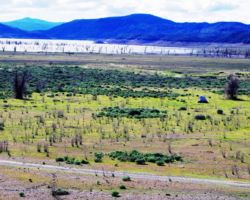
Indian Valley Reservoir with Mike, Bureau of Land Management
Trip Date: February 27, 2015
Most trips go smoothly –no problems, no drama, no malfunctions. The shorter the trip, less distance travelled, fewer guys going, all reduce the percentages of problems. Some trips – 2% say, have had problems, much of the time my Ford F-350, an illness here and there, a minor injury, another vehicle perhaps. Never anything major – like cut the trip short problems, just inconveniences and fodder for excellent storytelling. Some trips are smooth as silk, easy, simple, and most enjoyable.
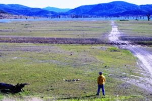 We hadn’t done a ton of planning or advanced preparation. I hadn’t been feeling great and my mom’s twin brother passed away earlier in the week; somewhat unexpectedly, but at 92, not totally out of the blue. Mike and I swapped a few emails about who’s bringing what gear and the general vicinity of where we were headed. It was just the 2 of us; he would drive, everything was minimal; our only concern was the weather.
I went to the BLM office on Cottage Way to get a couple maps, then to Sportsman’s Warehouse to buy a new camp chair – one with more support for my old achy back. I also needed a new tent, as the zipper on my old Coleman tent I had been using for years, for maybe 137 trips, finally gave out. I did a fair amount of searching on-line, but it was tough to tell the details. I went to Big 5, Sportsman’s Warehouse, and finally made my purchase at Target – another Coleman. I came home early Thursday afternoon and dragged myself around. Luckily, I didn’t need to do all that much to transition from the last trip to this trip.
I had just organized my camping gear, or should I say, moved it out of the downstairs to make room for the painters. In so doing, I was able to reorganize the garage to make room for the two shelf units I had been using in the closet, but not using so well. Using these shelves exclusively for camping gear out in the open of the garage downstairs allowed me to open up some of the plastic containers I use to see inside; to spread some stuff out on the shelves; and segregate my stuff from family trip stuff, from children’s stuff, etc. I gathered my minimal gear, minimal cooking/kitchen supplies, minimal food, beverage, ice, water, and clothes, and plenty of fire wood into the truck and was done by 8:00. I was in bed by 8:30 and asleep, but excited about heading out the next day.
 Morning came and Kristen and I got up like a normal work day. She made my coffee as all good wives do for their husbands, and off she went to work, earning another days bacon for me to consume upon my return. I couldn’t exactly remember what time I was supposed to be at Mike’s, but we did not need to stop at the BLM office since I had already gone, so I just kind of moseyed through the final packing of ice chest and my delicates; left a love note for my wife, and headed out to Mike’s.
I can never find the direct route to Mike’s house even though he lives in Carmichael less than 3 miles away. Even as I was driving out of my neighborhood I was already losing in my attempt to imagine how to get there. Fortunately, I remembered he moved, now even closer to me, but no more closer to a direct route. I don’t remember who I was talking to on the phone, but it was a conversation I had to pay attention to and before I knew it, I had gone pretty far West. I took the first major left I could and fortunately saw a familiar intersection. I was close and I knew how to connect the dots. My first critical test of driving across Carmichael to my friend’s house was victorious.
 Mike was mostly packed and ready to go. Again, with so little gear, we had transferred my stuff into his rig in moments and were now ready to roll. Mike had to stop for gas – a critical blunder for all those drivers out there (GET PREPARED THE NIGHT BEFORE!!!!) but we were soon on our way. North on 5, past Woodland, we picked up Highway 16 through the always beautiful and inspiring Capay Valley. Indian Casino/resort and all, this valley never disappoints. Following along Cache Creek, we were soon leaving the valley for the narrow windy passage through the hills. This stretch is some of the most interesting geology in all the State. Ridges of continuous rock thrust through the softer conglomerate and then completely tilted on its end – from being laid down horizontally to being lifted almost completely vertically. Then down at the bottom, the creek cuts further into the rock layers to make a very impressive series of solid rock pools and ponds and cascades connecting one pool to another. I don’t know about the fishing, but the scenery is worth a trip or a lifetime of exploring.
This narrow gorge separates the heavy farming and ranches of the Capay Valley from the wild meadows and open grasslands of the Bear Creek side. There is a resident Elk herd in this area, but I have only seen a few elk on a single occasion. There is supposed to be some great hiking into the canyons especially as Cache Creeks pulls away from Highway 16 just North of Cache Creek Regional Park and right at the confluence of Bear and Cache creeks, but I have only driven through on my way to destinations further away. It is definitely worth a special trip just to see this area someday.
 However, on this trip just passing through, we picked up the Bear and proceeded on up 16 past side canyon after side canyon, until at least we see the California Department of Forestry and Fire Protection (CDF) station and approach Highway 20. A left turn heading West on 20 and several options present themselves right away. Wilbur Hot Springs, a commercially developed hot springs with food and lodging is a few miles up Bear Valley Road. At some point, you have to take Bear Valley Road in the Spring. It follows Bear Creek, which in and of itself is worth spending a few afternoons. Further up valley, it opens into one of the prettiest valleys in all the land. The greens, open sky, and tranquility calm, relax, and unwind on the worst of days. Cows are among the stupidest creatures on earth and live the stupidest existence, but I do envy these cows. The birds and the bees and the spectacular wildflowers make it a must see. Passing up Bear Valley Road, we passed a few unnamed roads also heading north from 20, but we were destined to take Walker Ridge road, as I had never been all the way down its length.
It is a bit rough, but certainly not 4 wheel drive, and offers a slight glimpse of Clear Lake right off the bat. The road serves as the Lake/Colusa County Line, so we were constantly in an altered state from the rough transitions between trailer living, three wheel driving, meth living, cow tipping, Confederate flag waving lifestyles the two counties presented. About 6 miles in, ones comes to a “Y” that leads into Lake County and drops off the ridge towards the Southern end of Indian Valley reservoir – such as it is. It was a tad windy up top so the thought of getting off the ridge and perhaps down near the water seemed like a good idea, so left we went. A little less wind and great views of the reservoir, (the end that still had water), were getting us in a fine Lake County groove.
 About half way to the reservoir, we came to the BLM campground which is set along the road in a nice ravine, not that narrow or closed in, but a ravine as I know one. The creek was flowing, the air much calmer, and not a sole around, made this a very inviting spot. We stopped, celebrated our find, and looked around. It would definitely serve our purposes, but being about 10 sites in size, the risk of overpopulation was quite high. We remounted, and headed on down the road. Just as the going was getting really good, the gov’ment blocked public access again. The road was blocked above the reservoir, not only preventing further travel, but not even being blocked at a place that offered a view and perhaps a place to hang out or camp. At least someone could have used the end of the road as a camp site, but not here – no redeeming qualities here.
This was a shame because we were just getting down to the water – not that we expected to be able to camp at the water’s edge (but why not – why shouldn’t the public be able to do that?), but we were now down low enough to be out of the wind and the views out over the reservoir were great, so it was looking up for finding a great camp spot, and then boom like that, progress no further. Bummed, but undaunted, we climbed back in the rig to explore a couple options we passed along the way. One road heading off to the left was a short loop to an open area that looked like a staging area for the motorcycles and various off-highway vehicles (OHV’s). Good enough for trailers or a massive group, but not really what we were looking for.
 A bit further, down into a glade surrounding by hills, this spot had a ton of potential. Protected from the wind, and several spots that would be great, but between the boulders and the gate, you were hemmed in and again risked overpopulation to a high degree. I was glad to have taken this fork to explore it and see what was up, but it didn’t quite offer what we needed. Besides, it was early, and we had not travelled very far, so we had much daylight to use.
It should be mentioned, there are some half-billion acres of “public land” managed by the Forest Service, BLM, and other federal agencies in the West. Some 50 million acres, 15 percent of contiguous US holdings if I’m using all my fingers, were found to have “inadequate” access. Inadequate could mean no access whatsoever, as rich landowners gate off roads that may have been available for public access at one time. It may mean that you need one of these massive landowners permissions, or you may need 4 or 5 of their permissions because the road passes through that many different landowners properties now. In any event, we, the public, are being prevented from using “our” public lands. And, on the flip side, the rich are buying up huge tracts of land that entirely surround huge tracts of public lands that then they have as their private reserves – paid for by us, the average schmoes. Thank you very much.
Access to our public lands is a problem out here in the West. And who gets to do what once they get on public land is another huge issue. It is tough to make everyone happy, especially when some of the uses and users make such large impacts. If everyone wanted to just get naked and walk around in a daze, I think everyone could be accommodated. If everyone wanted to just hike and take pictures and observe wildlife, it is possible everyone could be happy. But some people want to kill the wildlife, and gun shots can unsettle other visitors from a long way away. And, the other visitors may now have a tough time seeing any wildlife – not necessarily because they are all dead, but because they are being hunted and don’t just hang out like it was 1800 or something.
 Some users like to ride really loud motorcycles and OHVs. These too can inject a lot of supercharged energy into a visit to our public lands, and that energy may not be what everyone is looking for. The noise is extremely invasive and disturbing and will affect people for miles around. And then the scarring of the land, the stripping of vegetation, the erosion, and the visual impacts are fairly appalling. I have a really tough time understanding how difficult it is for people like us that leave no trace, like everyone is taught to do, to find a place for us to enjoy – in peace and quiet and solitude. Yet motorcycles are free to go anywhere they want and everywhere they can to permanently destroy the landscape, kill plants, pollute creeks and streams, disturb wildlife for miles around, and yet they seemingly can be anywhere and everywhere they want to be. It is a curious land management decision.
We had a libation for clarity of thought, and headed back up the ridge to the “Y”. Turning left to continue on down Walker Ridge, I was happy to be back up on top, even though the wind was making it clear my initial vision of camping up top on the ridge with a massive view, either East or West, was not going to happen. There was another “camp” of some sort marked on the map that we headed for a few miles down the road. Turning left to head a mile or so down to the West, kept us on the windward side of the ridge, so we were less inclined to investigate this spot. Also, there was a vehicle parked, which made us even less inclined to poke about, but I wish we had. This was a spring and the area was thick in grasses and oaks. I’m sure there were tons of wildflowers to be enjoyed by those who left their vehicles and explored on foot, but we weren’t feelin it so we just looped the loop and exited back up to the ridge.
 Mike had seen some great pictures of the Sutter Buttes from Walker Ridge road and pretty soon we had them in our sights as well. This was a real treat. One benefit of the wind is that it clears out or rather pushes away the air pollution to make the vistas clear and bright. Down on the valley floor, the particulates were still pretty thick and brown, which made the Buttes sort of rise out of the muck into the cool ridge of sharp peaks – like the masts of a huge ship sailing down the valley. We tried hard to find a spot on the East side of the ridge, in sparkling Colusa County, that offered some protection from the wind and offered the view of the Buttes. We stopped at a site which offered the view and enough clear, level ground to make a go of it, but near zero wind shield. We celebrated the view and for me anyhow, having seen the roads I wanted to explore, with the exception of the remainder of Walker Ridge that lay ahead before it intersected with Bartlett Springs Road that runs East and West along the North end of the reservoir and up into Mendocino National Forest to the West.
There were few other options that we saw, so we came to the intersection of Bartlett Springs in no time. This was a high point for me as I had been on this road several times before, and recently with my wife Kristen, so it was neat to make that connection. Turning left we traversed the lone rough stretch of road. It is narrow and winding, and it is mostly a gray clayey slime, that if an once or more of water is added, becomes an impassible muck. We often closed Forest Highway (FH) 7 over Mendocino Pass in the winter, not because of the snow up top, but because of the mud – it was the slickest, stickiest, heaviest, nastiest goo I have seen. It is a short stretch, but of course that’s all you need to stop your progress. Fortunately for us, it hasn’t rained much in the past 15 years, so we made short order of this short stretch and were soon out in the open country on the North end of the reservoir.
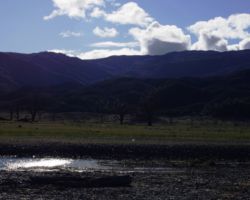
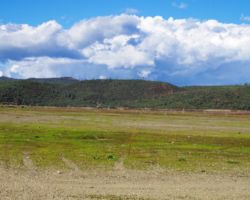
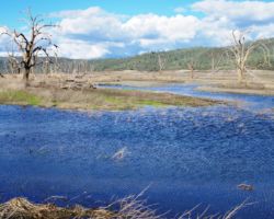
 Much to my surprise, we could see water from here. When Kristen and I were here in the Fall, you couldn’t see any water in the reservoir – none. It was a huge grassy plain – beautiful in its own right – as grassland, but certainly not acting as a reservoir should. There is a small pond on the North side of the road that gathers and contains much runoff out of the hills and the mountains beyond. I assume the road is built on top of the dam that backs up this water on the North side of the road and releases the stream through a culvert below. This trip, the pond was much higher that when Kristen and I had come, small lake-like, and it looked quite beautiful rather than flooded valley-like as it had before. The things humans do to nature.
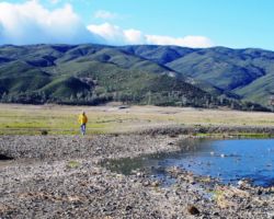
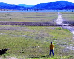
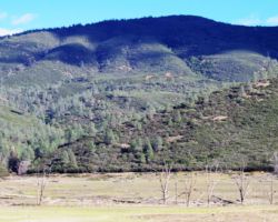
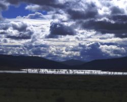
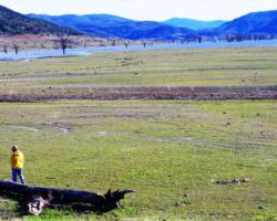
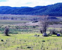
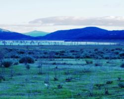
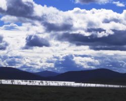
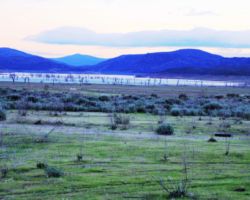
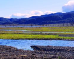
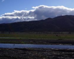
The grass not nearly as tall as last time, this being earlier in the Spring, and there was much more water in the reservoir – it covered about half of the valley now, only a few feet deep I would imagine, and probably only about 10% of capacity of the reservoir, but still, more water than last time. We took the road that dropped down onto the reservoir bottom. There were scattered oak and cottonwoods that hadn’t seen reservoir water in years, if ever. We stopped near the last tree, farthest from the road, and got out to have a look around. The wind was coming out of the West, and it was still blowing pretty good, not constant, and not ridiculous, but strong enough to consider it factor #1 in choosing our camp spot.
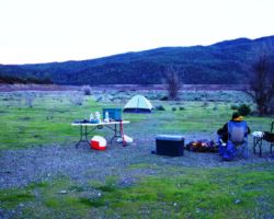
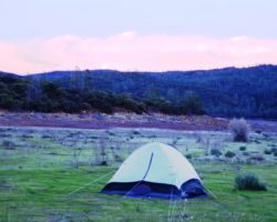
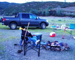
 We were down low, about as low as you could find in these parts, and although a thicket of brush and scrub would have provided a good wind break, this was pretty good. It was quiet, other than the wind, we were far from the road, although it could be heard; we had a lake view, big sky, and plenty of open flat ground. The time had come to be done driving. Unloading went quickly, this being perhaps the largest camp site I’ve ever camped in. We probably had 40 acres that were all the same. We added a few rocks to the old ring and spread our tents on either side of the fire, and the truck for that matter. The kitchen and communal area was set up in no time and we got a fire going, putting off the setting up of the tent as it is always the most effort, and in this wind, would prove all the more challenging.
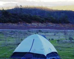
I was interested to set up my new tent. The zipper in the front panel finally gave out on my old Coleman dome tent. I must have had that for 10 years and well over 100 trips. When we were leaving Red Rock Canyon last month, Tom and I deposited it unceremoniously in the dumpster. I looked forward to buying a new one (picking it out, not paying for it), ever since. I looked on line and at Big 5, and Target, and REI, and Sportsman’s Warehouse. I believe I stopped at Sports Authority as well. I finally decided to stay true to the Coleman since it had serviced me so well for so long. Much to my disappointment, as I set it up, ¾ of the entire tent was mesh. I chose this tent largely on it showing a large rain fly, and it did have that, but I was not impressed with the screen tent. It went up smoothly and quite easily, even in the wind. However, as I was fastening down the rain fly over my mesh tent, I smelled some plastic burning. Ignoring it as any good woodsman does, I went back to my work. However, the stink grew stronger and it was blowing all over me.
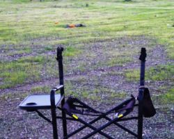
As I headed back to fire, it didn’t take long to see my brand new camp chair engulfed in flames, only the fire retardant label blown up against the outer edge of the fire ring rocks. I had sat in my chair on the Sportsman’s warehouse showroom floor, but I had never sat in it in the wilds. It just sat beside the fire on the windward side and became a plastic made in china fireball. The frame kept us company like another one of the fellas for the rest of the trip. The remains can still be seen leaning up against an oak tree keeping an eye on the reservoir. Maybe we will see it again someday.
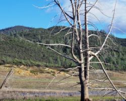
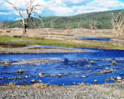
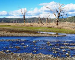
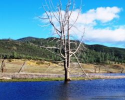
 We let the fire burn down and headed out for the edge of the reservoir. Like a desert, it doesn’t look like much is out there from afar, but when you get out there, you notice plants and birds and insects and rocks and all sorts of interesting things that you may not be able to see from the car or from the sidelines. Things are always better once you get in the game. Out on the massive flat gravelly/sandy expanse formerly known as reservoir bottom, there was much to see, notice, observe, and appreciate. There were now several roads created that crisscrossed this way and that. Once we were out a pace, we veered towards a nice stream that meandered out across the plain for a half mile or so until it indeed reached the reservoir. Along the stream were large trees, mostly dead from being submerged or at least partially under water, but from a distance they could have appeared to be dormant for the winter.
We naturally gravitated out of the open and towards the water and trees and followed the stream to the reservoir’s edge. It was really nice out here. Wide open, big sky, hills and mountains in all directions, the water glistening with the late afternoon sun. A little bit of color already in the Western sky. The wind was losing some steam but still a significant factor. We headed back to camp to get to dinner and make use of the last of the light. As with most camp spots, especially the marginal ones, as dusk falls, and the day quiets down and the evening calm settles in, everything about being out starts to feel better. It was good to be here.
 Back at camp, I couldn’t get over the stupid chair getting blown into the fire and burning down to the frame. I recall several chairs ending long careers in the fire, not that I had anything to do with it, but apparently this was my turn. I just couldn’t get over that I hadn’t even sat in it. Oh well. There had been many trips where I had a perfectly good chair but always stood or sat on an ice chest, so this would be another of those trips. We got the fire going again and dumped all the briquettes in to make up for the wind. Mike moved the truck behind us to block the wind and that made quite a difference. He put out some excellent bread and cheese; a cocktail was had and we were on our way.
Mike knows a great deal about the sky and the stars and such so he was interested to see what there was to see. A half moon was extremely bright so it wasn’t ideal conditions, but he pointed out several planets and constellations nonetheless. The wind calmed and the flames grew straighter. Thank god we had a lot of wood and there was quite a bit of cut brush lying about. Full bellies, a great day of exploring, some great country, a healthy buzz, calming winds and a very comfortable ice chest were making for a great night.
We had been keeping an eye on the clouds as the predictions called for some chance of rain. However none had materialized all day – not a drop. However, what did happen was a fantastic lightning show. We were sitting with our backs to the wind, facing East, so we were treated to a fantastic moonrise. Once the moon was up above, we could see a thick layer of clouds through a saddle of the bowl around the reservoir – probably the pass that the road dropped down from Bear Valley. As we watched this cloud, we finally asked each other if we were seeing flashes or if we were seeing things. Flash after flash after flash – it was quite a show. We couldn’t see the lightning bolts, but we saw dozens of flashes from the lightning coming out of those clouds – over the valley or the foothills we couldn’t tell as we weren’t quite high enough. But it was quite a show.
 It reminded me of the days I was stationed up the road at Alder Springs. We would often sit out on the helipad and look down into the Sacramento Valley on thunder storms passing down the valley. It was awesome to be looking down on a thunder cloud, but to be out on a warm summer’s night doing it with a big group of guys was even better. There used to be a really nice gym left over from when it was a boy scout camp or some type of youth camp, so we had this incredible gym and would play basketball and then have beers and hang out. I think Gabe was stationed there or would come up often from Willows, but Kevin Whitlock was on the crew and Jim – the local kid from Willows and Vince from Fort Bragg and Jim somebody was the Silviculturist on the district – back in the days when you had timber crews and fire crews and even biologists, recreational folks and anthropologists on each district. Now I think it is uncommon to have all those folks for the entire forest as much as staffing has been cut and resources other than for timber production have been spread thin.
In any event, with the light show over, sleep came quickly and deeply and my mesh tent held up well on a calm warm night at 1300 feet elevation. The morning was spectacular. An incredible bright orange glow, a light blue sky that was indescribable, uncapturable, and non-reproducable. It was calm and peaceful with just enough chill in the air to make it feel like a perfect morning. I had no time to look for a sandy spot so I had to settle for a rocky spot under the very last tree before the open expanse of the reservoir bottom, but it was glorious nonetheless. It was one of the few times, in all the rocky ledges and granite monoliths I have camped, that I burned rather than buried the toilet paper. Quite odd.
 We had wanted to get a reasonably early start so we decided not to have a big breakfast. Mike and Bob go for the big breakfasts. I don’t mind eating them, but I can’t get up for all the effort to prepare, make, and clean up from it. But, this morning was so sweet, we couldn’t make ourselves get up and go. We had a few cups of my special cowboy coffee where I just dump the grounds in the pot with the water and boil it. Most of the time, most of the grounds stay down the bottom when you poor the coffee into a cup, but I double strain it through a paper and a plastic reusable filter to make sure there are no grounds. We toasted bagels with cream cheese, had a banana, yogurt, maybe a snort or two.
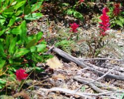
With things pretty much in order, we decided to walk about towards the road and the sound of water we could hear periodically. We found the little brook coming from a narrow canyon across the road and through a massive culvert. It must have raged during some winter storms. This area offered more good camp spots but was way too close to the road and was pretty beat up. We crossed the road and headed up a ravine with a well used trail. Mike noticed a really beautiful red flower stalk, maybe 4 or 6 inches tall growing from individual plants with distinct fern-like leaves. They were always nestled below shrubs and bushes that provided good shade. I had never seen these plants before yet they were so showy and distinct now. We saw many wildflowers, mostly small and easily unnoticed, but we were into it back in the ravine and were noticing all sorts of cool stuff.
We considered climbing through the brush to the top of the rock outcropping along the road, but we would have gotten thrashed by the brush and probably covered in poison oak, so fortunately, we thought better of it. Back by the road, we stopped at a massive pile of green rock – a couple VW bus sized boulders that had broken into many large chunks, many too large to handle but some definitely worth coming back for to put in the front yard. I hope to return some day for those rocks and tried to place their location clearly in my mind.
 What was clear when we returned to the truck and grabbed the bottle to toast our spot and say thank you and goodbye, was there was nary a trickle left. I was shocked and dismayed. I specifically recall filling this bottle, not full, but quite full before the trip. If this was true, Mr. Leaon drank quite a bit of whiskey on this trip. It was good. We headed further West on Bartlett Springs Road as I wanted to show Mike this area along the arm of the reservoir which has returned to river for the most part. This area is pretty heavily used by yahoos and motorcycle/OHV enthusiasts so I have stayed away from it in the past. However, this time it really impressed me how pretty it was and how large an area it was.
Even this time, there were quite a few groups camped down in there, but there certainly were areas that seemed to offer good camp spots and still plenty of distance between you and the others. We also passed what I recalled to be the stream crossing that Steve, Keir, Ken, and I had come to years ago – on my first camp trip with Keir. We saw quite a few possibilities to camp above the creek on the bank, not too far from the road, but probably far enough. The real deal though was to be able to cross the creek and get on that far bank. That was the ticket. I still could not see the remnants of a bridge or any logical place for the road from the South to cross over the creek and intersect Bartlett Springs road. I did not see any other place the creek may have flowed that would otherwise allow for a logical intersection of two seemingly major roads. So I remain stumped about how to get to the North-South road on the other side of the creek from Bartlett Springs. I may have to try a crossing in the Fall when the creek is real low, or try it on the motorcycle or come down from the South, but I shall continue to search.
 That area past the arm and along the creek may not be worth going to any more as the motorcyclists get more use out of it. The scars they were making on the hills across the creek were disgusting. There were 5 or 6 runs up the face of the hill and on ridges that will probably never cover over – they will be permanent marks left by an extremely destructive recreational activity that has so much impact, yet seems to go largely unchecked and uncontrolled. The damage to the hillsides and the creeks and the impact on wildlife and other humans is immense. And as more and more of them go out there, it just may not be enjoyable for people like us who just like to mellow and hang out. On our way back, near the arm, my spirits were lifted again to see all that beautiful riparian country looking good and lots of space and options for possible return trips.
We passed the road we took down to our site and went up and over the gooey gray clay stretch of road, having to pull off at one narrow stretch to let 3 rigs pass by, nice rigs with racks and gear and even one with a snorkel exhaust. They looked like they were up to some serious adventure and exploring. It was good to see other folks like us getting out. Rather than heading back the rough and slow Walker Ridge Road, went kept heading East, up and over the pass and dropping into Bear Valley, one of the most tranquil and picturesque valleys the public has access to. This is a good wide, flat graded road all the way to Highway 20. We stopped at a spot above bear creek almost back to 20, for a little break and again just got into how beautiful it was; the creek below, awesome rock outcroppings, quite a display of wildflowers already out, impressive valley oak trees, and incredible greens of the new spring growth.
 We followed our path back on 16 and stopped at the roadside bar and grill in Esparto. This is a great place with a great bar, good food, and awesome outdoor area. Had a BLT and a Jack and Coke. We were still home in the afternoon, feeling good and happy; like we had been off on a great adventure, even though it was barely 24 hours.
Find this Spot
Indian Valley Reservoir Photo Gallery
