Sonora Pass w Tom, Toiyabe National Forest
Trip Date: May 29, 2015
Ah, the simple times. Two people; one rig, one night; two days. It really is so simple, especially with a few years and several hundred trips under our belts. We know what we need; we know what we want; we know how to do it. Now actually remembering everything is another story altogether.
Tom was at my place about 8:00. I had pulled my shat together a little at a time over the week and had assembled most if it alongside the house, in my truck, and on the couch by Thursday night. My dear wife shopped for me Thursday night as well. And lest I forget, for the hundredth time, or purposely omit for the ninth, wifey dearest always does my camping dishes for me when I get home and of course does all my laundry, so I am able to enjoy myself on my trips and not have to worry about dishes and such. She almost always unpacks the ice chest and puts away the left-overs too. Yes, friends it is true. I have a great wife, for so many reasons of course, but for these reasons as well. And now you know. And now for the rest of the story…
Friday morning I got up at the normal work day time of 5:30 and went through my normal work day routine. This got me ready by about 6:30 and gave me an hour and a half before Tom arrived to pack the ice chest and bring everything to the driveway, open the garage door, water, have coffee, play with the kitties, get rid of (I mean say a loving goodbye to) my wife, leave her a sweet note, prepare the shots for Tom and I and generally be all ready to button down the house and blast off.
We were so chatty and excited to be off, that we suddenly realized we were blasting East on highway 50 without regard to the location or direction of the intended destination. Of course, we could go either way; up 50 to Mormon Emigrant to highway 88, over Carson Pass to highway 89, over Monitor Pass to highway 395 to highway 108 and back West up to Sonora Pass or thereabouts. The roads we wanted to explore were on the East side of the Pass so this would work. Instead, we decided to circle back to highway 49 and head South to 108, then East up the West side to go over the Pass (9624’) to the East side to hunt for our roads that headed North behind the Marine Corps Mountain Warfare Training Center.
Although this turned out to probably be a bit longer drive, I am glad we went this way. For one, I love driving highway 49 through the gold country and all the small historic towns. It is also kind of the more direct frontal approach to the Pass so it was logical to go this way. The time passed quickly and before long, we were hunting for roads. Our intel from Bob was that there were 2 dirt roads off to the North side of the road. Once over the Pass, past the parking area for the Pacific Crest Trail (PCT) it was only a minute to the first road, 032 if I recall. In a matter of minutes we took a sharp left turn and crawled up a wide open, flat ridge, to a flat landing. It must have been used as a parking area for rigs or gathering place for many people and much equipment as the flat areas were ground down to bare gravel. But the views, OMG, the views were beyond spectacular.
We headed into the trees to try to get some relief from the wind which was blowing pretty steady. We had to try to follow the road to the end, so back into Tom’s rig we went and climbed up a real steep grade of loose gravel and soil. Tom picked his way through the trees and larger rocks until the path was barely visible and we were on quite an angle. He pulled off and we went the last 50 yards or so on foot up to a bench. What few trees there were at this elevation were thin, sparse, short and not quite vertical. The wind is serious up here, the temps cold, the winters long and the growing seasons short. Only the extremely hardy survive up here. This was truly tree-line as the tree coverage was spotty and most of the ground was open grass and very small/short shrubs. The view was fantastic, but the rig was below and the spot we had driven to was pretty special, so back we went after a few moments spent absorbing as much of the scenery and vistas as we could.
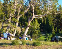
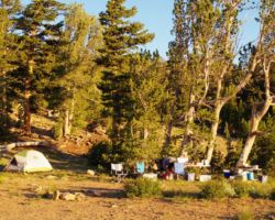
This spot was amazing. The flat ground was totally exposed as it was all ground rock and gravel, however it was also exposed to the full force of the wind as it was out away from the last group of trees. To tuck back into the trees meant being on a slope, some slight, some slightly more so, but it was definitely worth it to be some shelter from the wind. It took me some time to walk in circles long enough to pick my spot for the tent and Tom and I moved the fire pit a time or three, again, trying to balance slope, with wind protection, with maximum viewage .
I ended up choosing wind protection over degrees of levelness (or is it levelity?). The huge flat area out in front of us would have been an ideal spot for tents, but I was concerned that it would be windy all night and it would either be loud as hell, I would get a piece of the tent or rainfly flapping or just getting buffeted by the wind all night would be loud and irritating. Back in the trees, was a cubby made from the marines that was just big enough for the tent. The boys must have spent some time in this exact spot as in the trees were all these handmade fortifications. It reminded me of Civil war entrenchments. There were numerous depressions among the trees and roots. Every nook and cranny was stuffed with rocks, branches, twigs, whatever would fill the cracks and crevices to make the little beds more wind resistant.
I assume the guys would be sent up here to the high country (my clinometer said 9100’ but I didn’t set it before we left. Google maps said 9600’ with the terrain feature) to survive a night or more without tent or bags so making a little deer bed and doing ones best to block or at least deflect the wind as much as possible probably makes a considerable difference at those temperatures. I didn’t mind all the rampart work so much, but the littering of all the plastic food ration pouches was disappointing. I understand these guys aren’t boy scouts out for an enjoyable outing in the woods, but nonetheless, after the drills and maneuvers and war games are done, I don’t think it is unreasonable to have a detail come through and clean up. I also don’t expect a “No trace” level of clean up as that many soldiers and equipment and heavy rigs and all are going to leave marks, but at least pick up the trash, especially plastic and those items/materials that are not going to decompose for a very long time, if ever.
At this elevation, everything took a little longer and a little more effort (my extra 30 pounds had nothing to do with it I assure you). I was still breathing heavily from our jaunt up the last 50 yards of the trail Tom drove up, and the unpacking, and the thinking, and deciding, and setting up. I needed a beverage to relax and regain my composure. This was one of those real special places where you get focused on one thing or another, do whatever you are doing and then even after a few moments, you look up and are staggered with how beautiful the view is. It is the kind of picture book or television view you
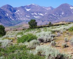
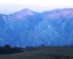
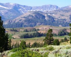
We were looking East – slightly SouthEast. About 180 degrees of our view was totally unobstructed – not so much as a bush, shrub, or tree blocked our vista. The extreme 20 degrees to the NorthWest and SouthWest were partially blocked by the last clumps of trees below tree line and a small ridge that blocked some of the uppermost portions of the Pass. Of our entire 220 degree vista, the main event was to our far right (SW) was Sonora Pass, and Leavit, Relief, Kennedy, Grizzly, Hunewill, Forsyth, Tower Peaks, and Walker, Hanna, Molo, Center and Black Hawk Mountains. They were jagged and sharp edged, black, especially contrasted with the patches and strips of snow. There were 6 or so pretty clear glacial valleys carved out from the ridges and peaks left behind
Out in front of us were the local mountains, forests and valleys that were smoother, rounder, and less dramatic. They were mostly covered in forest, with the exception of the ridge that borders Leavitt Meadows and the meandering West Walker River. It is a very strange green gray color with vertical patches of red and orange. Beyond that, we certainly were seeing into the northern end of Yosemite, but I could not say what peaks or mountains we were looking at. I would imagine we were looking over the tops of the mountains behind Twin Lakes just outside Bridgeport.
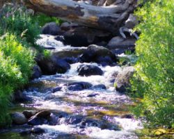
These classic Sierra peaks contrasting with the snow and the blue sky were truly a special sight, but the difference maker for me were the Sweetwater Mountains just a little North of true East. These guys were completely covered in snow so they appeared to be a massive white millipede floating above the Great Basin further East. A few more local peaks were visible way around to the North that completed our 220 degree vista. I imagine a spring fed the wet area in the ravine beside our mound, aided by the melting snow, that eventually fed Little Wolf Creek, that crossed 108 and fed the West Walker. The West Walker is a trip, as most of these Eastern Sierra rivers are, as it follows Highway 108 East to 395, then turns right and parallels 395 North, takes a rest in Topaz Lake before heading East to meet up with the other forks of the Walker and eventually dump into Walker Lake. The twists and turns these Eastern side/Great Basin rivers take, huge loops North and then East and then South, are very impressive while being quite confusing.
My tent went up smoothly – only the second trip for it but I had a real good feeling about it. In my little cubby hole, I had trees and logs to attach the spikes to tie the rain fly onto and cinch them tight to avoid any flappage in the night. I really had to stop and take a break regularly – I mean I am fat as hell, but we were up high too, and had already had a few beverages to attempt to quench the raging thirst. We went back and forth on the location of the fire ring and finally adopted a compromise position with slightly more wind protection than ideal view – still exceptional but not 100% maximized.
The wind was pretty consistent so I was glad we had this end of the finger of Lodgepole trees to protect us a little. We still used my table as a wind barrier by placing it on its edge on the ground to protect the fire. Tom’s Manhattan’s were awesome, coupled with the view, the light, the simple fact that we were up at 9600’ elevation at Sonora Pass. I was super happy to be here in this place, and out and about in general. We had the usual outstanding faire at dinner and a little pie for desert. The wind died down for an outstanding night. The stars were awesome too, making for a completely outrageous first day.
I slept reasonably well. The slope was just enough that I would slide into a lump in the corner of the tent and then have to inch-worm my way back up to the high side to start the process all over again. I was super warm too, not only from the alcohol and meat content, but also the temps. were quite reasonable for that elevation and the clear vacuous sky. Morning was breezy again, and started with a rush. I cracked open the tent flap to pee and noticed that the Eastern sky was blazing orange. I quickly decided to get up and try to take some pictures so I rushed to get dressed and out into the cold but not freezing morning. It got right to my camera in Tom’s rig and walked across the open flat in front of us to the Eastern edge, turned the camera on, took off the lens cap, and it was gone. The orange had faded to cream and the brightness of the rising sun obliterated all clarity and sharpness that had existed in the softer pre-dawn light. I was disappointed at not being able to even attempt to capture the color, but the honest beauty was in the moment, and that I did not miss.
It was quiet but for the breeze through the trees, a slight gurgle of water from the lush green dale North of us. It was calm and peaceful and tranquil. It was the classic Sierra sunrise moment, conscious that this moment is special, that this is an experience that should be absorbed and savored. It came that I was happy not to have tried to capture it – that I didn’t make the picture or the documentation of the moment, more important than the moment – that I stayed in the moment rather than outside of it, behind a lens, trying to keep it from evolving. Instead, I evolved with it, and I felt connected.
Soon, I felt more human feelings of being cold, thirsty, and needing a healthy bowel movement. I returned to the fire ring and the shelter of the trees, got a little fire going, heated up some water, grabbed my shovel, and headed towards Tom’s tent. I passed by Tom’s tent and headed up the hill, looking South over the Pass and into Yosemite and watched the light change everything as the sun crested a huge cloud and finally was out at full strength. Back at camp, Tom was up and working on the coffee, and we soon had a little morsel and lots of coffee to get us going.
Packing up the tent and camp is typically a dreary and dreadful task, but this one was less so than many of the others. I was still stoked at being at Sonora Pass and we had had an exceptional day and night and we were going to explore today prior to heading back. It didn’t take long, it really never does, before we were loaded up and rolling down the track to the main road. We were more than satisfied that the fire was safely out, but we didn’t have enough water to drown it completely cold and wet. As fate would have it, half way to the road a massive fire truck appeared to be heading towards us. After a few seconds of trepidation, a turn of the road made it clear they were on the main road already past us and heading for more distant locals. We hoped this wasn’t a sign we would be near and around folks the rest of the day.
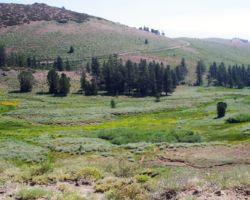
The second road we explored was spectacular. It led us out to a bare ridge overlooking Leavitt Meadows. There must have been a tower of some kind there as the rods and guy wires were still in place. Back down from this exposed point were 2 fantastic camp spots; definitely locations to bring the boys back to, although I couldn’t decide if these spots were better than where Tom and I had just stayed. Better local views for sure, good tree cover for wind/shade as needed, plenty of firewood, plenty of open flat ground, easy/good access, far from the main road, road dead ends just past these spots, but nowhere near the long distance views of up above. We wandered about a bit, had a beverage, and then piled back in to see what else there was to see.
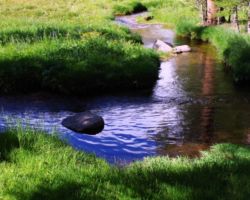
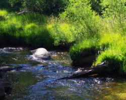
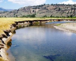
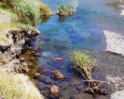
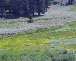
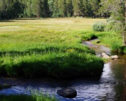
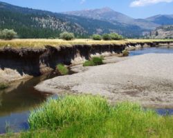
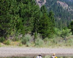
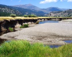
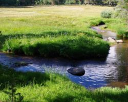
Tom had been in this country a decade or so before and talked about a cool meadow with a creek, so we kinda sorta headed in that direction, it having been many years since and coming from a completely different direction on completely different roads, the odds were against us, but it really didn’t matter. We were in great country that was new to us and we were having a great time exploring it. We took a track or two and came upon 2 massive Mountain Juniper trees. They were impressive and we stopped to check them out. Tom was feeling like we were on the right road and sure enough, around another bend or 12, we came to a little ski run with a rope tow. It was part of the Marine Corps mountain training center. He had gotten real warm and we noticed a gate. Now he was on to it, around a tree, over a root ball, over the chain, and we were at the edge of a spectacular meadow with a quintessential meandering stream.
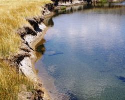
We pulled out beverages and lunch grub of all sorts and sat in the sun surrounded by the specter of nature. This was a sweet spot. We got in the stream and rinsed off the dust, and were off after a great lunch stop and a bit of wandering about. We headed back up and through the gate eventually ending up on the far side of the meadow. This was much more open and dry and was currently occupied by 30 or so marines doing maneuvers. We didn’t linger. Heading back towards the base, we veered North up the end of the valley. Tom was having a ball following every track, road, and path.
SP15p7 top text
We headed way up a rocky road until we were on a very narrow ridge crest. The road ended at an old radio shack below a tower. The views from this spot were fantastic. Back down this path we rumbled down some super steep paths that were so steep, we didn’t think we would have the traction to come back up them. But of course, we had to try, and of course Tom’s rig did it all in stride. It was a blast taking all the tracks and exploring here and there. Soon, we found ourselves at the official gate of the military base and the officer waved us through. It was a bit weird, but being on our way out, it didn’t affect us that much. We turned the rig towards home to end another fantastic journey.
Find this Spot


