Indian Valley Reservoir, Bureau of Land Management
Trip Date: December 11, 2015
I don’t recall too many December trips over the years. As one could imagine, time after Thanksgiving is dedicated to putting Thanksgiving away and getting ready set go for Christmas. There were a few day trips at or around the first of the year – out to Folsom Lake I recall with a mud-bogging incident, and one night camping at Beale’s Point that I couldn’t handle and had to drive home before bed time. But, otherwise, typical camping trips in December have been few and far between.
I’m not sure how we decided this would be an exceptional year, but it was thus decided. As usual, our numbers swelled slightly as the trip approached, and we numbered five at departure. We settled on heading up to Indian Valley Reservoir, surrounded by BLM Land, North of Highway 20, between I-5 to the East and Clear Lake to the West. It is sort of the hill country, just beyond the South East corner of the Mendocino National Forest. It is pretty rough country, with few roads, and few developed recreational sites or amenities.
Bear Valley Road that runs through Bear Valley to the East is a very popular place in the Spring to view fields of wildflowers. The North end of Bear Valley is bisected by Brimm/Bartlett Springs Road heading East along the North shore of Indian Valley reservoir and up into the Mendocino. The road we were heading out on, Walker Ridge, runs high above the Eastern shore of the Reservoir and feeds access roads down to the dam at the Southern end of the Reservoir. This area, in addition to another 300,000 or so acres, is now part of the new Berryessa Snow Mountain National Monument which encompasses Snow Mountain in the Mendocino at the North end, all the way down in one chunk to Lake Berryessa and then picks up a few incontiguous pieces of BLM land South and West of Berryessa. I’m not sure if this is a good or a bad thing, but I can only assume big changes are coming for the area.
Since we were heading out Highway 16, we decided to meet at Bill’s house in Woodland. Steve came to my house, we went to Ken’s house where Bob was already waiting, fully loaded and ready to roll. Although Ken knew where he was going, and perhaps Bob did as well, I was having trouble with my mind’s eye map, and I was making several turns and exits and on ramps at the last minute, making it more difficult for Bob to follow. However, we made it to Woodland intact and only a tad late.
I was fighting back the images of Jordan in his prisoners outfit in chains hobbling into the court room and all the court visits in Woodland and visiting him in jail and picking him up from jail after his 3 days. That was a terrible stretch for all of us, and has forever tainted Woodland, not that it didn’t already have a pretty good stain on it simply from being Woodland. In any event, many of the Davisites are moving North to Woodland to save some money but still live in the same general area, and Bill and his wife live in one of these lovely new developments.
As we pulled up in front, the garage door was open, but there were no other signs of life nor activity or the getting prepared for a camping trip kind. The morning was clear, calm, and warm in the sun and the fields across the street were beautiful and inviting, so it was easy to stand out in the street and look South West and absorb the warm sunlight for a few minutes while we got our bearings and waited for Bill to appear. This latter situation not materializing, we knocked on the door and thence he didst appear.
I was waiting for him to roll his rig out of the garage so we could unload Bob and Ken from Bob’s rig into Bill’s Tundra and roll. However, Bill invited us in and appeared to want to show us around. Once inside, we were treated to a surprise breakfast and coffee Bill had prepared for us – breakfast sandwiches with eggs, bacon and cheese on English muffins, tons of coffee and whiskey or Kalua to taste. It was a fantastic surprise. We pulled up chairs to the massive center kitchen island and chowed down.
An hour or so later, we were pulling away to begin our journey by stopping for ice, ice mind you at the Bel Aire about 10 minutes from his house. This was an outrage not to be ready to go, but to bring the boys on errands – shopping no less and for ICE of all things. Fortunately, Highway 16 starts minutes from his door and we were on our way on the very scenic highway in no time. Unfortunately, in our hast to chastise Bill for not being ready, we realized we didn’t have briquettes either, so we had to stop in the lovely burg of Esparto for yet another shopping adventure. The boys are beginning to slip a bit.
On the road for a third or fourth time now, we passed the Cache Creek Casino and entered the far end of the valley which is far less busy and populated. It is one of the prettiest valleys and drives around, surrounded by hills and both sides, flat as a pancake with the creek running through it, it is just a great setting. There is strong potential for some of the county roads heading West up into the ridge separating the Valley from Lake Berryessa on the other side to access some pieces of BLM land, so Steve was following along with the BLM map as we passed the numbered roads leading off in that direction.
I remembered so many other drives through this valley, one time when I stopped with Kristen on a random road to pee on our way somewhere. I think it was along road 44 that led us out into the middle of the valley to an old farm house that just begged me to move in. Another time, I drove out another road, perhaps Forest Road out of Guinda, to call Kristen when I was driving along with Jordan on one of his bike races when he was riding with Davis. I have had many enjoyable drives through this valley.
After leaving the open valley portion of the drive, we entered the narrow Creekside stretch. Within a few turns, we had to veer over to the outer edge of our lane to allow room for the speeding jackass who had crossed over the double yellow line into our lane. This got our hearts pumping for sure, and snapped us out of the haze that had wrapped us up from a mellow drive through the country. Can’t ever get too comfortable.
Turning East on 20 for a few miles, past the turn off for Bear Valley road, then turning North on Walker Ridge Road, we could exhale a tad. The weather was deteriorating a bit and it was now pretty unlikely we would pass anyone or have to deal with yahoos on a Friday afternoon. It was a little more of a climb up to the ridgetop and the roads were far muddier than I had imagined. I began to be concerned about the possibility of more rain, a slight but not impossible chance, making the roads so slick they could become impassible. This was after all the infamous Mendocino mud. Having worked here for several years and endured my share of wet weather and horrific mud, I had my reasons to be concerned.
We tried a couple spur roads, possibilities in drier conditions, but not now. Views of the Sutter Buttes were tempting, but the wind was blowing and cold, and we needed shelter more than a ridgetop view on this trip. Beer, pee, and observation breaks were short and swift, not wanting to be out in the cold for too long. I was getting worried about a cold wet trip followed by the challenging road conditions. Oh my. Another dip and a few more rises, and we were at the intersection of the road that dropped to the dam and the area that Mike and I had explored on our way to camp on the North shore last January.
My recollection of the road and distances and direction was somewhat accurate and we dropped to the Blue Oaks campground in a few short minutes. This was the fall back location if we didn’t find any suitable dispersed spots, and thus far, nothing had presented itself. We hadn’t seen anyone on the way in. Some of the guys had heard shots when we stopped for a break to check out the view, and a possible road, and stretch our legs, and empty our bladders, and address all such needs, which wouldn’t be a surprise in them parts seeing as many a visitor is a redneck ATVer, redneck gun toter or both, but I didn’t hear anything. It was about 2:00 or so and it was time to be getting settled, so it was decided, seeing as we would most likely have the entire 7-site campground to ourselves that we should not look for an undesignated site elsewhere and just stay in the campground.
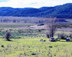
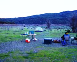
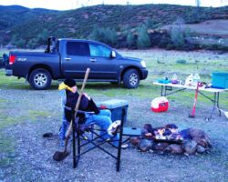
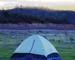
As soon as we parked in the last two spots in the back of the campground, it began to sprinkle. The boys displayed immense agility and guile, courage and strength in the face of the pounding storm. Tarps were spread, one of the pallets was propped up against a tree as a ladder, ropes were unfurled, bungee cords stretched, and a roof was soon providing shelter from the storm. By that time, the sprinkles had stopped and the intermittent breeze calmed to a slight stirring of the air. The fire raged and trucks were unpacked. We had a table for each of us; a water jug for each of us; an ice chest for each of us; a tent for each of us, yet only one bag.
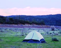
Steve set his tent up beyond the cables of the campground out in yonder wilderness; Ken and Bob were in the upper campsite; Bill in the below campsite. I decided to stay local and occupied the homestead site near the kitchen and fire. We were all in pretty good shape in an hour or so. Gathering back at the fire, the bar was officially opened. One of the many great things about these trips is the surprises that are bestowed upon the participants.
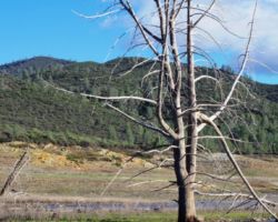
Knowing the boys would be in need of beverages since Tommy would not be providing Manhattan’s, Bob stepped up to the challenge and provided an excellent substitute of Ginger ale and Bushmills. A round of red cups was met with much rejoicing. As the day was coming to an end, we decided to head down a path that eventually became the creek bed. It was a great walk and ended at a huge oak snag that definitely had seen and experienced much in its lifetime. It was a very cool remnant of days gone by. At that spot, we had to head overland to avoid retracing our steps.
Alas, this venture brought us to one of the other camp site possibilities I had wanted to show the boys, but didn’t get to as we decided on the campground. I was pleased we stumbled upon this place and they got a chance to see it. It was also uninhabited, but it was thrashed from heavy use – or heavy users as it may be. There was the usual assortment of gun shells, plastic target fragments, glass, garbage, and fire rings – also often filled with refuse, rubbish, and debris. This area was used hard and left angry. We were happy with our choice of the campground above.
We waddled up to the road and back to camp. The sun was setting and a light orange impregnated the few puffs of clouds. Set against the bare oaks, the low light left no mistake it was Winter – or at least very late Fall. Back at camp, the fire was stoked and another round of Ginger Bobs was poured. I forgot my grill but fortunately Ken brought his. We rigged a light in the tree, and tunes were aloft, a menu took shape, a kettle on the boil, and we were in gear. The air was completely calm and the sky as clear and clean as could be. The night was shaping up divinely.
We had another round of Ginger Bob’s, then a round of clam chowder, then a round of seafood pasta in red sauce – some might say a Cioppino. At some point we were out of the Irish whiskey so we were forced to go to the Brother Thelonious – no not the beer, but the whiskey I bring on most trips in the bottle – love the cork. The boys were stuffed and feeling a little frisky so it was decided to stroll through the campground to the road for a looksee at the starry sky.
This turned out to be an excellent suggestion as the stars were spectacular. There was no moon as it was a new moon, so the stars were at their max. It was getting cold, especially away from the fire. It was very still and quiet, and the impending storm we faced when we first stopped at the campground seemed like a distant place. It felt great to be out, to be amongst friends, to feel free, to experience these things and these places.
On our stumble back to camp, we were a bit spread out and possibly in our own spaces – some far some farther. Apparently, there were those amongst us without light, nor the ability to drop ones cocktail in order to use their hands as a cushion for ones face prior to it colliding with the ground. We were made aware of this situation back at camp when we were again reunited, the one whose face was planted momentarily, a time or two, was emitting a fair amount of blood. The boys stumbled into triage mode, with the 1979 first aid kit at the ready.
The first tube of antiseptic ointment was dry as a boner, but the next was sure to work. A dry towel, a wet cloth, a beer soaked rag, no steps were too great to provide aid to our fallen comrade. He had fallen, but he had gotten up, and he had returned on his own power to the clan. The left side of his face looked like week old meatloaf, but he mustered on – a brave and tough lad was he. Once we were sure he was right as rain, we hoisted a beverage in his honor and bade him good night.
Steve and I were last at the fire, a very relaxed and enjoyable time. The early dawn brought tales of shooting stars and glorious stars in the wee hours from those forced from their slumber by needs of all kinds. Rumors of vomiting at the upper terrace were greatly exaggerated as it was later explained away as “moaning” emanating from the tent – reports remain unsubstantiated, however, and all were present and accounted for at the dawn. The face looked less fierce in the daylight, although now it took on the look of a rough and tumble longshoreman – not someone whose glance you wanted to catch.
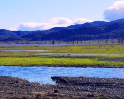
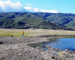
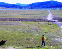
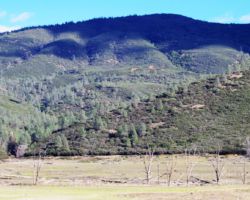
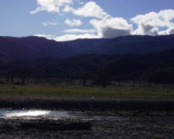
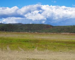
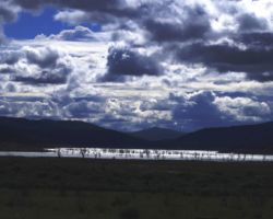
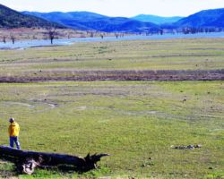
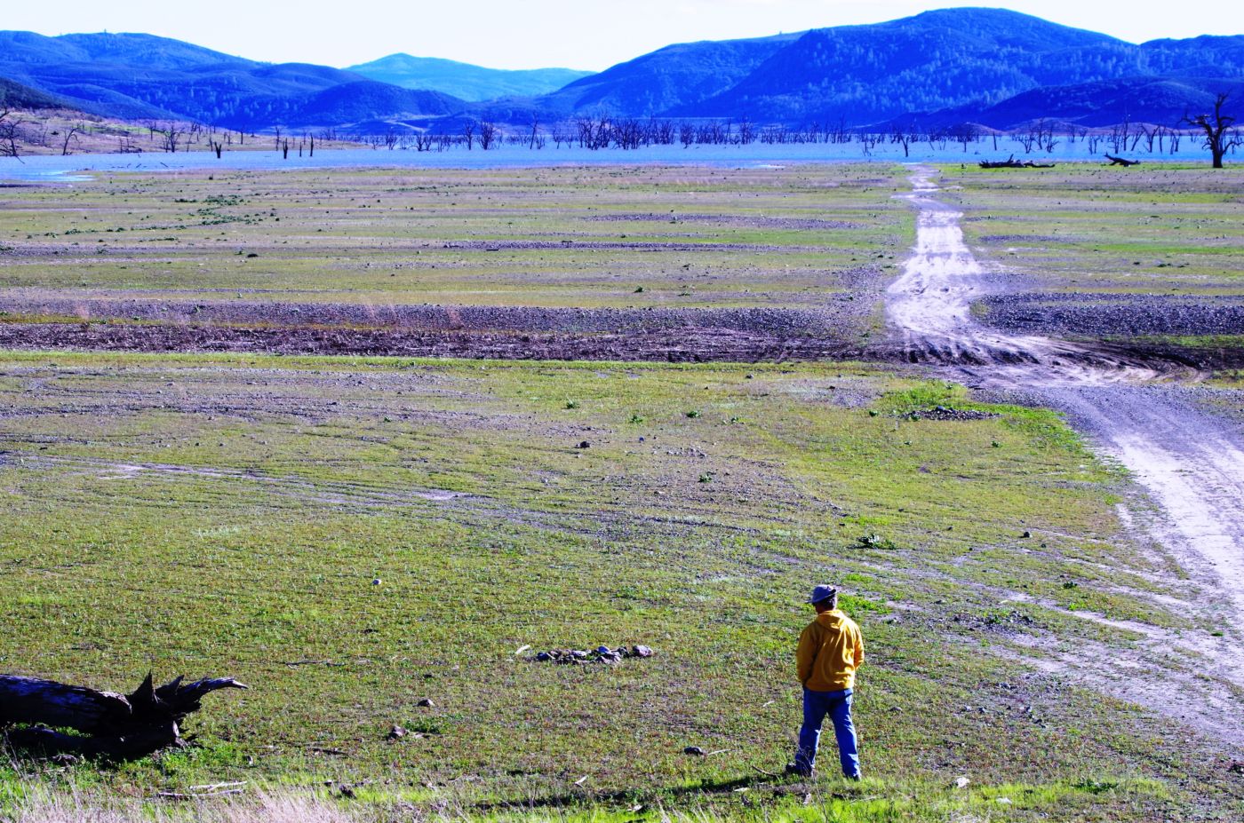
An inner stirring had grabbed some of the boys by midmorning and it was decided to aloft in Bill’s rig for a ride to the end of the road and an exploration of the dam and parts thereabouts. Ken had lost feeling in his innards and decided to stay behind. The road to the dam was still gated at the same place it was when Mike and I had come the prior year. We parked, geared up and wobbled down the road to the dam. We knew it was the dam because of the immense amount of cement and massive steal gates, but we wouldn’t have known it was a dam if we were looking for water behind it. Nary a puddle was within site. Even whenst we crossed the dam and looked down the spillway, it was dry as a bone. We walked down into what was once another campground and boat ramp – again, not only high above the water, but with no water in sight.
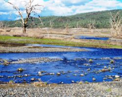
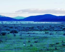
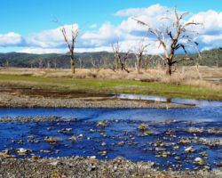
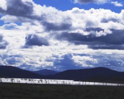
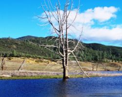
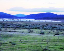
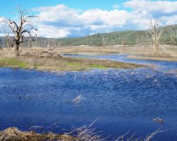
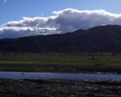
We walked out around a point and finally, on the far side of the reservoir, we could see the lowest point, covered by some amount of muddy waters, pierced by dozens of trees, bleached white; a haunting contrast to the greyish brown water, the red mud ring exposed by the receded water, and the green brush above the line formerly marked by water. Beyond the last pools of water, the grassy plains now looked more natural than what would have been a huge bathtub of agricultural irrigation. One could easily see this scar returning to a more natural state if allowed or provided the chance with continued drought.
We had a great walk through the campground, down the old boat ramp; it could have been a zombie movie or an old video of Spinal Tap, but there was a strange feeling being in a place that used to be so vibrant and full of people having fun and enjoying themselves such a long time ago. It was sad to see it empty and crumbling and yet, again, one could imagine all of it gone and back to seed. Not a bad ending me thinks. We eventually had to admit we had to walk up the hill back to the rig and so it was, around and around and back and forth, finally a turn that revealed the truck a reasonable distance further up the hill.
I couldn’t help myself but to gather a small stone or two and load it into the truck. It would be a fine reminder of a fine day. Back at camp, we found Kenny amusing himself in our absence. Once reunited, lunch was brought to bear and the dissolution of camp was begun. No sooner had we lowered the tarp, than it began to rain – or sprinkle more like. Only a few drops, but enough to give us all a laugh at the irony of getting a sprinkle as soon as we stopped and then again as we were leaving, but not as much as a spit in between.
Fine sandwiches consumed, camp broken, gallons of water having drowned the fire, a beverage or two for good measure, and we were off. I don’t recall the exact moment we parted ways, but I wanted to retrace our path along Highway 16 and I believe Bill and the boys shot back Highway 20 to get back South via the Interstate. I don’t know how many times I have been on Highway 16 through Capay Valley and along Cache creek, but it never gets old. It is a beautiful drive and there are a great many interesting sites and places and roads along the way. I have never felt like I knew the route, but this time, with Steve navigating and following along with the map, we were going to focus in on a few details.
First, we stopped on Road 40, which we were pretty sure was the road that went through from 16 to Knoxville Road above Berryessa. Our suspicions that the road no longer went through were confirmed in about 500 feet as signs and gates blocked our path. We walked down to the creek to take a look and returned to the rig satisfied with our new knowledge. The next spot was Road 44 where I believe Kristen and I drove one day to stretch our legs and take a break. At the spot where the road forked into private driveways was a house on a little rise that looked out over the valley in both directions. It had a separate garage/shed and a few nice trees and with a little work and paint, could have been returned to a real sweet little escape. Thankfully it was not for sale, and we could end our fantasy as soon as we drove back down the lane to the pavement.
The next spot was Forest Road heading West out of Guinda past the Corner Store with the big Mickey Mouse. This appeared to be the best possibility for a road that may get up to and possibly over the hills separating Capay from Berryessa. It also appears to touch a spot of BLM land that could offer us shelter in some future time. These roads were marked on the map and in our minds for another time. It had gotten too late to stop at the Road Trip Bar and Grill in Capay; again we shall save this stop for another time.
We turned down Brookside Way at just about 4:57 PM; our ETA intact. The Travel All was waiting its master to get back to Arden. Kristen greeted us with a smile and helped unload. It took a bit for the Travel All to warm up and get up to speed – possibly about the time it got home. It started to sprinkle yet again, to mark the beginning and the end of another great trip.
Find this Spot
Indian Valley Reservoir Photo Gallery


