Mojave National Preserve I
Trip Date: January 9, 2017

I had been communicating with a rangerette who worked out of the Baker office and had picked up some good maps and done some reading. There were so many places I wanted to go and see and this is a massive area, second only to Death Valley I believe in public federal landholding. And, once you are so far out there, of course you are close, or closer to so many other faraway places. We talked about getting to the Colorado River, which is only about another hour or so East at Needles. We talked about getting to Amboy and other famous locals along Historic Route 66. We talked about getting up to Tecopa to get into the hot springs the area is known for. And we talked about getting into the Southern end of Death Valley National Park, particularly into the Owls Head Mountains which I have heard a lot of good things about. And, of course, we were going to the Mojave Preserve and there were a million or so acres to see there.
 Obviously, we had to limit our “must see” list, but we had about 8 hours of drive time to discuss the itinerary. Bob came over mid-week and dropped off all his gear with the exception of the ice chest and a few last minute items. This allowed me to pack and load all the gear so we were ready for flight at first light Monday morning. We got on the road by 8:00 and made great time blasting down Highway 99. Within no time, we were heading up Highway 58 over Tehachapi Pass. It was windy and cold up top but we needed to stop for gas, so we made it a quick one. Before long, we left the famous train tracks and the wind farm and the familiar stretched of road from our Red Rock Canyon trip behind and were heading East towards Barstow and then onto Interstate 15 to Baker. The drive wasn’t bad at all and the time just screamed by, so before long, we pulled into Baker to get gas and take a look around. In about as much time as it took to read this, we had seen what there was to see in town and so headed south down Kelbaker Road (the road between Kelso and Baker). Bob started navigating with the maps, images and PDF’s from the rangerette, and we took a left turn onto an unmarked dirt road about a half hour south of town. Our confidence level was low, but our excitement was very high.
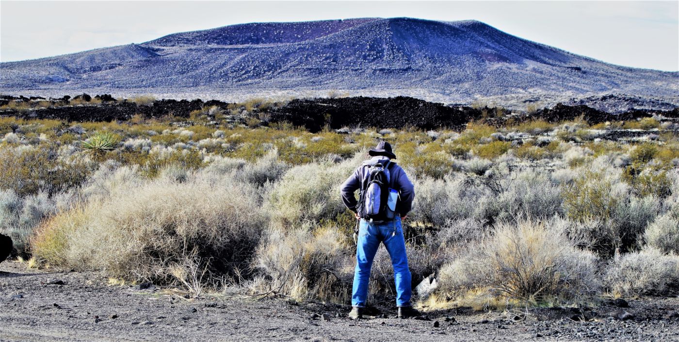
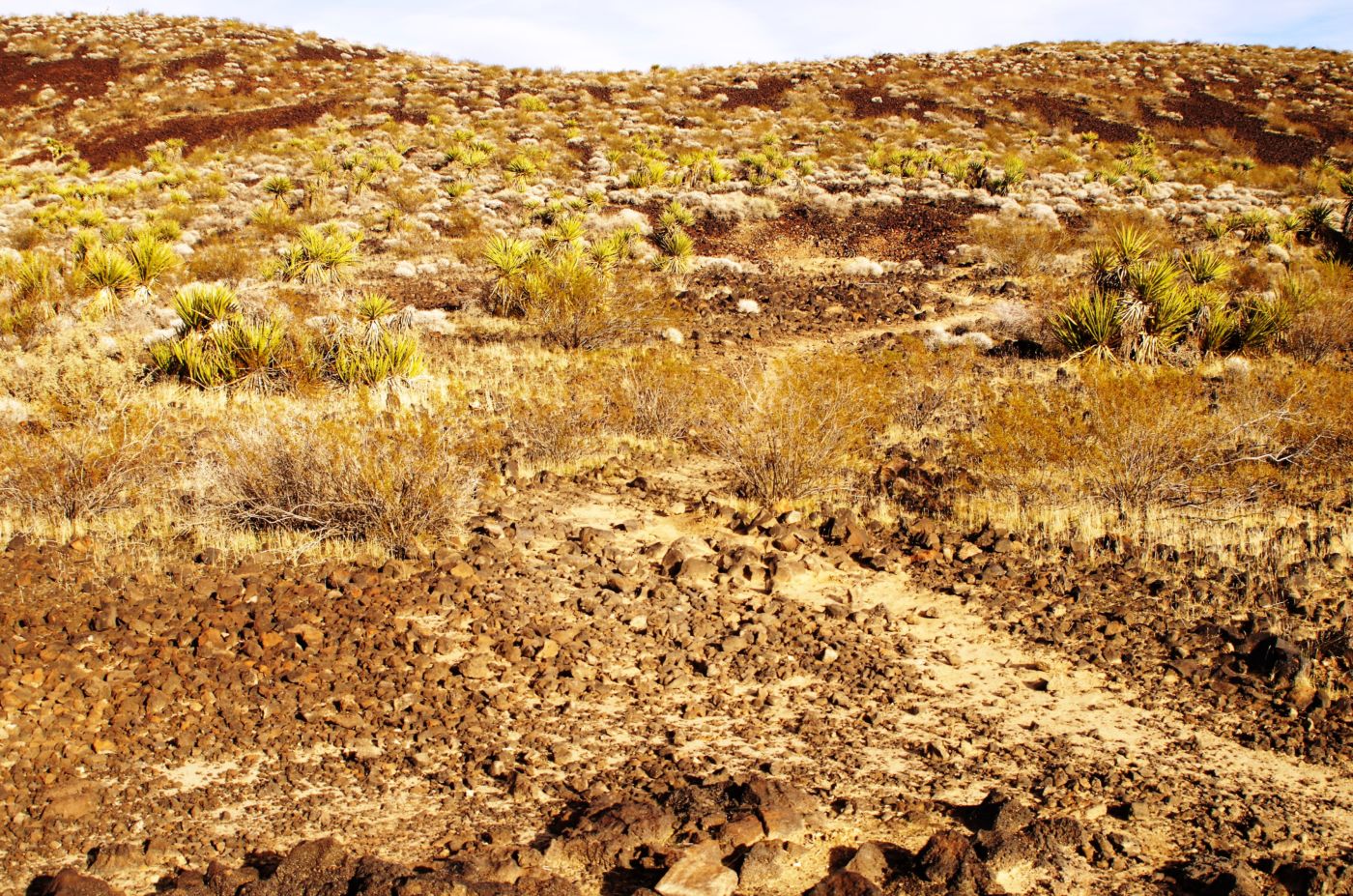
 We soon were on a sandy track with little sign of use. In about a mile, we came up against the edge of a massive black lava flow, maybe 15 feet high and a mile wide. We knew we were in the spot or very near the spot we were looking for, but it did not seem very “disturbed” to us, we couldn’t really get out of the wash, and being not too far from the road and up against this massive wall of lava, the loan vehicle that happened down Kelbaker road was a tad too obvious for us. After wandering about for a few minutes, we confirmed our prior reservations and decided to back track down the road a piece to a prior dirt road we noticed that seemed to hold some promise. With these short winter days and the long drive, we had been concerned about having adequate time to select a good camp spot, one which merited staying at for the entire 5 nights with so little time. However, we had made great time and specifically chose this area to focus on because it was the nearest main entry road into the Preserve and therefore, it would allow us the most time before it got dark to find a spot. This all worked out as it was only about 3:30, and we felt like we were in good shape to hunt and find a suitable spot.
 This second road felt good as soon as we left the pavement. It showed sign of much more use than the prior road. I spent a fair amount of time with the rangerette making certain I understood the rules for “undesignated” camping and was reasonably assured where we could cap and where we shouldn’t. The rules, on top of our high standards for camping sites, puts a fair amount of pressure on us when we go to new locales, however, searching for yet another fantastic camp spot is half the fun. What I understood to be the major factor in legal undesignated camping was being in a previously disturbed site. Now, one could conceivably take a philosophical approach and suggest that everywhere has been “disturbed” by man, be they Native or Eurotrash.
Even deeper, one could argue that being is disturbing, such that anywhere you are has thus been disturbed. I am far too shallow for such thoughts, and while we take great pains and exert much effort to get away from people so that we can relax and not be disturbed, I am extremely reluctant to “break the rules” and camp illegally. That would make it very difficult for me to relax and therefore knowing the rules and abiding is high on my list for these trips. However, we were buffeted by the immense size of the place, the fact that this was basically the most offseason time one could visit, and we would do our due diligence to avoid people as usual.
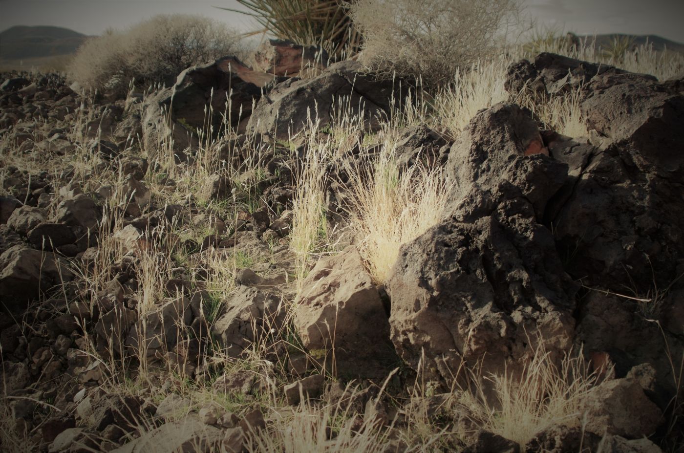
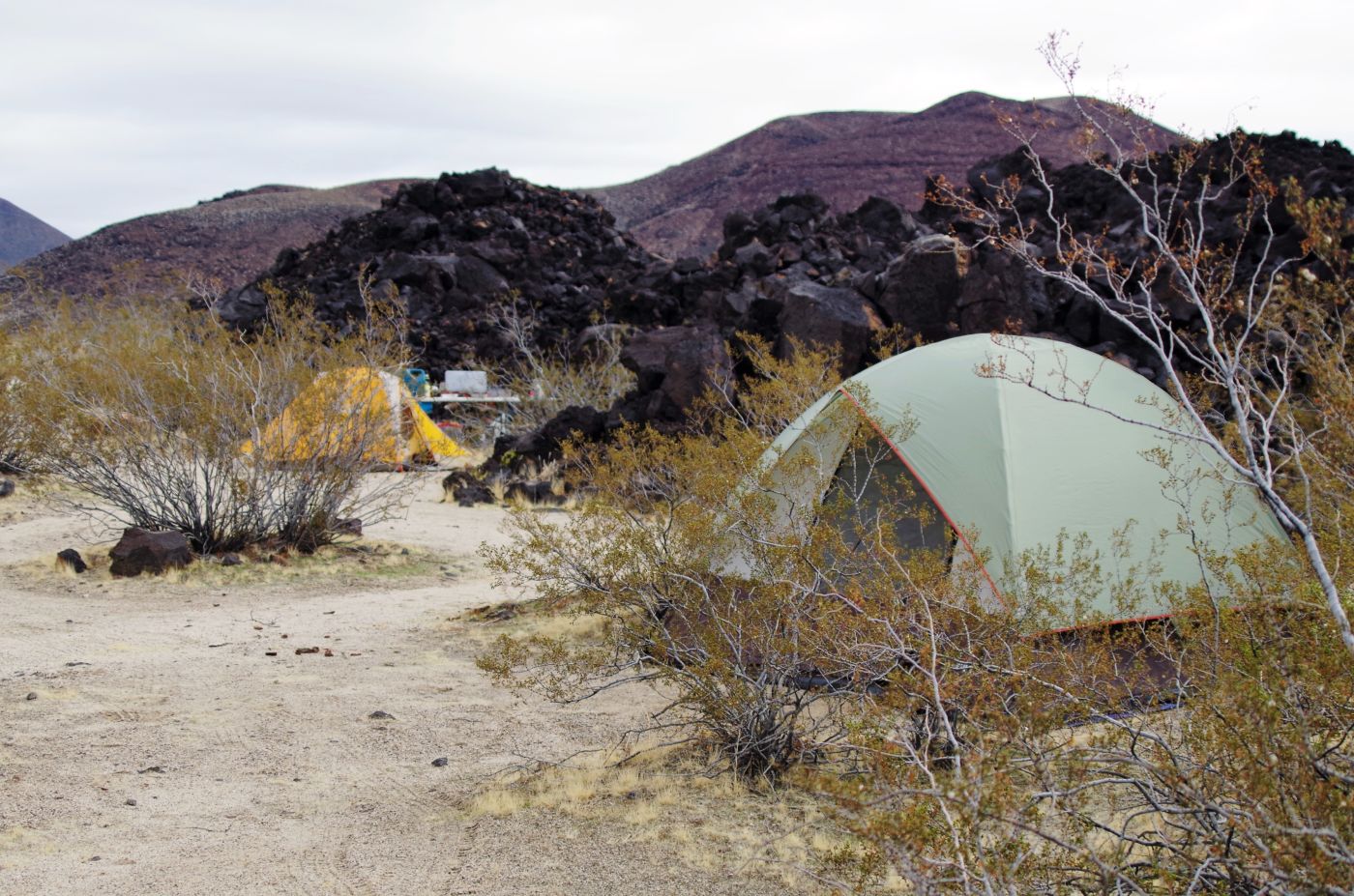
 All these factors collided in another very favorable camp spot as we rose above the valley floor and reunited with the massive lava flow – this time on the North edge rather than the South. This was obviously a previously used camp spot and met all our minimum qualifications. It showed no signs of prior inhabitants with the exception of tire tracks and a fire ring. If someone happened up this road they would come right past the site, there was not another spur or 2 one might have to trek to find us, but the sense we got of just how few people might be out here this time of year, we felt like we had found our home for the next few days. There was much rejoicing.
We went about ground sleuthing the site and picked our tent sites. We were unloaded in no time and got as fire going to make it feel downright homey and fend off the darkness just a bit longer. Bob had brought some pasta that we could easily heat up for an excellent and well deserved meal. A few cocktails, outrageous stars and then the gigantic moon all seemed to signal we were right to be in this place. While I was tired, I must have still been roiled in adrenaline as Bob retired and I hung by the fire. It was breezy, and away from the fire was a dim, cold world, but roaming up the road a bit and hearing the yaps of the coyotes, made me super happy to be here. Before long though, it was time to retire.
 The morning was cool and calm, but not for long – the calm part anyway. It seemed we would have a little calm, depending on when we got up, before it started flapping again. After the long drive, we decided to kind of take it easy, stay close, explore locally, and not drive too much. It was an obvious and easy call to continue driving up our wash to see what lay beyond. If we were where we thought we were, we should find a road up the wash a little that turned sharply right to head up over, and across the lava flow and bring us to the first potential camp spot we explored. It would be cool to cross the flow, and I was intrigued at how such a road could have been created across the rugged, jagged uneven flow. The wash itself was sandy and soft, and even a bit damp still from somewhat recent rain, cool days, high humidity, and morning dampness. It was super easy going over the extremely smooth surface.
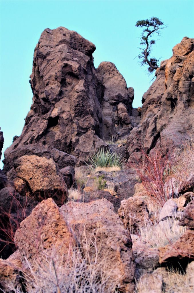
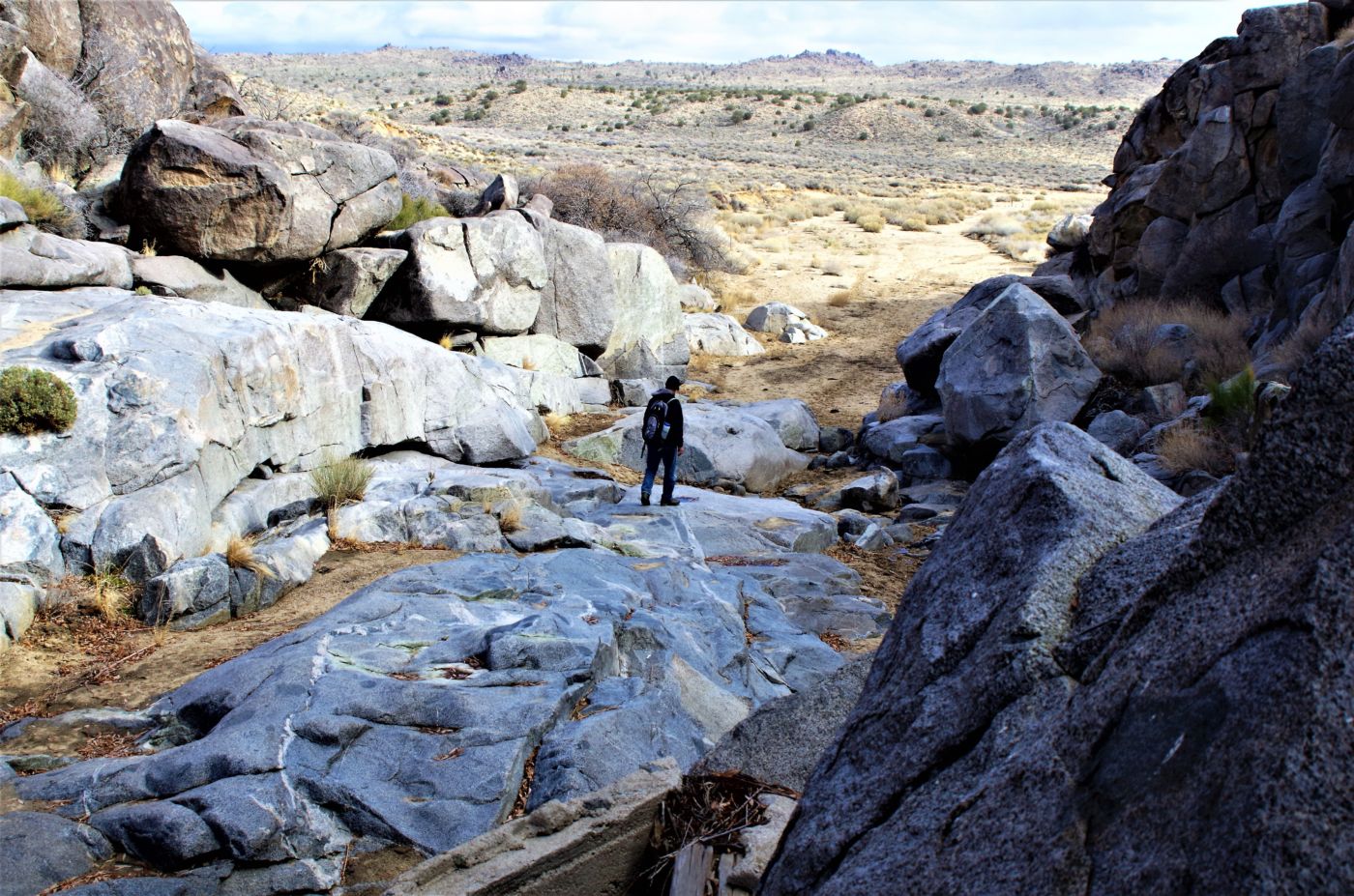
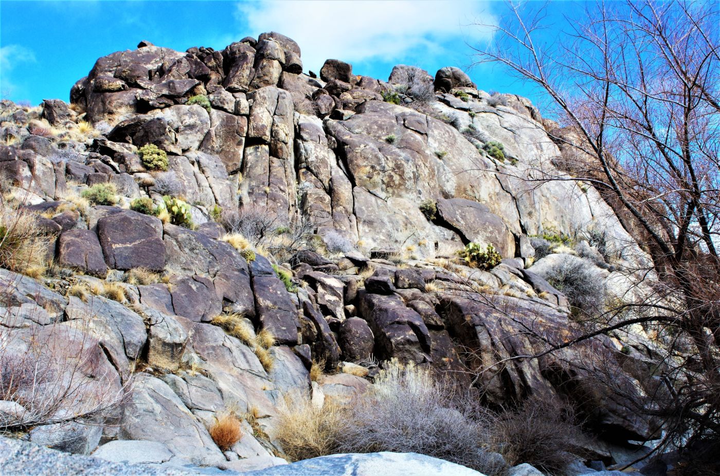
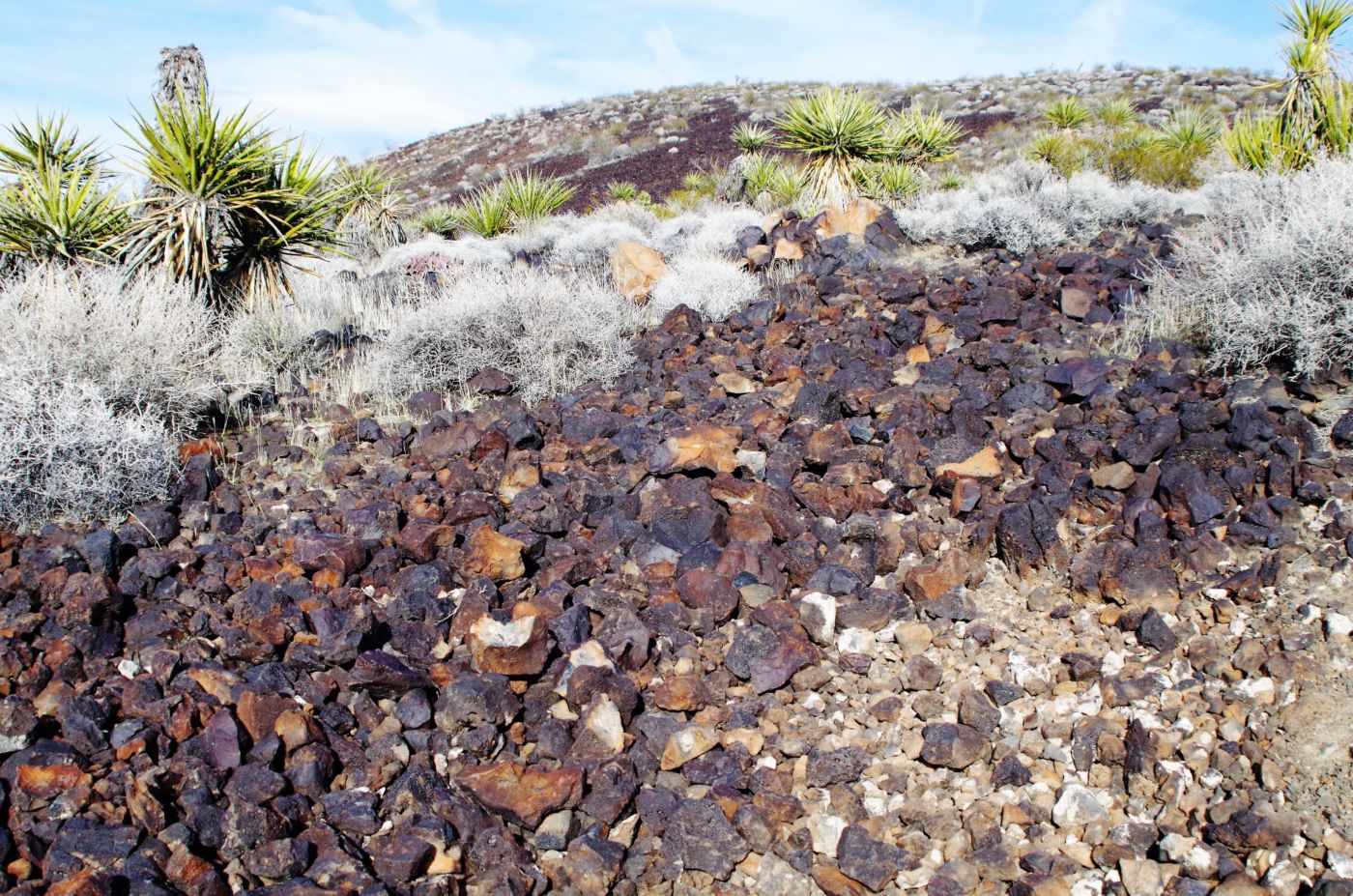
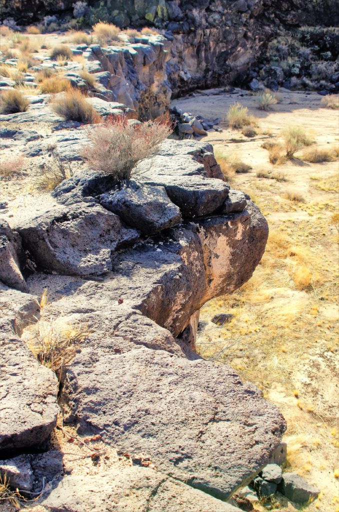
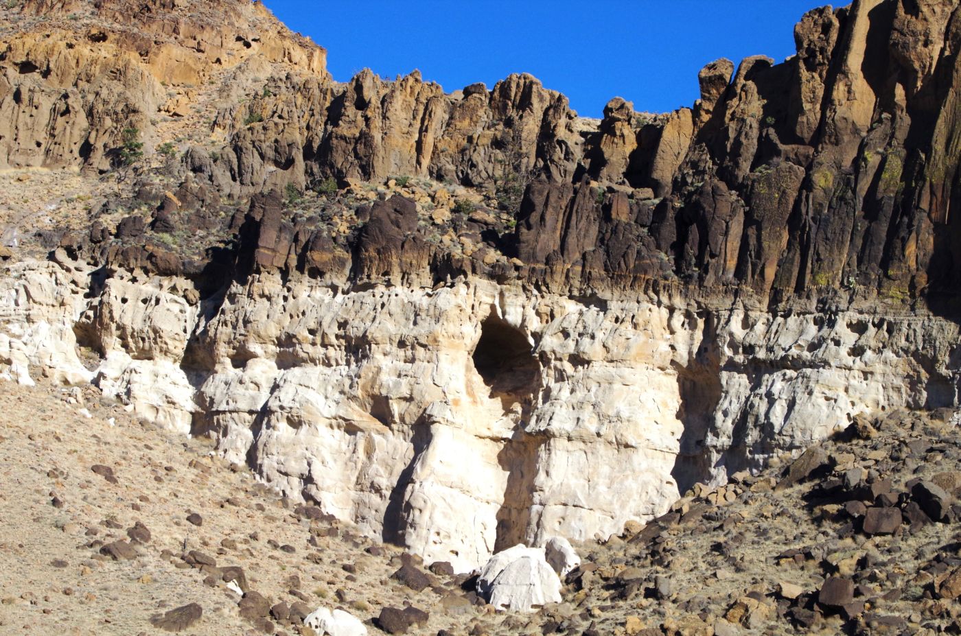
We did not spy a road up and over the lava flow, but we did notice the end of the road blocked by a 15 foot vertical lava wall. Our wash had narrowed from a vast vista at our camp, to a couple hundred feet across, to 50 feet across at the wall. The South side was solid lava flow; the North side was the side of one of dozens of red rock, flat top monolith that popped up all over the Preserve – very Southwestish, and very prehistoric. We got out of the truck in our tiny box canyon, pretty awestruck at the lava, and the colors and textures in the rock that walled us in on 3 sides. We hiked up a draw on the left side of the lava wall and got up on top to see another massive valley and many more red buttes dotting the landscape near and far off into the distance. We couldn’t help but to start to wander out into the expanse, drawn to the vastness, to the unknown, to the prospects.
 The early morning was calm, overcast, but nice. A great fire and coffee and a few biscuits got us ready to go. We figured to stay close, not do too much driving after yesterday’s long haul. We knew of a lava tube that you could go down into and look up out of through small air pockets that burst open as the lava dried. As the lava streamed out across the land, it slowly began to cool. Often, the top of a flow would cool while liquid lava continued moving underneath, creating a tunnel. When the eruption ended, the flowing lava in the tunnel either cooled in place or emptied out the tunnel’s end, leaving a hollow lava tube.
We knew it was within 10 miles of our camp site and would give us our first experience on the Mojave Road. We had no idea at the time, but this road would provide us with many sparks during the trip. Just a few miles south on Kelbaker, past our first unmarked dirt track we explored for a camp site the day before, we took the next unmarked dirt track a couple more miles down the road. The track was alternatively deep sand and then rocky lava. It was pretty easy going 2 WD, but consciousness was called for.
 After a few minutes of slow crawling, we intersected a larger, wider, sandier road, presumably The Mojave Road. This was pretty exciting for us, because as little as we knew about the area, we knew this was a major track across the entire park. We passed 2 vehicles traveling together, but that was it. A few more limes and we intersected a major dirt road. This was (my ass was) Aiken Mine Road, which led out to the Lava tube. According to the description in the book, we were to turn left on a short road to a wide open circular parking area with a well used trail leading directly out from the parking lot.
We found just those features, seemingly matching the description very well. However, no tube. We hiked up a well-used trail which led up to the top of a red butte, from whose back side we could look down the wash to the proximity of our camp. With some good binocs, and a little more familiarity with the landscape, I feel like we could have fixed its position fairly well. However, we were currently hunting for a lava tube, which the more we searched, the more we realized we were looking for an underground feature, which seemed to make our hunt a tad more challenging.
 We were evidently following old mining roads as they cut and zigzagged across this butte and rose higher than we cared to go. Certainly beyond what we understood to be the location of the tube. We split up and wandered towards seemingly likely formations, but we remained “O for lava tube spotting”. Back down the hill towards the parking lot, we picked up another “trail” that seemed to be a possibility. We followed it out a bit until it seemed we had gone well past the 300 yards from the parking lot, where we were supposed to see the obvious path to the tube. We were losing hope.
Assuming a beverage would clear our minds, we headed back to the rig. The only other car was a white Ford sedan, pretty clearly a rental car, that was “parked” in the middle of the road. It wasn’t pulled to the edge, or tucked alongside some brush or otherwise in an out-of-the-way place. It was as if the people just came down the road and feeling like they had arrived, stopped and got out.
While not causing a traffic jam, or a bottleneck to the commute, we did have to drive around it, in the opposite direction of the typical circular traffic pattern. Unless perhaps the driver was from “Down Under” and was used to driving on the opposite side of the road, hence coming in from the left and exiting right, his parking was incongruent with the public norm. As such, this person received a failing grade for parking lot etiquette. We were quite willing to negotiate the mark with the offender as we saw him at his car upon our return from our failed hunt for the tube.
 He was a nice enough guy, coming back from Vegas on his way home to San Diego. In shorts, tank top, and of course flip flops, this guy had apparently hiked to the very top of the red butte, like it was a stroll along the beach. We were humbled. He did let us know that we were about 2 miles short of our destination, and that we would find all the landmarks as described further down the road. Relieved and thankful, we sprayed him and his stupid white Ford rental car with rock and gravel as we sped out of the parking lot – on the wrong side of the road because of his inconsiderate behavior. (Only kidding)
A couple miles down the road, we came to the exact same set of landmarks, or at least somewhat reasonably similar to what we had seen below, and entered the parking lot as described for a second time. This time, however, 300 yards up the path, was a sign for the lava tube. The “signs” were so obvious, it was a tad embarrassing. But a celebratory beverage and not a sole around soothed our bruised egos. Up the trail we went, and we were not disappointed.
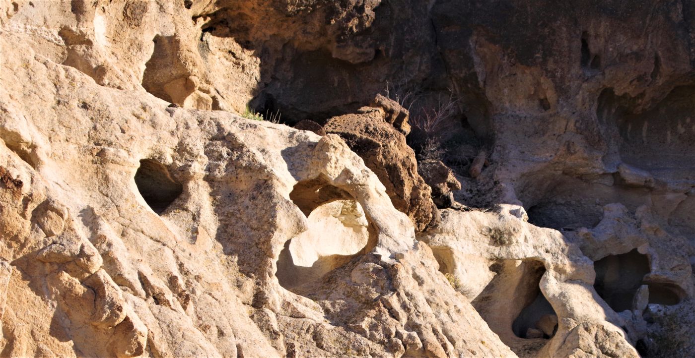
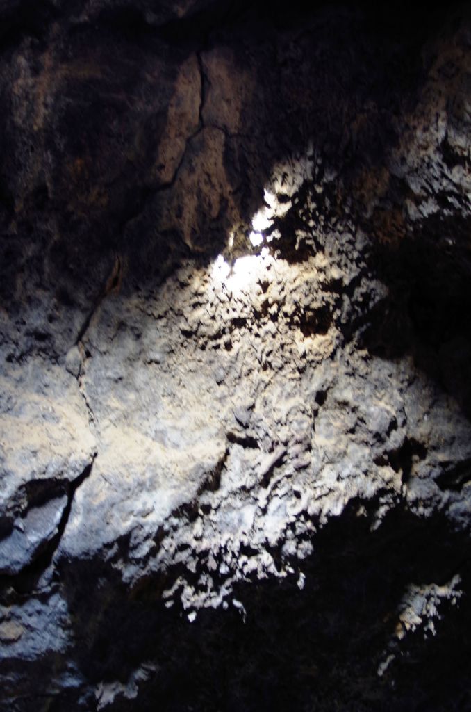
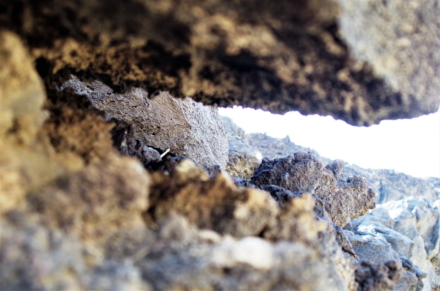
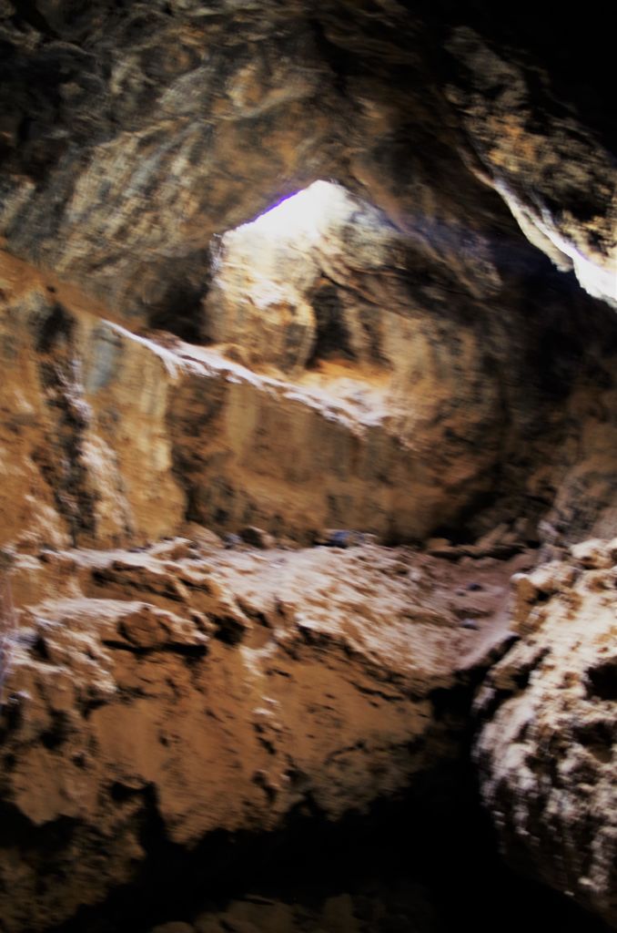
 You could see down a couple 2’ x 2’ “holes”, jagged corral-like surfaces that you really could imagine resulted from a “bubble” of lava popping open. It seemed the cavern was about 20 feet below and I was a little concerned about how we were going to get down there, knowing that a trip or stumble, or the use of your hand for anything could lead to a bloody stump in no time. Alas, a metal ladder alleviated the concern. Down we want into the 20×20 foot area of the cave-in, just a big hole in the earth. To the right, another cavern may have once existed, but was now just a pocket maybe 10 feet deep. The cool part was to the left.
Cave-ins and erosion was obvious from the piles of rock strewn about. With all the recent rain,, even out in these parts, concern was high. We stepped down a few levels and then had to crawl or squat through a 10’ stretch to the first main chamber. Even though we weren’t too deep or far in, it was quite a feeling to be inside a lava tube and looking up through the opening at the sky. We heard voices above and hastened into the far corner of the tube to see through the last opening above. The sunlight wasn’t streaming through as in the park brochure, but the sensation was pretty strong. After a few photos, the 2 Russian voices were in the chamber with us, so it was time to go. No sooner had we gotten up the ladder, they also appeared and with pace, headed back down the path to their vehicle. I imagined they were father and son on a trip to Vegas and left the women in town to do some exploring. I was glad they were gone.
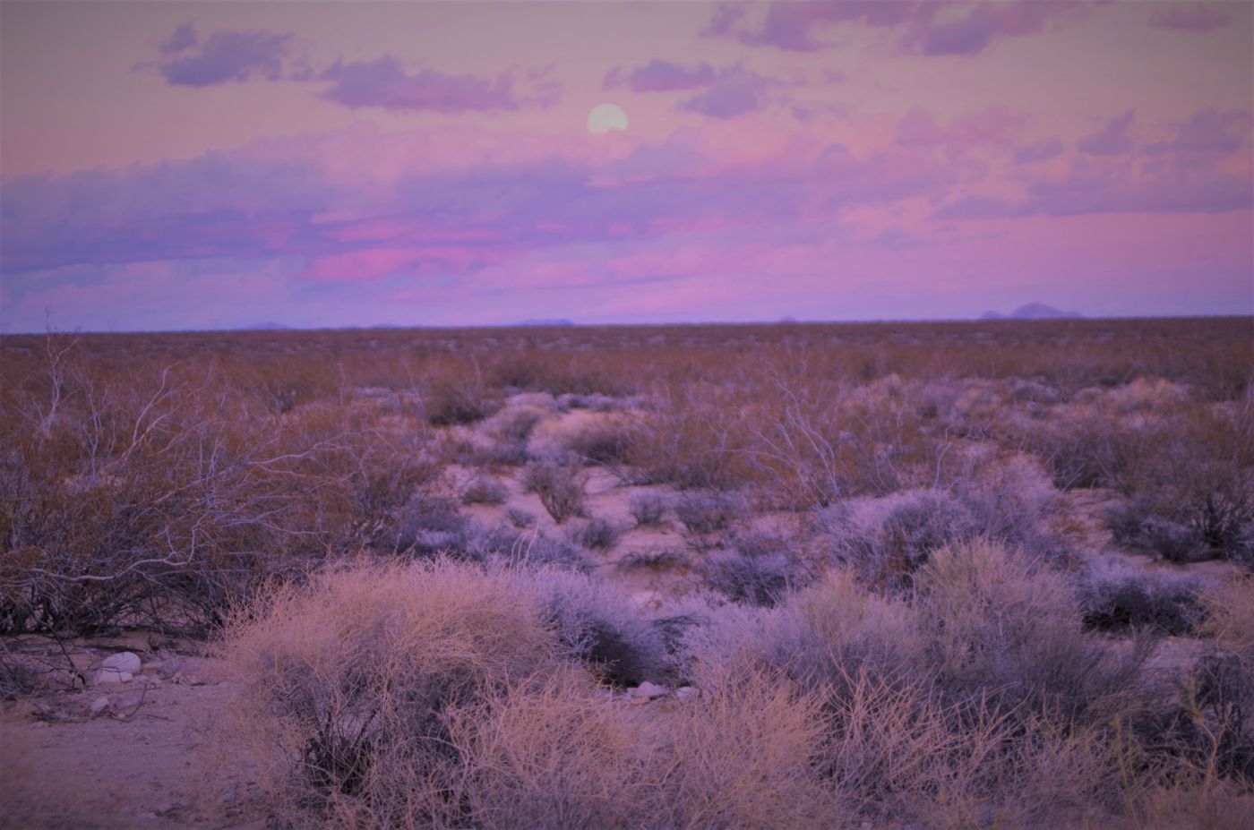
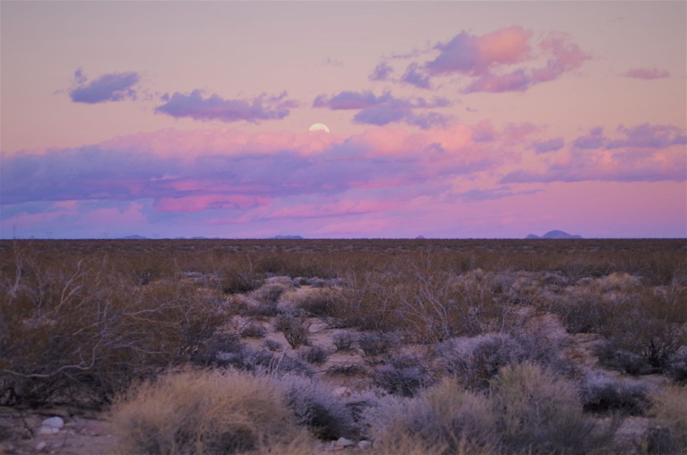
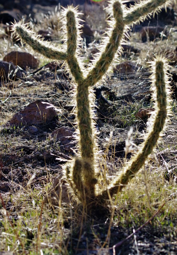
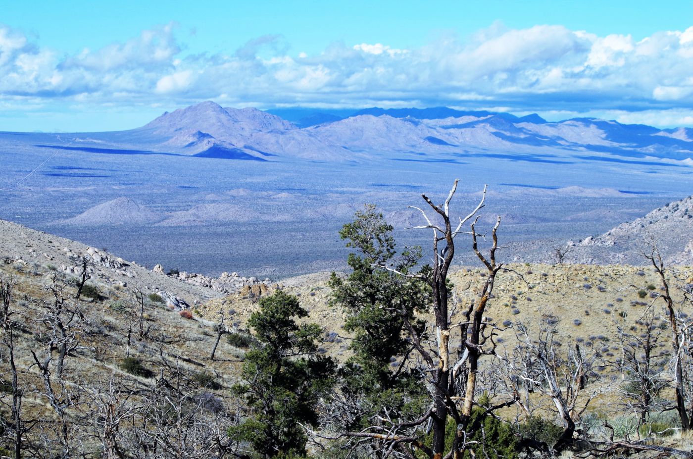
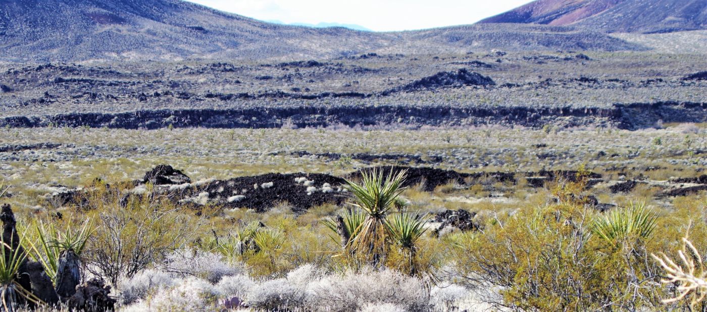
 Turning around to head back down the path, the valley dropping off in front us was pretty spectacular. The black lava flows sticking out prominently in places,, but largely overgrown in many others by the yuccas, Joshua Trees, creosote bush, and cholla and mixed in with the red rock from the erosion of the massively prominent mesas, really made for a colorful palette. It recalled the sense from the first time I was at Death Valley with Heidi in about 1980, I had a hard time focusing because I was enthralled with the microcosms of individual plants, the colorful sand, gravel, and mosaic tile of the desert floor, and yet, whenever I would lift my head, I would be blown away by these massive vistas, incomprehensible distances with such clear clean air, that valleys, alluvial fans, and mountains all blended seamlessly into a geology that clearly defines the human as insignificant.
Fortunately, the humans had invented the automobile, and ours was operational. We headed back to the pavement of Kelbaker and decided to check out the visitor center at Kelso to maybe help us pair down our lengthy list of places we wanted to see while here, or add to it. The last time I was here, was maybe 20 years ago. Gabe, Ingrid, and the kids celebrated New Year’s Eve at Afton Canyon on the Mojave River. It was a bleak campground, but unoccupied lest for ourselves, the trains crossing the famously photogenic bridge over the Mojave River, and the occasional coyotes singing to us.
 At that time the Kelso Depot was in shambles, deteriorating behind chain link fence. A huge billboard indicating it had raised about 10% of the funds needed to restore it and make it the National Monument Visitor center. Not a sole was around. Now, the place looked great, was full of visitors, and park staff everywhere, helping folks, selling stuff, maintaining things. It was quite a contrast to where we had just been, but it was good to get some intel.
Bob struck up a conversation with the information ranger and he turned out to be from Humboldt State. Both Bob’s kids went to HSU, and of course Ingrid and I did (and Gabe, Marty, Pete, Tim, Larry (aka Laurence), Howard, Dana, Terry, Brian, Jennifer, Yvette, and so many other fine people), so any connection to HSU typically results in friendly conversation. He gave us some good ideas, and mentioned the forecast, and we purchased a map or two, and we headed upstairs to the museum portion of the completely renovated building. The photos and displays were great; particularly one of a railroad tie carrier – a thick wooden rounded handle about 4 feet long with a heavy duty steel tong hanging below it in the middle. There were photos of guys hauling ties into place as they build this stretch of the line up the Cima grade.
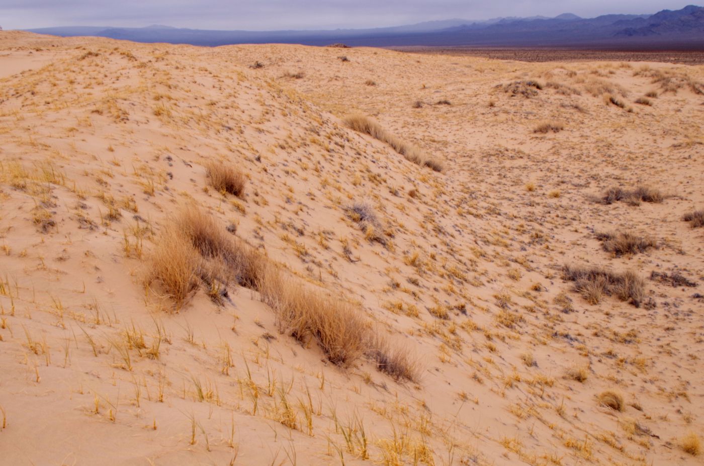
 This was of interest because my brother Mike had given me 2 of these things he got from his weekly trips to the flea market in San Francisco (and eventually all over the Bay Area). Neither of us were sure what they were or what exactly they were used for so it was cool to get some historical documentation on at least one application. Since the Kelso Dunes were nearby, we decided to check them out. It was cool because the weather was unsettled and only a few other people were on the dunes. Bob headed much farther up the dune than I did, but I amused myself with clambering around the rises and depressions of the sandy side hills and shoulders and checking out the vegetation that manages to make a living here. Cocktail time was approaching so we headed back up Kelbaker road to our home. The weather remained damp, cool and breezy, but we managed to have an extraordinary night.
 The next day we decided to head out and explore some of this immense park. Back down to Kelso then NE up Cima Road. We were looking for a road that crossed the mountains to the East, but didn’t see it. Just as well we thought, as the ranger described it as fairly gnarly, and we were looking to cover some grounds and see some sites rather than pick our way along a rough mountain pass at 3 MPH. We passed a cool plaque at the intersection of the Mojave Road describing it as a major Indian route for thousands of years.
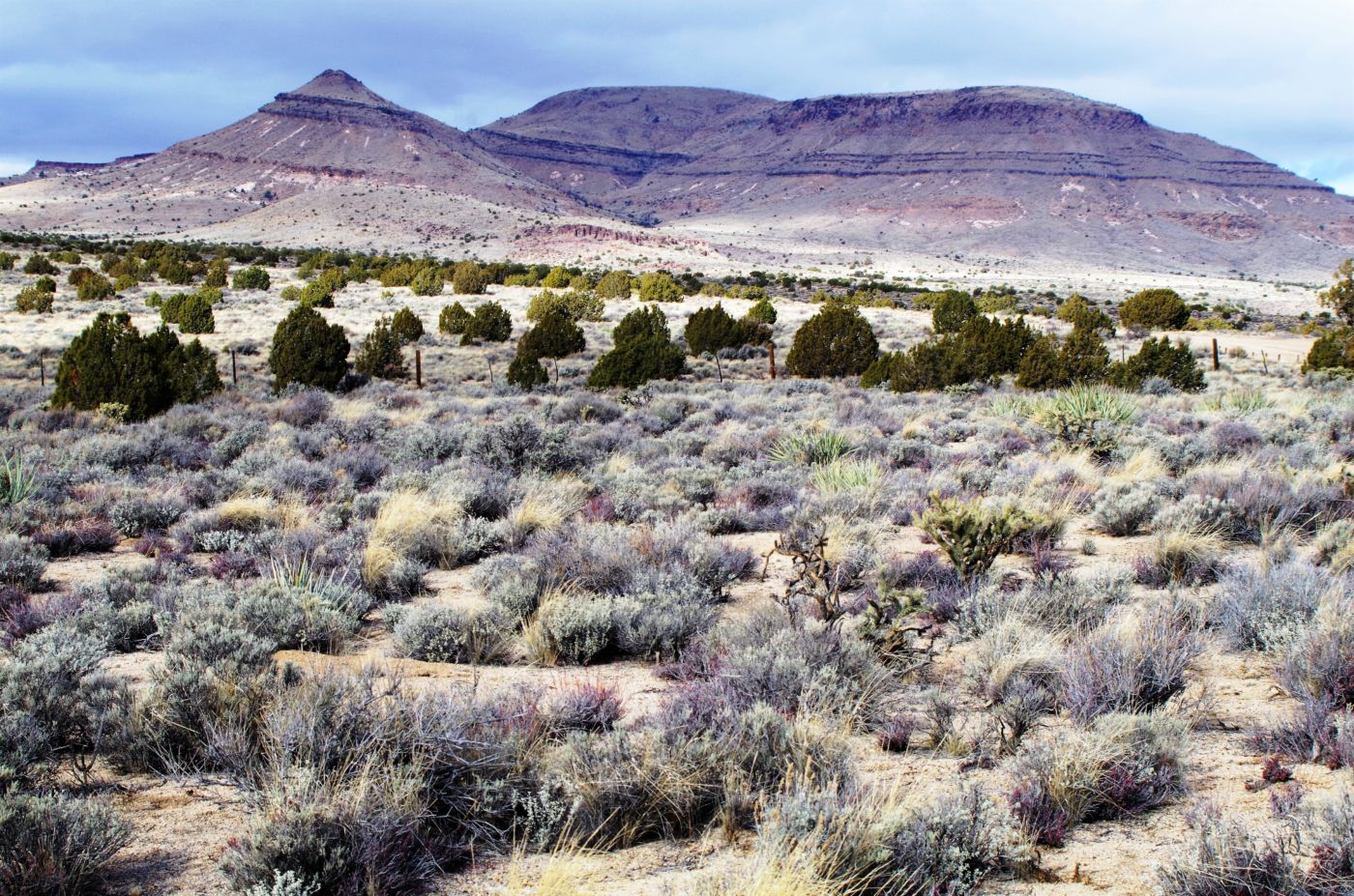
In 1776, Spanish Missionary Francisco Garces became the first non-Indian to trek the route. In 1826, Jedediah Smith became the first known white man to use the trail to reach the coast overland from Mid-America. The route became a military wagon road when Fort Mojave was established on the Colorado River in 1859. The Mojave Road was the main route to Los Angeles until the railroad was constructed in 1883. All this history and connections to known and unknown figures and events really made an impression on us. We felt, along with the extreme natural beauty, this remote and little visited area was packed with historical relevance.
 The intersection happened to be the one we were looking for, so we turned right and headed East onto Cedar Canyon Road and began to climb into the high country. We visited Rock Spring, a triple bonus. First, it has the Rock House, built in 1929 by Bert Smith, a WWI veteran whose lungs were damaged from being gassed in the trenches. He came out here to the dry heat in hopes of extending his life expectancy. A couple of his veteran buddies joined him and he lived a good long life raising sheep and goats until 1954. The rock house has since been used as visitor center and art studio and still stands in great shape.
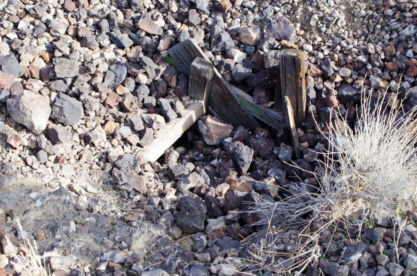
The Rock Springs Loop is a fantastic mile or so loop among some foundations left from mining operations, fantastic boulder formations, Rock Springs, still putting out some fresh water, and the site of an old military outpost from the 1800’s. It was cold and spitting rain off an on, so we made haste on the route. No one else was in sight. This road continued East and split to the North to head up into the New York Mountains, but they would have to wait for another time. We headed back West a bit to pick up Black Canyon Road and then took the Wild horse Canyon Loop Road. This was a fantastic decision.
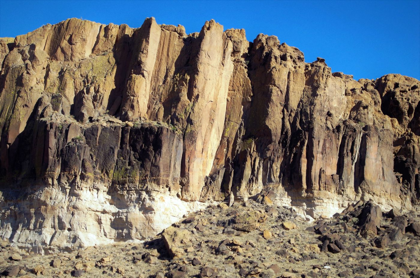
 We headed up to Mid Hills campground to check it out and have lunch, then we continued on down Wild Horse until we saw a spectacular rock wall up in a side canyon, that seemed to be within hiking distance. And so it was. We filled up our packs and hiked up into these mountains and spent a couple hours just exploring and hanging out. The vertical walls were awesome colors and raptors of some kind were doing their thing. The views were awesome and the quiet too. It was really an awesome place.
Not too far beyond, we came back into Black Canyon Road and the Hole-in-the-Wall area. It has a campground, visitor center, and Fire Station, a real concentration of activity, development and population for these parts. We did the Rings Loop trail which was a very cool couple mile loop where you have to descend into a slot canyon using steel rings the national preserve staff have pounded into the rock. Once you get down the wall, you pass through a narrow slot canyon, which gradually opens up wider and wider until you are out in the open desert. It feels just like you made the same journey of a drop of rain or a grain of sand, out of the mountains, down the canyons and deposited out on the alluvial fan.
 The sun was setting as we left Hole-in-the-Wall, and we started our long drive back to camp. Black Hills Road becomes Essex Road, which brought us down to Highway 40, the Needles Highway. I believe this was the first time for me on this highway. We had to head back West on highway 40 to Kelbaker Road, past Kelso, and on up to our camp. It started to rain on the way back, so once we were at camp, we just dove into our tents and ate what we could quickly grab. It was a massive day and sleep was good. The rain continued on and off during the night and morning, so we decided to head North out of the Preserve to some hot springs.
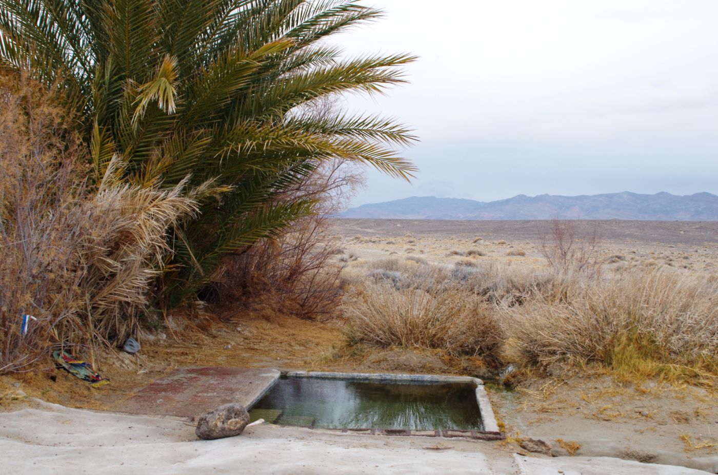
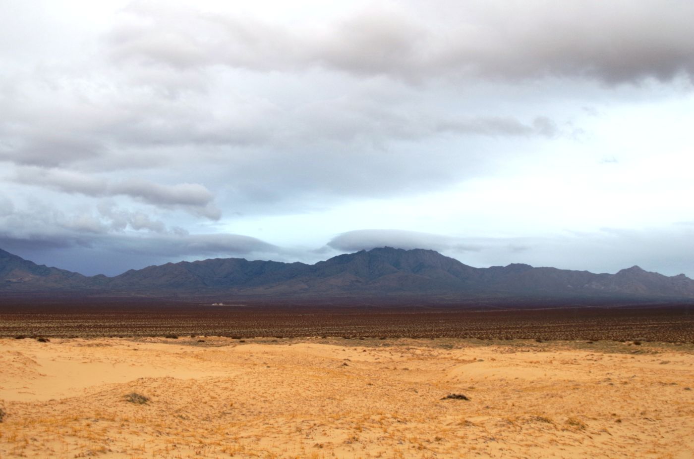
The rain was pretty steady in the morning so we grabbed our stuff and jumped in the truck heading North on Kelbaker Road, back to Baker and on up highway 127 into Tecopa. Tecopa is mainly a series of hot springs that have been developed into motels and resorts on some sort. A few bars and restaurants have sprung up to provide for the soakers, but it is all fairly dusty and dingy. Outside of town were supposed to be some springs that people had made tubs for, but were otherwise natural and away from any structures or development. We tried to follow the directions in the guide book, but ended up on the wrong side of the tracks. Trying again and perhaps again, we found the track to the lone palm tree.
 There was, of course, a van, but it was parked a fair distance away. The water was great and the views and solitude were outstanding. The hot soak did wonders for body, mind, spirit, and soul, not to mention cleanliness or a sense of it anyway. On our way back, or at least we thought it was, we came to another series of springs, or so we assumed. There were half a dozen vehicles and 20 or so people, local families and tons of high school kids. One snotty kid gave us the brush off like he didn’t want us to know where the hot springs were, even though it was obvious where everyone was hiking up the hill. Not to mention we had just left a great spot where nobody else was, but whatever. The clouds were dark and the rain continued to spit off and on. The forecast was not in our favor, so we cut the trip a day short and headed out of the Mojave better people, determined to return and continue our exploration.
Mojave National Preserve I Photo Gallery