Trip Date: January 10, 2018
Find this Spot
Wow. From rather rough beginnings, this trip was outstanding. I got sick on December 23rd with a fever, diarrhea, sweats and shaking uncontrollably. I was achy and had sinus headaches, then drippy runny nose. We have our Christmas with the kids on Christmas eve, and we were delivered a decent window of energy, clarity, and relative comfort. However, the next day, Christmas Day, I was back on the couch under a mountain of blankets, still cold.
Kristen powered herself up to go take care of her mom. When she got home she went to bed for 17 hours. I was getting better, until I wasn’t and finally went to the doctor for antibiotics and a variety of cold remedies. By New Year’s, we were both moving about, but not feeling great. All this time, we had been watching the weather deteriorate in the Mojave.
The first forecasts were high 60’s during the day and overnight lows in the low 40’s, possibly falling into the high 30’s. By the time the anticipated trip date of January 8 was near, our Monday drive day looked to be decent, but Tuesday was expected to have rain and 24 mph winds with gusts up to 40. Wednesday was to be scattered showers and then the rest of the days got a little better each day.
Between my lingering diarrhea, weakness, lack of energy, and the Tuesday ridiculousness, we pushed the departure day back to Wednesday the 10th. This was the ticket to awesomeness. Bob came over Sunday to look at the map, decide on a rendezvous spot and find potential camp spots. Bill came over a little later Sunday afternoon for more of the same. We decided I would drive and he would come over Tuesday afternoon to load the truck and sleep over so we could get an early start Wednesday AM. Bob and Steve would also try to get on the road about 6:00 am.
With the delay in our departure date, it felt as if I had been laying stuff out and organizing my gear for weeks, but that also made it seem so easy. An hour or so a day over a week or more and by Monday afternoon I was basically packed, had shopped and cooked. All I needed to do was get dry ice Tuesday evening and pack the ice chest. Bill was here by 5:00 ish and we transferred his gear (and some extras of course) quite easily. We ran a quick errand to Bel Air for a 10 pound block of dry ice, came home, packed the ice chest, and relaxed on the couch with the latest episode of Married At First Sight.
 Kristen’s alarm went off about 5 (since retiring, I no longer have an alarm) and I excitedly showered, dressed and got upstairs to get the coffee going. Bill was wandering around already and we soon had Bill’s truck in the garage and were heading down the road. It was a very strange feeling because we always load the ice chests and various other incidentals the morning of, but with the dry ice, we packed everything and had it all tied in and ready to roll, so we literally jumped in the truck and left at about 6:30.
The drive 99 South was easy and fast and we soon completed that first leg and turned East on 58, crossing Tehachapi Pass, entering the Great Basin. I had recently read about 5 books on the Great Basin, so I was full of random thoughts and recollections from those books. I hadn’t read a book in years, never having been much of a reader, but I picked up these free books at the closing of the Wooden Duck in Berkeley with the kids, and since being retired, had time to get to them.
Some were certainly better than others, but they helped me get a better feel of the area, and the geology, and the people who had been there over the last 500 or 15,000 years. It was becoming more of a comfortable place for me, even though I don’t retain much of what I read and have very little memory, having read those books gave me a sense of calm confidence from the increased familiarity.
That, and this was probably the fourth time in as many years as I had used this route: Bob, Steve, Tom, and I had come to Red Rock Canyon State Park a few years back, Bob, Steve, and I went to Panamint Valley in Death Valley National Park, Bob and I came to the Mojave last year, and now we were coming back for a 2nd helping. Bob and I had a great trip last year. It was cool and often wet, but mostly rained at night or on our longer drive days. We were blown away by the scenery, vastness, landscapes, much like Death Valley, but also very different. Only half as large as DV, it is still 1.6 million acres and as such, takes hours just to drive from end to end, let alone explore, hike, and experience. Bob and I saw much of the West side, so this trip was to explore more of the East side.
As usual, I had done a ton of reading, research, and staring at googly earth. As usual, we had a lengthy list of places and parts we wanted to see in the Mojave, maybe some Route 66 landmarks, and maybe even cross the Colorado River and step foot in Arizona. I have gotten better about not getting all worked up about seeing everything, leaving little time to relax, enjoy, and ingest some of the surroundings, so I wasn’t at all worked up about our lengthy list. Besides, Bill and Steve had not been here before, so we wanted them to get a broader view of the park.
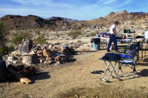
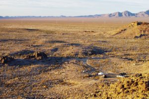
 I don’t think we connected with Bob and Steve until we were out 58 and they were a bit ahead of us. We met at the intersection of Essex Road and Black Canyon about 1:00 and there was much rejoicing. The weather was great and we had an easy journey thus far. The first spot we wanted to explore for a camp spot was just a couple miles up the road. We found the dirt road and passed a large area right near the road, but knew the 2 spots we had the most interest in were just ahead. We stopped and looked over one strong spot, but decided since it was so early in the day, to continue on to see the other spot. We soon found ourselves heading out into open desert, thus turned around and headed back to our rock formations jetting up out of the alluvium. We found the end of the road, a quasi camp spot that looked much more promising from googly earth, and thus headed back to our best option. We were unpacking by 3:00, very happy with our spot, and ecstatic about being here.
It was getting dark by the time we had set up and turned our attention to fire, cocktails, and dinner. Bob had prepared some raviolis and red sauce with bread warmed on the grill. It was excellent, and filling, and satisfying. The stars were outstanding. Bill saw a huge burner he said may have been the best shooting star he had ever seen. I was early to bed.
I think we all slept pretty well that night. My stomach wasn’t yet completely settled, and I didn’t pick the flattest spot for my tent, but I loved it because it was away from camp, and up a little higher to provide an outstanding vista. I was up before sunrise, but just barely and was treated to an awesome orange sunrise. We gathered for coffee and fire and to discuss the day’s activities. We decided on the Hole-in-the-Wall hike just up the road and then a loop drive out Wild Horse Canyon, up to Mid Hills Campground, then back Black Canyon to camp. An easy first day.
We loaded up beverages and lunch and drove the 8 or so miles to the Hole-in-the-Wall visitor center. Against my better judgment, the boys entered the visitor center and sure enough, our troubles began. The boys were advised against hiking the trail from East to West because of the near vertical climb down the tiny passageway through the canyon. However, Bob and I were unimpressed with this advice, so we proceeded a short distance from the parking lot down the rings, while Steve and Bill took the long way around.
As short as the distance was in the tiny passageway, it was still terribly impressive. Literally no wider than our shoulders, we stepped down the steel rods that had been pounded into the canyon walls, without which, passage would not have been possible. I would have gone back up and then some again, if I had known the stretch in the narrows was so short, the shear walls rising one hundred or more feet above. Within a few steps out of the canyon, one could no longer see a way through; no such passage existed, just shear walls.
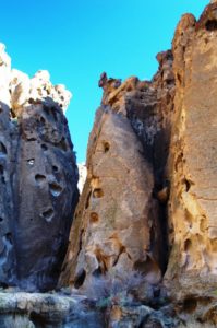 A spell-binding feature of the Eastern side of the walls were these incredible hallowed out etchings; hundreds of them, large and small, faces and shapes, and formations no 2 alike. It looked like prime real estate for rodents and birdies, and their abundance seemed to corroborate the assumption. We were treated to some aspect ratio with the presence of a young couple hiking in from the East side. Their tiny little human bodies and the ability to see beyond the vertical canyon walls up to the top of the rounded peaks, entrenched the perspective of our insignificance. A couple specs, in front of massive canyon walls, below a mountain that is a tiny spec upon the alluvium, amidst a mass of desert of a landscape as far as one could see. Humbling perhaps.
Bob and I picked our way along the trail, looking to the intersection of the trail that should lead back to Wild Horse Canyon Road where we had left my truck and hopefully the provisions for the day as there was some considerable confusion at the parting of the vehicles what and whom went where. We saw a lone youthful hiker come down from the much longer Gold Valley hike, however watching his progress brought our attention to the older, taller scamps making their way through the cholla, barrel cactus, yucca, and creosote bush. We considered trying to hide and surprise attack them, but cover was scarce.
United, we found trucky and celebrated with a beverage. Just a tad up the road, we were dropping into 3 and 4 foot deep washes, crossing the sandy flats, then climbing up the other steep embankment. We saw a white Toyota with a white guy wearing a white wife beater and white cowboy hat. Fearing for our lives but unable to avoid the confrontation, we asked about the road conditions up yonder. He suggested we would not even need 4 wheel drive, despite having been in it for some time already. We soon past the walls of the cliff Bob and I had spent so much time in the year before and watched the Eagles sore. It was fun just to be driving the opposite way Bob and I had ventured the prior year.
We stopped at Mid Hill Campground. Disappointed to not have it all to ourselves like last year, the sole inhabitant had picked the worst site in the front of the first loop, so he was quickly left behind. Like last year, we pulled into site 21 and then left it quickly for site 22. We ate and sipped and enjoyed the views. At 5600’, it was much cooler than our site down below, but the air was clear and clean and a pleasure to breathe.
We were back in camp right about sunset, and Steve set to work reheating a pork shoulder roast that he had cut into small stew like pieces and simmered in an outstanding green sauce. We made burritos out of these. I had to have 2, although forcing myself to finish the second one made me queasy. Thank god for cocktails as they settled my stomach and prepared me for another spectacular night of stargazing. I was early to bed.
I was up well before dawn and had to poop. Since I was up and awake, and it was perfectly calm and not at all cold, I decided to strike out to set myself up for a sunrise extravaganza. I walked down the road we had explored beyond us to the East and then turned up the spur that seemed to enter the small valley behind us. As we were considering coming down Monday and trying to endure the Tuesday blast, we had considered getting into this valley as it would offer protection from all sides but the entrance that faced SE.
I scrambled up the end of the rocks that formed the ridge at the back of our camp, separating us from the valley behind us. With each little rise, I seemed to rise hundreds of feet above the valley floor as its apron of desert sand and pebbles fell away to the South and East. In the pre-sunrise orange glow, I felt everything; insignificant and a conqueror, meaningless and important, alone and connected to everything, empty and full, melancholy and joyous. I wanted to take a picture of every pebble, every plant, and every relief in every direction.
I kept climbing along the East side of the rocky ridge until I neared the top of the formation.
That was the only bit of climbing I needed to do and it was worth the effort to get on top and see out to the Southern expanse for the first time, to look down on the camp and to see my 3 tiny friends gathered by the fire. I was happy to be here. Back at camp, we proposed the day’s events, packed up Bob’s Tacoma, and headed out Essex Road to Highway 40 back West to Kelbaker Road and into Kelso. We stopped at the beautiful Train Depot Visitor Center to gather some intel, look at the displays, and use the facilities.
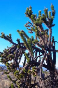
We then headed up Kelso Cima Road to Cima, then up Cima Road past the war memorial and the trailhead up Teutonia Peak. We wanted to get off the road to eat so we headed down a dirt track through an incredible Joshua Tree forest, so dense we kept driving to find an open spot to get a view. We were up on the North side of Cima Dome, one of the most interesting yet least spectacular geologic features in the park. It is the Existentialists dream topography. The dome is what you don’t see. It is not the peak, the outcrop, the rocks that stand out. The dome is the very subtly rounded smooth rise that you do not notice until, after looking and searching for a long time, you realize you see it by not looking for it.
 It is covered by the largest and densest Joshua Tree forest on earth. The dome is subtle and discreet; a broad sloping upland dome, the erosional remnant of granite plutons that formed deep under the Earth’s surface 180 – 80 million years ago when the Farallon Plate was being subducted beneath the North American Plate.
The Dome rises 1,500 feet (460 m) above the volcanic plain, 2,132 to 4,950 feet (650 to 1,509 m) high, and covers 70-square-miles (180 km2). Cima Dome is an extremely symmetric dome of this granitic formation type, and one of the most visible ones by being in open desert plains, if you know what not to look for that is.
We had driven a few miles down the road and taken a left at a 5 way intersection onto a spur that might lead to Deer Spring. We finally gave up on the unobstructed view concept and settled for a small turnout along the narrow track. We caloried up and decided to hike on down the road to see what there was to see. Sure enough, within a mile, we came to a corral and the spring of Deer. After pondering the possibilities, we headed East up an old road that has now been closed, climbing some elevation although along the Dome, it is very gradual, so gradual, that one could easily be walking on the downslope without ever realizing they had actually reached the top. I hate the feeling of walking and getting nowhere, so I moseyed back toward the corral to take pictures and slow my roll.
A couple guys passed me on the way up, and then the boys passed me on the way down, although I am certain I was able to conceal my location and spring upon them as they unknowingly passed beyond me. Exhausted from our trek, we consumed additional liquids. Although the temperature was dropping in the late afternoon, I rode in the back of Bob’s rig back to the intersection, before heading back to the pavement. Bob needed to gas up, so we headed NW out to Highway 15. What a massive hit of undesired reality.
The gas station was mobbed with lines at every row of pumps. People were milling about, smoking, talking on phones, in and out of the convenience store/restaurant/insane asylum. Bob pulled into a line and soon realized neither car in front of him was putting gas in their vehicles. He got out to investigate. The front car was unoccupied and the car in between had a guy talking on his cell phone a mile a minute, but otherwise not appearing to realize he was parked in front of a gas pump. Bob was able to get an indication from the guy that getting gas was not a priority for him.
Fortunately, the driver of the first car came out, apparently having paid for his gas and pulled away. Bob maneuvered around the van with the talking head and got gas. We all sort of just stared at the guy on the phone, amazed at his oblivion. Another car pulled behind him. The passenger got out to communicate. They too were unable to convince the guy to get out of the aisle; however, he did pull forward in front of another gas pump, allowing the people behind him to gas up. We drove off with the guy still blocking pumps talking away the time.
Bob relayed additional emotional trauma and turmoil from the inside of the place such that, we were drained and highly agitated at the same time as we peeled out of the station and back onto the road away from the people and into sanctuary. This sort of advanced society aint for everybody. With a full tank of gas, we headed back to Cima, East on Cedar Canyon Road, then smack dab into a bonafide emergency situation. A minivan type SUV was pulled off the side of the road as much as it could, but still barely allowed passage of Bob’s rig. A young couple stood about with many of their belongings strewn about behind the rig.
 We pulled alongside and asked the trouble. They had a flat and couldn’t get the crappy little jack to work. They were a cute couple; slight, pasty, somewhat rounded figures, accountants or web designers I could imagine. They were from Seattle in a rental vehicle and were overmatched. The boys sprang out of Bob’s rig and into action. Although Bob balked at the initial suggestion to use his wooden cutting board as the base for the jack, we quickly dug out some room under the rig, realized the place the guy was trying to set the jack wasn’t right, found a good solid flat rock, set the jack, jacked up the car, removed the bad tire, set the spare, lowered the car, oh yea, tightened the lug nuts and just about all sprang back in Bob’s rig at the same moment. It was like Ricky Bobby. No waiting around for flagellation or aggrandizement. They were thankful enough, if not a little naïve. Hopefully they took our advice not to head further into the back country on the spare, or actually without a spare. Who knows. What we did know is that we had a huge day and needed fire and beverage.
 It took a bit of distance and time to put the gas station and the road-side service experiences behind us, but beverages and assorted cheeses and crackers aided our pursuit. We got the fire going in our fire pan (the Webber lid) and I got another fire going in the topless Webber to heat up my root brew, as it was my time to cook.
I was excited to eat my stuff. It had rutabagas, beets, onions, yams, 2 pork tenderloins, and many small chunks of ham. To heat things up easier, I cut up the T-loins into small bites and set it in the cast iron. Only half the brew would fit. We ate heartily and almost emptied the caldron. After dinner, Bill again regaled us with the names of constellations and planets and other celestial sagas.
 I hope it wasn’t my root brew, but at different times throughout the evening, we heard voices coming from beyond the little ridge to the West, seemingly just beyond my tent. We all heard them; they seemed like young people, a guy or two, laughter, and then a girls voice. We were convinced we heard them and shined a very bright light in their direction, but no response. We didn’t see any lights from them despite it being pitch black. We didn’t hear a rig despite the sound traveling so far. It would have been a bit eerie, if the voices had not been so plainly audible, happy, and friendly. Despite the mystery, I sat alone by the fire for a few minutes after the boys had retired. It was another grand day. Although I didn’t hear the youthful voices any more, I did dream of an old man’s voice talking to me. It was calming and comfortable. I was happy for the experience.
I was the last to emerge from my den this morn, having again slept well, nary arising to urinate. We had decided to traverse the Mojave Road this day and to warm up by surmounting the Providence Mountains. Bob and I had spent a few miles on the Mojave Road last year, but with only one rig, and little knowledge, we did not pursue it as much as we would have liked. Now with 2 rigs, we were anxious to get our fill of this incredibly important and rich stretch of California history. Bob being a history professor was particularly interested to experience it first-hand. On our way out of camp, we looked without success for signs of a nearby camp, rig, or people. Our voices will remain a mystery I guess.
The Mojave Road is an ancient route, in use as long as humans have lived in this vast, harsh desert. The Chemehuevi Indians lived on prickly pear, mesquite and roasted agave blooms and hunted deer and bighorn sheep. They resided in the Kingston, New York, and Providence Mountains west to Soda Dry Lake and south to the Whipple Mountains. Mojave tribal peoples were concentrated along the Colorado River and the Mojave trail became their main trading route from the Colorado River through the Cajon Pass toward the Pacific coast.
The first non-Native American man to make his way across was a Franciscan missionary from Spain named Francisco Garcés, who did it on foot in 1776, with Mojave guides. In 1826, the trapper, trader, and explorer Jedediah Smith — known for a huge facial scar caused by a grizzly in one of three bear attacks he survived in his life — became the first white American to cross the route. John Fremont came through in 1844, and by the mid 19th Century a wave of settlers began to use the road to reach California, causing the U.S. Army to set up a series of outposts to protect the mail carriers and settlers from natives, animals, and the greatest danger of all, themselves.
As if the sand and desolation of the Mojave Road wasn’t enough, we thought we would take a “short-cut up and over the Providence Mountains. I think the gas station experience scarred us sufficiently to want to avoid another interaction with highways and the like that travel them. Just a few miles down Essex Road, we picked up a straight dirt track leading due West. It followed the phone lines as many roads do and then, as we picked up elevation, it picked up the power lines too. Our ascent was fairly gradual, although, increasingly in our view was a treacherous looking grade up the side of a rock. We were definitely headed in that direction, but we had been out in the open on the alluvial fan and the mountain didn’t seem to be that high, and surely there was a more reasonable pass or a wash through which to gain the other side.
We tried. At a significant “Y” in the road, one arm being that thin, twisting grade up the rock face, we chose the soft gentle sandy wash to the right, only to be rebuffed after a very short distance. I was not happy about this, but the top looked very much within reach, so we headed up what we hoped was a brief stint on this electrifying rock path carved out of the side of the rock, not only because it was one hell of a ride, but also because the power lines were crackling with enough lost energy to make our hair stand up and our brains warm. It was a very uncomfortable feeling to be underneath them, but there was nowhere else to be. I didn’t see the road again for many miles as it lay well below my hood until we reached the decline on the West side of the range.
We had to stop several times for Bill to get out and clear boulders from the road. We did not see another vehicle the entire time we were up on this perch. Fortunately, the path was carved out of rock and thus was very stable. At numerous spots along the route, side spurs had been made to let heavy equipment pass each other as they maintained the road or serviced the towers and lines, or headed to the Vulcan Mine. During World War II, iron ore was mined here and shipped to the Kaiser steel mill in Fontana, ultimately being used to build Liberty ships, like the SS Jeremiah O’Brien docked in San Francisco Bay, one of the very last remaining ships of this era.
 This was an extraordinary drive, offering a spectacular view of the Kelso Dunes far far below. Kelso Dunes, also known as the Kelso Dune Field, is the largest field of eolian sand deposits in the Mojave Desert. The dune field covers 45 square miles (120 km2) and includes migrating dunes, vegetation-stabilized dunes, sand sheets, and sand ramps. The tallest dunes rise up to 650 feet (200 m) above the surrounding terrain. The dunes are composed predominantly of light-colored quartz and feldspar, most likely eroded from the granitics of the San Bernardino Mountains to the SW.
 The Kelso Dunes are also notable for the phenomenon known as singing sand, or “booming dunes”. Enthusiasts sometimes climb to the top of the dunes and slide down slowly, generating a low-frequency rumble that can be both felt and heard. This effect has also been noted at the Eureka Dunes in California, Sand Mountain in Nevada, and the Booming Dunes in the Namib Desert of Africa. The booming is much more pronounced when the dunes are extremely dry. Bob and I spent some time out there last year, but we will have to return in the summer or Fall to experience the rumbles and the booms.
We sped by the Depot this time, zeroing our trip odometer at the junction of Kelso and Cima roads to help us find our Powerline Road at about the 11 mile mark, which would take us out to the Mojave Road. We looked but obviously sped past it in our zeal to finally begin our trek, the morning session taking much longer and much more out of us than expected. Soon, we found ourselves at a familiar intersection of Aiken Mine Road, although we didn’t realize it at the time. It wasn’t until we passed across the Mojave Road, again not realizing it and came to a parking area at the base of a massive red cinder butte.
This is what Cima Dome should look like. It should be massive, impressive, obvious, robust, stout, erect, well significant anyway. Bob and I stopped at this place last year, thinking it was the Lava Tube. Now, at the same time, we both realized we had done the same thing again this year. Did I mention there are no signs out here? We reversed course, back to the Mojave Road and turned left (East) to begin our adventure. We were stoked. I don’t think anyone was disappointed we didn’t see the Powerline Road as we sure didn’t look too hard. Coming down to Aiken Road to intersect the Mojave connected where we had been on it last time, with this section. And since the ranger suggested we exit Mojave Road on Powerline (back the way we should have come in) this would basically give us a little loop.
Our first destination was Marl Spring, one of a series of 5 springs along the Mojave Road between the Colorado River and Barstow that would also eventually become the sites of military posts or redoubts, some less than a fort, along the lines of a few huts and crude shelters. Along the way, we came to a very strange place marked by a well-placed and secured mailbox. I suppose that led to the erection of a series of odd collections of oddities, oddly placed, by probably some very odd people. It is not my style, but it was odd, which is generally good.
Finally, we came to Marl Spring, tucked behind the Marl Mountains, out in the middle of Mojave Preserve. Although we had passed a number of 4-wheelers most in very L.A. type get-ups, new shiny rigs, jacked up excessively, ridiculous amounts of excessively bright lights – you know, the typical excessive shininess of the LA scene, this felt like we were out in the desert. It was after all Saturday, albeit in January. Maybe more people celebrate Martin Luther King Jr. Day than we thought?
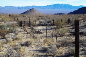 We found the old site of the spring, we saw some standing water and the coral, we found an old arrastre used to crush ore (not that we knew it at the time). After some exploring we got the fire going and a beverage was had, just as another group of 6 or so rigs descended on us like a crappy scene from Las Vegas NCIS or some shit like that. As fast as they drove in, they stopped a respectable distance away and didn’t spray us with dust or rock. In fact they seemed just like us, just a couple decades younger. They burst from their rigs, laughing and calling out to each other, heading to a nearby bush to pee, and just about as abruptly, started to pile back into their rigs.
As relieved as I was they were not staying, I couldn’t help but wander over to get some intel. Since they had just come across the stretch of road we had been warned not to take, but that I very much wanted to take, I caught the attention of one of the guys who obliged me in some neighborly conversation. He suggested the road was no big deal and it was only 20-30 minutes to the pavement of Cima Road. Now recalling the last youthful cowboy who gave us road advice, I figured it might be 45 minutes to pavement, but still beat the crap out of going back up to Powerline, then out Powerline in the opposite direction we needed to go back to our camp.
With their rapid departure, we were left to enjoy our accomplishments to date, our current good fortune, our bright future, and all that is good in the world. A saaaaaaaaaaaaaasage and a beer never tasted so good.
In time, we headed further East past a designated undesignated camp spot on the NW side of one of the constellations of the Marl Mountains. It looked like an LA high school parking lot. There must have been 10 rigs all crammed in next to each other. I was disappointed to see this much use, but we passed it by quickly and we were again out on our own. Except for the string of yet another 6 or 8 rigs reflecting the late afternoon sunlight off their windshields. They never caught up to us so I assume these also were destined for the confab at the camp site. Good riddance.
The undulations or the hoo hoos, or the hoo doos, or the flim flam lamb- a-lamb a ding dongs in the road were nothing much. It kept the ride mellow and well paced and we were at the pavement of Cima Road in no time. I stopped to let Bill read the monument there and then slipped across the road to follow Bob out Cedar Canyon to Black Canyon and then home once again. However, the universe had other plans for us, again. A hundred yards up the road, just as the pavement was breaking up and giving way to the desert, Bob was out in the middle of the road waving his arms like a flight control operator on a carrier deck. We slowed in some amusement until we noticed Steve screaming at the Mini Cooper and noticed the gal standing in the midst of the scene looking quite lost.
Apparently the Mini Cooper left its oil pan in the road and spilled its guts. Steve was trying to get him to stop driving because it had no oil and the pistons were just banging on each other. Bob had offered to drive them to the asylum/gas station on I-15 to get help, call a tow, negotiate with the rental company, find a place to stay for the night, whatever their approach was going to be. Good Samaritans again; Bill and I were headed for cocktails and fire. We proceeded with caution as this stretch had turned from one of comfort and joy to something of a wrecking yard.
This was Bill’s night to cook, so he prepped for the boys return while I drank, I mean tended the fire. It seemed like not more than an hour when the headlights lit up our little valley as Bob and Steve returned. They regaled us with their story and we toasted our heroic deeds. This was a Manhattan worthy day. Soon Bill had us eating lobster ravioli’s in a lobster bisque, meatballs, and wormed bread. It was outstanding.
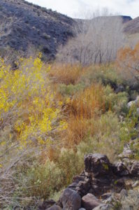 Although some of the boys eyes were a bit foggy, the stars did not disappoint, nor did the moon with its absence. The air was again calm, the fire warm, the bellies full, the mind weak and full of thoughts, stories, and memories. I believe I was again the last by the fire lingering as the flames died away, and the embers glowed bright under the twinkling sky. It had been another great day in the neighborhood.
We had to again whittle down our list of activities. Discharged from the list was route 66 and Needles/the Colorado River. We wanted to maximize our time in the park, again feeling like there was so much of it we had yet to see, and certainly couldn’t see it all in the last day of this trip. We decided to head towards Ft. Piute, on our list from last year, but being in a remote SE corner of the park, it would take a dedicated effort to get to. This we decided.
 Much of the road was to be pavement or decent dirt so I didn’t figure we needed 2 rigs. I needed gas, so we headed out Essex to 40 and East to Fenner. The gas station has several large shallow concrete pools with many Koi fish and fountains and vegetation. It is quite the place. We didn’t linger. We jumped on Route 66 which was cool, even though this wasn’t the stretch with the cool towns of Bagdad or Amboy, even though apparently not much of them remain either. In any event, we were headed to Goffs, which, while not much of a town, had a very large and interesting desert, West, rail museum that is worth checking out. But we didn’t.
We were in pursuit of the Ft. Piute ruins and intended to cover some serious ground on this our last day. As we headed East on Route 66 (very cool to even say that), we were struck by the number of large trains passing us by. It is a shame we are on the last day of the trip and I don’t think I have even mentioned the trains. Beginning around Barstow we saw trains; 3 or 4 at a time. In Kelso, one of the most historic train Depots around, we saw trains. Right in town, while at the station, climbing the Cima grade, and now along Route 66. Eventually we came to the intersection of Highway 95 and turned North, away from the traffic and trains.
We again set our trip odometer to intersect a dirt track a mile or so south or Mojave Road which is supposed to be a bit better road than the Mojave. We found it at about the 11 mile mark, then headed West for about 6 miles. While we missed the road we thought we wanted, we found the road we really wanted which was even better. Turning North for about a mile we again picked up the Mojave Road and followed it a short distance on very rough rock. Not wanting to pound the truck and estimating the Ft. to be about 300 yards ahead, we packed up and hiked in. It was a beautiful clear warmish day and we were following a fairly flat road in.
 A little over a mile from the rig, we saw the remains of the Fort. It was very cool. There was obviously another spring, and this one much more significant than any of the others, other than the stretch of the Mojave River through Afton Canyon. There were many Cottonwoods and Willows, huge patches of reeds, and grasses in a large swath heading up into the higher reaches of the canyon.
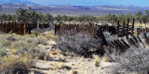
 The stone remains of the Fort and corrals were obvious as was another large wooden post and wire corral. According to a lone Jeeper that crawled all the way to the gate, the corral on the outer edge was the remains of a more recent turkey farm. It is hard to believe being so far from a decent road or a potential market, but I guess it is possible. Bob found some petroglyph looking markings on some rocks strewn about the turkey farm. I would hope that if they were real, the NPS would have taken them away from their new use as a fire ring. Bob also found the remains of a very cool cabin tucked up on a ledge above the creek, but below the ground level so almost invisible from the road. All that was left was a beautiful stone chimney; no walls or roof remnants, and a simply stunning location. The Fort was a great find.
We celebrated our discovery with a snack and beverage and then navigator Bill again charted our course to head SW across open desert to intersect Lanfair Road. This was going to be a highlight for me because I spent an inordinate amount of time on googly earth looking for potential camp sites in Lanfair Valley. We skipped one option but found a better one and intersected Lanfair at the desired location. There were scattered homes and buildings along Lanfair Road, but the town/site of Lanfair itself was nothing but a weird compound of strangeness. We continued on another mile or so to find the Mojave Road coming in from the East, then returned to the East side of Cedar Canyon Road.
We stopped out and about for a snack. The air was cold but calm. It was totally calm and quiet and we absorbed the landscape and geography. A single car passed by. In a short bit, we passed by Rock Spring and the stone house that Bob and I visited last time. We had connected another dot and it felt great. As we approached Black Canyon Road, the cliff faces of the Pinto Mountains were ablaze in the low light. The light tan and white soils glowed in the sun reflecting light all over the valley. It was truly a spectacular moment to be passing by, another special moment to share with my friends and experience out and about.
Turning South onto Black Canyon we were again treated to a view of the shimmering buttes and the spectacled light throughout this incredible flat wide open high plain of the Mid Hills. We cruised towards camp one last time; Bob and Steve pointing out the spot where they saw the Mountain Lion the night before. We decided to leave a huge chunk of pork loin for him/her or for some other creature to enjoy.
Back at camp, I couldn’t help but be notching the “lasts”. It is a bad habit; I try to be more in the present, but I was trying not to speed into the future too quickly. Fire, beverage, relaxed conversation. Steve surprised us with lasagna. The meals were exceptional. All the dinners, plus a bacon and egg breakfast from Bob and a pork burrito breakfast sandwich from Steve. Eating more was almost hard to do. I again lingered by the fire after the others had crashed, allegedly in separate and distinct domiciles. I was not ready to leave so I planned to propose one short morning trip to Bill before we left.
I was last to join the boys for no fire, no coffee, no breakfast, but I had already packed up my tent. I had done some organizing the night before and we were in full packing mode in no time. I offered my proposal to Bill who again was his naturally easy going self. I was buoyed by the thought of having one more adventure before we headed home. We said Aloha to Steve and Bob and watched them head on down the road. We finished loading the truck, wandered about camp looking for lost or stolen items, then headed off ourselves.
On the way out we saw a very old couple walking down the road. We stopped to chat with the old timer who was a super nice guy, still driving his full sized truck pulling a 20+ foot trailer into the Mojave Desert. Most inspirational. When we hit the pavement of Black Canyon Road, we turned North to head back through Black Canyon yet again (never say never), through Cedar Canyon, into Kelso and then back up Kelbaker Road. We zeroed the trip odometer again, determined this time to find the Powerline Road that duped us last time.
Turning up Aiken Mine Road, we started hunting red rock. I wanted to show Bill the Lava Tube and perhaps head all the way into Aiken Mine, which I think was a place I took Gabe, Ingrid, and the kids to when we stayed at Afton Canyon some 20 years ago. There were only 4 people at the Lava Tube and 2 were leaving as we walked in. We didn’t bring headlamps or flashlights for some reason. I don’t recall having them with Bob, but perhaps we did. It was too dark to go into the main chamber without lights and Bill, being so tall, would have had to really struggle, so we just hung in the caved-in portion at the bottom of the ladder for a bit.
I was thinking about my red rock the whole time and, despite yet again passing by our spot, we went back to it to find our plunder. We hit it hard and with a full load of booty, we headed into town. Gassing up in Baker, I reminisced about Bob and I eating in the Mad Greek restaurant in town. The weather was again glorious and we made great time. I had hoped to be leaving Baker by noon which we did exactly. I had hoped to be home by 8 which we did exactly. We were nearly overcome by stink and stench and foul air all the way from Bakersfield to Merced. I feel sorry for those people.
Find this Spot

