Mojave National Preserve IV
Trip Date: April 11, 2022
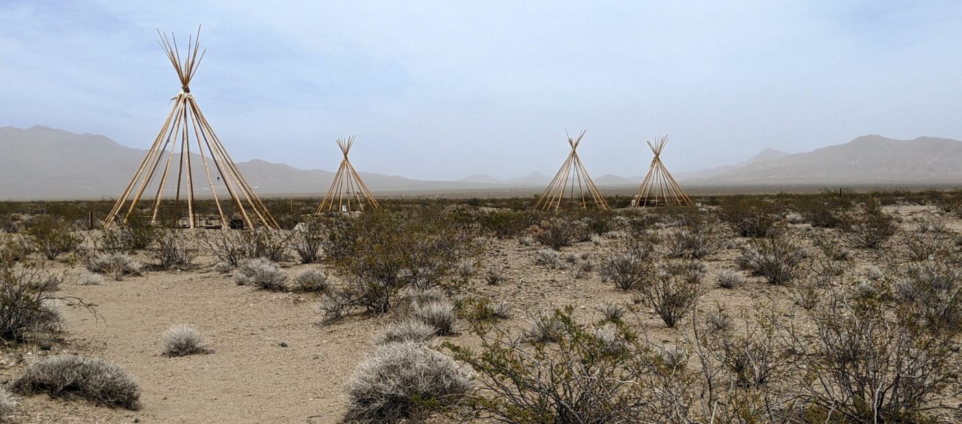
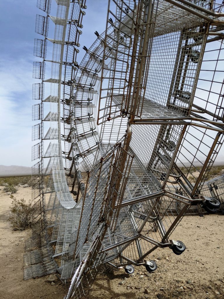
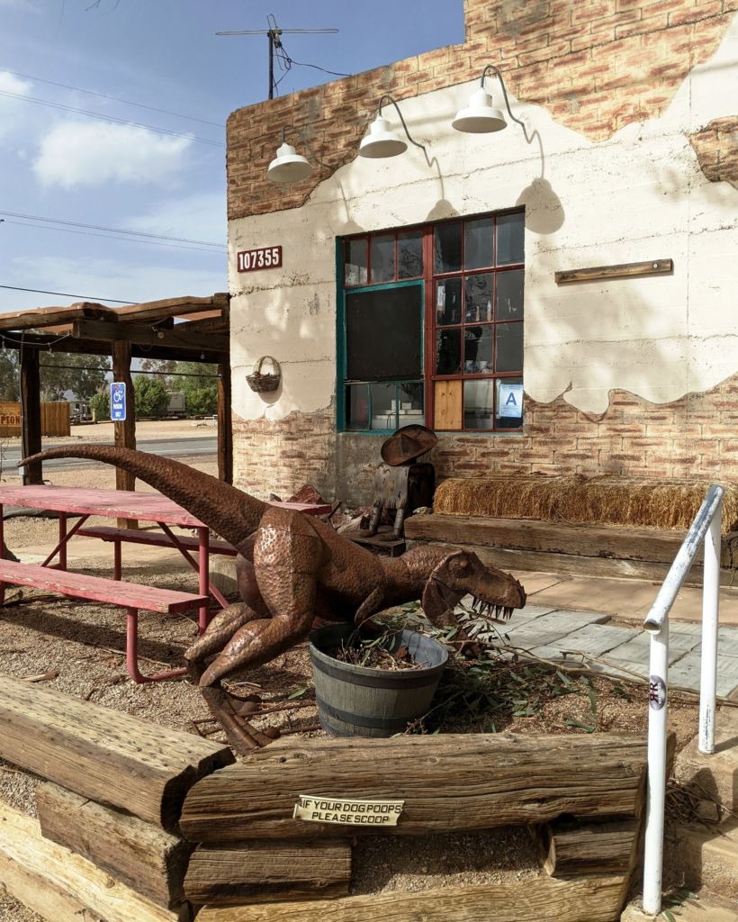
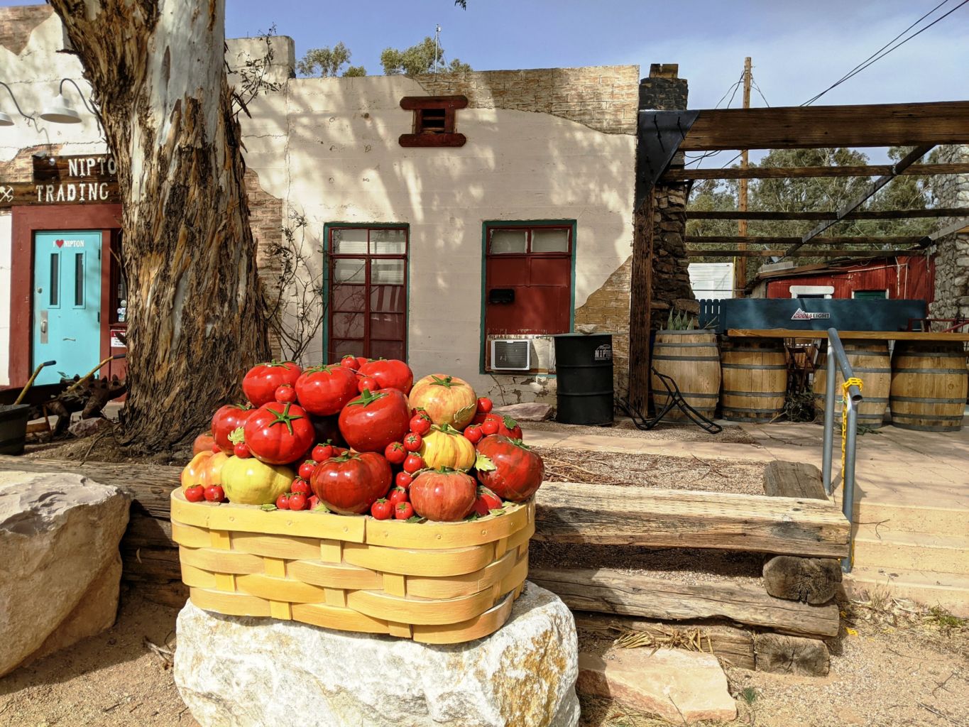
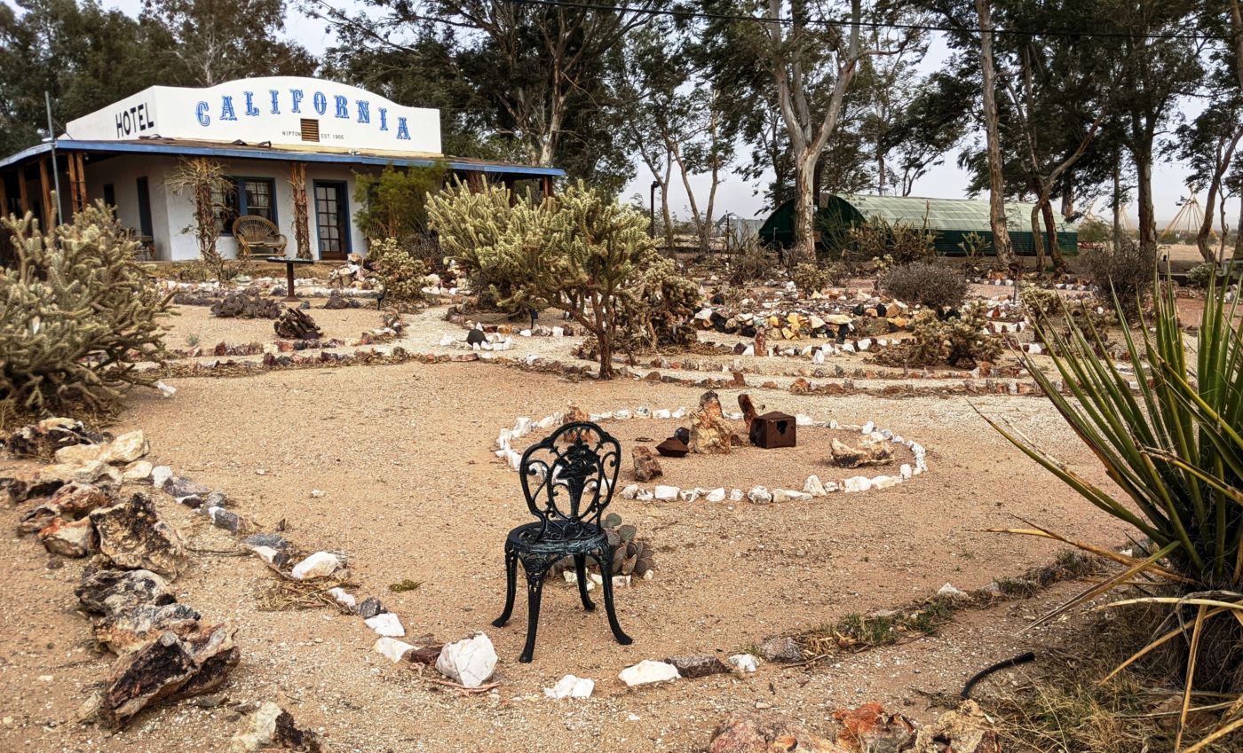
It soon became apparent that we were late for the boom history of Nipton. The store was closed; the bar was closed; the hotel was closed; the campground may have been open but we couldn’t tell. We pulled into a parking area that seemed to be attached to something, but we couldn’t tell what. A tiny “No Trespassing” sign at ground level alongside a chain that was laying on the ground didn’t provide much deterrent; not give a strong impression that they really wanted to keep people out. Besides, before us lay a very strange collection of “art” or desert strangeness not uncommon in these parts.
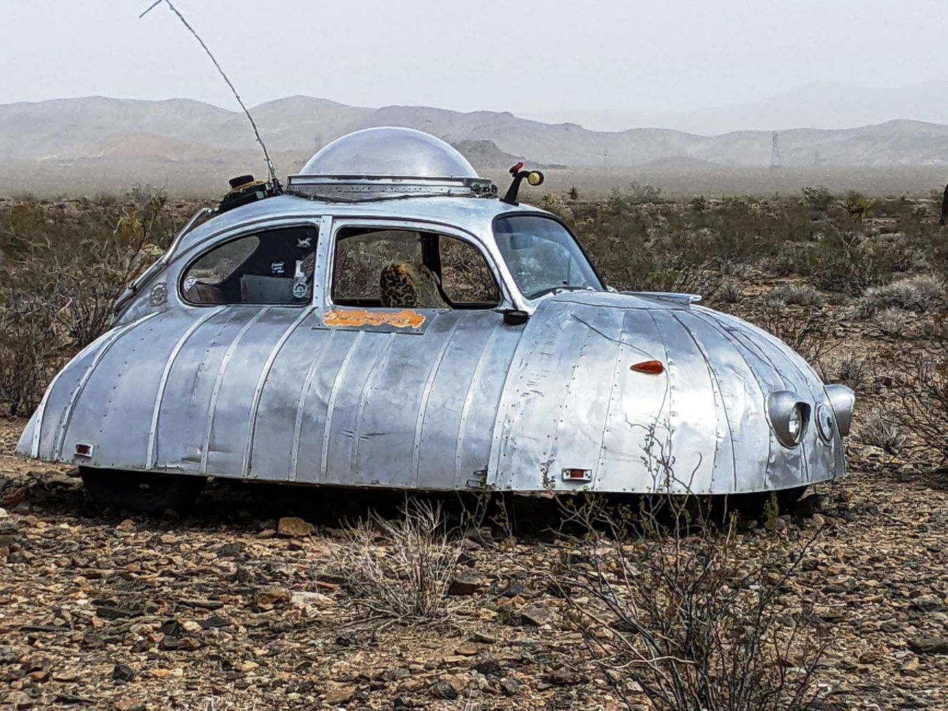
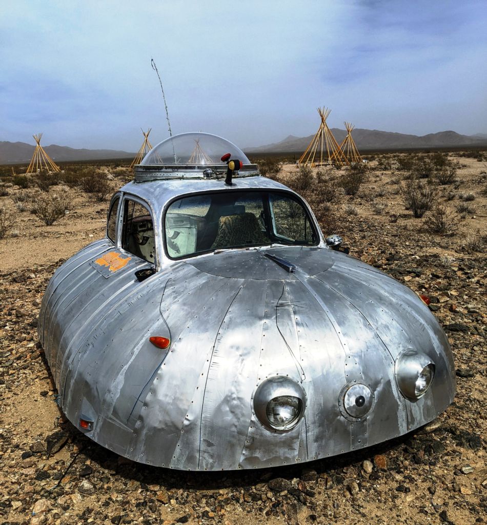
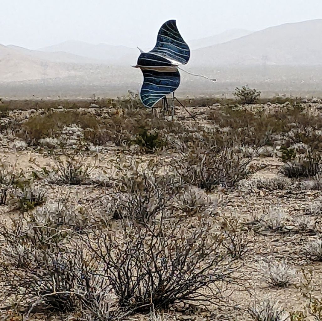
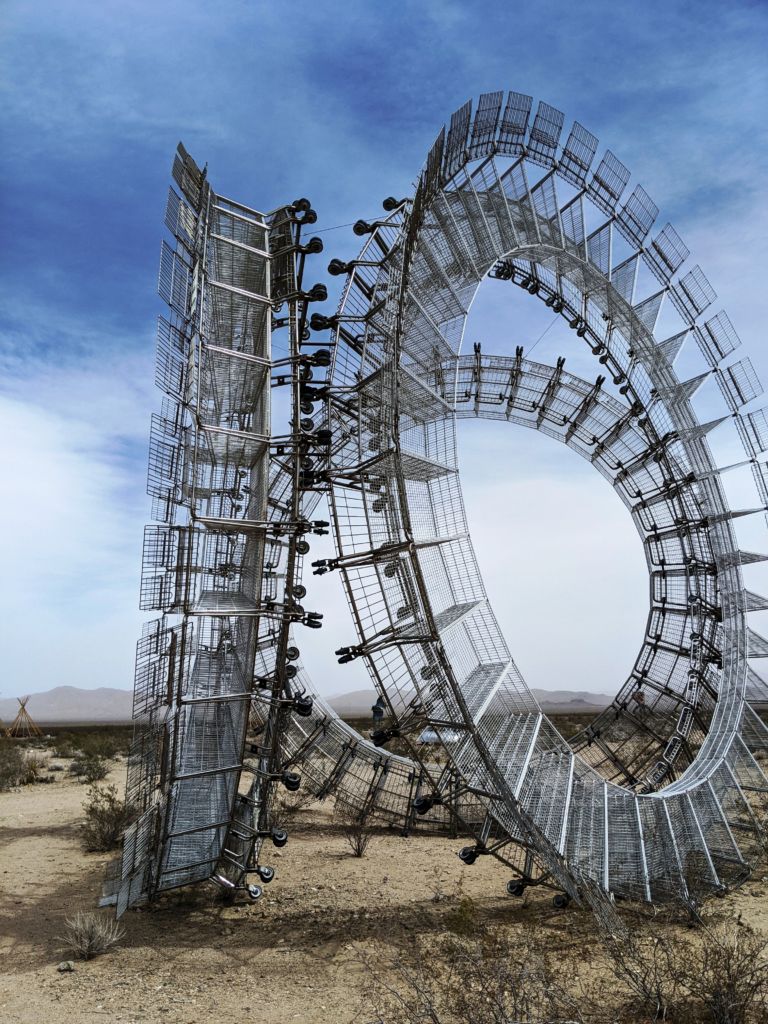
There was a giant bright silver shiny three wheeled thing that looked like 3 electric razor heads on end, maybe 30 feet tall. Up close, we saw that they were shopping carts on their sides made into these 3 giant wheels. There was a spaceship car, a giant flying stingray, and the frames of half a dozen teepees. As Bob, Tom, and I wandered about taking pictures, Bob was drawn away by the presence of a guy in a golf cart. After a brief discussion, Bob came over to tell us we were trespassing and had to go. The guys wasn’t too pleased that we had driven in across the chain, but he knew we were harmless and the only other living humans around these parts.
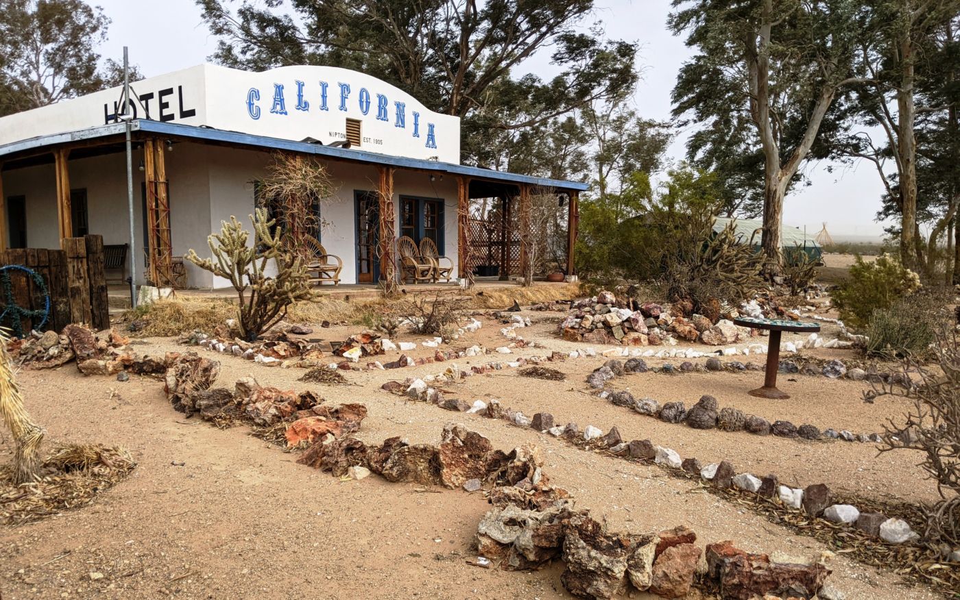
We snapped a few last pics and returned to the rigs, back across the chain and back through town. As we passed the bar/store, we also passed him talking to another old desert rat. He motioned us into the parking area in front of those buildings. This area had a nice large mesquite tree, picnic bench, some more art, and a sign talking about the brief history of Nipton. We looked around a bit to see if there might not be an open side door or secret entrance to these establishments. Still outside, I walked around to talk to these guys and see if I could scrounge up an unlocked door or access to anything in town. Maybe the secret poker game was in the abandoned trailer on the outskirts of town.
He was a little gruff at first, but after I told them we were after a beverage, he eased up, and told me a lot about town and himself and his travels, but no liquid refreshments were provided. After a good talk, I returned to Bob and Tom and we settled for drinking our own beers. After a good rest, we headed back to the intersection to meet Bill who had spent some time in the Costco gas line in Bakersfield on the way down??? Once united, we headed South down Ivanpah Road, crossed the railroad tracks, passed through the narrow gap at the edge of the New York’s and continued on South looking for the New York Mountain Road at the intersection of a large, long abandoned ranch.
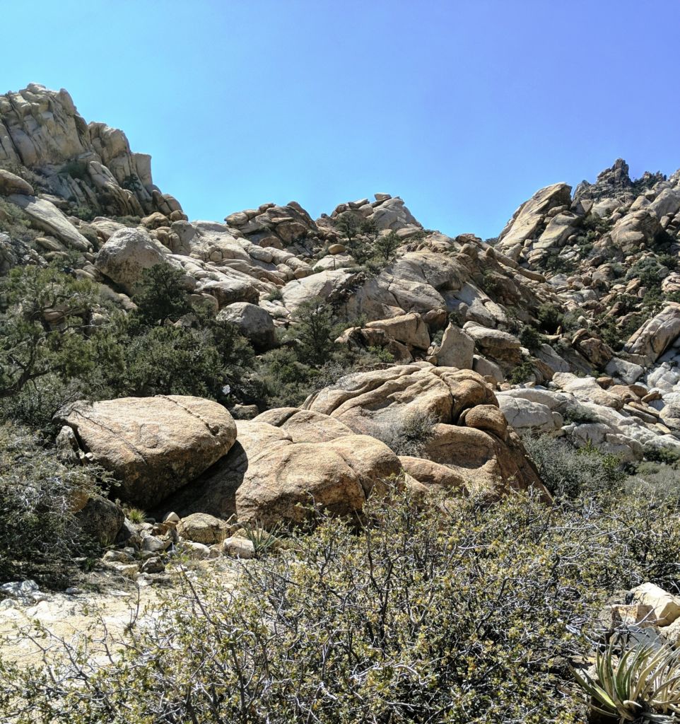
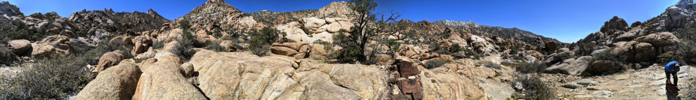
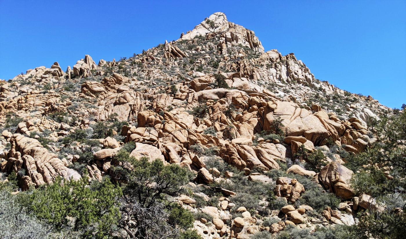
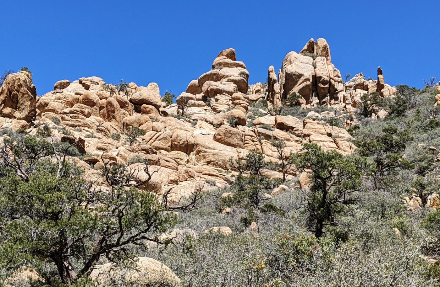
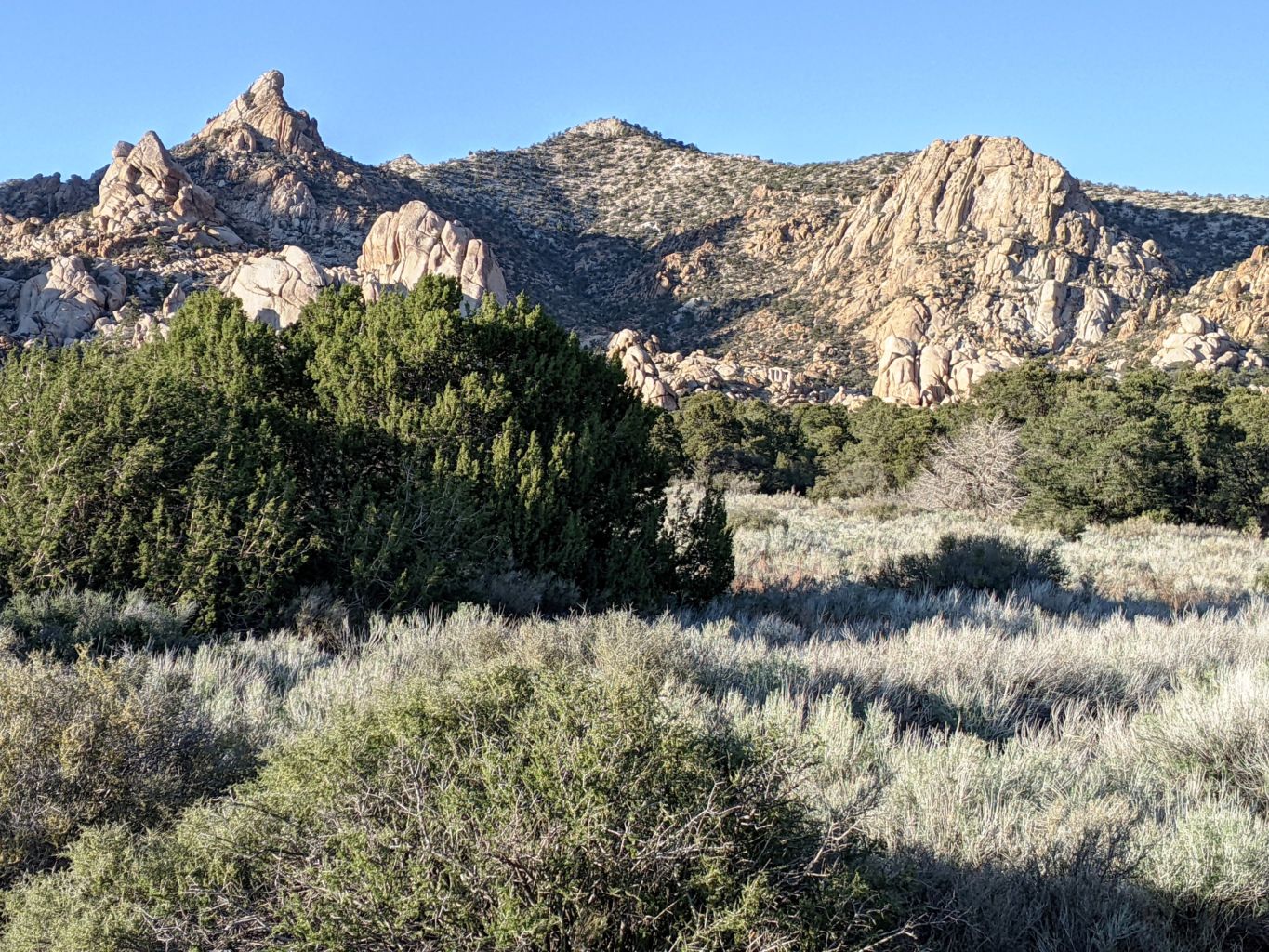
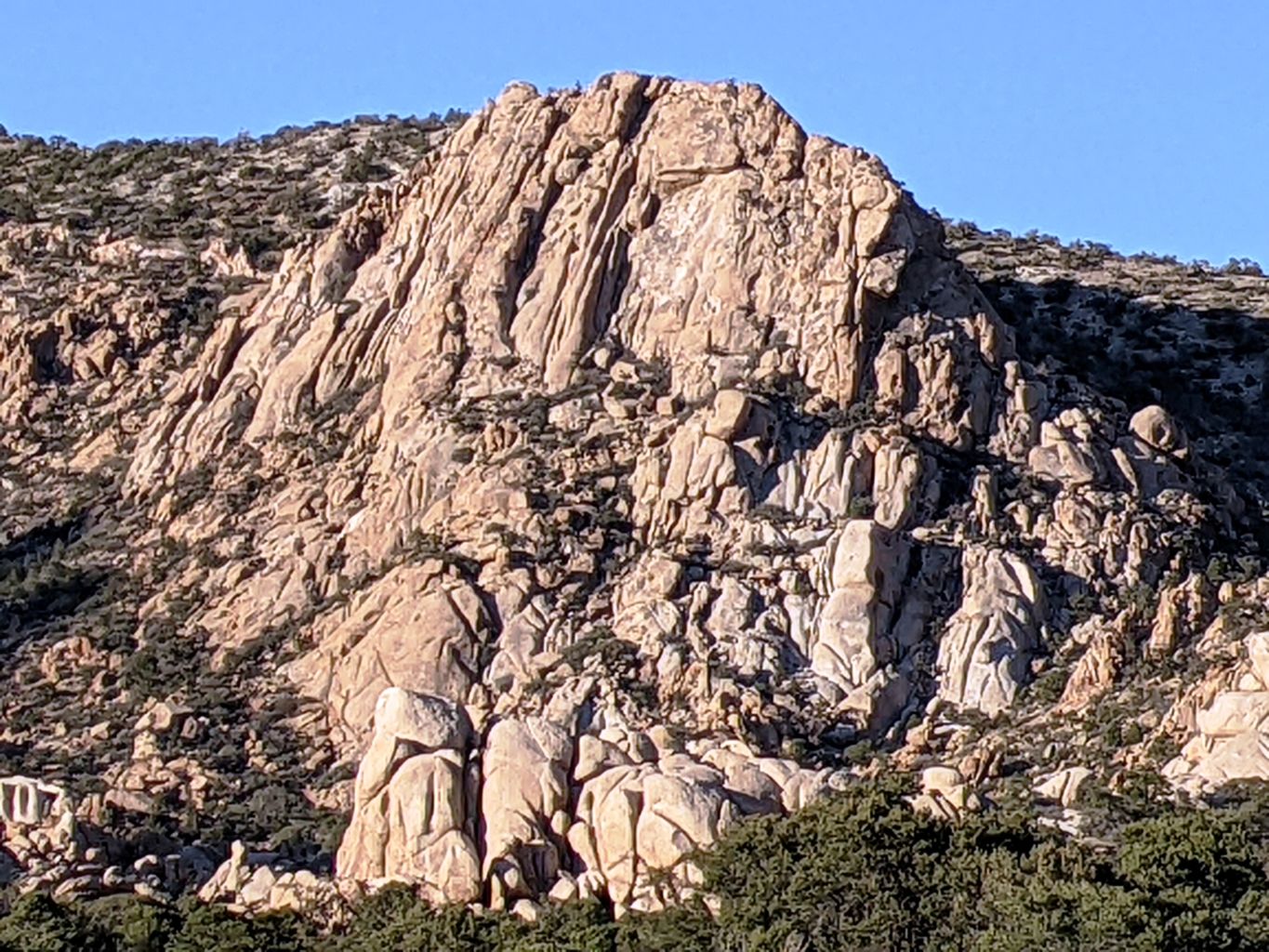
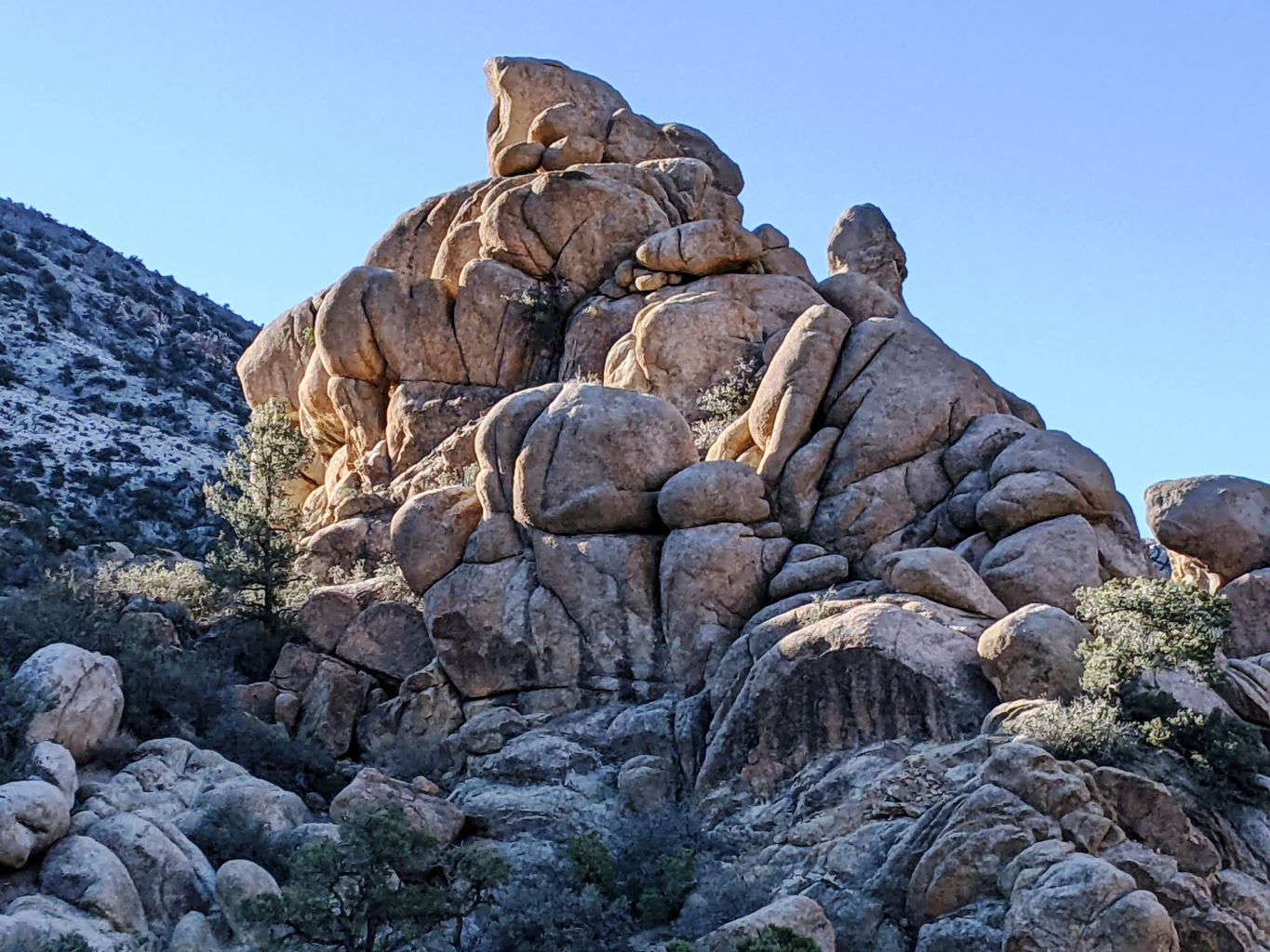
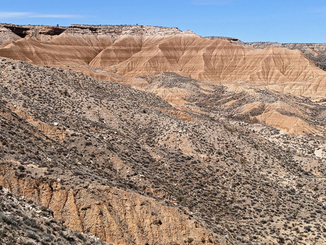
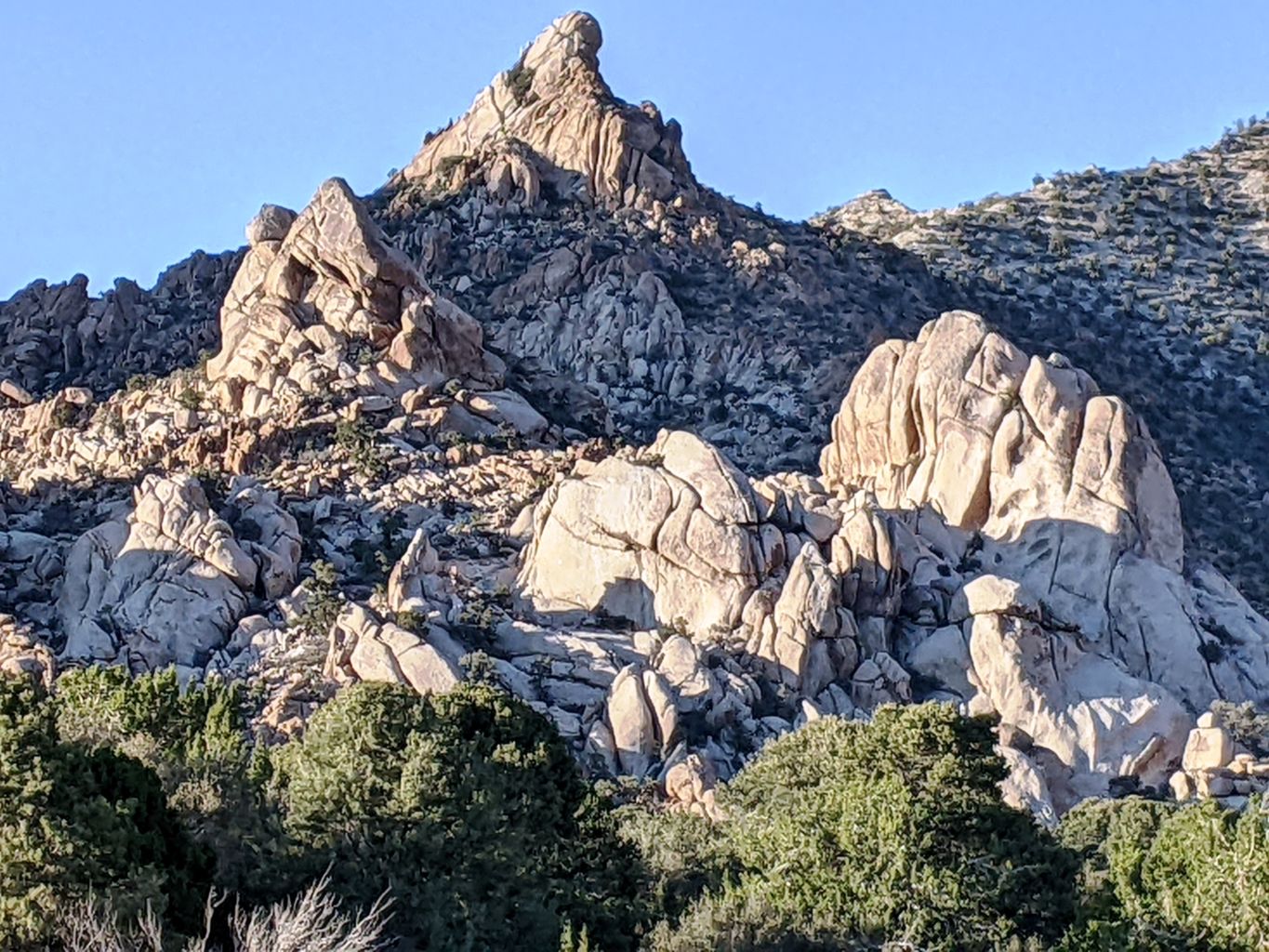
We were looking intently for signs of strong winds that were predicted for tonight, but with so little vegetation, nothing but short brush, it was tough to tell what was happening out there. My estimated distances were pretty darned close and we knew we were only about 6 miles from Caruthers Canyon once we turned onto NY Mtn. Rd. The roads were very decent and time passed quickly; the entrance to Caruthers did not look familiar to me, but coming in from the East at the end of a huge day may have contributed. Once up inside the canyon, we saw the old windmill and the steel water catchment basin and all the old heavy pipe. We had arrived.
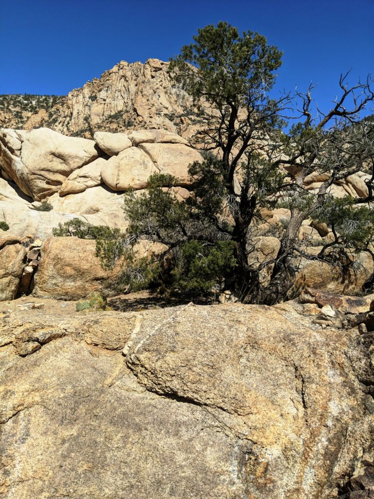
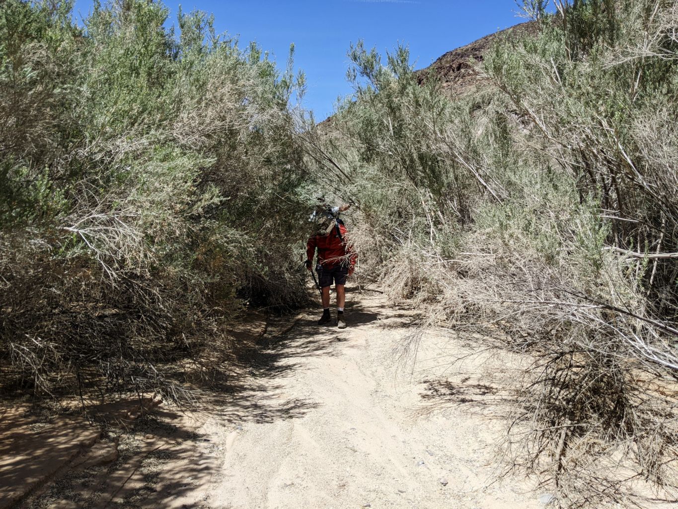
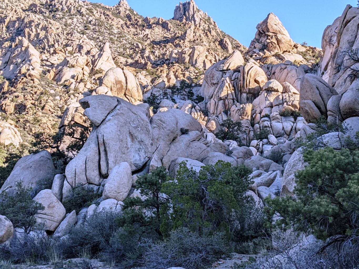
Bob pointed out the road he and Marya had camped on last Spring, and we eventually turned off on the last spur where Tom and Bill and I had driven with Jordan and David on our last trip to Mojave. When we got out of the rigs, we were met with the wind we had been expecting. This was the farthest up the canyon I had been, and although we were among a grove of large Pinyon Pine, the wind was blasting, and there was scant level or clear space. The boys were not home yet. We split up and explored a couple spur roads we had passed and Tom and I went back to the main road in and then turned left to go higher up into the canyon. There didn’t appear to be much road, but as is sometimes the case, we found that it did continue. There is always more to explore.
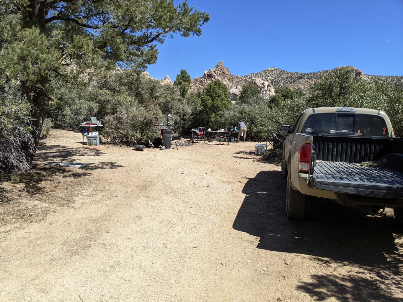
We dropped into a ravine and crawled back out and into a very large and dense Pinyon forest. The pines gave shelter to a lot of underbrush, so the grove was very well protected. There were camp sites all over the place, plenty of tent sites and flat ground, and although the wind was still blasting, this was as much cover as we could hope for. We were giddy at coming to the end of the long days drive and anxious to tell Bob and Bill. Meeting back up, they had not found much for potential sites so it was an easy decision to bring them back into our spot. They were much pleased. We pulled our rigs into the farthest spots and began to unload.
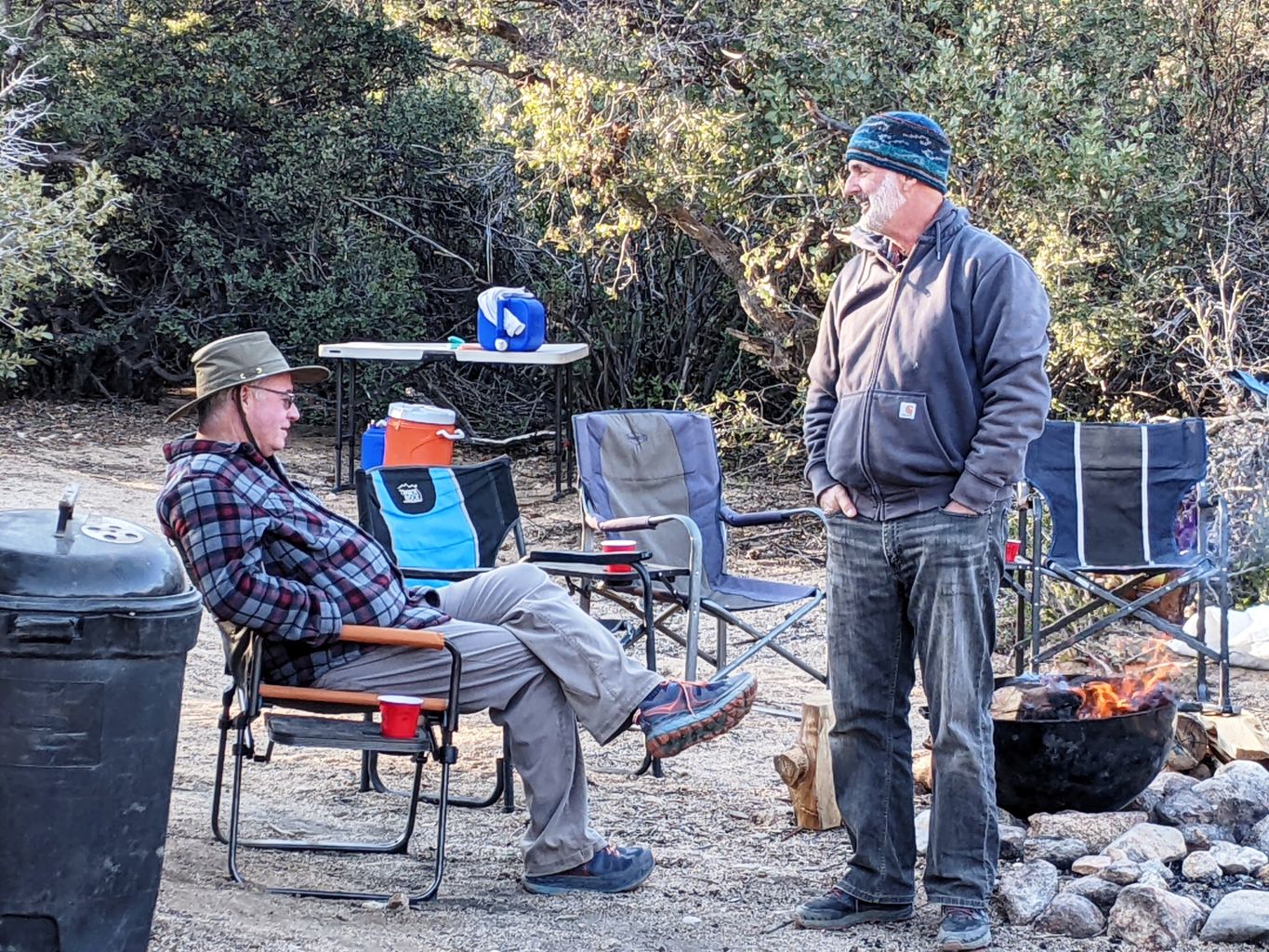
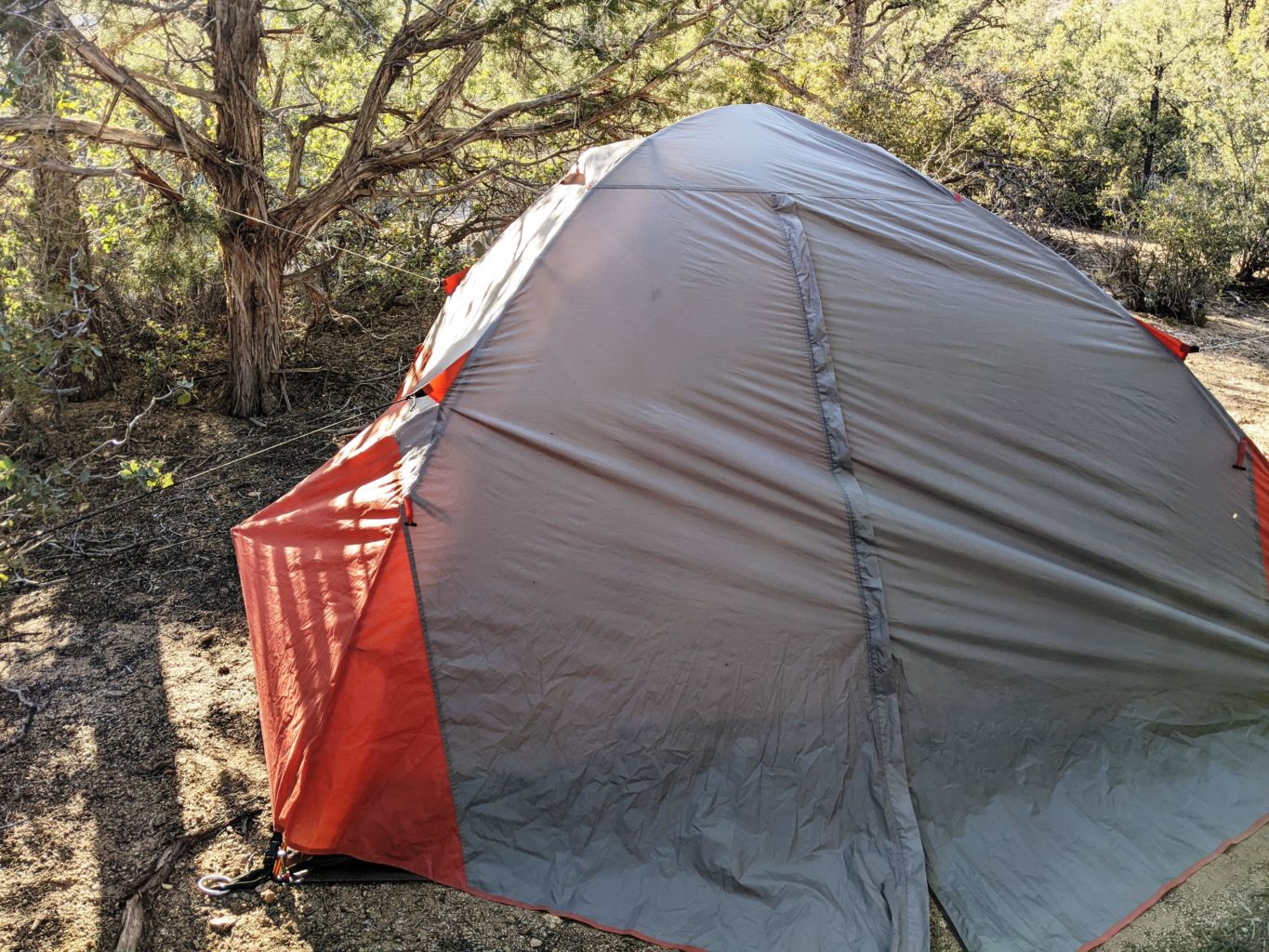
We soon had a good kitchen spot, but it took some time to find tent spots for each of us. We were all trying to figure out the wind, to no avail, so eventually settled for maximum protection on all sides. Tom and Bill positioned their rigs to add some level of protection, but we were getting the sense that this wind prediction was going to be more accurate that most weather forecasts. Everybody helped each other set up tents and roll out ground cloths. It was still sunny and warm despite the wind, so there didn’t seem to be a looming storm. It was probably near 7:00 when we finally had every single possible guy wire, tent stake, and rain fly support in place to hopefully withstand the gusts. I had used every piece of string, twine, and cord I had with me to lash the fly to the branches of the surrounding Pinyon. I was up a little trail into the dense trees, so I felt pretty good about my fate.
Exhausted from our day’s adventure, and with a fair amount of trepidation of the blasting wind, we toasted the success of day one and retired to our cocoons. It was none too soon. It seemed like the wind just continued to grow and grow. I guess just sitting in your tent so focused on one element will certainly raise your awareness, but it seemed like the wind was coming upon us as waves to the shore. You would hear the wind gather and collect into one large blast long before it arrived. It seemed to me to assemble outside the canyon in the wide open plains that is much of the Mojave. Growing in size and strength, it would then crest the gentle rise of the crumbling rock of the canyon and come crashing down from above. Then it would retract, and become almost calm, with brief short gusts like the side waves in between the big ones. Although the big waves are said to be every 7th, these wind blasts were every few minutes.
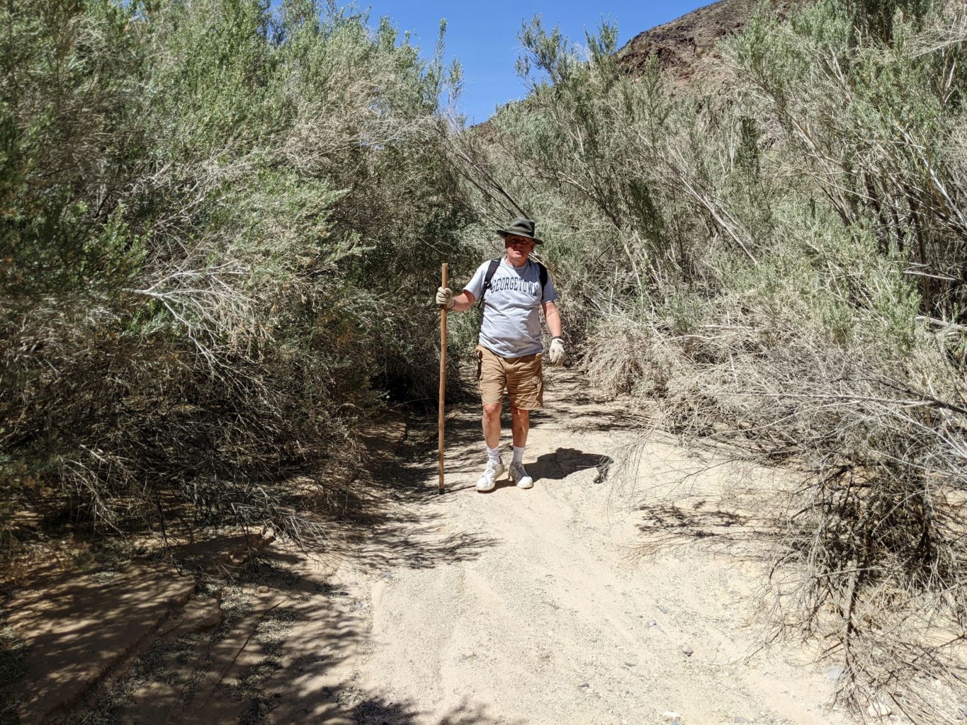
Needless to say, sleep was rare, although I felt pretty good when I awoke. This despite, not only the wind, but my air pad going flat and not being able to sleep on my side. The morning was breezy, but the tremendous blasts were non-existent. The forecast had predicted up to 70 MPH gusts for the Eastern Mojave. I don’t know if they were that strong, but they were easily the strongest and most sustained gusts I had ever camped in. We all were in pretty good shape and soon got to planning our day and consuming coffee and breakfast. It was an easy decision to stay close to camp and not get back in the rigs so we decided to hike up the canyon to a mine that Bob and Marya had hiked to when they were here last.
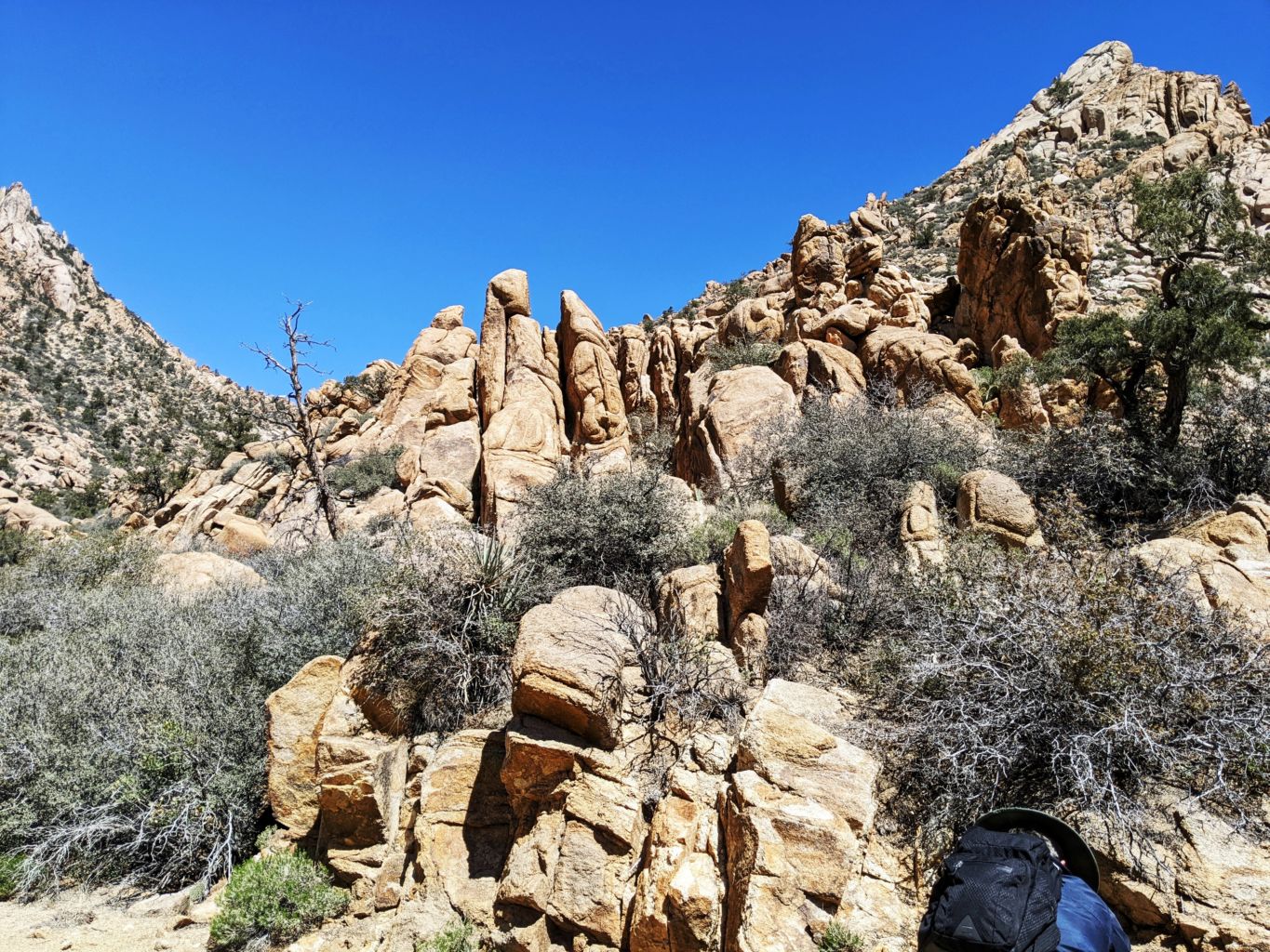
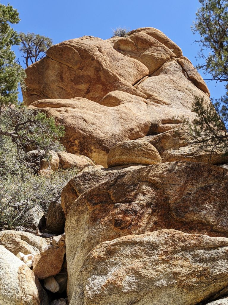
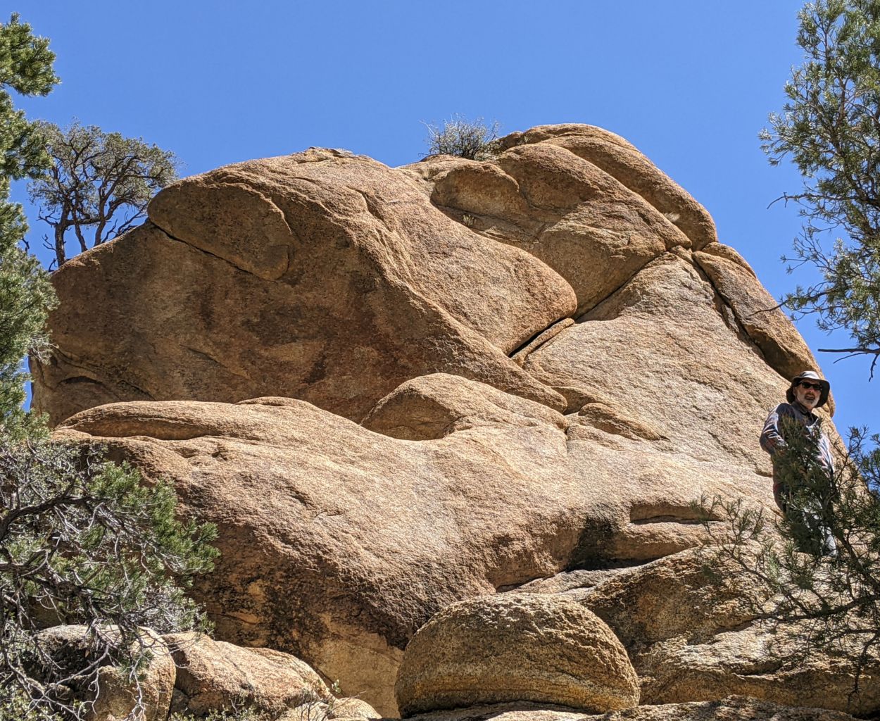
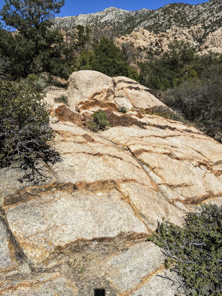
On my early morning pilgrimage, I had walked up the road with shovel and important papers in hand. It was cool in the early morning so I sought the early rays of the sun creeping over the canyon . I found them byscrambling up a boulder pile and sitting upon the granite overlooking the valley below. It was a sweet spot, quiet, calm, very peaceful. I stayed here for quite some time admiring the rock formations, towers, vegetation, birdy songs, and took in the tranquility of this fine morning. I was excited to be on this trip with the boys and at the adventure at hand. Being moved by the spirit, I wandered back to camp refreshed and ready for the day.
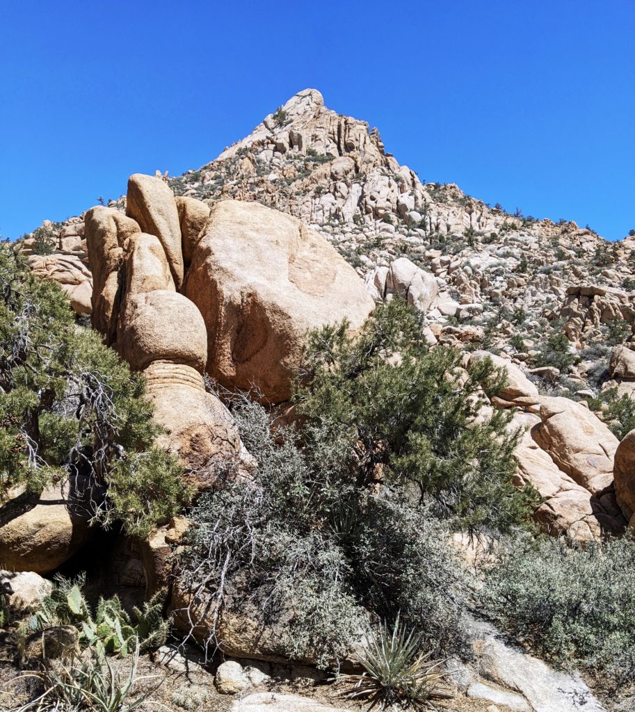
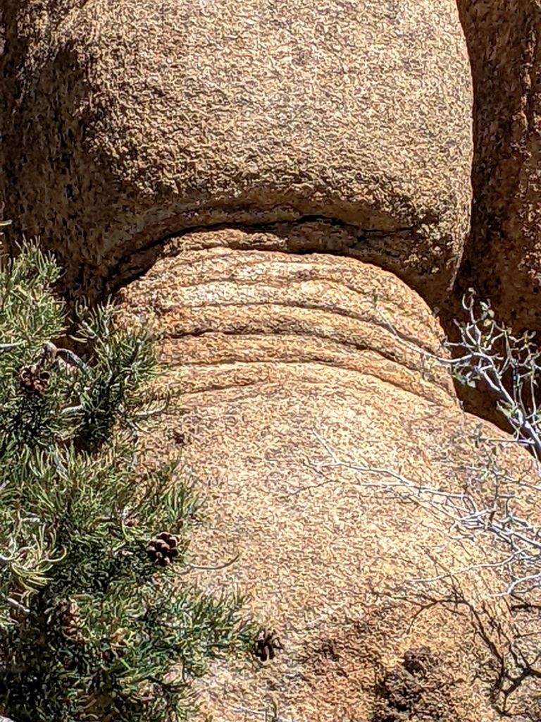
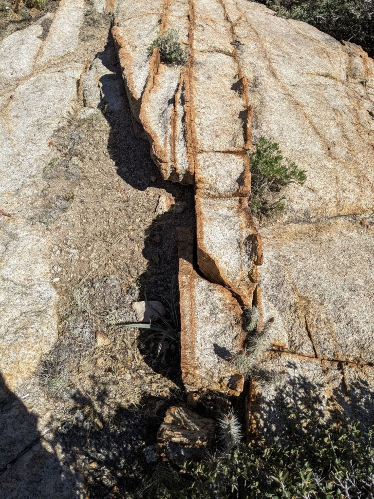
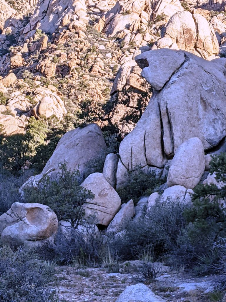
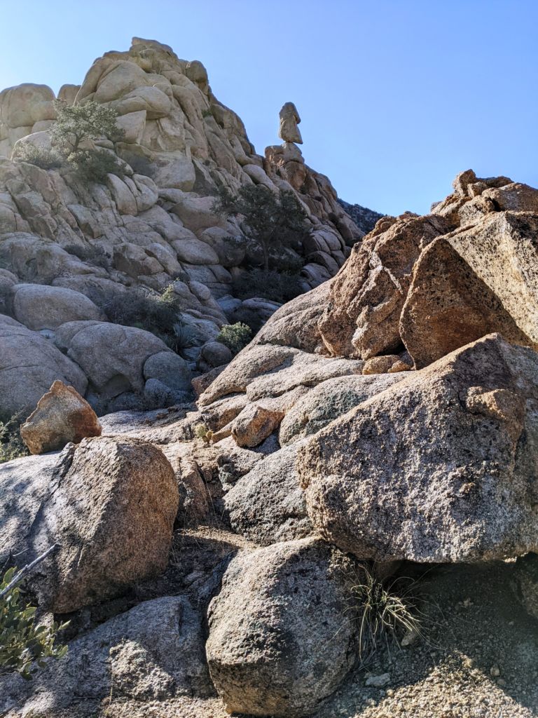
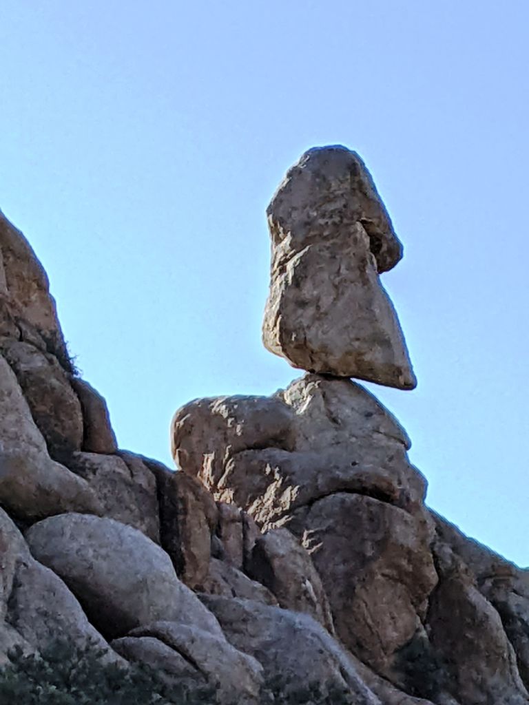
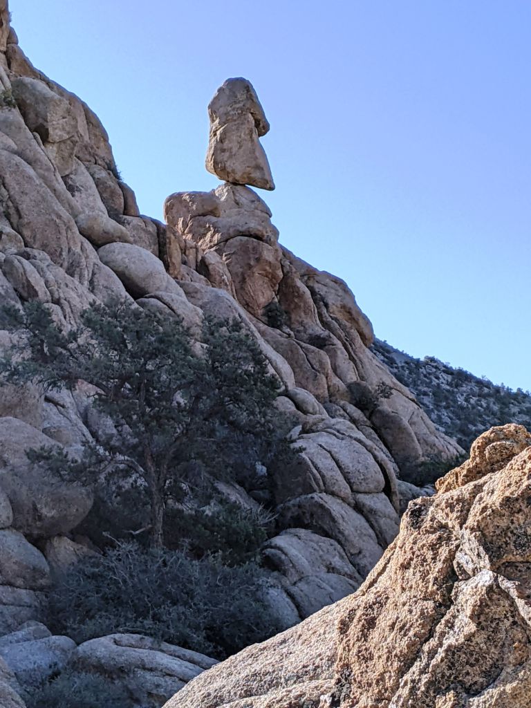
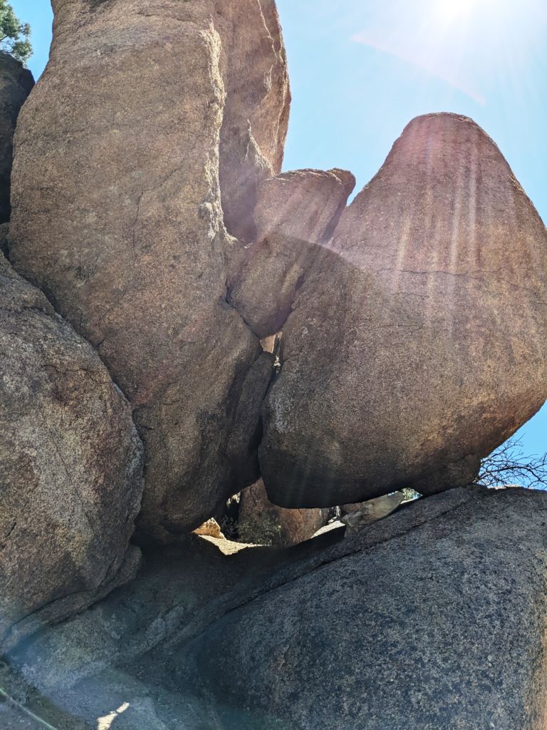
On the way I was suddenly aghast at the sight of a massive balancing penis rock. It instantly brought me back to Kodachrome Basin State Park in Utah, which would be more aptly named Phallus Field or Inspiration Tower or Let’s Get Busy Valley or Do You See What I see Park. It is wildly suggestive with numerous rock hard prominent towers that impress and amaze. This lone balancing rock was less prognathic, as Tom likes to say, but nonetheless impressive in the singleness and in equilibrium. I noted its location and hoped to clamber up near its base at some later time. With a fine morning experience under my belt, I headed back down the road to camp.
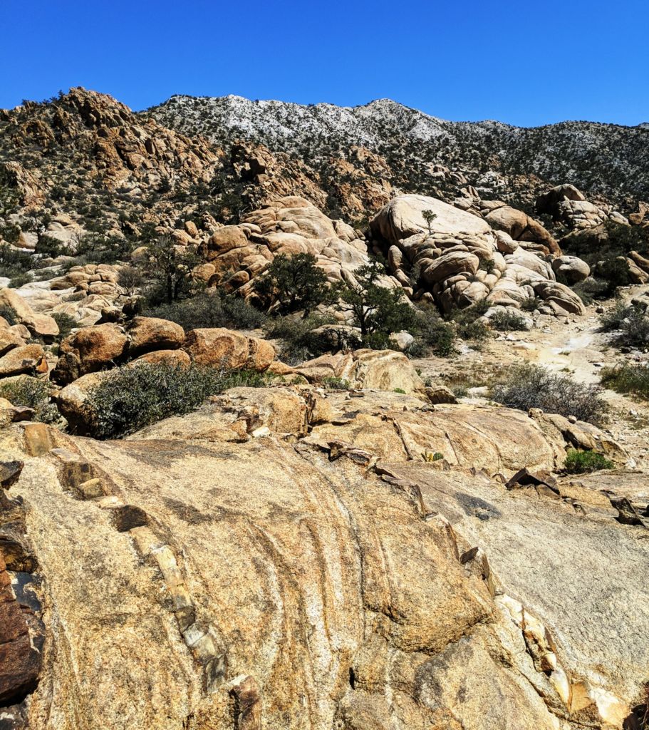
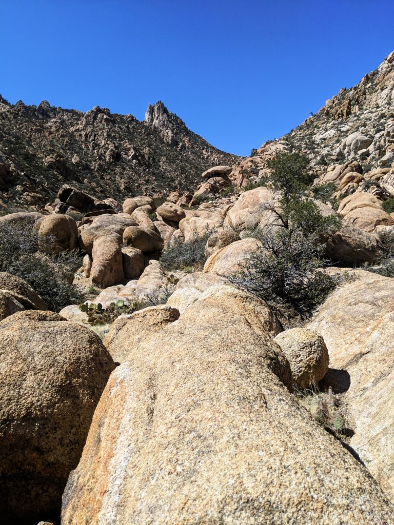
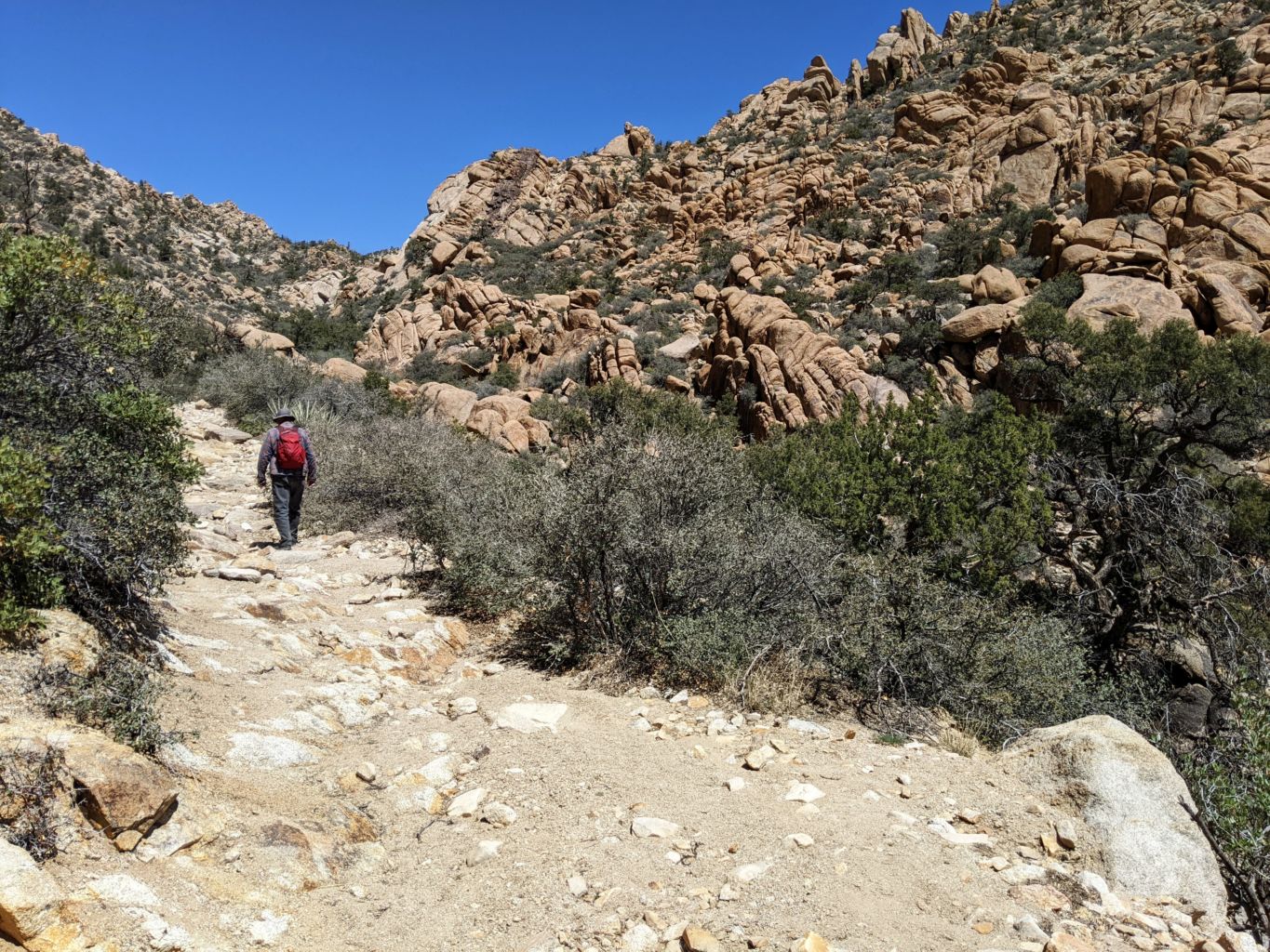
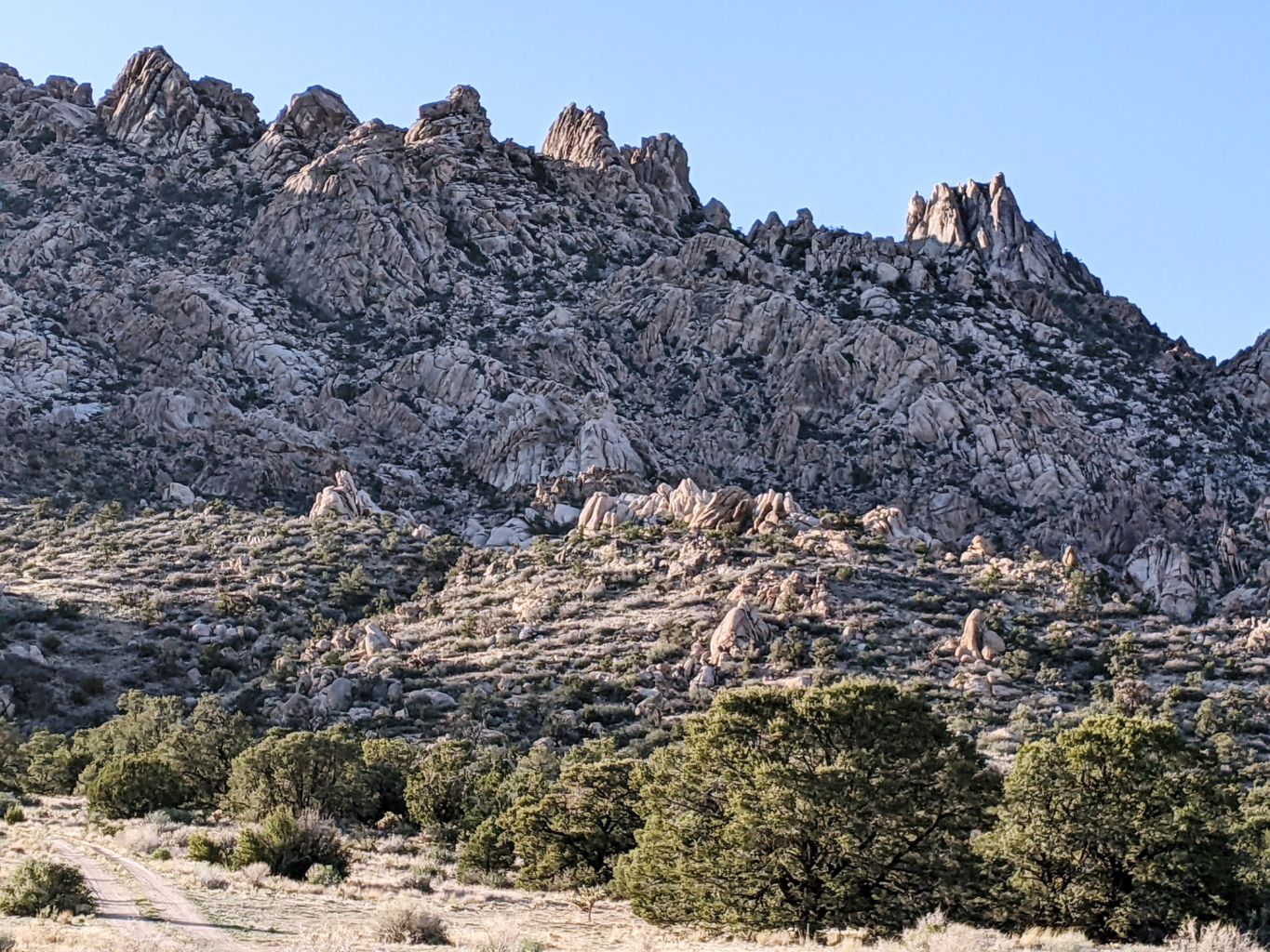
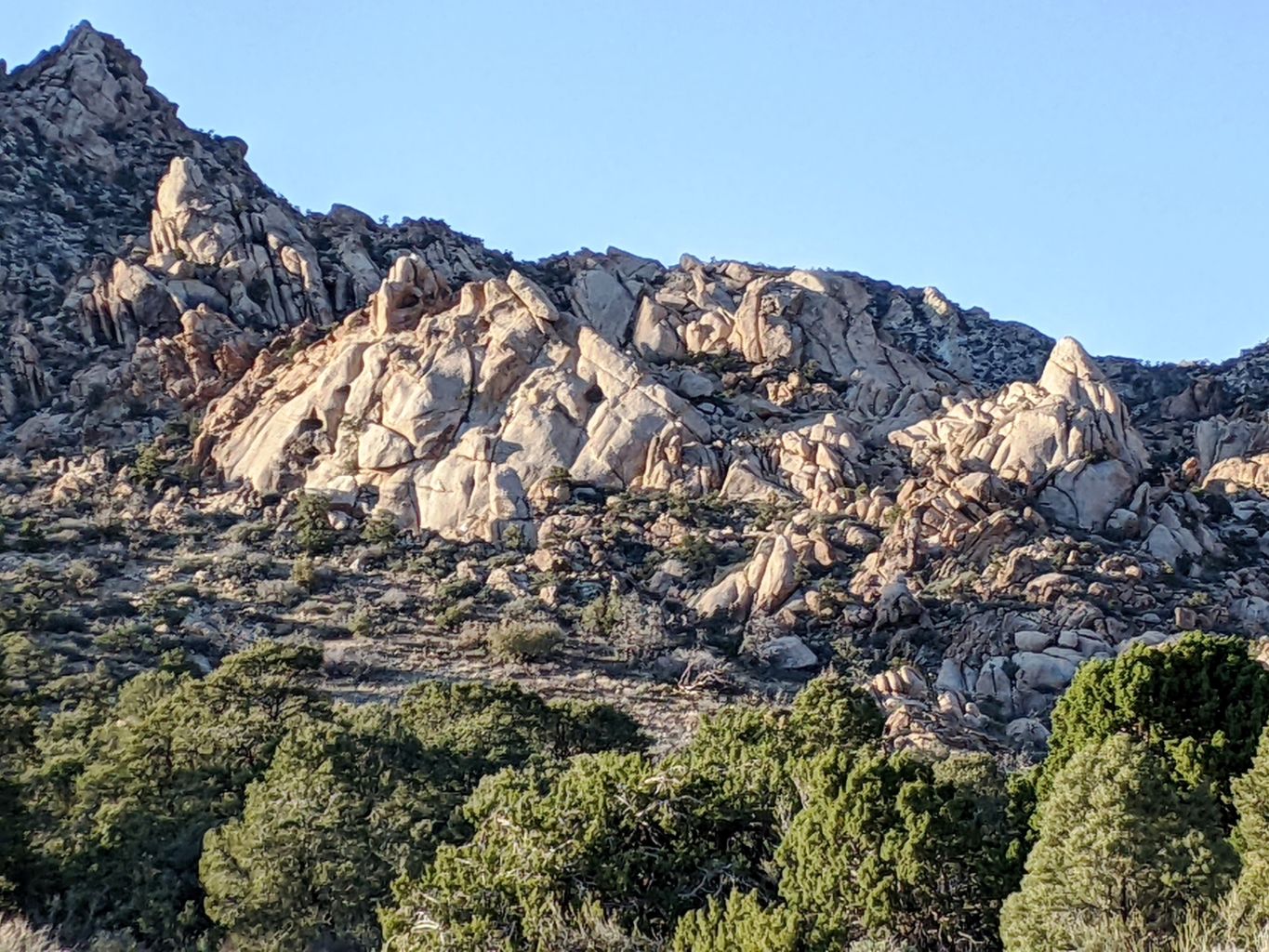
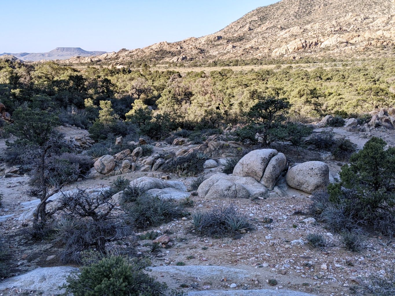
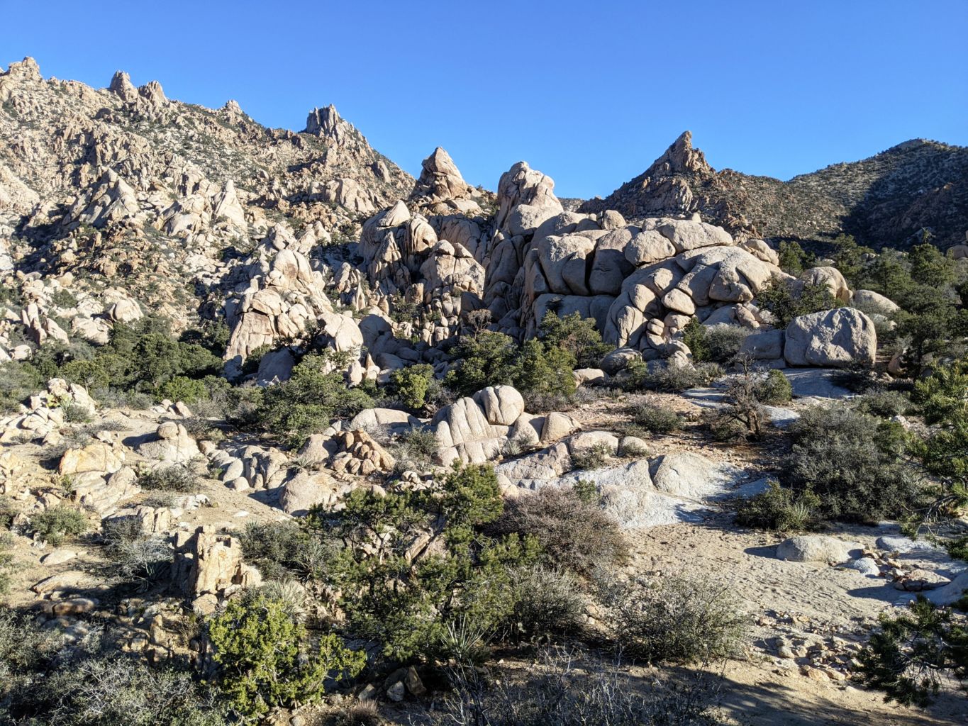
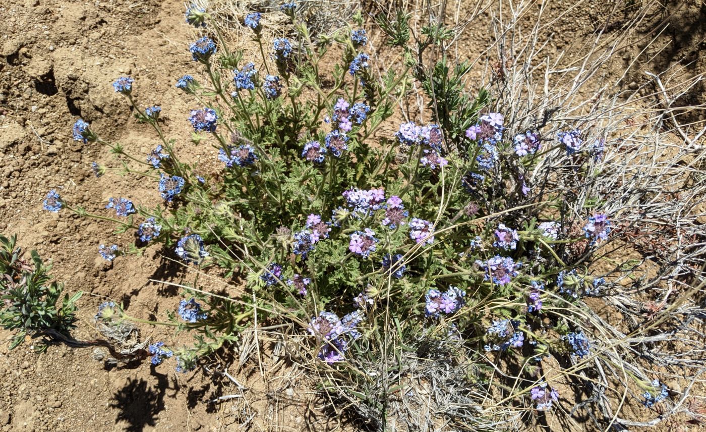
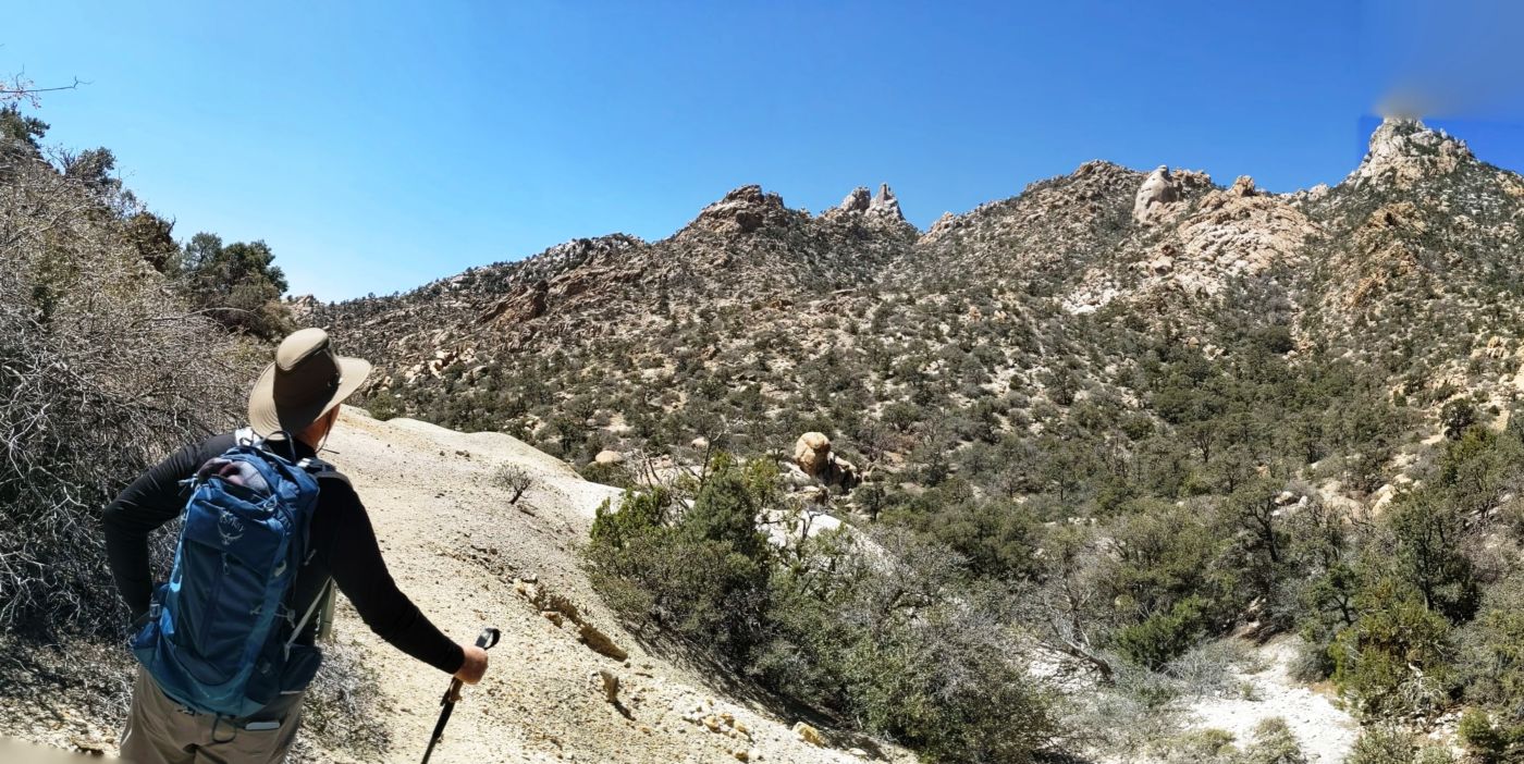
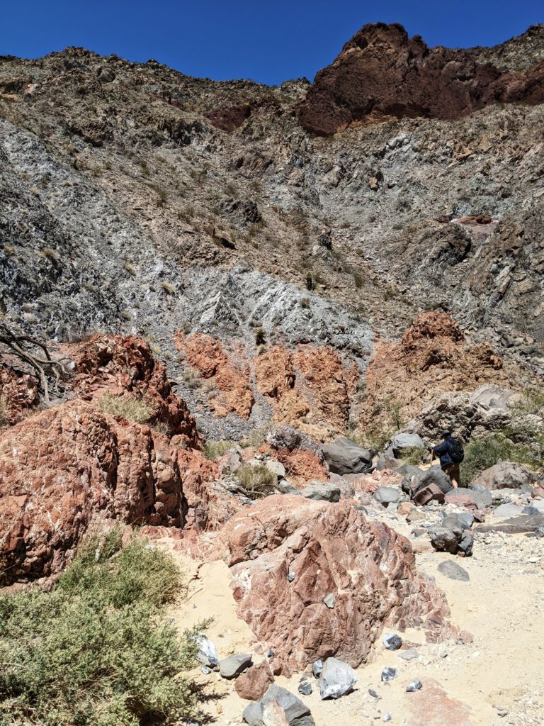
We loaded up our day packs with grub, water and several beverages in the soft cooler bags I got years ago from one of Beth’s Special Olympic events. They make the best day hike coolers and fit perfectly in the bottom of my pack. We headed on up the road we drove in on and passed another spot that would have easily hosted us, however I do not think it would have afforded as much vegetative protection as we had. It was also more open to the road and any passersby, so we decided we were in a much better spot. On up the road, we decided we had reached the spot where it became undriveable for us, but perhaps still for a Rubicon rig. The rock formations were spectacular, and although there was no surface water, the low depressions were still moist and supported fine grasses and algae. The birds were most appreciative.
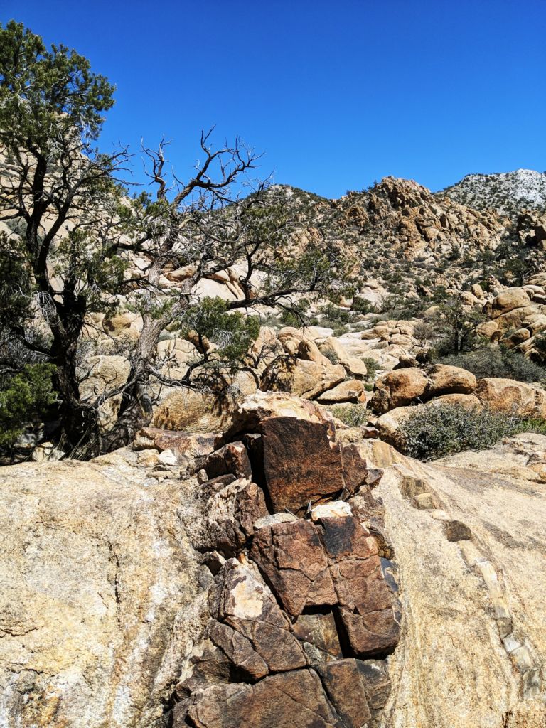
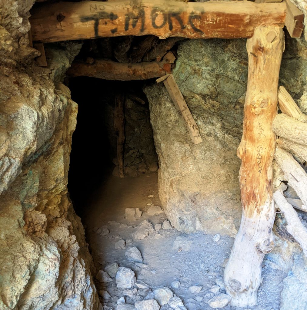
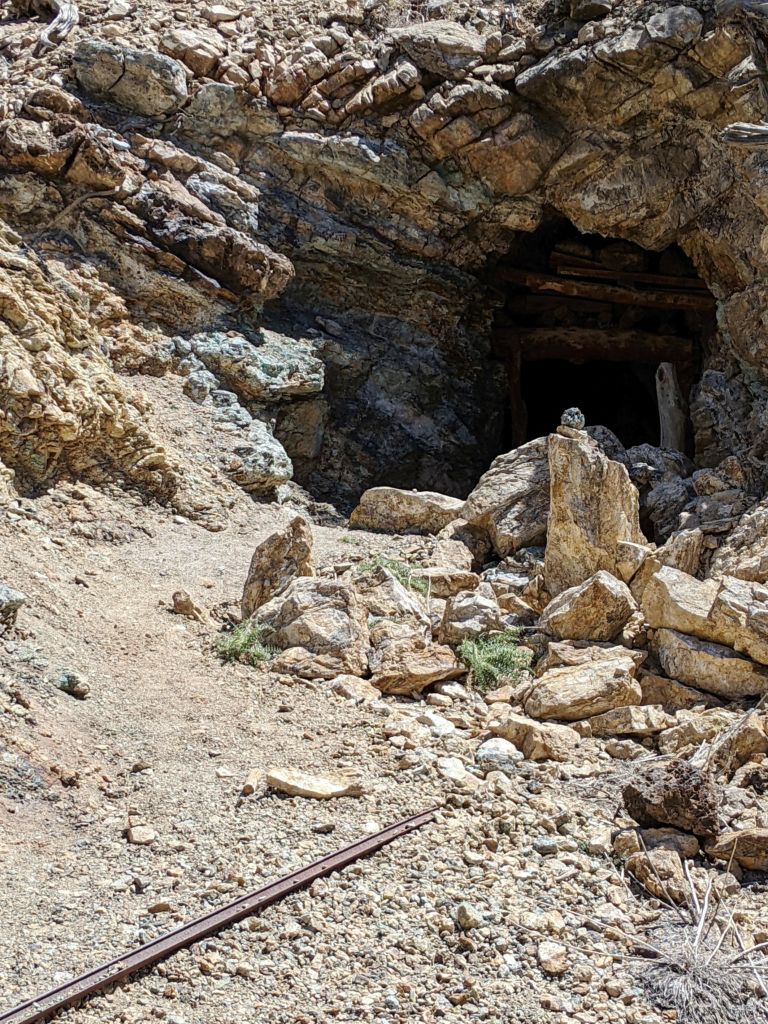
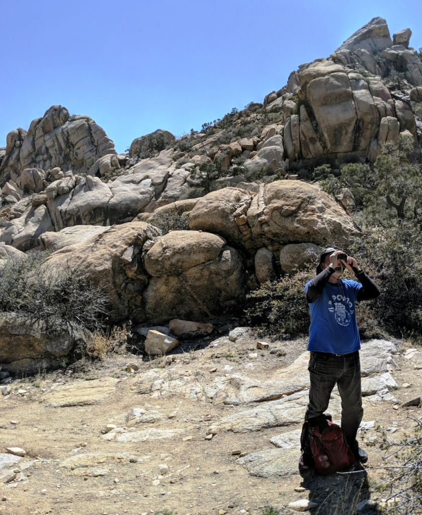
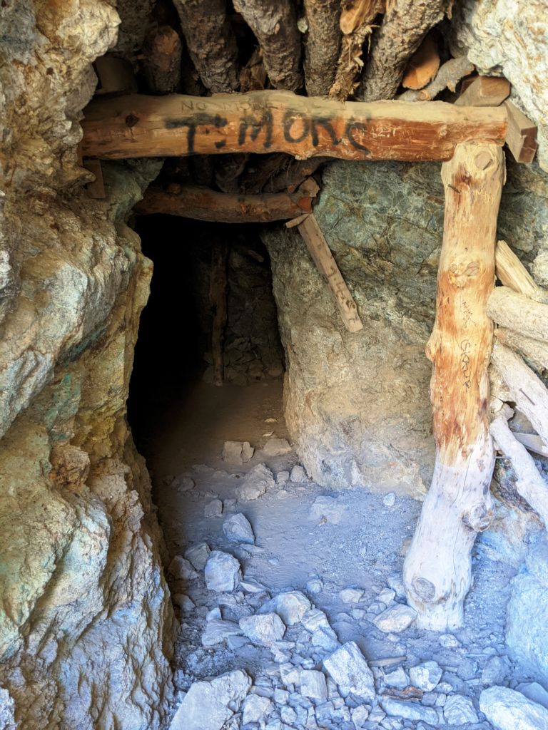
The road eventually became more of a narrow wagon trail. It clearly had been made for the mine, and perhaps even went up and over the ridge to the North, past the mine as more of a through road rather than just access to the mine. I was getting to the end of my hiking interest when Bob identified the little side trail up to the actual mine. Below the lip of the mine was covered in green shale-like rock and some of the wooden beams of the shoot and the massive bolts holding them together were still present. We poked around a bit and then retired in the shade for a celebratory beverage.
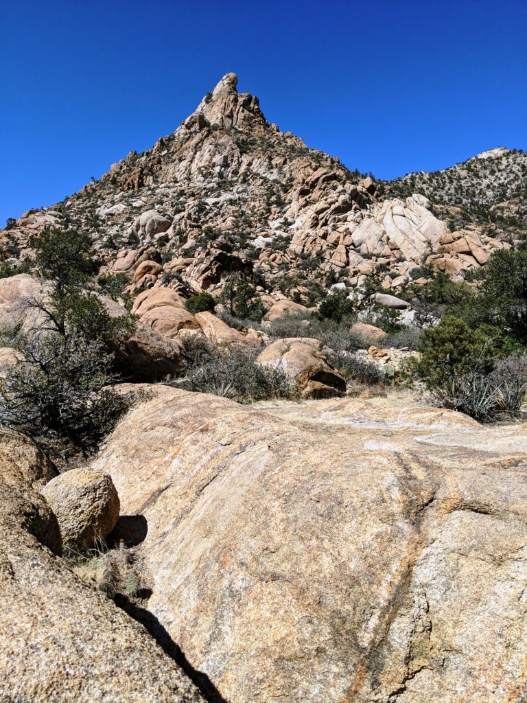
Bob and I wanted to explore up higher a little more to see if the road possibly continued on up and over the pass to the North, so we headed on up what may have been a trail, but soon petered out into perhaps seasonal creek or game trail. We picked and prodded under fallen trees and scrambled over boulders, climbing higher as we went. We stumbled into what appeared to be a rock outline for a cabin foundation or the perimeter of an old garden or sitting area. We soon found 2 areas where massive numbers of canned food and goods had been deposited. This definitely had been someone’s camp a long time ago. That was about the end of the line. If there was a path or route up and over the pass, we weren’t on it, and had been gone long enough. I had assumed Bill and Tom had headed on down from the mine ahead of us, but as we approached the first big rock face, here they sat. Reunited, we began the descent back to camp, getting another perspective on all the wonderful rock formations.
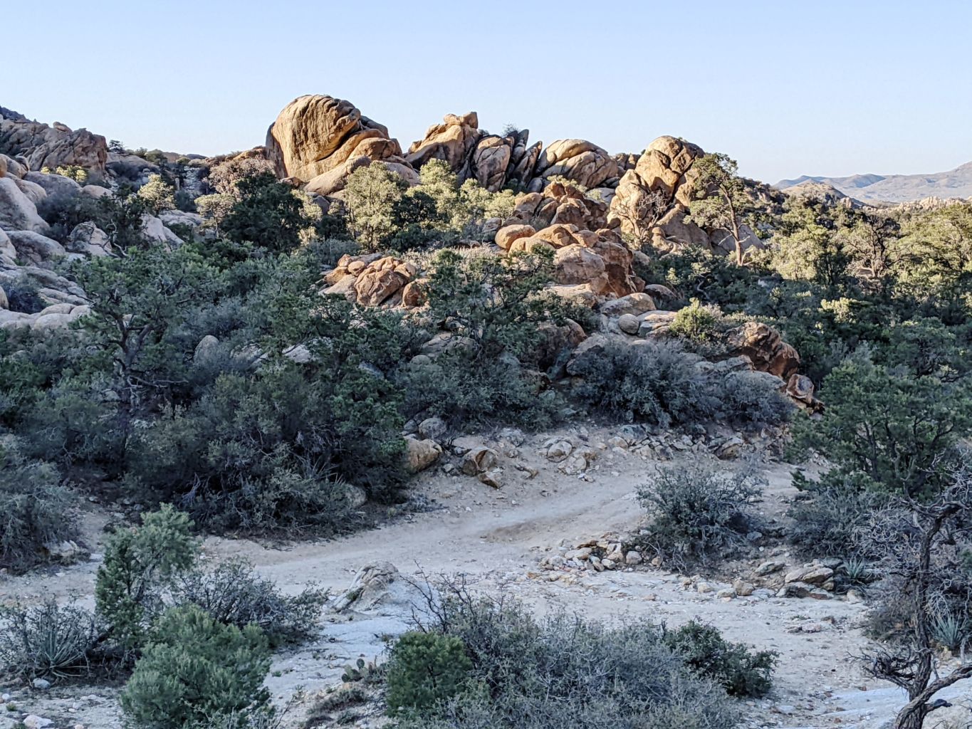
We got some grub and a beverage and sat in the shade reliving our hike. We dozed, and futzed with gear, and washed up, and nodded off, and read a bit. Eventually, it was grub time and Bob fixed up one of his tostada meals with all the fixins. It was wonderful. We had a nice little fire after the breeze died down even more. A gummy or 2 was distributed to ease the aches and pains and they must have invigorated the boys as we headed out of camp for a stroll up to the massive rocks that sort of marked the spot where the broad open savanna-like valley ended and the road dropped down into the thick Pinyon Pine forest we were camped in.
Night was slowly coming on and the lasting colors in the sky set the rock ablaze as the sun dropped below the western canyon wall. It was really a trip, because on one side of the rocks, we were in a fairly thick pine forest. On the other side, we were out in a wide sparsely vegetated valley. In just a few steps, our worlds changed dramatically, and this entertained us for hours. It was dark by the time we headed back to camp, which, fortunately, was not far. We lingered around the fire for a short time before heading off to slumberland. Bill lent me not one but two sleeping pads which made my sleep that night most excellent. The wind picked up again, but it never gained the strength or the crashing wave nature of the first night.
This day was going to be a giant adventure for us. On one of our prior trips, the second trip to the Mojave I believe, we drove out of the SouthEast corner of the park to Goffs, East out Route 66, then North on Highway 95, then West back into the park to check out Ft. Piute. The drive was cool and the chance to see Goffs was a unique one, but after some research and map study, we saw that we could get back to the Ft. from the East, without having to drive out of the park and all the way around. This was our challenge and we were stoked to get on with it.
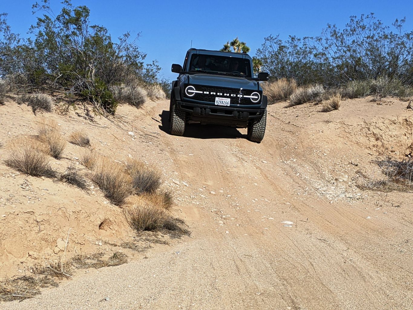
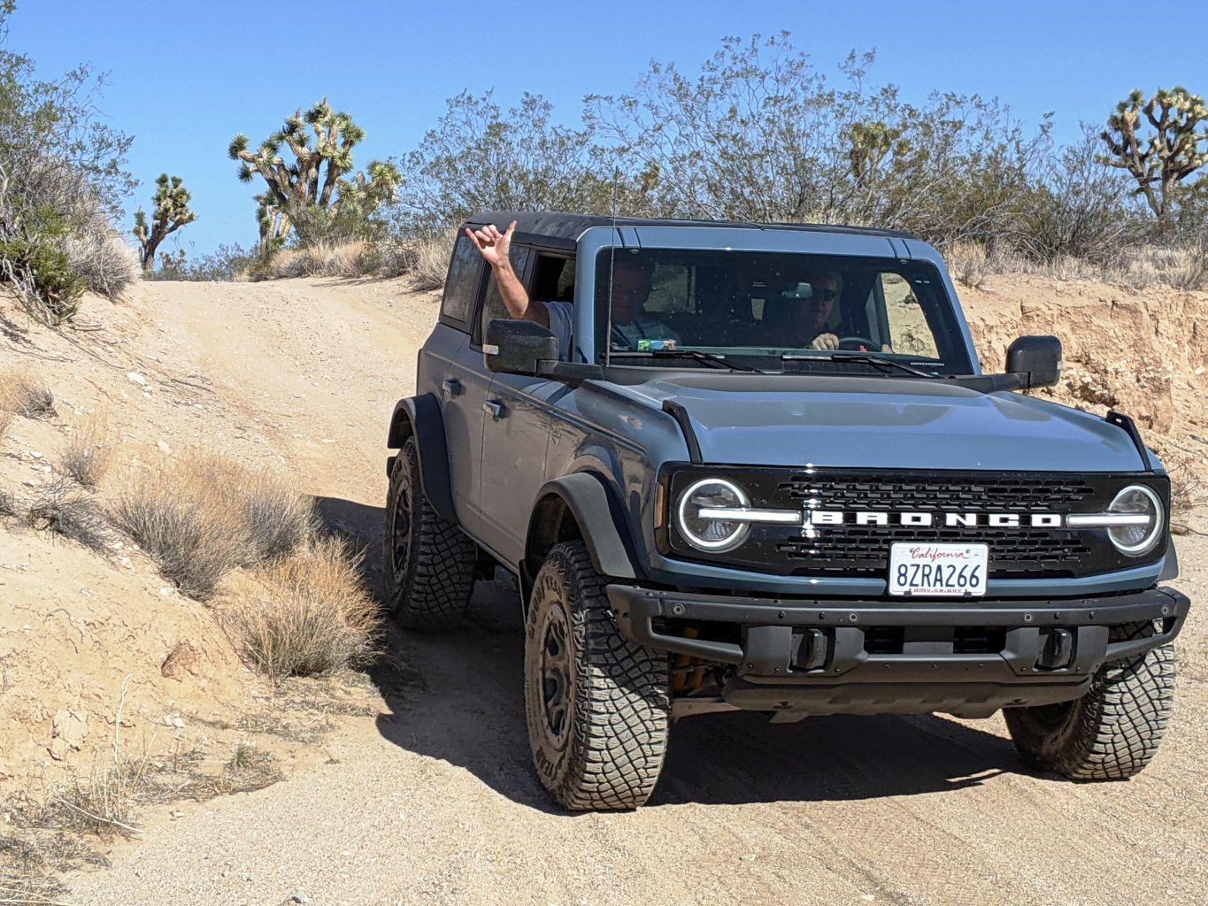
I had done a fair bit of research and had a hand drawn map of a braided trails and roads and washes and combinations thereof that decorated the landscape we would traverse. I had rough estimates for mileage, generous on most counts, so as not to surpass the estimate and become concerned about having missed our mark. Bill on the other hand, hand downloaded a GPS map onto his laptop and could follow the blue dot marking our exact location along the entire journey. I much prefer my historical methods. Nonetheless, with the brand new technology laden vehicle behind us, the old tried and true rig with the map carved on the stone tablet in the lead, we headed down Lanfair and then East on Old Government Road, passing the very odd round white structure, that must be some sort of radio, radar, communications tower.
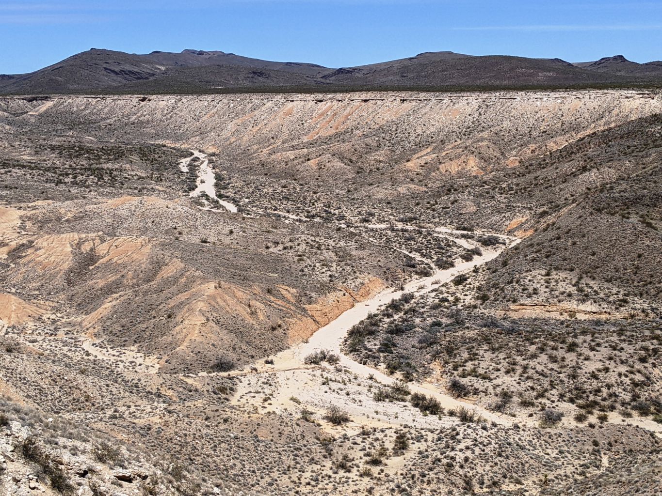
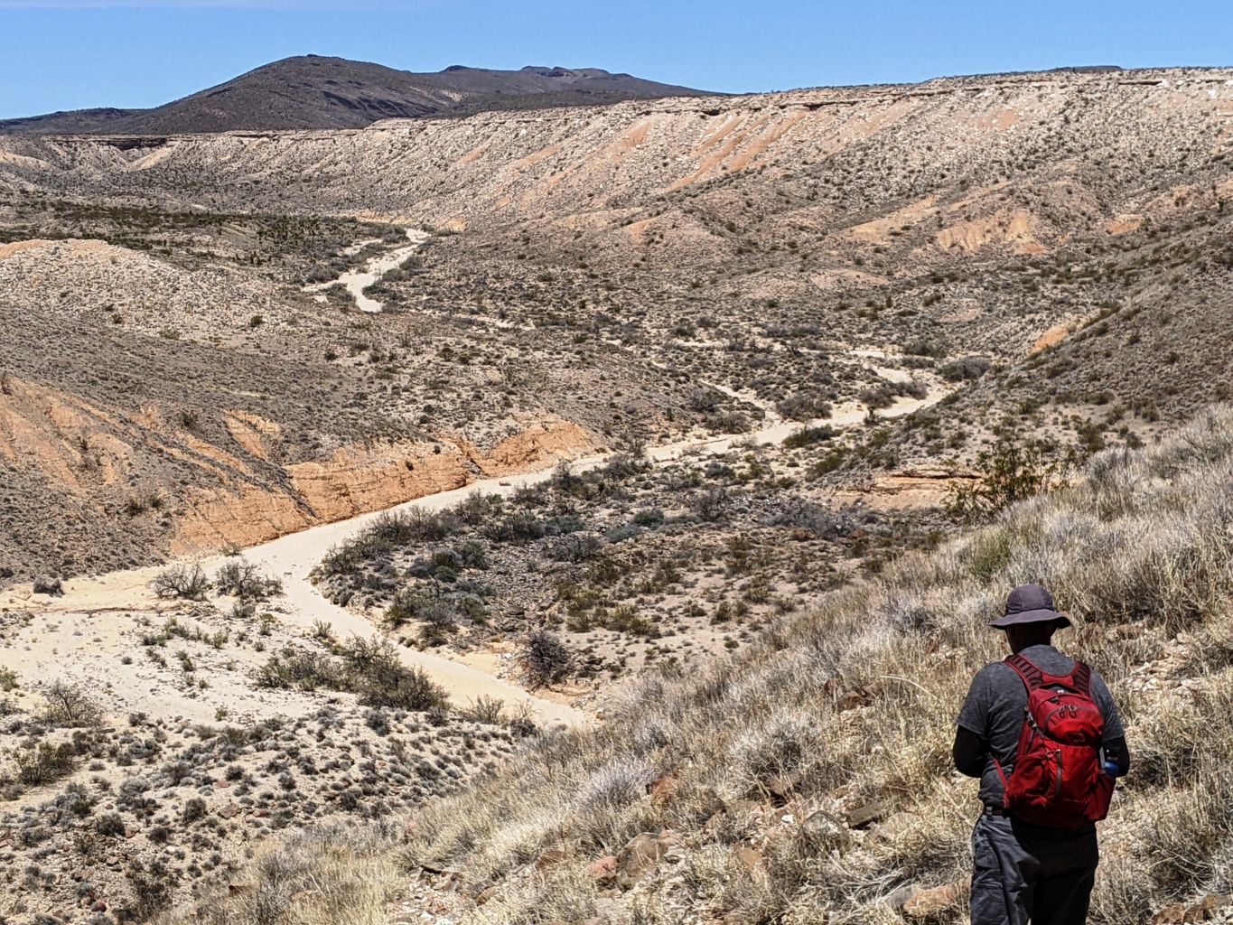
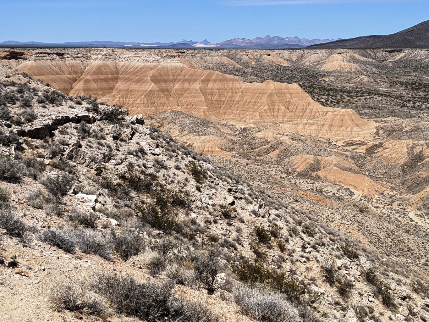
Before long, we were out there. The road in stretched was great smooth gravel where we could go 35-45 MPH. In other stretches, we were climbing or dropping 20 feet into massive boulder strewn washes or listing at 30 degrees on clay banks that may not have been easier to drive on than just heading cross country through the brush. It was a wild wild drive and really gave a scale of vastness that stretched all the way to Arkansas and Louisiana before the vegetation changed. We weaved back and forth on a number of routes that criss crossed each other and several others. We stopped a couple times to compare notes, but I think it didn’t matter which track we were on, they were all going to end on the lone North-South track that lay at the foot of the hills to the East that we had to hike through. And so it did.
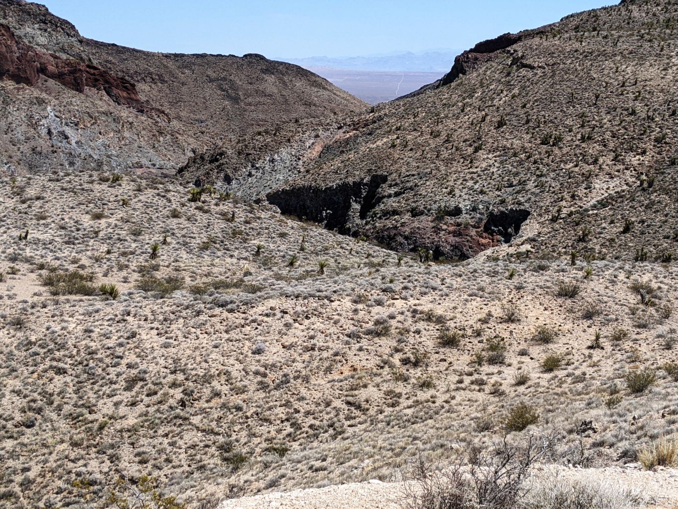
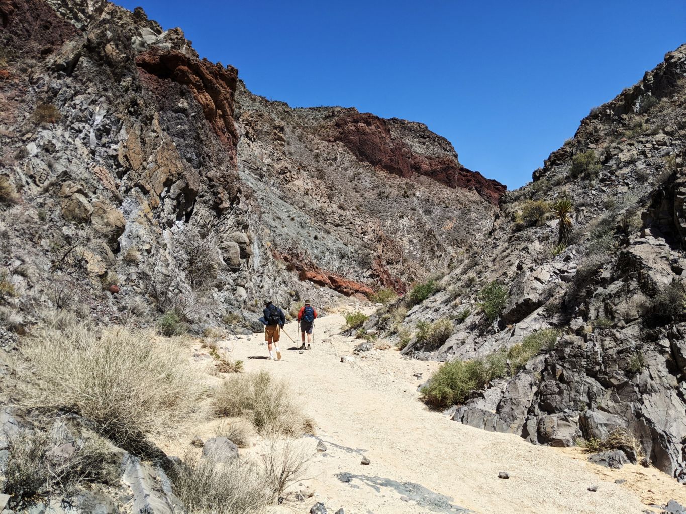
Suddenly we came to a lone rig tucked just off the road camped out all alone. It wasn’t the most beautiful spot I ve ever seen, but I sure could imagine the quiet and solitude. Shortly after passing the rig, we intersected our North-South track and turned left. Now we had to hunt for the trailhead, such as it were, to hike through the canyon and into Ft. Piute. We saw a massive canyon fall away into a narrow pass and assumed that was where we needed to be, but had to try a few routes that ended in overlooks, before we found the tiny, old sign that indicated we had arrived.
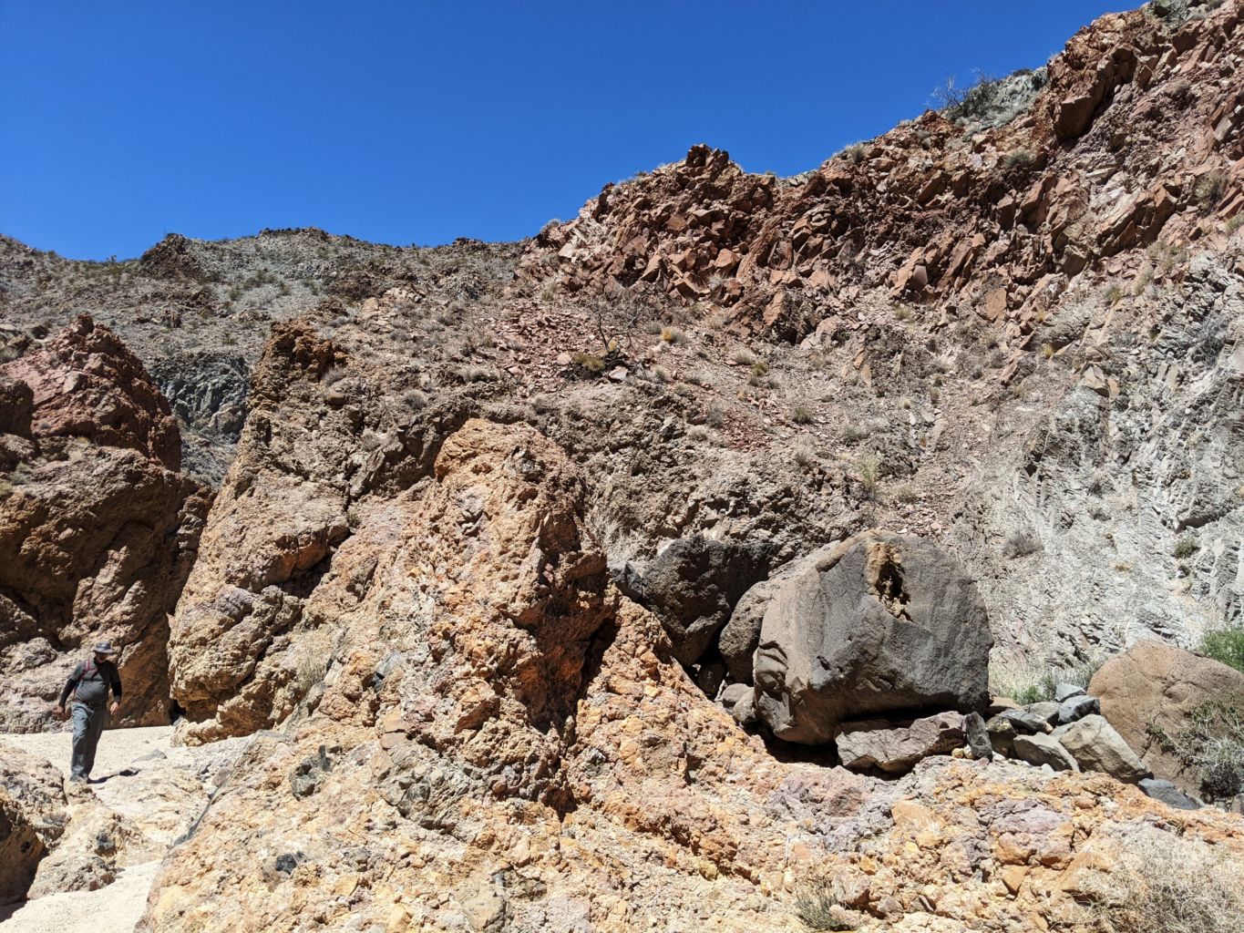
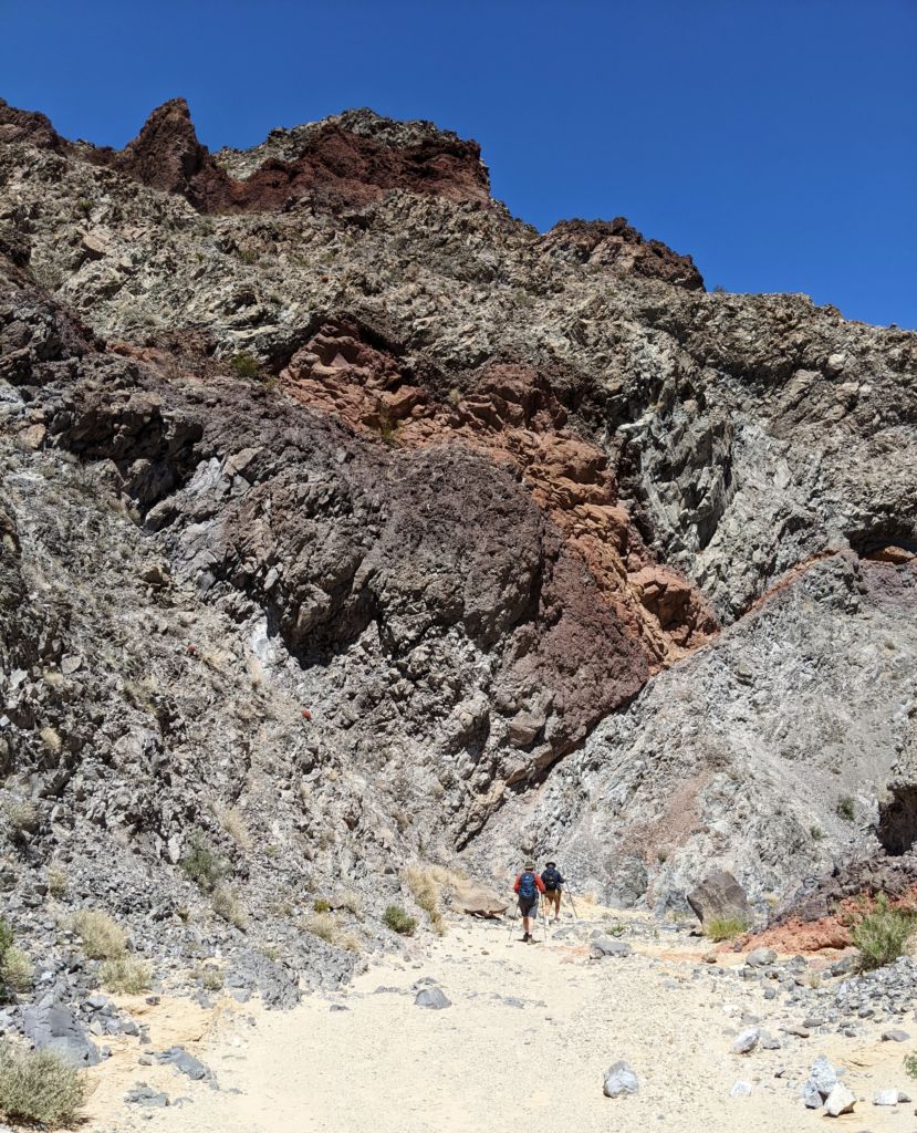
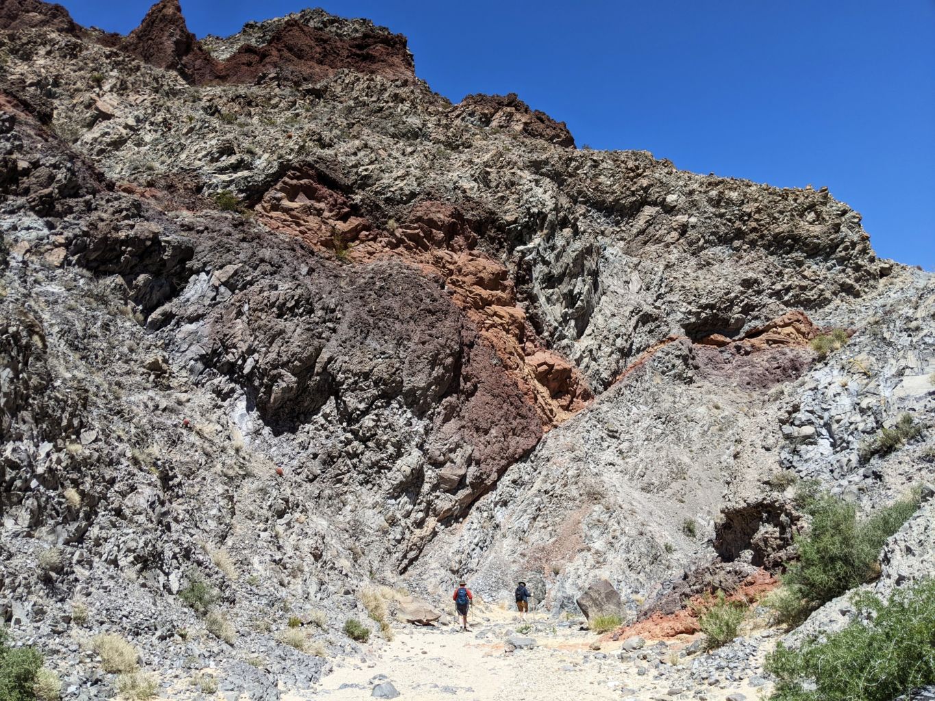
We had not gotten an early start, and it took several hours to get to this spot, the beginning of the hike that was to be the main adventure, and were estimating the hike could be several hours, and we didn’t have that time to get there, be there and get back before dark. But we were here now, and without too much discussion, over we went, and dropped steeply into the wide wash that quickly became a narrows twisting and turning like every drop of water and grain of sand that helped carve this tiny gap through the mountain range. The canyon was way more impressive than I had expected, which was nothing special. But it truly was spectacular in every way; colors, formations, flowers, birds, steepness, narrowness. It had everything except a little waterfall or even trickle of water, but still, it turned out to be a gorgeous place.
We made pretty good time going downhill at a gentle slope, broken up by vertical drops where any precipitation would create awesome waterfalls. We did discuss the likelihood of being able to scramble back up the drops, but we chose to do them all. The twists and turns afforded ample shade in stretches as we moved in and out of alignment with the sun. The narrows were highly entertaining and we moved along pretty well. We had gone pretty far and time was definitely on our minds, when we came to a dense thicket of willow and poplar and mesquite. Progress slowed to a crawl as we navigated this swamp, literally sinking into the damp muck if we were not careful with our foot location.
After 20 or so minutes of this, and no end in sight, we concluded the expedition. We knew we were within a few hundred yards of the Ft., but there was no end in sight of the thicket and we knew it was like that right up to the pond we had found last trip. There was no way of really telling how much further we had to go, other than knowing we were very close. But time was of the essence. We wanted to stop and enjoy some downtime, have something to eat and a celebratory beverage, but also still had to hike out, drive back, and hopefully have some sort of dinner and e3vening before bed bed. Much to do before I rest. None of us fought too hard to keep slashing through the thicket and before long we all were headed in the opposite direction.
We found a great shady spot with a nice sandy bench for lunch, and had a great little rest. A nap could have easily been accomplished, however, no time for the weary. I didn’t even finish my second beverage and the boys were back at the march. Going back was less fun than coming down, but it wasn’t difficult, and it was just as beautiful coming the other way. At last, the narrows opened to the massive bowl, and all that was left of our hike was the steep open switchbacks to the parked rigs. That part was brutal.
We were all stoked that we had found the trail and had such a great hike, despite not getting all the way to the Ft. or being able to see it again. I had brought my trunks anticipating a dip in the creek that the army had dammed up 150 years ago, but alas, it was not to be. That was disappointing, and not being able to check out the Fort ruins again was a bummer, but even though those were the major objectives, we had such a great hike, I was still really happy with the days events. The drive was epic, the hike was outstanding, we had a great little lunch, we had found where we were looking for, we made it out and back without incident. Much to be grateful for.
Back at camp, Tommy pulled out a jug of Manhattans and began prepping some steak and asparagus. This was to be Tommy’s last night with us as he was heading back to Sac a day early to help Jean prepare for his 60th birthday party that was planned 2 years ago. Not wanting his ex to do all this work for him and he just rolling in the night before the party, he was heading back to help out and give her some much needed assistance. The evening breeze was still with us, but had become more of a welcome friend than raging drunk. The temps were great and we had a delicious meal. After hanging a bit with Tom, I was off to bed and sleep came swiftly after such a massive day.
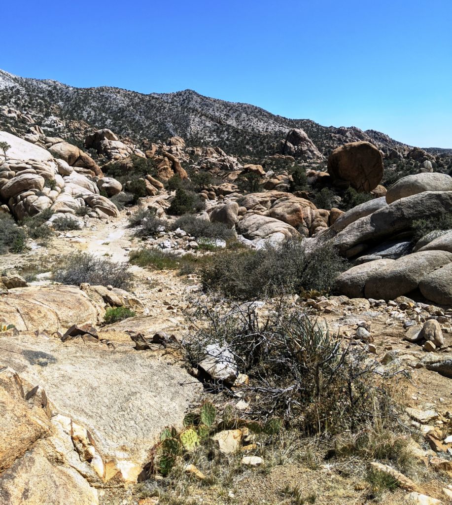
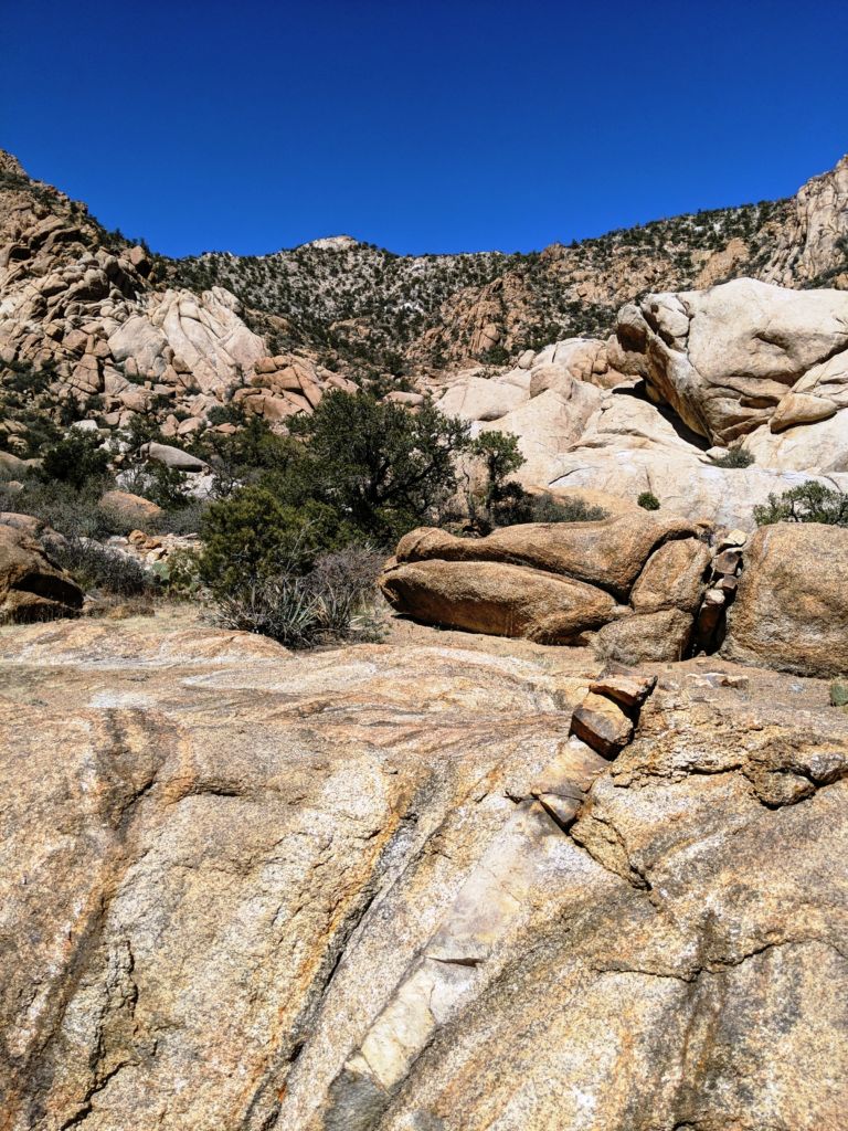
The next morning Tom was up and out early leaving the 3 of us to adjust. We had decided to wander back down the road and explore some of the side roads that headed up into rock formations and heavier vegetation. After a leisurely morning, we hiked out of camp to see what we could see. There were 2 tracks that passed between posts, without a gate, but were posted no trespassing private property. I know it is possible that some of that land is private, as we passed many private homes and ranches throughout the park. However, I was suspicious of these , thinking some rude people may have just wanted less people using the camp spots they liked.
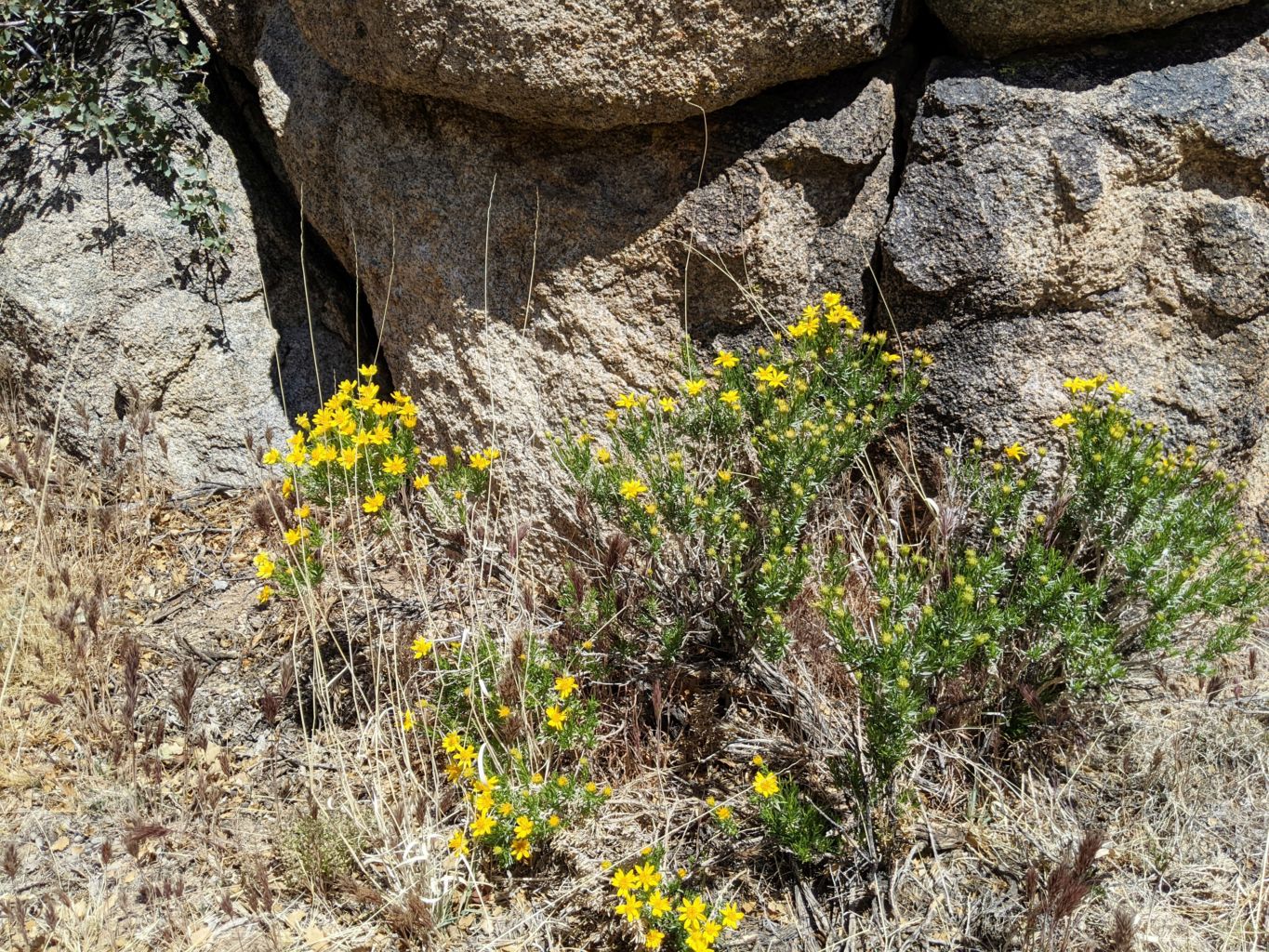
 Nonetheless, prior to coming to those tracks, we came to another road without such signage so we decided to head up it and explore. It obviously had been used quite extensively as the road in was good and several spots had been trampled and cleared from use. We poked around here and there and finally settled in the shade of a massive boulder pile for some R and R. We were marveling at the great number of plant and brush species there were right in this little area, even though, at first glance, there wasn’t much growing at all. I should have pushed on and checked out those other roads as coming back is less and less likely. However, we again ran out of time and motivation and just headed back to camp.
We had 2 rigs come by and they set up camp elsewhere in the grove, I think one up by the rock formation we passed at the beginning of the grove. They were plenty far away and we did not see or hear them at all. Back at camp, we began breaking down and packing up anything that we would not use that night in anticipation of wanting to get an early start. We had the superfluous stuff set aside when it had clearly become cocktail hour. We toasted Tommy and the trip and raged through a package of leftover piggy from the roast. It was delicious yet again. We had a great little fire and fireside chat, determining that we should relieve ourselves of a return trip out Ivanpah Road, and instead circle back to Cedar Canyon Road at Rock Springs and pick up Kelso-Cima Road on back to the 15.
Sleep was magnificent and I reluctantly gave Bill his pads back. Thank Dog Bill brings so much extra stuff with him. Something from the resupply wagon is always needed. The ride back was great and brought back many memories of passing over those roads many times on prior trips. We bade farewell to Bill at Kelso-Cima road and headed back to15 without the dust and sand storms that had been whipped up on our journey out here. Without being buffeted by the hammering winds, we made good time on a much easier drive back than down. We giggled with joy at the new 58 bypass at Kramer Junction at the intersection of 395 that used to be such a nightmare. 99 was no problem and we were back at Bob’s before we knew it. Another outstanding trip and a 4th jaunt to Mojave National Preserve in the journals.
Mojave National Preserve #4 Photo Gallery